Map size in jpg-format: 8.32403MiB
Click to open in high resolution (open in new tab).
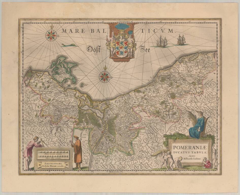
Blaeu's map of Pomerania.
Decorative map of the area of Pomerania, in present day eastern Germany and Poland with considerable detail.
An elaborate coat of arms of Pomerania is at the top center. A mileage scale, in German and French miles, is at the bottom left, surrounded by two large figures of scholars, who appear to be working at a table (the top of the cartouche).
The title is at the bottom right, again surrounded by an elaborate scene. Ships and compass roses adorn the sea.
Willem Janszoon Blaeu (1571-1638) was a prominent Dutch geographer and publisher. Born the son of a herring merchant, Blaeu chose not fish but mathematics and astronomy for his focus. He studied with the famous Danish astronomer Tycho Brahe, with whom he honed his instrument and globe making skills. Blaeu set up shop in Amsterdam, where he sold instruments and globes, published maps, and edited the works of intellectuals like Descartes and Hugo Grotius. In 1635, he released his atlas, Theatrum Orbis Terrarum, sive, Atlas novus.
Willem died in 1638. He had two sons, Cornelis (1610-1648) and Joan (1596-1673). Joan trained as a lawyer, but joined his father’s business rather than practice. After his father’s death, the brothers took over their father’s shop and Joan took on his work as hydrographer to the Dutch East India Company. Later in life, Joan would modify and greatly expand his father’s Atlas novus, eventually releasing his masterpiece, the Atlas maior, between 1662 and 1672.
If you are a student, write to us in telegram: @antiquemaps and indicate what material you need and for what work you need a map in high detail. We are ready to provide material on special terms. For students only!


