Map size in jpg-format: 46.1357MiB
Click to open in high resolution (open in new tab).
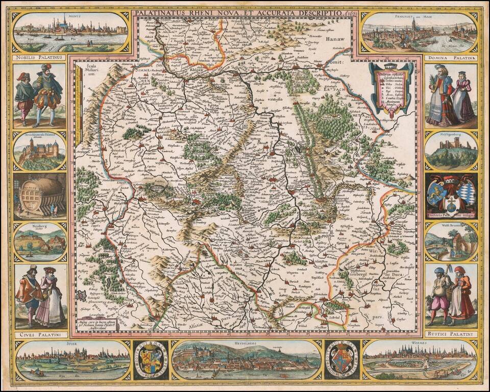
First State of Visscher's Map of the Rhine Valley
Finely colored example of Nicholaus Visscher's decorative map of the German Rhine River Valley.
The map follows the course of the Rhine River from the area near Baden-Baden in the south to just south of Koblenz. The map includes a view of a number of the larger cities in the region, including Heidelberg, Mentz (Mainz), Frankfurt, Worms and Spier, and partial views of Heidelberg Castle, the wolf fountain and the monastery at Neuburg, along with 3 coats of arms and representations of the indigenous dress of the locals.
The map was first published in 1621, with subsequent states published in 1630, 1633, 1650 and 1652.
If you are a student, write to us in telegram: @antiquemaps and indicate what material you need and for what work you need a map in high detail. We are ready to provide material on special terms. For students only!


