logo

1780. Le Royaume D'Ecosse divise en Shires ou Comtes . . .

  • Le Royaume D'Ecosse divise en Shires ou Comtes . . .

Le Royaume D'Ecosse divise en Shires ou Comtes . . . information:

Year of creation: 
Resolution size (pixels): 
 14877x12812 px
Disk Size: 
 32.5422MiB
Number of pages: 
 1
Place: 
 Paris

Print information. Print size (Width x height in inches):
Printing at 72 dpi 
  206.63 х 177.94
Printing at 150 dpi 
 99.18 х 85.41
Printing at 300 dpi 
 49.59 х 42.71

An example of detailing the file of this map of in a printable high-resolution:

Click to open in high resolution (open in new tab).
Attention! this is just the central piece (central area 960x960 px) of the map file!
This is an example, so that you can see and study the level of detail of a given map. The entire Map will be fully available after payment!

Le Royaume D'Ecosse divise en Shires ou Comtes . . .

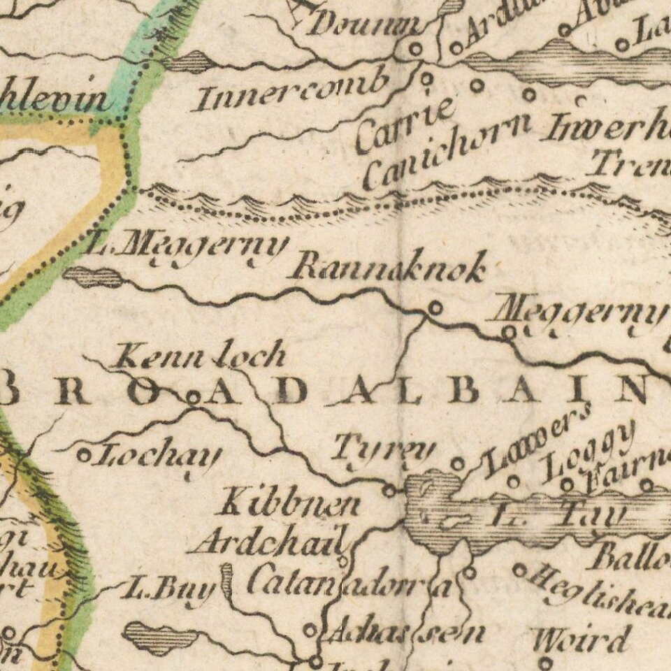
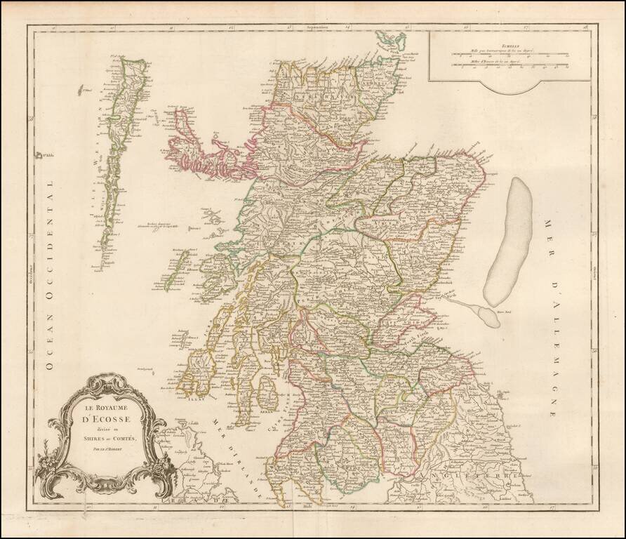
Detailed map of Scotland from a later edition of DeVaugondy's Atlas Universel.

Includes towns, mountains, rivers, lakes and a host of other details.

Pedley, Bel et Utile #52.

Special conditions for students!

If you are a student, write to us in telegram: @antiquemaps and indicate what material you need and for what work you need a map in high detail. We are ready to provide material on special terms. For students only!

Item information:

Year of creation:
Size:
14877x12812 px
Disk:
32.5422MiB
Number of pages:
1
Place:
Paris
Author:
Gilles Robert de Vaugondy.
$14.99

Related item