logo

1807. Scotland

  • Scotland

Map size in jpg-format: 10.7172MiB

Download "Scotland", in high resolution.

Scotland information:

Year of creation: 
Resolution size (pixels): 
 5659x7095 px
Disk Size: 
 10.7172MiB
Number of pages: 
 1
Place: 
 London
Author: 

Print information. Print size (Width x height in inches):
Printing at 72 dpi 
  78.6 х 98.54
Printing at 150 dpi 
 37.73 х 47.3
Printing at 300 dpi 
 18.86 х 23.65

An example of detailing the file of this map of in a printable high-resolution:

Click to open in high resolution (open in new tab).
Attention! this is just the central piece (central area 960x960 px) of the map file!
This is an example, so that you can see and study the level of detail of a given map. The entire Map will be fully available after payment!

Scotland

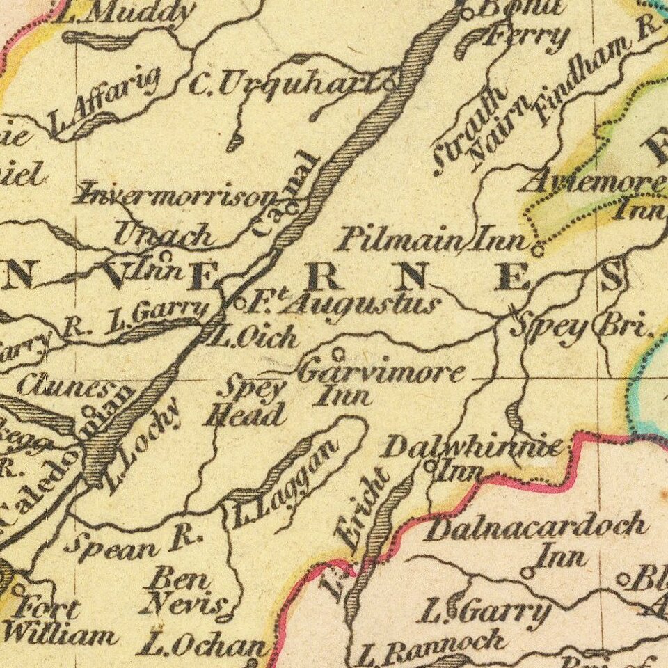
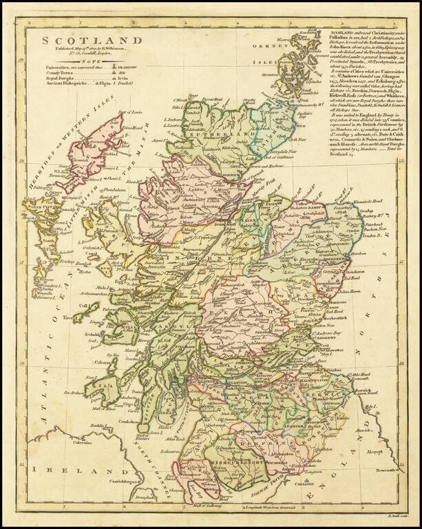
Updated map of Scotland, published by Wilkinson.

This is an extensively revised example of the map, with three paragraphs of notes at the right on the history of Scotland.

The map is hand colored by counties and shows rivers, lakes, islands, etc.

Robert Wilkinson was active in London as a cartographic publisher from 1785 to 1825. He produced a number of nice works, including a General Atlas and a re-issuance of Bowen & Kitchen's English Atlas, along with excellent large format separate maps.


Special conditions for students!

If you are a student, write to us in telegram: @antiquemaps and indicate what material you need and for what work you need a map in high detail. We are ready to provide material on special terms. For students only!

Item information:

Year of creation:
Size:
5659x7095 px
Disk:
10.7172MiB
Number of pages:
1
Place:
London
Author:
Robert Wilkinson.
$14.99

Related item