logo

1839. Scotland

  • Scotland

Map size in jpg-format: 14.0436MiB

Download "Scotland", in high resolution.

Scotland information:

Year of creation: 
Resolution size (pixels): 
 6289x7610 px
Disk Size: 
 14.0436MiB
Number of pages: 
 1
Place: 
 Philadelphia
Author: 

Print information. Print size (Width x height in inches):
Printing at 72 dpi 
  87.35 х 105.69
Printing at 150 dpi 
 41.93 х 50.73
Printing at 300 dpi 
 20.96 х 25.37

An example of detailing the file of this map of in a printable high-resolution:

Click to open in high resolution (open in new tab).
Attention! this is just the central piece (central area 960x960 px) of the map file!
This is an example, so that you can see and study the level of detail of a given map. The entire Map will be fully available after payment!

Scotland

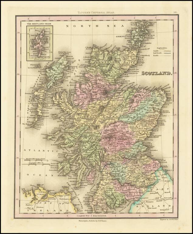
Fine example of Henry Schenk Tanner's map of Scotland, published in Philadelphia.

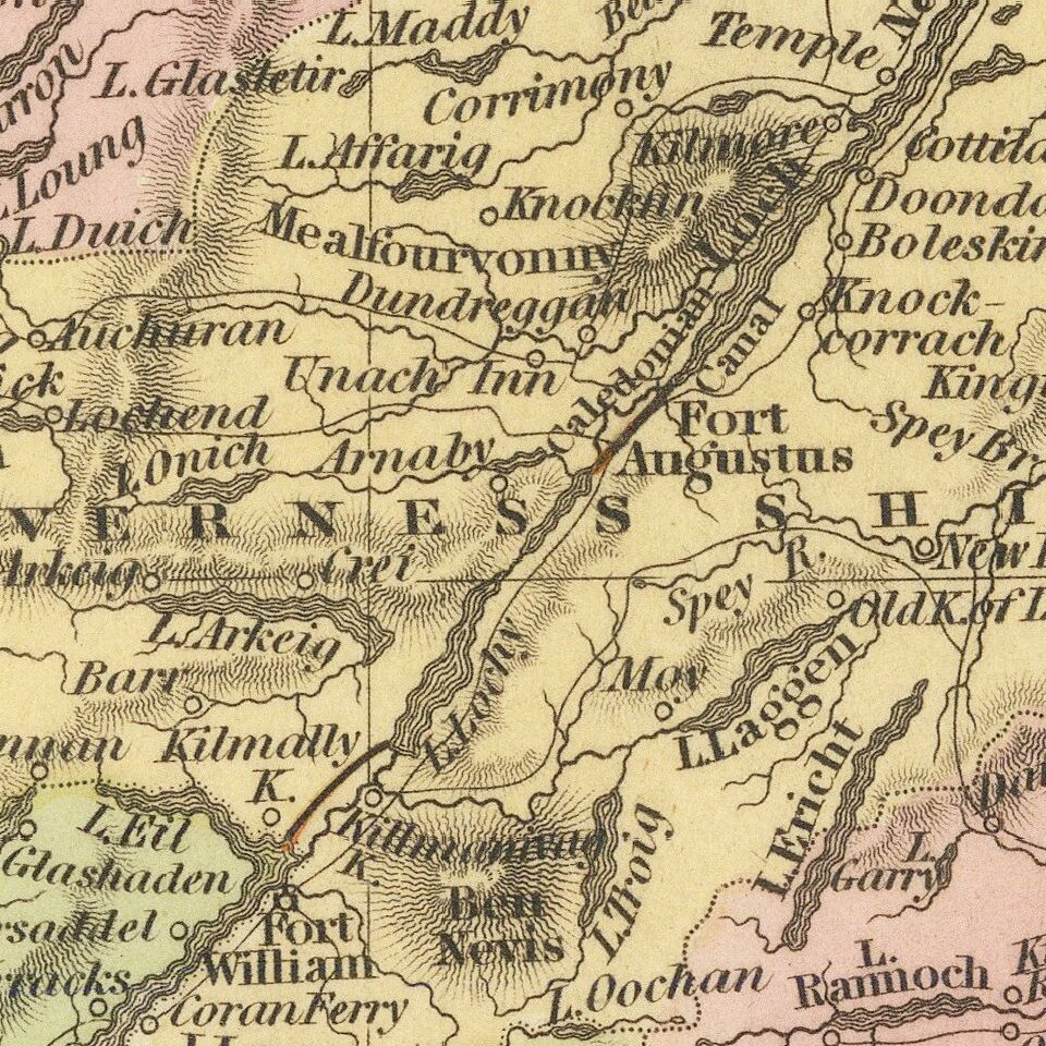
The map is hand colored by counties and showing towns, rivers, lakes, railroads, roads, etc.

Tanner was perhaps the single most important American commercial mapmaker of the 19th Century and is regarded as the most sought after of mapmakers during the golden age of American cartography (1820-1840).


Special conditions for students!

If you are a student, write to us in telegram: @antiquemaps and indicate what material you need and for what work you need a map in high detail. We are ready to provide material on special terms. For students only!

Item information:

Year of creation:
Size:
6289x7610 px
Disk:
14.0436MiB
Number of pages:
1
Place:
Philadelphia
Author:
Henry Schenk Tanner.
$14.99

Related item