
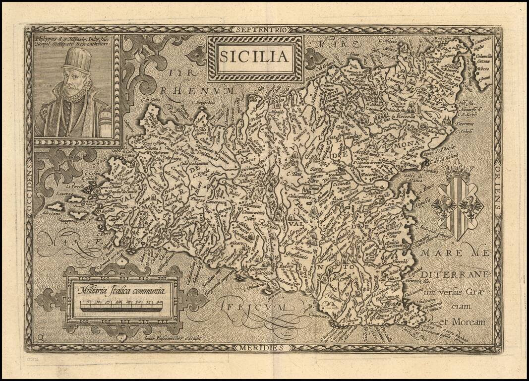
Decorative map of Sicily, with a portrait of King Philip of Spain and coat of arms. Matthaus Quad was a German cartographer based in Cologne, The map was engraved by Johannes Bussemacher and appeared in several Geographical works published by Quad and...
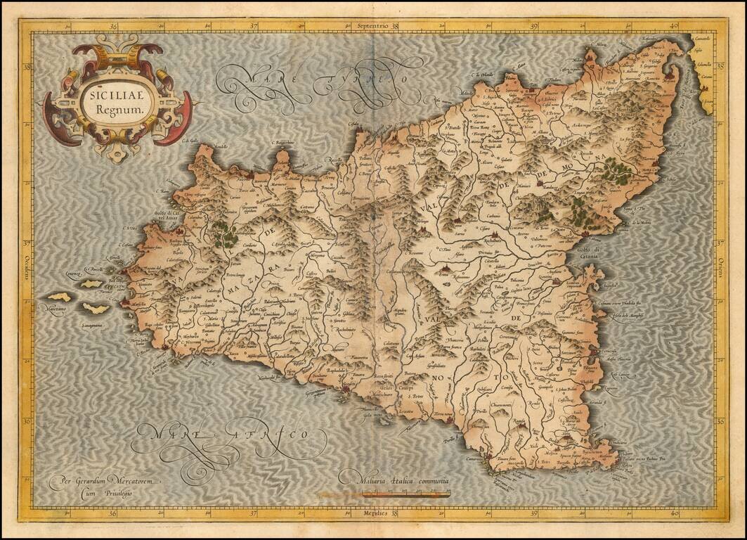
Nice old color example of the first state of Mercator's decorative map of Sicily. An example of the second state, with revised cartouche, can be seen here: /gallery/detail/31471sm
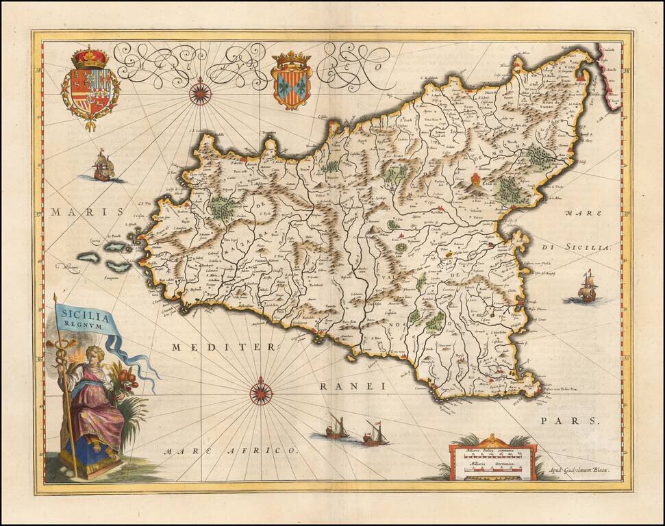
A gorgeous example of Blaeu's fine decorative map of Sicily, from his Atlas Novus. Blaeu's map is without doubt one of the most attractive of all 17th Century atlas maps of Sicily, with 2 ornate cartouches, large coat of arms, 4 sailing ships, sea...
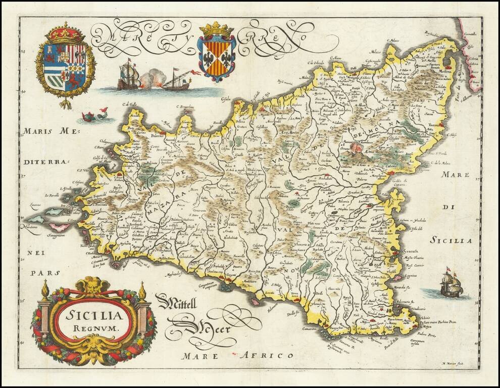
Decorative antique engraved map of Sicily, including two large coats of arms, title cartouche, 3 sailing ships, and a sea monster. The map is based upon Willem Blaeu's map of Sicily and was published in Frankfurt in 1640 by Matthias Merian.
Striking map of Sicily, with a large decorative cartouche. Mt. Aetna can be seen in the midst of a volcanic eruption.
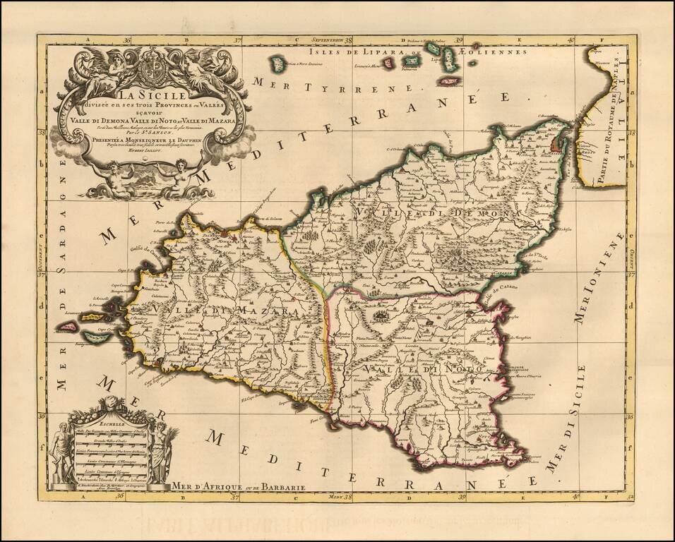
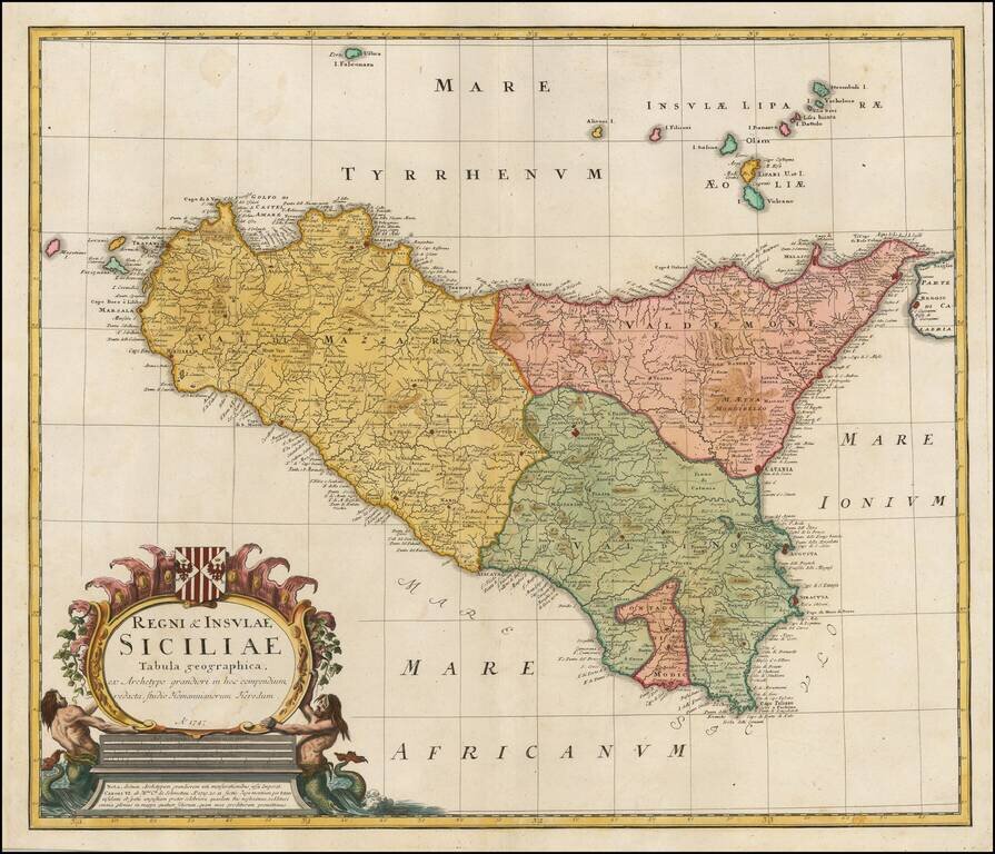
Fine Pierre Mortier edition of Jaillot's large decorative map of Sicily, showing the eruption of Mount Aetna both on the map and below the decorative title cartouche. The island is divided into 3 provinces including Valle Di Demona, Valle De Mazara...
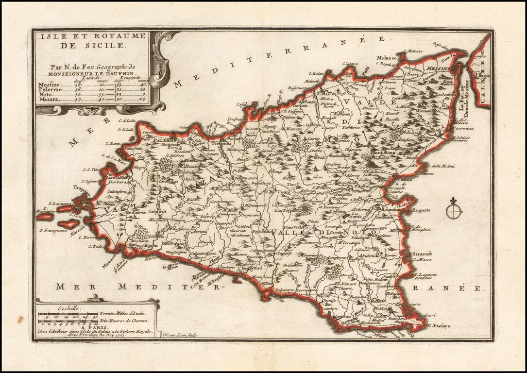
Detailed map of Sicily, showing towns, roads, rivers, harbors and a host of other details. From De Fer's Atlas Curieux . . .
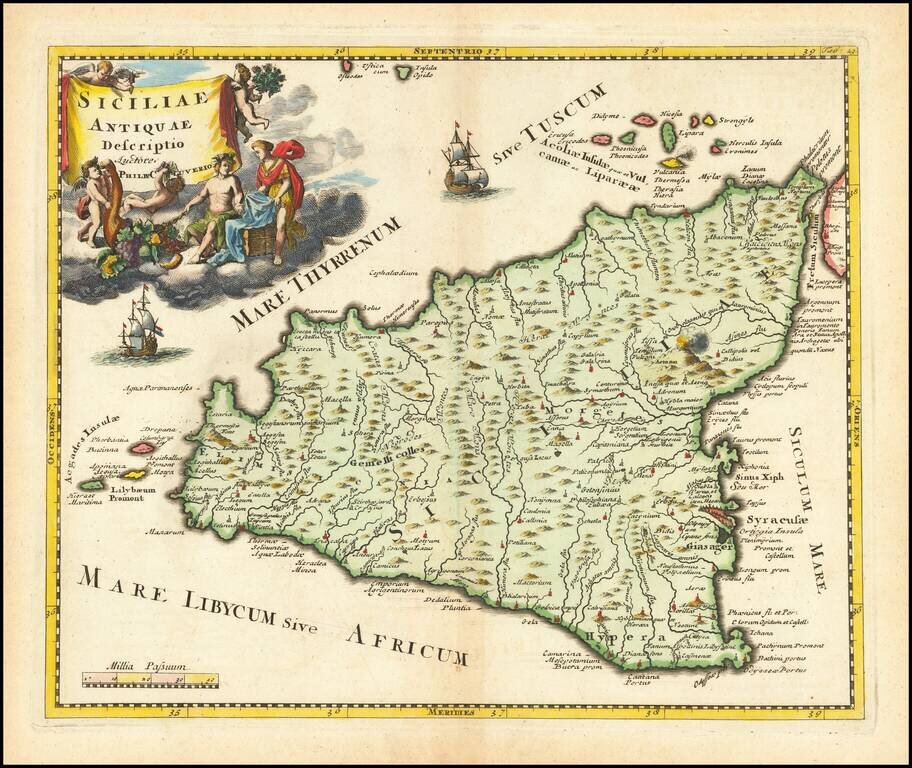
Terrific map of Sicily and its neighboring islands, with ancient place names from antiquity. The map appeared in an early edition of Cellarius' Notitia Orbis Antiqui, Sive Geographia Plenior...et Novis Tabulis Geographicis, which was published in...
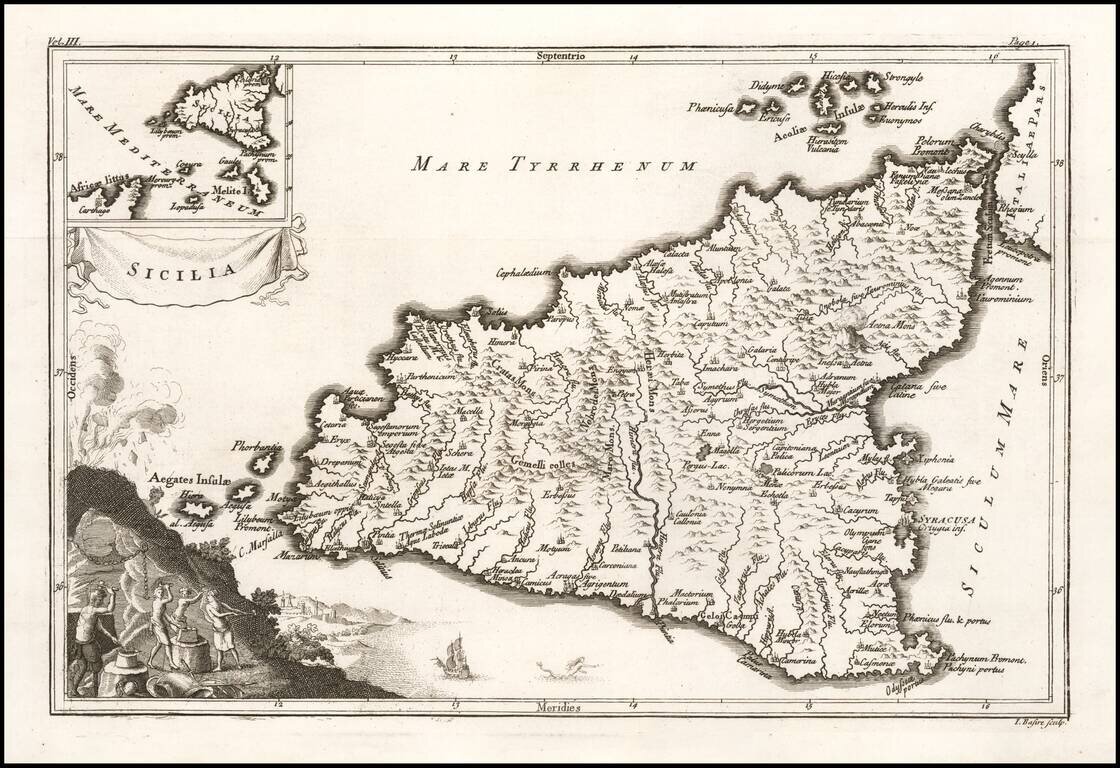
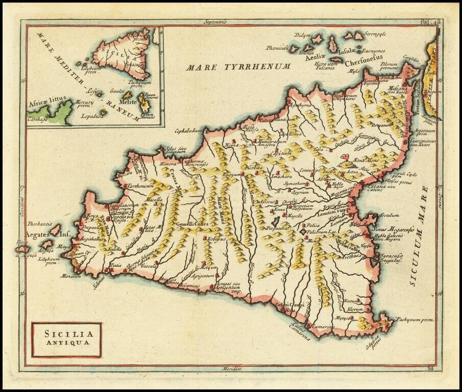
Decorative map of Ancient Sicily, with an inset showing Sicily's relationship to the coast of Africa. Vignette shows Mount Aetna erupting, with a work scene below.
Fine detailed map of Sicily, published in Nuremberg by the heirs of J.B. Homann. Includes a coat of arms and an allegorical cartouche. Excellent detail in the interior of the map.
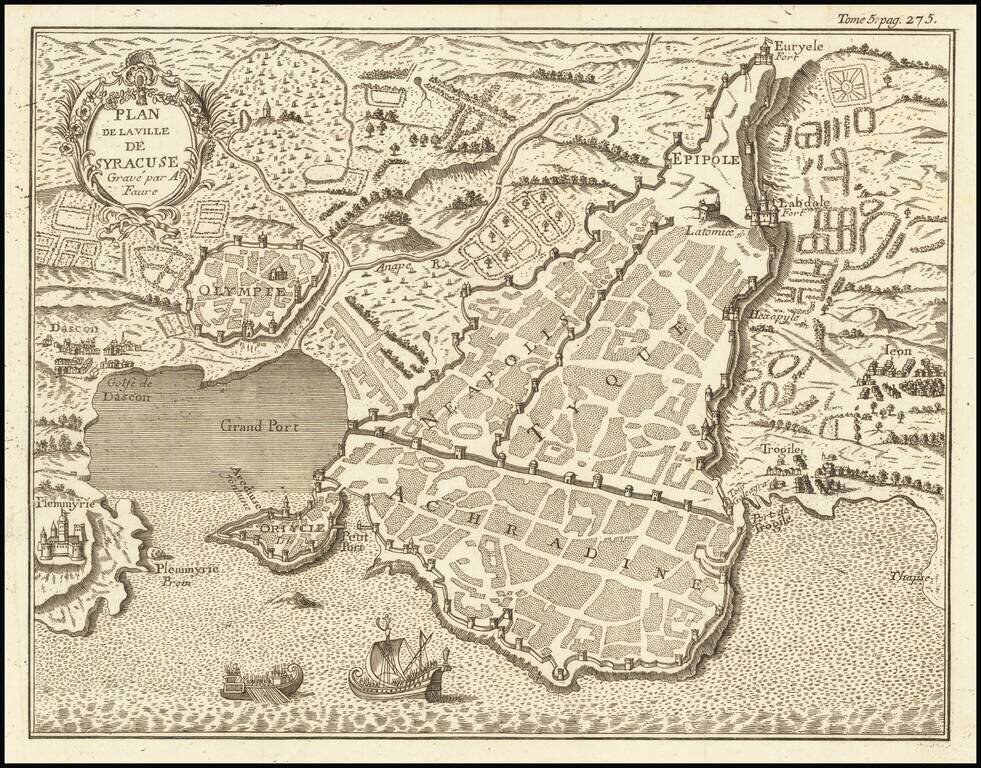
Interesting mid-18th Century plan of Syracuse in southeastern Sicily.
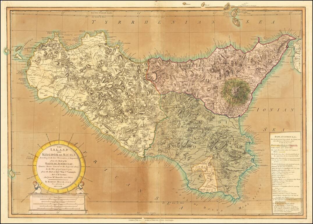
Old color example of this detailed map of Sicily by Robert Mylne, which appeared in Laurie & Whittle atlases in the 1790s. Mylne's map is a fine compilation of the most important cartographical sources of the time, including the maps of Austrian...
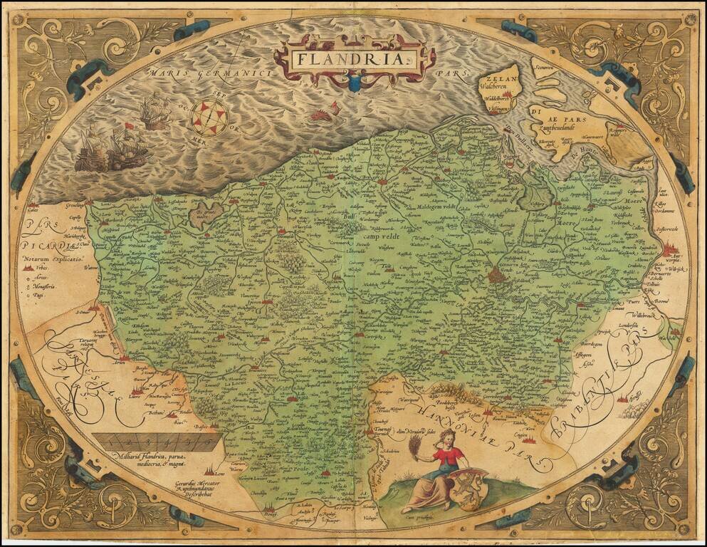
A nice example of Ortelius's second map of Flanders, from the 1584 Latin edition of his Theatrum Orbis Terrarum, the first modern atlas of the world. The map is executed inside of a decorative strapwork egg-shaped border and is one of the most...
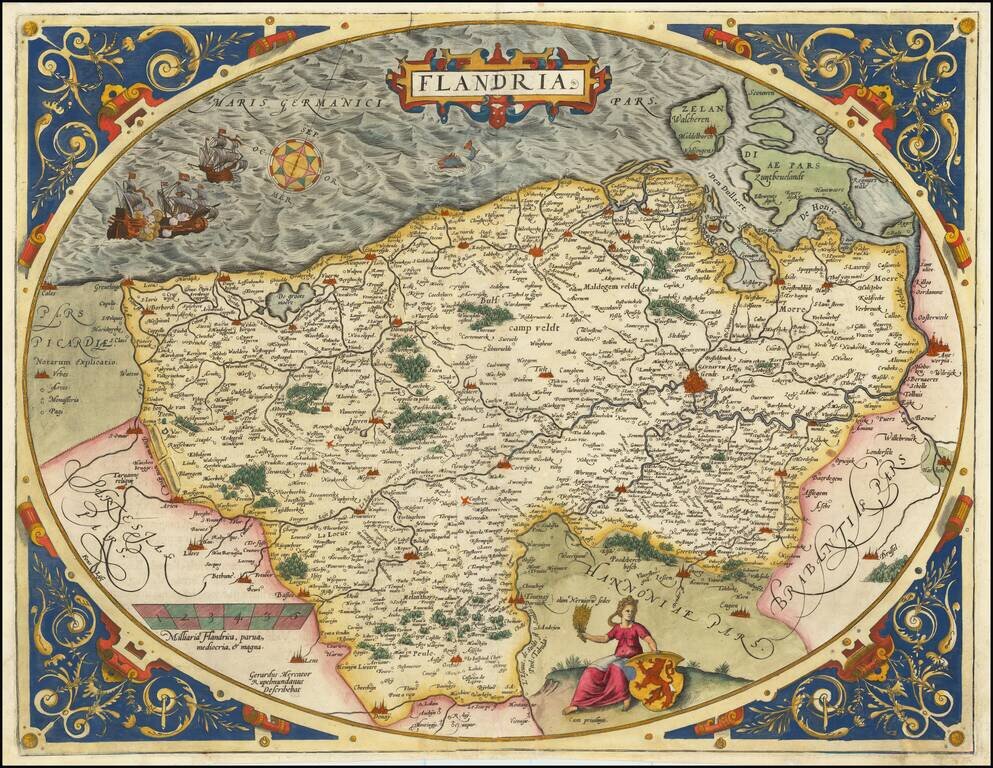
A nice example of Ortelius's second map of Flanders, from the 1584 Latin edition of his Theatrum Orbis Terrarum, the first modern atlas of the world. The map is executed inside of a decorative strapwork egg-shaped border and is one of the most...
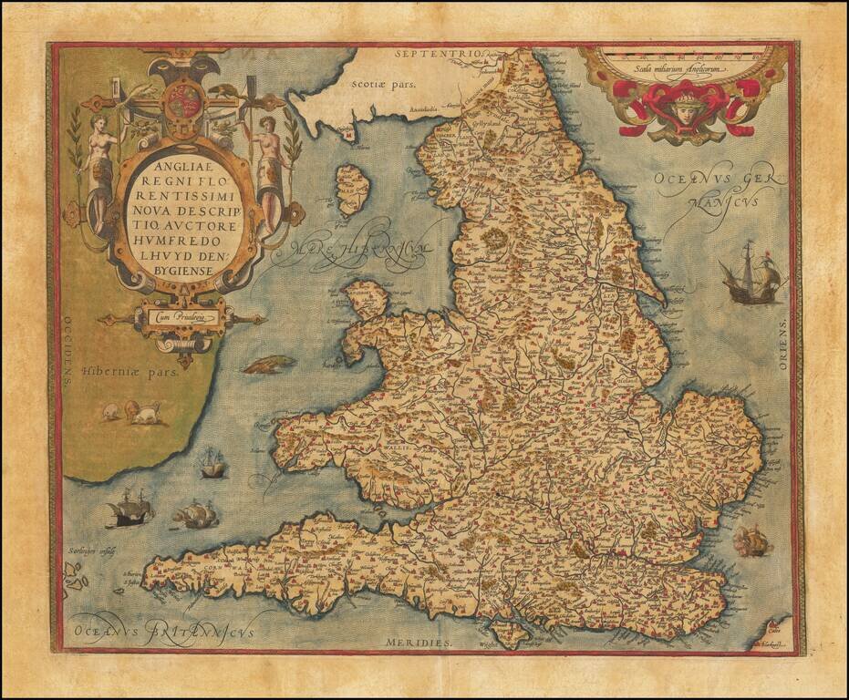
A gorgeous old color map of England and Wales, from the 1574 Latin edition of Ortelius' Theatrum Orbis Terrarum, the first modern atlas of the world. Included are an ornate cartouche and many sailing ships and sea monsters, as well as some sheep...
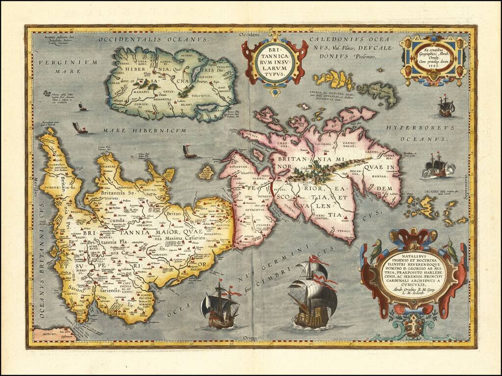
Notable Atlas Map of the British Isles, From the First Modern Atlas Scarce, fine map of the British Isles, from Ortelius' ground-breaking atlas, Theatrum Orbis Terrarum. Oriented to the west, the British Isles are shown as if on their side. The...