Map size in jpg-format: 69.137MiB
Click to open in high resolution (open in new tab).
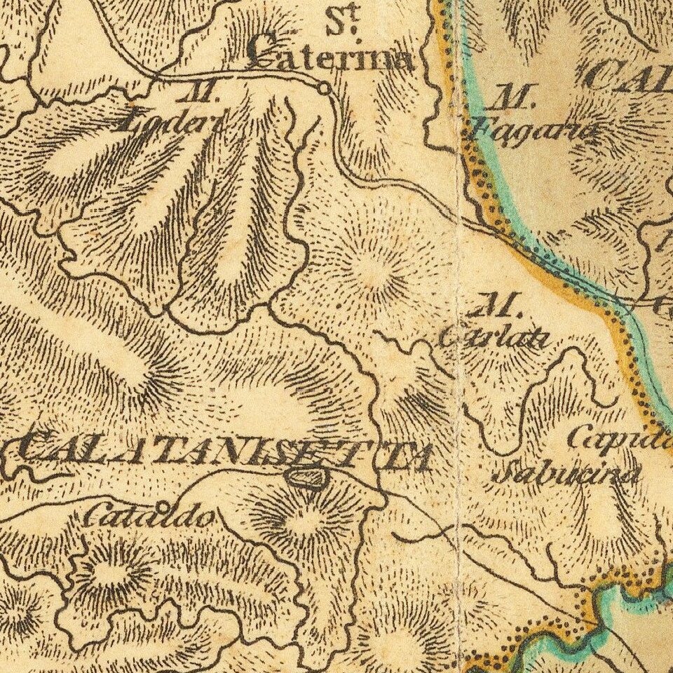
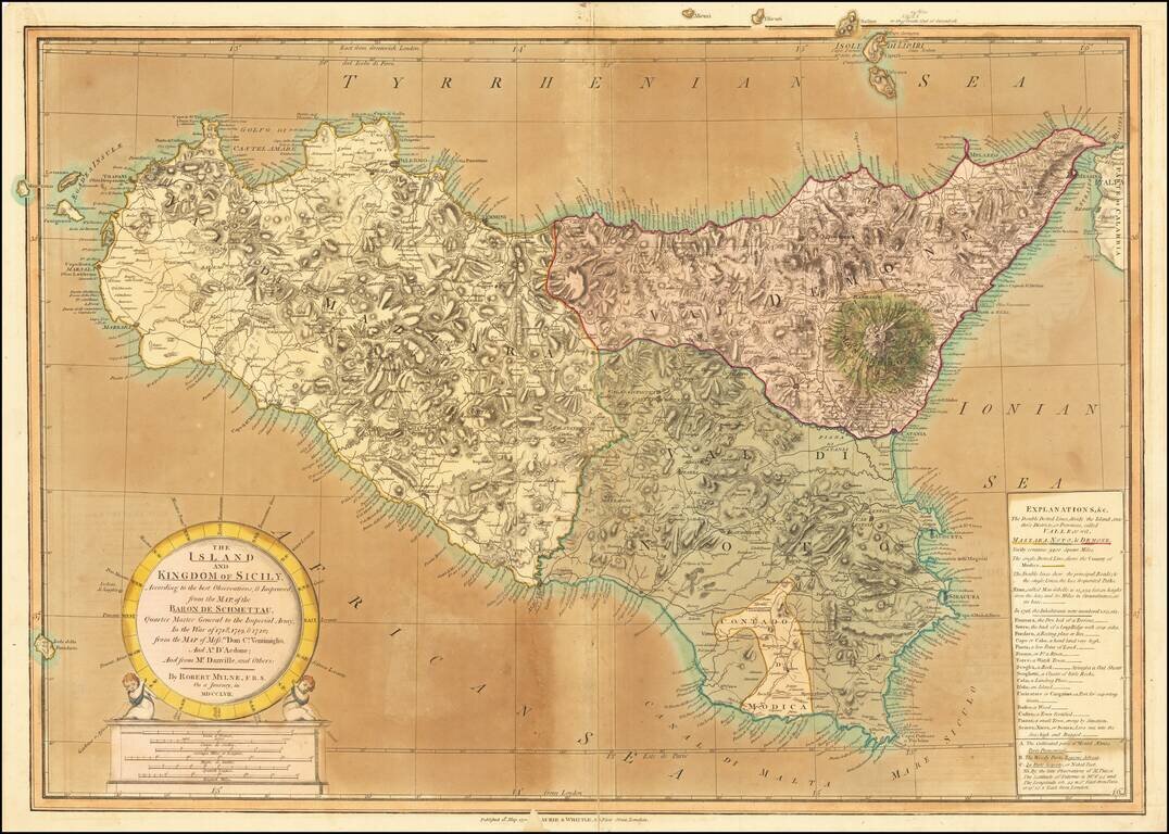
Old color example of this detailed map of Sicily by Robert Mylne, which appeared in Laurie & Whittle atlases in the 1790s.
Mylne's map is a fine compilation of the most important cartographical sources of the time, including the maps of Austrian General Samuel von Schmettau and French cartographer Jean Baptiste Bourguignon d'Anville. The map shows the three provinces and the county of Modica. Details include roads, inns, watch towers, forests, fortified towns, and lava fields. Particular attention is paid to Mount Etna with areas denoted as cultivated, wooded, or naked.
The text box at the bottom right includes a detailed explanation of the map and statistical information about Sicily, along with a key translating the Italian nomenclature to English.
Robert Mylne, a Scottish architect and civil engineer, who was best known for his design for Blackfriars Bridge in London. Mylne studied architecture under the direction of Giovanni Battista Piranesi in Rome.
In the spring of 1757, Mylne accompanied the diplomat Richard Phelps, and antiquarian Matthew Nulty, on a tour of Sicily where he undertook the preparation of this map to pay for his studies.
Laurie & Whittle
Robert Laurie (ca. 1755-1836) and James Whittle (1757-1818) formed their Fleet Street, London-based firm upon the 1794 death of their employer Robert Sayer, himself one of the dominant print and mapmakers of the last half of the 18th century.
Laurie & Whittle started managing Sayer's business as early as 1787. They took over all managerial duties when Sayer's health flagged in 1792, and they changed the imprint in 1794 upon his death. Sayer left the two a 21-year lease on the shop (at £100 a year) and on Sayer's Bolt Court premises, as well as an option to acquire stock and equipment at a preferential price of £5,000 payable over three years.
Robert Laurie retired from the firm in 1812, and his role was assumed by his son, Richard Holmes Laurie (1777-1858). The younger Laurie worked with James Whittle until the latter died in 1818. After R. H. Laurie died in 1858, Alexander George Findlay, FRGS (1812-1875) purchased the firm from his daughters. The firm continues today under another name, specializing in yachting charts.
Laurie & Whittle were prolific print and map publishers, and throughout their careers, they produced numerous very important and rare works. They carried on Robert Sayer's atlas business and were responsible for editions of The Complete East-India Pilot and The American Atlas.
Laurie & Whittle refers to the partnership of Robert Laurie (1755?-1836) and James Whittle (1757-1818), engravers and map publishers. Both men were employed by Robert Sayer (ca. 1724-1794), one of the most prominent British publishers and map sellers of the eighteenth century. Sayer died in 1794 and his business was taken over by his assistants. The two worked together as Laurie & Whittle until 1812, when Laurie retired. They were especially known for publishing sea charts and maritime atlases. From 1812-1818, when he died, Whittle worked with Laurie’s son, Richard Holmes Laurie, as Whittle & Laurie. After 1818, the firm was known as R. H. Laurie, even though Richard died in 1858. Later, the firm was managed by Laurie’s draughtsman, Alexander George Findlay, and, later, Daniel and William Kettle.
If you are a student, write to us in telegram: @antiquemaps and indicate what material you need and for what work you need a map in high detail. We are ready to provide material on special terms. For students only!