
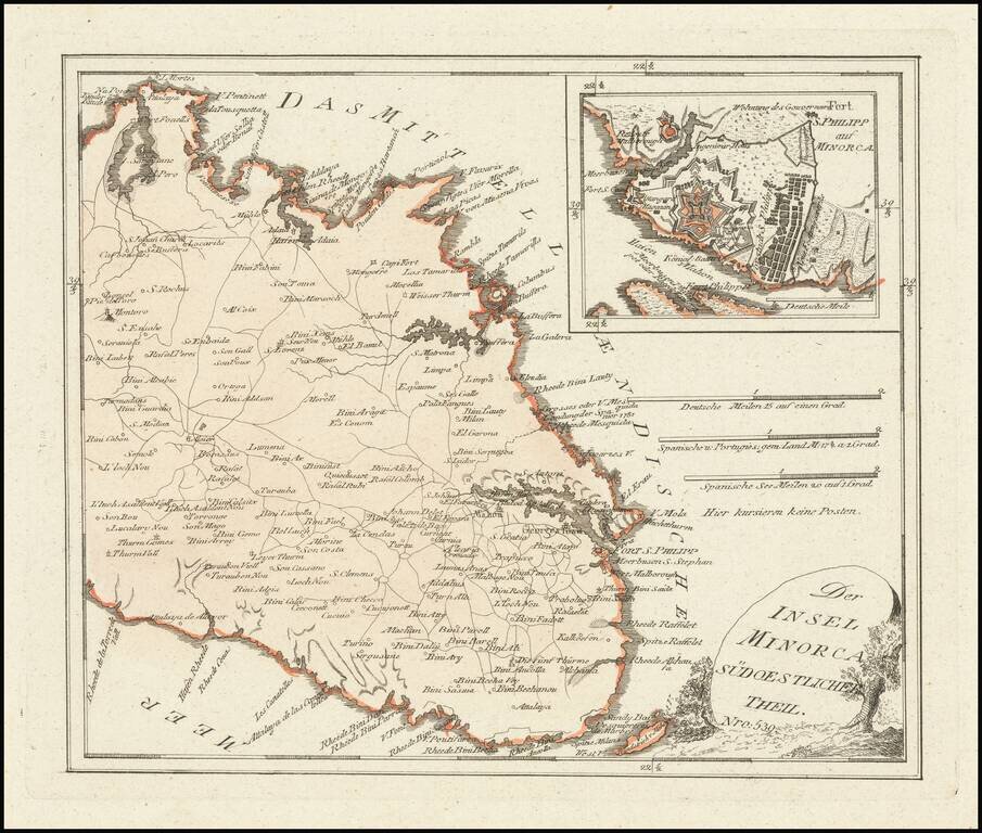
Scarce map of the Eastern part of Menorca, published by Franz Joseph Johann Von Reilly in Vienna. Includes a large inset of Mahon and Port Philip.
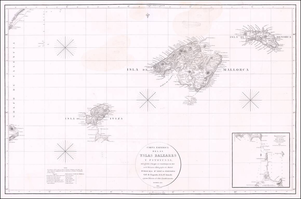
Rare Chart of the Balearic Islands -- Published in London Fine chart of the Balearic Islands by Jose de Espinosa y Tello, published in London in 1812 and engraved by "E. Jones". The chart was produced during the time period when Spain's Direccion...
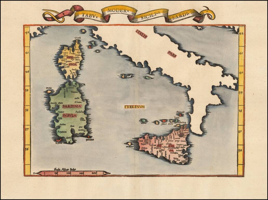
Nice example of the 1535 edition of Lorenz Fries modern map of Sicily and Sardinia. First published in Strasbourg by Johannes Gruninger in 1522, Fries map is based upon Waldseemuller's map of 1513.
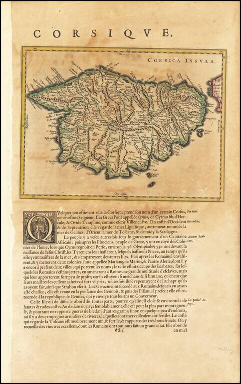

Fine Large Map of Corsica from the late 18th Century Detailed large format map of Corsica. Includes highly detailed topographical details, including mountains, roads, rivers, bays, and other details. Text note in the lower right corner. Laurie &...
![Quarta Asiae Tabula [Shows Cyprus]](/map/small/64078.jpg)
Fine Old Color example of Martin Waldseemüller's edition of Ptolemy's map of the Holy Land, the Levant and Mesopotamia, printed in Strasbourg in 1513. This remarkably beautiful map is one of the most historically important and finely printed early...
![[Untited Modern Map of Cyprus, Syria, Palestine, etc.]](/map/small/55764.jpg)
One of the earliest obtainable modern maps of Cyprus, Syria, the Holy Land, and contiguous regions, from the 1525 edition of Fries edition of Ptolemy's Geographia. Fries map of Cyprus, Syria, Mesopotamia, Babylonia, Arabia Petraea, Armenia Minor and...
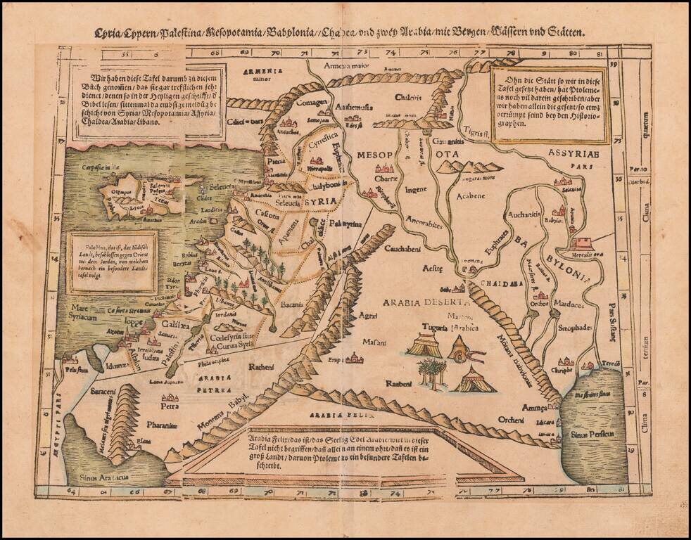
Colored example of Munster's map of Cyprus, Syria, the Holy Land and contiguous regions, from an early edition of Munster's Cosmographia. Munster's Cosmographia was one of the most influential geographical works of the 16th Century and had a profound...
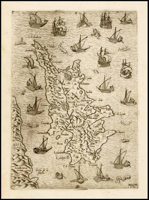
Rare separately issued map of Cyprus, published in Venice in 1570 by the Venetian mapmaker, Nicolo Nelli. The map shows Cyprus at the beginning of the Turkish attack of 1570, surrounded by Venetian ships. Historical Context: The Popular Fascination...
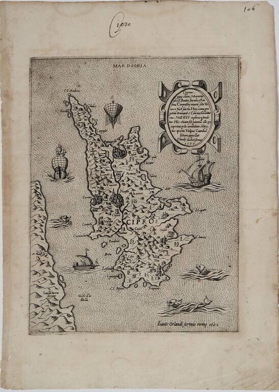
Rare Early Map of Cyprus By Paolo Forlani Second state of this rare early map of Cyprus, published in Venice by Paolo Forlani. The map is oriented with the east at the top and includes a nice descriptive cartouche at the top right. From the...
![Tab. IV. Asiae in qua Mesopotamia, Syria, Arabia Petrea ac Deserta . . . [Shows Cyprus]](/map/small/58766.jpg)
Nice wide margined example of Mercator's Ptolemaic map of Cyprus, the Holy Land, Syria, Chaldea, Mesopotamia, Armenia, etc. Nice example of Mercator's map of the region, from Mercator's edition of Ptolemy's Geographia, first published in 1578 and...
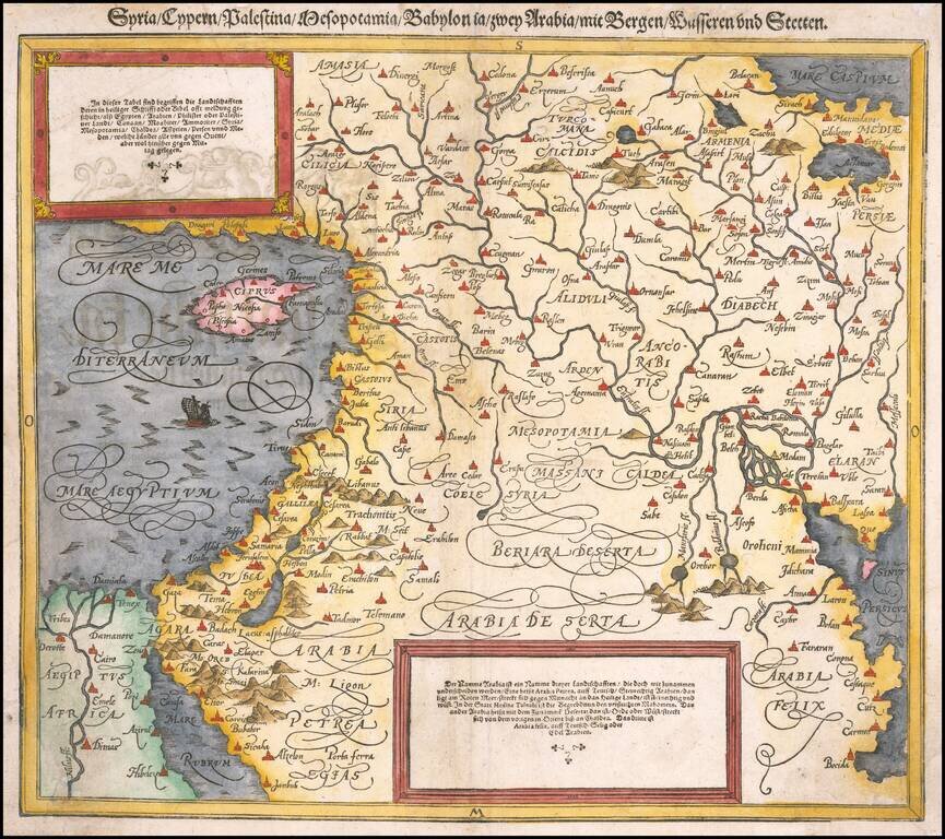
Finely colored map of Cyprus, Syria, the Holy Land and contiguous regions, from an early edition of Munster's Cosmographia. Munster's Cosmographia was one of the most influential geographical works of the 16th Century and had a profound impact on the...
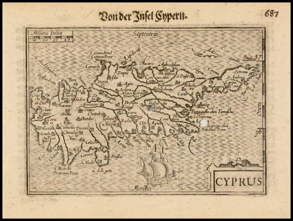
Nice example of this early state of Barent Langenes's map of the Island of Cyprus, which first appeared in the 1598 edition of Langenes's Caert-Thresoor, published in Middelburg. Langenes's map was first issued in his Caert-Thresoor and later...
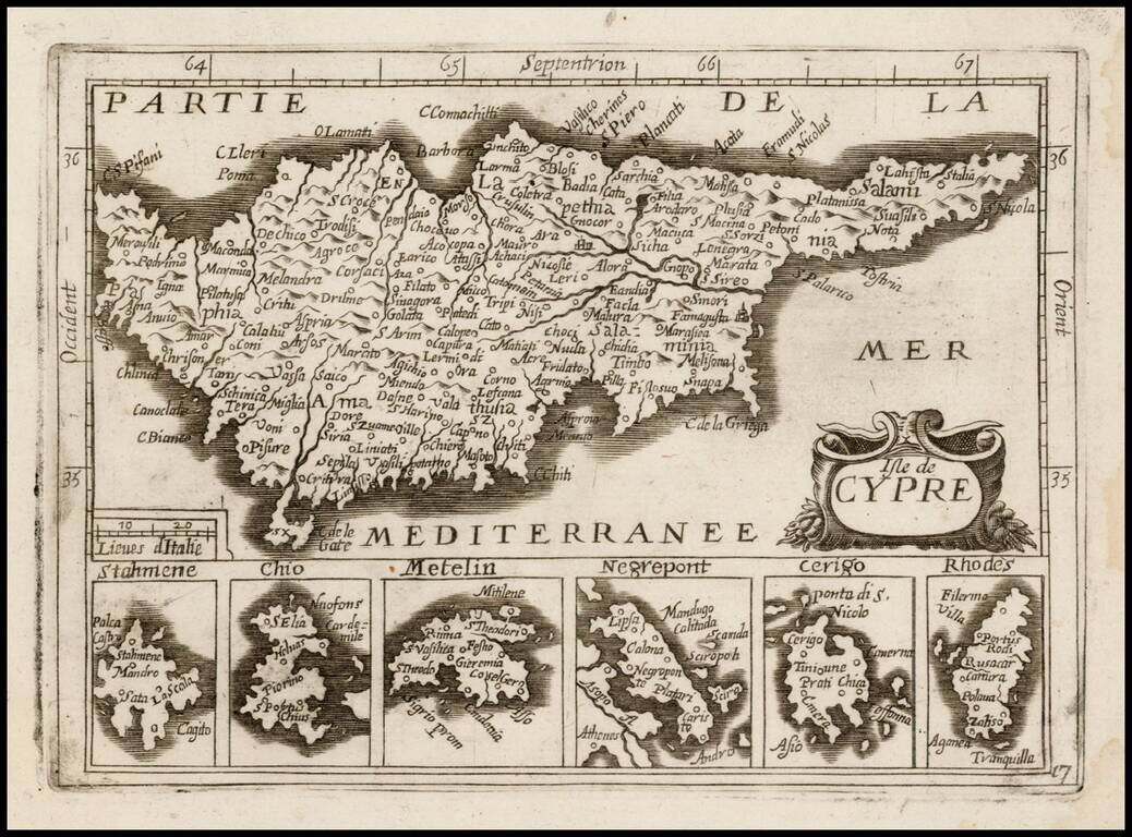
Detailed map of Cyprus, with 6 smaller inset maps below, most likely published by Antoine de Fer in his Cartes de Geographiques, although it may be by a different publisher, as the map is apparently unrecorded. Burden suggests that the 1657 De Fer...
![Asia Minoris Iacobi Cantelli Vineolensis . . . 1686 [Shows Cyprus]](/map/small/37656.jpg)
Rare map of Asia Minor and Cyprus and neighboring regions by Cantelli da Vignola. The map provides a fine depiction of the region. Engraved by Francesco Donia Messis.

Attractive map of Cyprus, Asia Minor, the Holy Land and Egypt. The map appeared in Arrowsmith's London Atlas.