![Tabula Secunda Africae [with Malta, Sicily & Sardinia]](/map/small/64887.jpg)
Waldsemuller's 1513 Ptolemaic Map of Northern Africa, Sicily and Sardinia antique map by Martin Waldseemuller, showing the ancient, Ptolemaic image of part of the Coast of North Africa and contiguous islands of Malta, Sicily and Sardinia. This map...
Fine example of Gastaldi's modern map of Sicily and Sardinia, also showing Malta. Gastaldi's mapping of Sicily is of special note, as the map would unquestionably include the same information as contained in Gastaldi's Descrittione della Sicilia con...
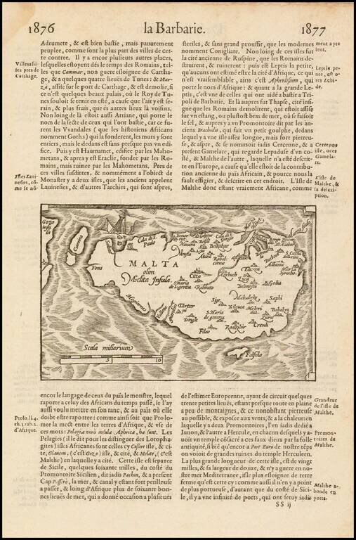
Scarce 16th Century map of the Island of Malta, from Francois De Belleforest, for his La Cosmographie Universelle de Tout la Monde, published in Paris, in 1575. In 1544, the scholar and geographer, Sebastian Munster, published his Cosmographia, one of...
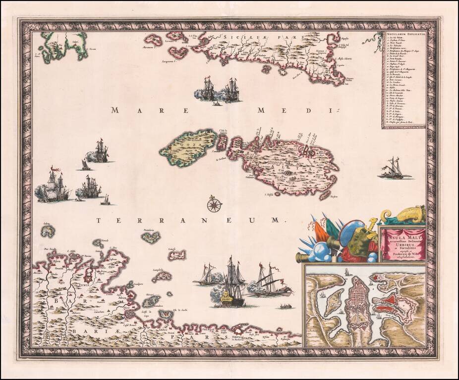
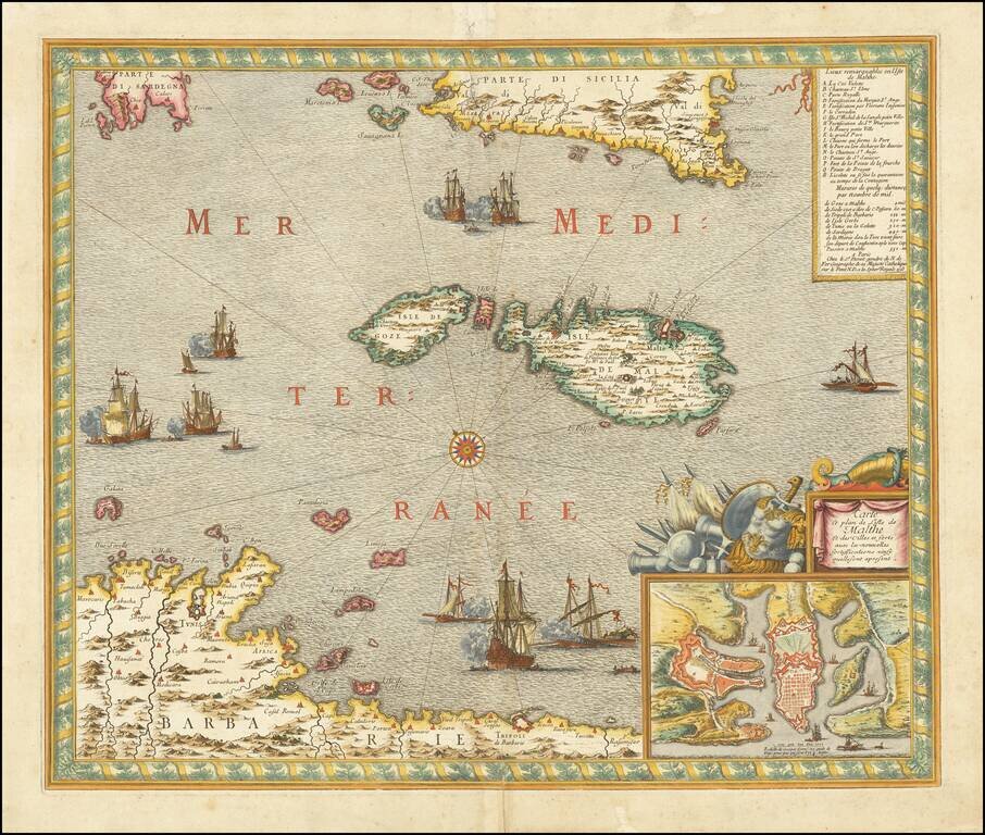
Fine early map of Malta, published in Amsterdam by Frederick De Wit. The map includes a large inset of Valetta. Includes lower area of Sicily and north coast of Africa from Tunis to Tripoli. Three large vignettes depicting sea battles. The table...
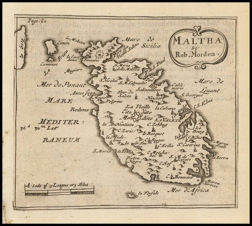
Rare 17th Century English map of Malta, including the neighboring Islands. Many place names. This map first appeared in Modern's rare Atlas Terestris, first published in 1687.
![Barbary and Bildulgerid. [on sheet with:] Egypt and Barca &c.](/map/small/70916.jpg)
Antique engraved map with images of northwest Africa on top and Egypt on the bottom, with a further inset of Malta above the bottom title block. The map was published in Herman Moll's 1701 System of Geography. It is reasonably scarce, this being the...
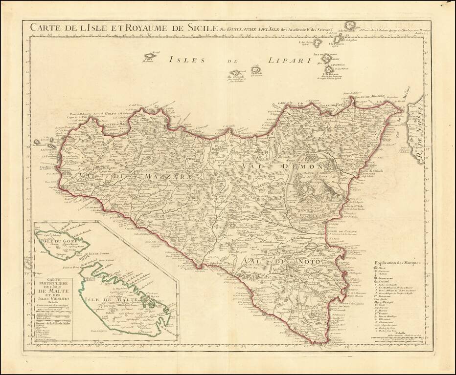
With a Large Image of a Volcanic Eruption at Mt. Aetna Finely detailed map of island of Sicily, with a large inset of Malta, published by Guillaume De L'Isle in Paris. The map extends to include the Aeolian Islands, which are here called the Lipari...
Fine example of Danet's rare map of Malta, with a plan of the harbor and fortifications of Valletta, on the Island of Malta. In upper right corner, there is a key locating the principal places (most of which are fortified) on the map. A number of...
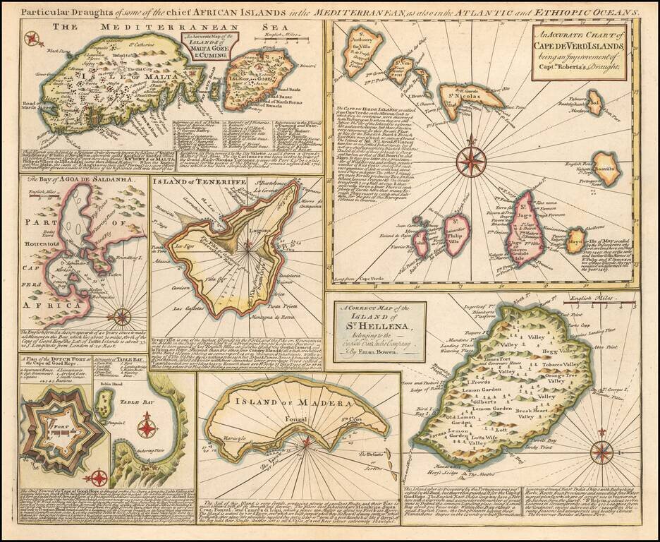
Detailed set of 8 maps, including a large and detailed Malta, the Bay of Agoa de Saldanha, Teneriffe, the Dutch Fortress at the Cape of Good Hope, Table Bay, Madera, St. Helena and the Cape Verde Islands, all with extensive annotations.
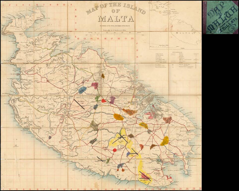
Fascinating map of Malta, pubished by the War Office in London. This example includes some interesting manuscript additions. Detailed map of Malta on a scale of two inches to a mile, with a key detailing roads, railways, churches, police stations,...
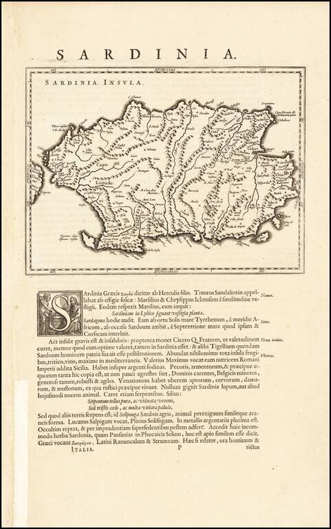
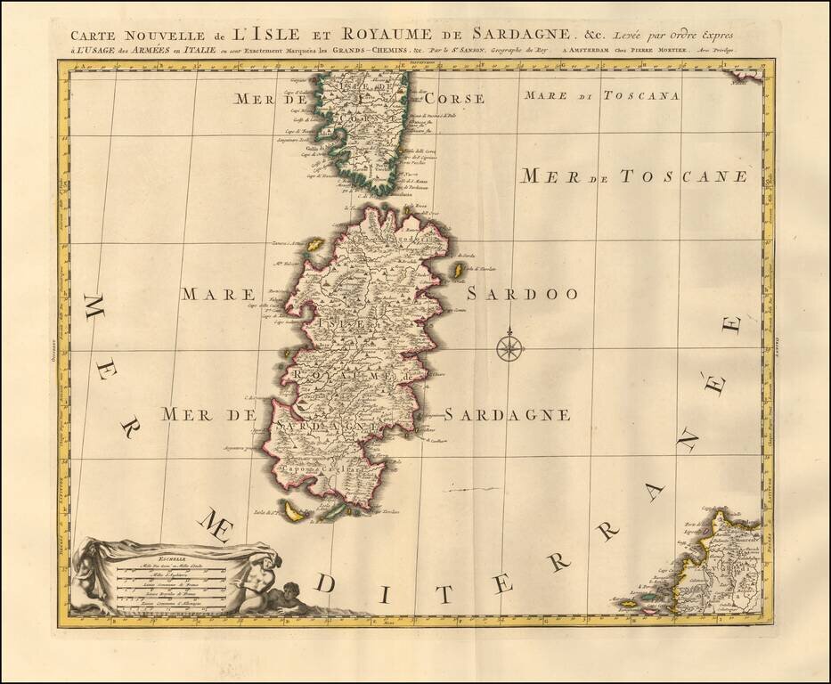
Nice example of Willem Blaeu's map of Sardinia, set in a page of text. Fine dark impression and clean wide margins.
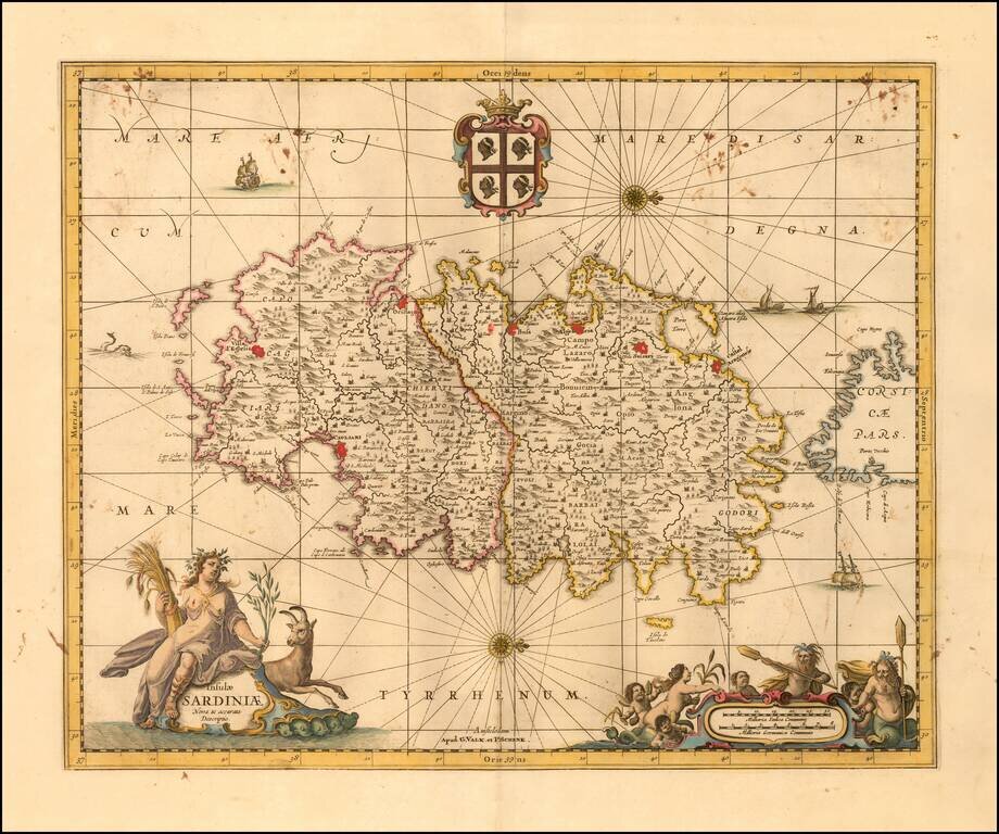
Finely executed map of Sardinia, published in Amsterdam by Valk & Schenk. The map includes a decorative title cartouche, compass rose, coat of arms and second cartouche, along with sailing ships and a sea monster.
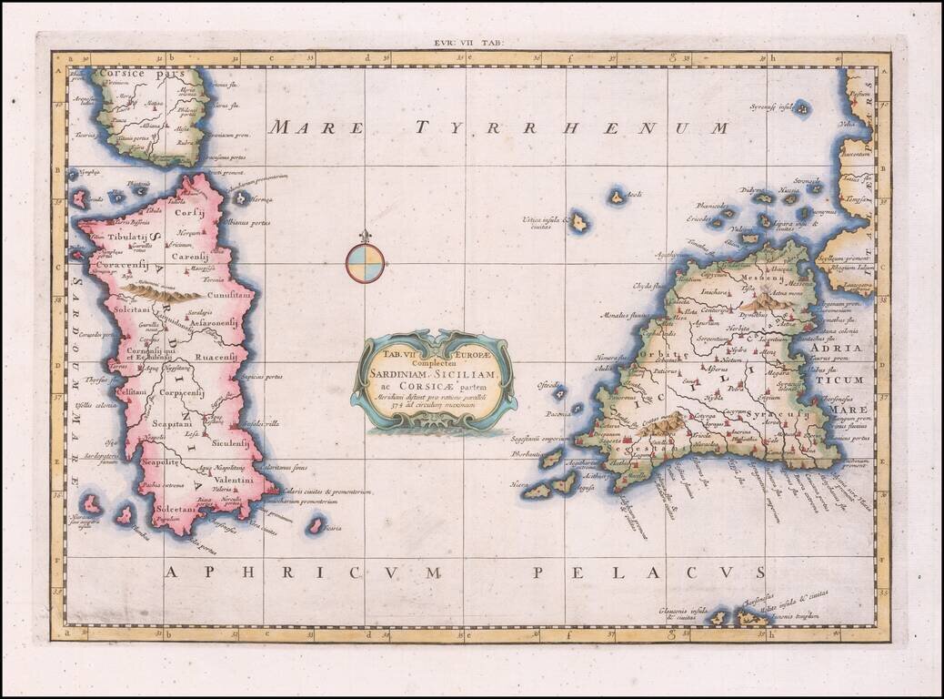
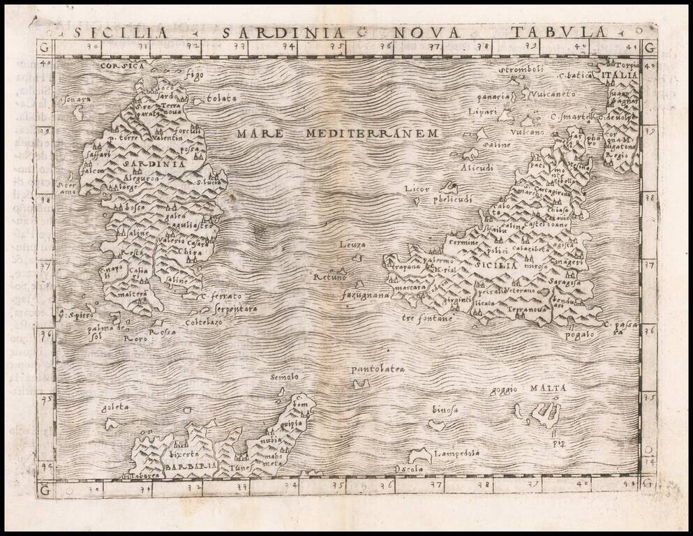
Nice example of Mercator's map of Sicily and Sardinia, from Mercator's edition of Ptolemy's Geographia, first published in 1578 and republished in Amsterdam beginning in 1695. Gerard Mercator published his edition of Ptolemy’s maps as what he...
![[Sicily] Li Nomi Antichi e Moderni De l'Isola d'Sicila](/map/small/43268.jpg)
Rare and finely engraved early map of Sicily, published in Venice by the important Lafreri School mapmaker Ferrando Bertelli. Bertelli's map of Sicily is one of only a very few Lafreri School maps of Sicily. As with the other early maps of Sicily,...
Fine early map of the Island of Sicily, from Porcacchi's L'Isole Piu Famose Del Mondo… Finely engraved, with compass rose and decorative cartouche.