Map size in jpg-format: 43.5047MiB
Click to open in high resolution (open in new tab).
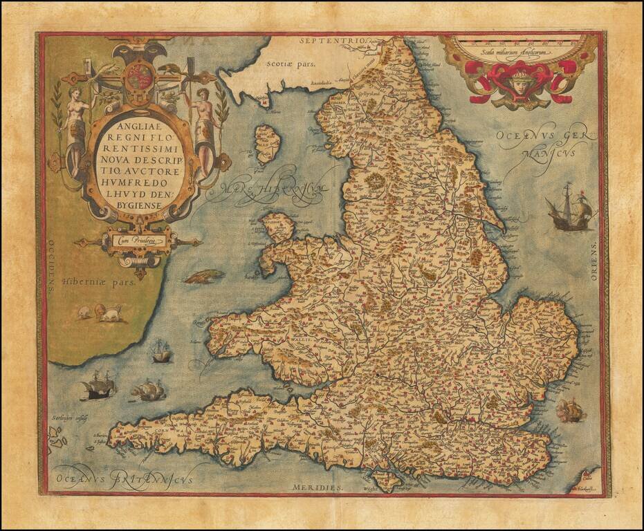
A gorgeous old color map of England and Wales, from the 1574 Latin edition of Ortelius' Theatrum Orbis Terrarum, the first modern atlas of the world. Included are an ornate cartouche and many sailing ships and sea monsters, as well as some sheep grazing in Ireland. The map is based upon Mercator's eight-sheet 1564 wall map of the British Isles as well as Lhuyd's 1596 manuscript map.
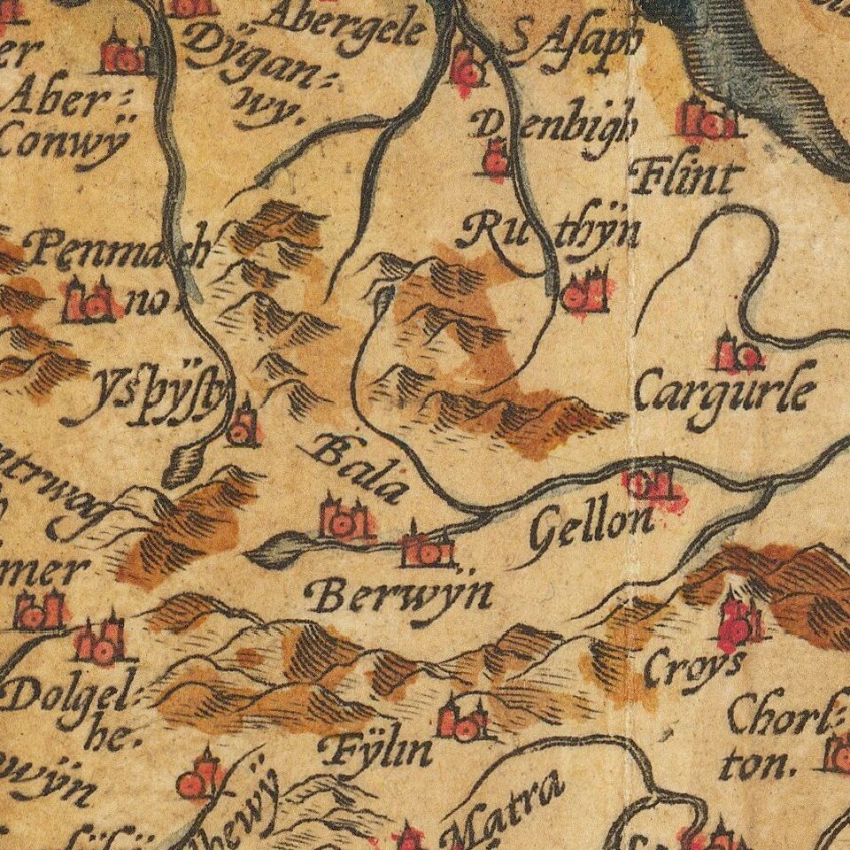
The map is attractively designed, showing extensive detail. Many cities and minor towns are named. The few mountain ranges of England and Wales are shown, as are forests. Intriguing is the remote town of Clapham, near Lancaster, which is represented completely surrounded by trees. While this remains one of the (relatively) more secluded parts of England, the hamlet no longer appears to have an encircling forest. The Isles of Scilly are labeled the "Sorlinges insule", which uses the northern European name as its root, and not the true Latin root of Syllingera. Parts of Scotland, France, and Ireland are all also visible on this map.
Theatrum Orbis Terrarum
Ortelius's Theatrum Orbis Terrarum (or "Theater of the World") is widely considered to be the first modern atlas, meaning that this was the first published set of uniform maps with supporting text gathered in book form. Previous bound map collections exist, for example the Italian Lafreri atlases, but these were sets of maps selected and bound together on demand. The Theatrum, in contrast, was the best available summary of sixteenth-century cartographic knowledge, covering much of the exploration of the world in the century following the discovery of America.
The atlas was first published in 1570 Antwerp. Ortelius’ atlas outperformed later competing atlases from other cartographic luminaries like the De Jode and the Mercator family. The broad appeal of the work is demonstrated by the array of languages in which the atlas appeared: in addition to Latin, the atlas was published with text in Dutch, French, German, Italian, Spanish, and English. Between 1570 and 1612, at least 31 editions of the atlas were published in seven languages. The editions grew over time, with the first edition having had 53 maps, and the 1612 edition having 167.
At the time of its publication, the Theatrum was the most expensive book ever produced. Ortelius created all maps personally, hand drawing the rough sketches. Those drawings were then interpreted into prints by his engravers Frans Hogenberg, Ambrosius Arsenius, and Ferdinand Arsenius.
After Ortelius's death in 1598, the copper plates for his atlas passed to his heirs. They, in turn, sold the collection to Jan Baptist Vrients (1522-1612) in 1601. Vrients added new maps and published the atlas until his own death in 1612. Vrients's widow then sold the plates to the Moretus brothers, who were the successors of Christoffel Plantin. Recent research has unearthed examples of the atlas with maps dated to 1640.
If you are a student, write to us in telegram: @antiquemaps and indicate what material you need and for what work you need a map in high detail. We are ready to provide material on special terms. For students only!

![[Eastern Hemisphere Globe Gores] (Nova et integra universi Orbis descriptio)](/map/small/54480.jpg)
![[The First Maps in a la poupée Printed Color] Cartes en Couleur des Lieux Sujets aux tremblements de Terre Dans toutes les parties du Monde Selon le Sisteme de l’impulsion Solaire](/map/small/52293op.jpg)