
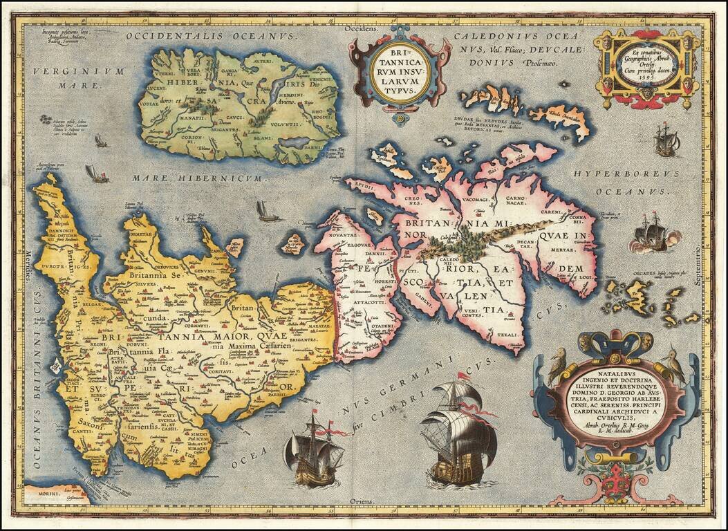
Notable Atlas Map of the British Isles, From the First Modern Atlas Scarce, fine map of the British Isles, from Ortelius' ground-breaking atlas, Theatrum Orbis Terrarum. Oriented to the west, the British Isles are shown as if on their side. The...
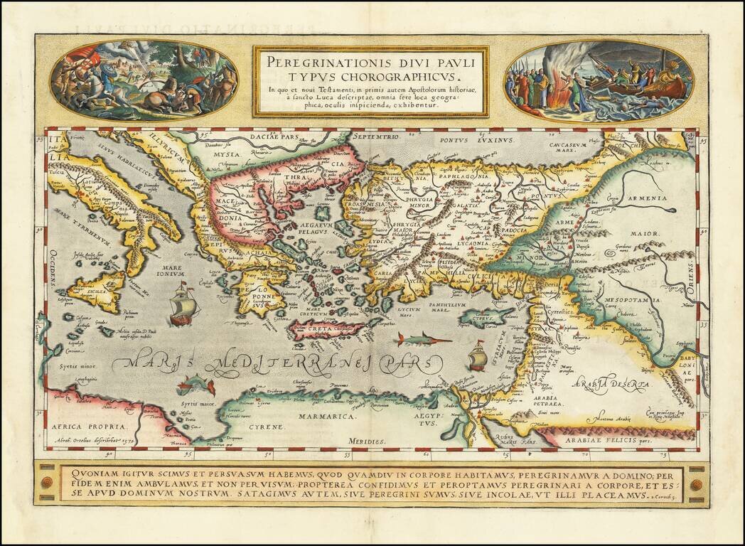
A gorgeous example of Ortelius' map of the travels of St. Paul the Apostle through the Mediterranean, extending west to Italy and east to the Euphrates, including parts of the Red Sea and the Black Sea. Several sailing ships and sea monsters in the...
![Lisbona. Olisipo ... vulgo Lisbona Florentissimum Portugalliae Emporiu. [with] Cascale Lusitaniae Opp](/map/small/67935.jpg)
A view of Lisbon and Cascale, which first appeared in Braun and Hogenburg's Civitates Orbis Terrarum. Lisbon is shown as a great port city, with many large ships in its harbor. In the city, castles, churches, port buildings, and citizens can all be...
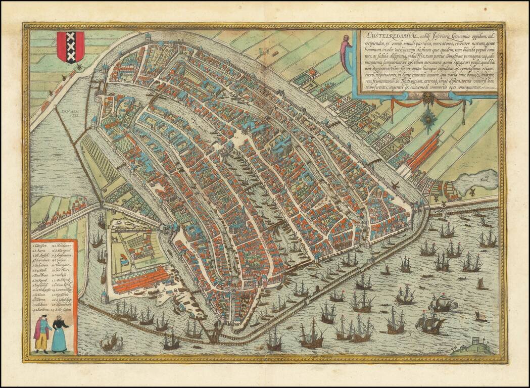
This is a finely colored example of Braun & Hogenberg's first view of Amsterdam, from Part I of their Civitates Orbis Terrarum, first published in Cologne in 1572. Braun & Hogenberg's view is based upon a plan of Amsterdam by Cornelis...
![Posonium [Bratislava]](/map/small/67630.jpg)
An attractive antique view of Posonium [Bratislava] showing the city from the east, from across the Danube. The city is small, with a handful of churches, several neighborhoods, and a castle overlooking the city. The map is delicately colored....
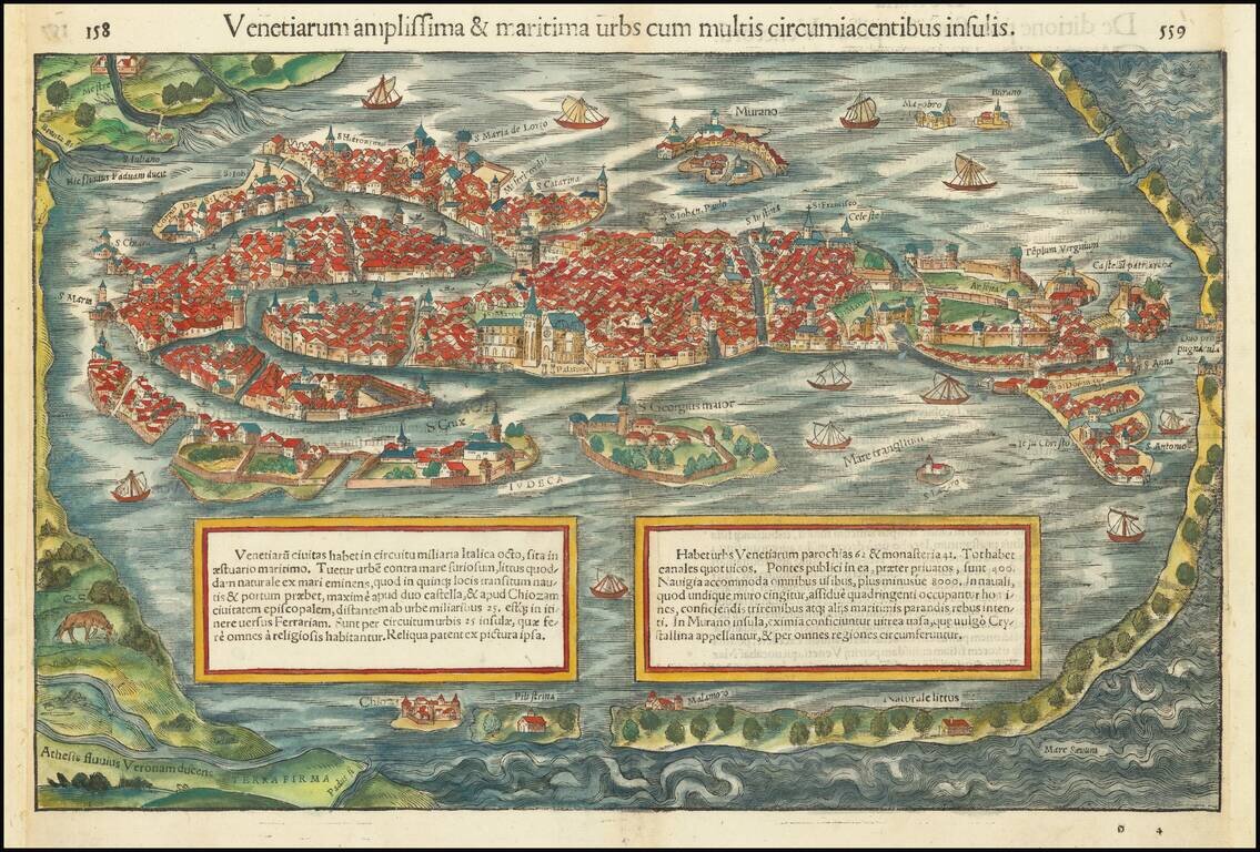
This is a gorgeous full-color example of Munster's view of Venice, from a Latin edition of Munster's Cosmographia, which was one of the most prolific works of the 16th and 17th centuries. This is one of the earliest obtainable birds-eye views of...
![[Fall of Berlin - Operation Clausewitz] Umgebung von Berlin](/map/small/60025.jpg)
Extraordinary Defensive Plan of Berlin, Prepared by Nazi Forces on the Eve of the Soviet Capture of the City and the End of World War II in Europe. This Map was Captured by Soviet Soldiers and Bears an Inscription in Russian in the Upper Left Corner....
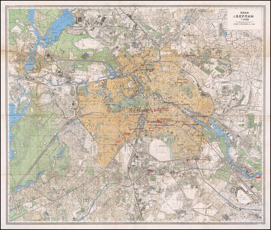
Mapping the Soviet Propaganda Machine in Occupied Berlin. Color-printed folding map of Berlin, issued by the Soviet government in 1945. This example is substantially enhanced with early (circa Spring 1945) manuscript notations of major printing and...
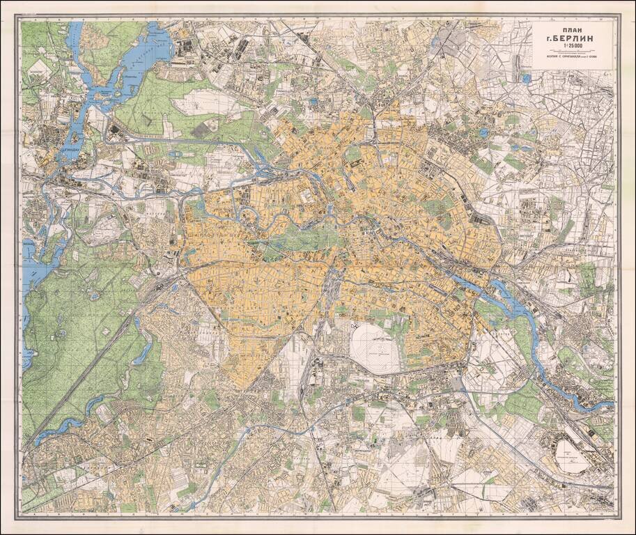
The Official Soviet Map Used in the Battle of Berlin, April 1945. Color-printed folding map of Berlin, issued by the Soviet Union in 1945. In many cases, these maps were carried into Berlin by front-line Red Army troops. The map was issued in...