Map size in jpg-format: 1.77822MiB
Click to open in high resolution (open in new tab).
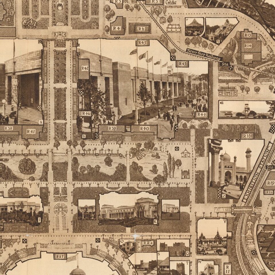
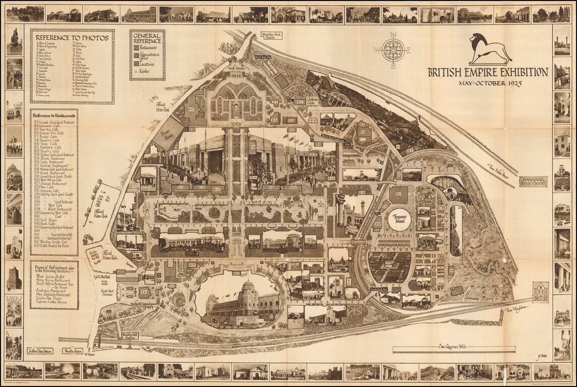
A highly decorative and detailed map of the 1926 British Empire Exhibition, incorporating many photographs of buildings both in the border, and integrated into the map image.
The map includes keys to the photos, a general reference key (describing administrative offices, restaurants, lavatories, and kiosks), and a key to restaurants.
The photography is credited to Campbell Gray, and the map was published by Waterlow & Sons Limited.
The map is titled on the cover: "The New Wembley 1925 British Empire Exhibition May-October. The Same Empire but a New Exhibition."
If you are a student, write to us in telegram: @antiquemaps and indicate what material you need and for what work you need a map in high detail. We are ready to provide material on special terms. For students only!


