logo

1639. De Noort Cust van Engelandt tuschen Crammer en de Revier van Nicasteel / Les Costes Marines d' Engleterre et Escosse entre Crammer et Orcades.

  • De Noort Cust van Engelandt tuschen Crammer en de Revier van Nicasteel  /  Les Costes Marines d' Engleterre et Escosse entre Crammer et Orcades.

De Noort Cust van Engelandt tuschen Crammer en de Revier van Nicasteel / Les Costes Marines d' Engleterre et Escosse entre Crammer et Orcades. information:

Year of creation: 
Resolution size (pixels): 
 12944x9421 px
Disk Size: 
 23.4019MiB
Number of pages: 
 1
Place: 
 
Author: 

Print information. Print size (Width x height in inches):
Printing at 72 dpi 
  179.78 х 130.85
Printing at 150 dpi 
 86.29 х 62.81
Printing at 300 dpi 
 43.15 х 31.4

An example of detailing the file of this map of in a printable high-resolution:

Click to open in high resolution (open in new tab).
Attention! this is just the central piece (central area 960x960 px) of the map file!
This is an example, so that you can see and study the level of detail of a given map. The entire Map will be fully available after payment!

De Noort Cust van Engelandt tuschen Crammer en de Revier van Nicasteel  /  Les Costes Marines d' Engleterre et Escosse entre Crammer et Orcades.

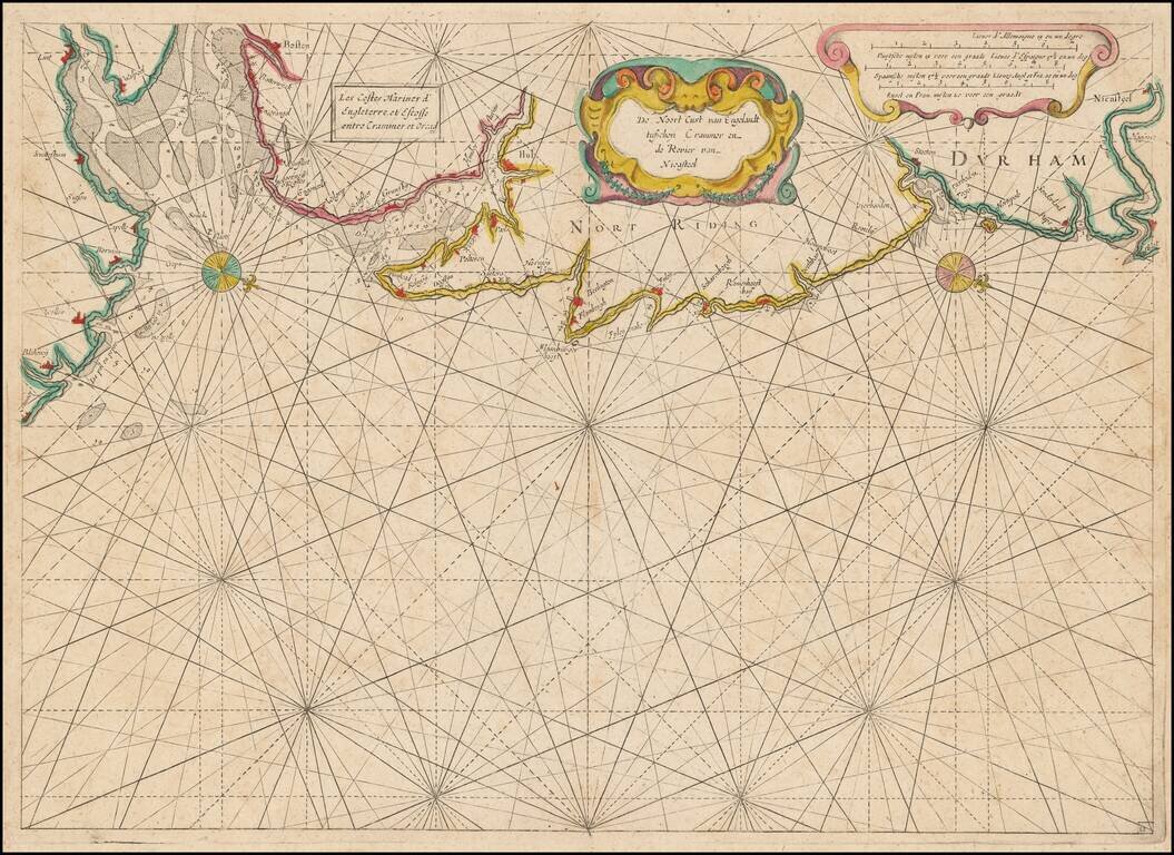
Rare Dutch Sea chart of the Coast of England, published by Jacob Colom, circa 1639.

The map appeared in Colom's The New Fierie Sea-Colomne, one of the earliest of Colom's works.

Oriented with west toward the top, the chart extends from Cromer in the south (near Norwich) to the area near Sunderland, Newcastle and the mouth of the Tyne River.

The chart is very rare on the market.


Special conditions for students!

If you are a student, write to us in telegram: @antiquemaps and indicate what material you need and for what work you need a map in high detail. We are ready to provide material on special terms. For students only!

Item information:

Year of creation:
Size:
12944x9421 px
Disk:
23.4019MiB
Number of pages:
1
Place:

Author:
Jacob Aertsz. Colom.
$14.99

Related item