
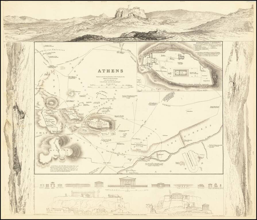
Highly detailed plan of Ancient Athens, surrounded by views of the ancient City. Includes views of ancient monuments and the restored Acropolis. One of the best published in a commercial atlas in the 19th Century. Marvelous ancient plan with vignettes.
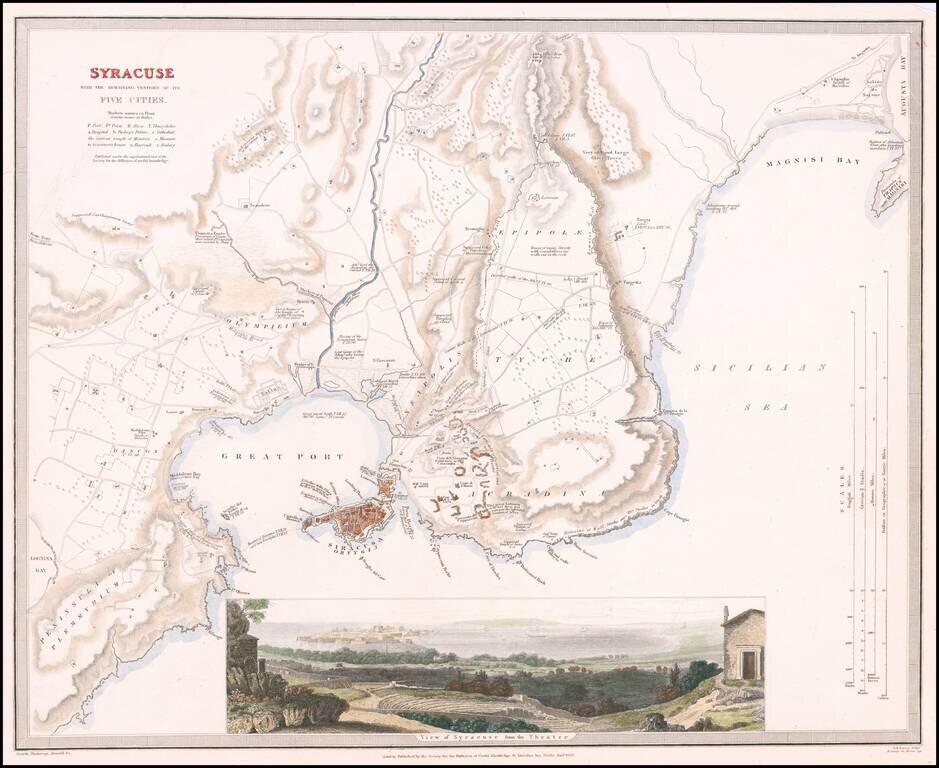
Highly detailed town plan of Syracuse, with a larger view of the City from its Roman Ampitheatre. One of the best published in a commercial atlas in the 19th Century. Plans of Syracuse are quite rare.
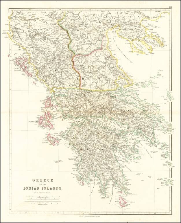
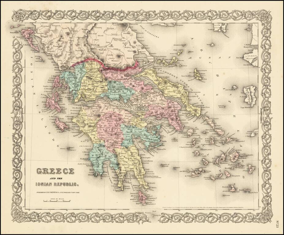
Attractive map of Greece and the Ionian Islands, prior to the consolidation of the Island into the Greek nation. The map appeared in John Arrowsmith's London Atlas.
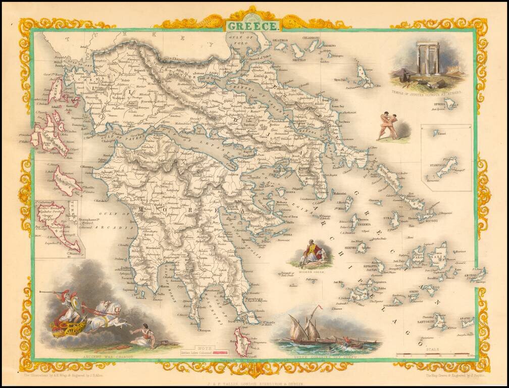
Decorative color example of this marvelous map. Decorative vignettes of an ancient war chariot, Temple of Jupiter on Mt. Olympus, Greek Corsairs off Corfu, a modern Greek and wrestlers. Engraved for R. Montgomery Martin's Illustrated Atlas. Tallis was...
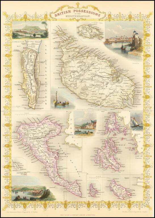
Gorgeous full color example of Tallis' map, with vignettes showing Valetta, Ithaca, Gibraltar and Corfu. Islands that are shown are Gibraltar, Malta, Corfu, Zante, Cerigo, Morea, Cephalonia, Ithaca and Gozo. Engraved for R. Montgomery Martin's...
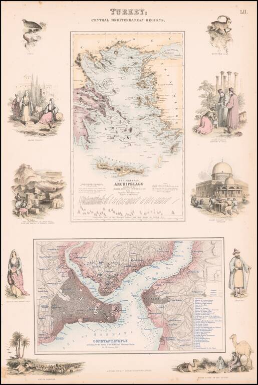
Highly detailed map of Turkey, Greece, the Greek Islands and the Aegean, with a second large map of Istanbul. Two maps on one sheet, the first showing The Grecian Archipelago, the second showing Constantinople. Decorative vignettes showing local...
Detailed map of the Greek Islands, showing towns, mountains, rivers, roads, lakes, gulfs, bays, etc. Decorative border. A terrific regional map, from JH Colton, one of the most prolific American mapmakers of the mid-19th Century.

An attractive antique map of western Turkey, Greece, and the Balkans with various insets. The map is highly detailed, showing many settlements, islands, railroads, and more. The map is colored in attractive pastels. The geopolitical boundaries at the...
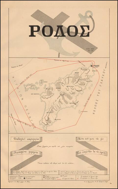
A Rare Greek Independence Propaganda Map Propaganda map of the Island of Rhodes, from Ivan Petrov's Atlas of the holy struggle of the Greeks for Independence" [ "Ατλας Τον Υπερ Ανεζαρτηησιας Ιερο Των Ελληνων...
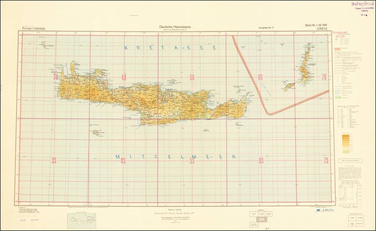
World War II-era German Army map of Crete, published shortly before the liberation of Crete from Germany occupation in October of 1944. The map is a sheet from the 1:500,000 Europa series and it is replete with topographical and political data. This...
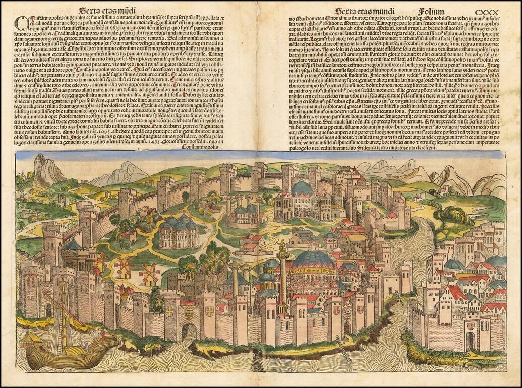
Decorative example of Hartmann Schedel's incunable view of Constantinople from Schedel's Liber Chronicum, perhaps the single most influential secular illustrated book of the 15th Century and one of the landmark printed works of the 15th Century....
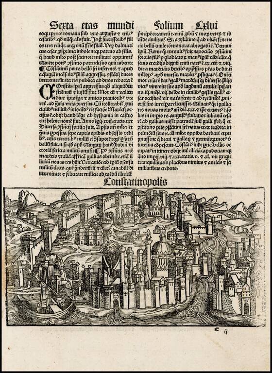
One of the earliest obtainable views of the City of Istanbul, from Schonsperger's miniature edition of Schedel's Liber Chronicum. The Liber Chronicum (Nuremberg Chronicle) was first published in the summer of 1493 in Latin. The German edition appeared...
![[Bosphorus Straits, Black Sea, Sea of Marmora]](/map/small/42361.jpg)
Interesting early map of the the region centered on the Bosphorus Straits, and the Sea of Marmora (named Palus Maeotica), which appeared in the 1538 edition of Solinus' Polyhistor, rerum toto orbe memorabilium thesaurus locupletissimus. Huic ob...
![[Asia Minor] Tabula Asiae I](/map/small/70464.jpg)
Nice example of Munster's Ptolemaic map of Asia Minor and parts of the Black Sea and Cyprus. From an early edition of Munster's Geographia, one of the most important works of the 16th Century. Sebastien Munster is generally regarded as one of the...
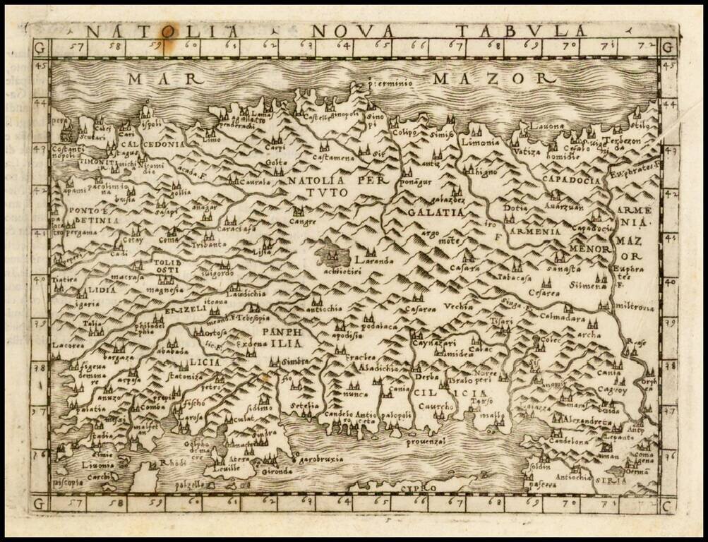
Fine dark impression of Gastaldi's modern map of Asia Minor, one of the earliest modern maps of the region, from Gastaldi's Geografia di Claudio Ptolemeo Alexandrino . . . , published in Venice in 1548.

Finely colored early view of Constantinople (Istanbul), one of the earliest widely distributed views of the City from the 16th Century. Munster's Geographia (first published in 1540), and his later Cosmographia, were cartographic landmarks. The...