
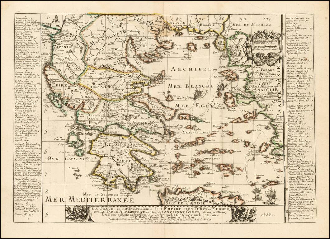
Rare map of the Greek Islands by Pierre Du Val, published in Paris. Du Val's map focuses on the Aegean and the various trade routes through the region and beyond, tracking the routes of ancient and modern Mariners from the Dardenelles, Gallipoli and...

Decorative map of the Greek Islands of Pelagnisi, Saraquino, Prosonissi, Lidrome, Scoglieto, Dromo and contiguous islands, from Mallet's Description de L'Univers, first published in Paris in 1683.
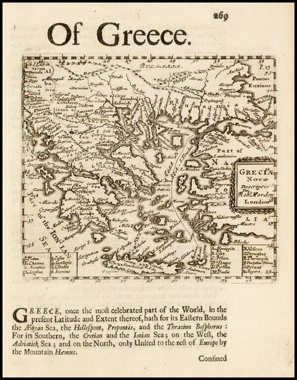
Rare English map of Greece and contiguous islands in the Aegean and Ionian Seas. This map first appeared in Modern's rare Atlas Terestris, first published in 1687.
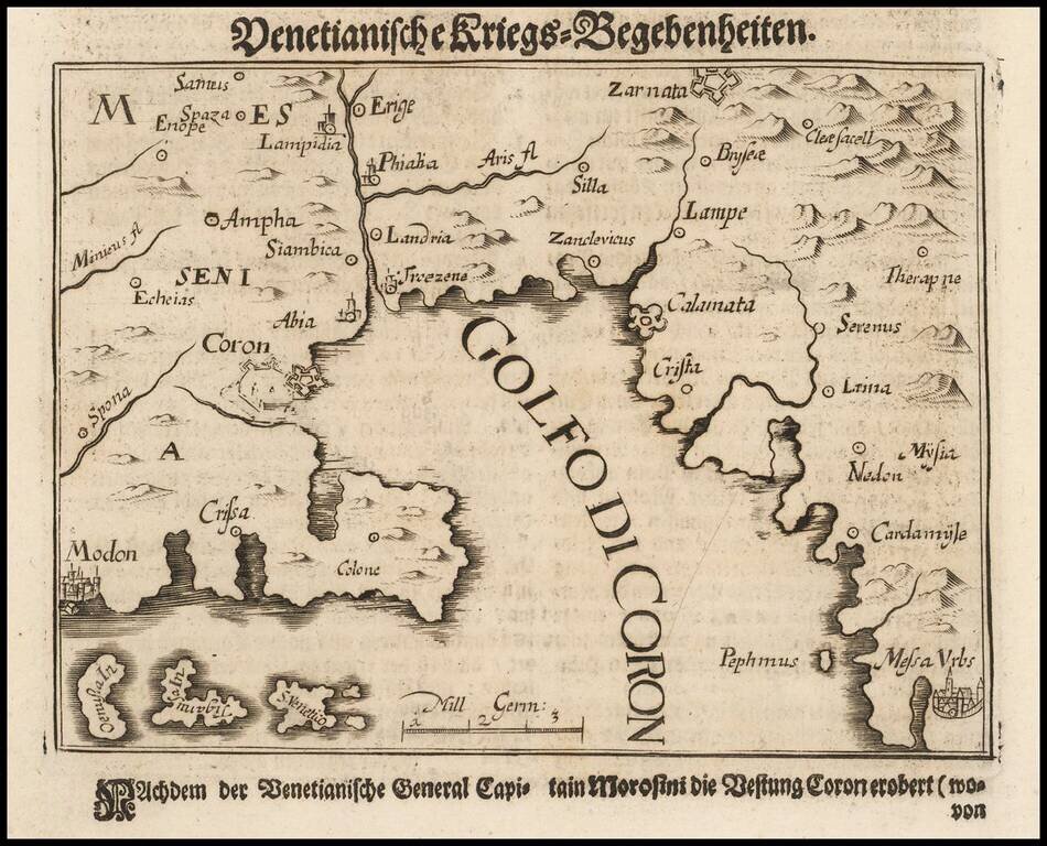
Morosini's Sacking of Koroni in 1685 Scarce map of the coastal region near Kalamata, extending from Methoni and Koroni to Kardamyli and Stoupa. The map illustrates an expedition of Captain General Francesco Morosini against the Ottoman Turks....
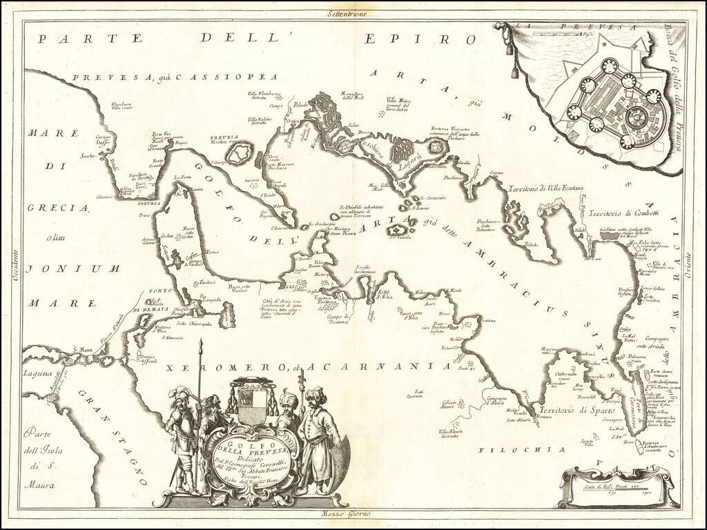
Celebrating the Ventian Conquest of Preveza Fine early map of Preveza Bay on the west coast of Greece, published in Venice by Coronelli. The map was likely published to commemorate the conquest of Preveza and environs by the Venetians from the...
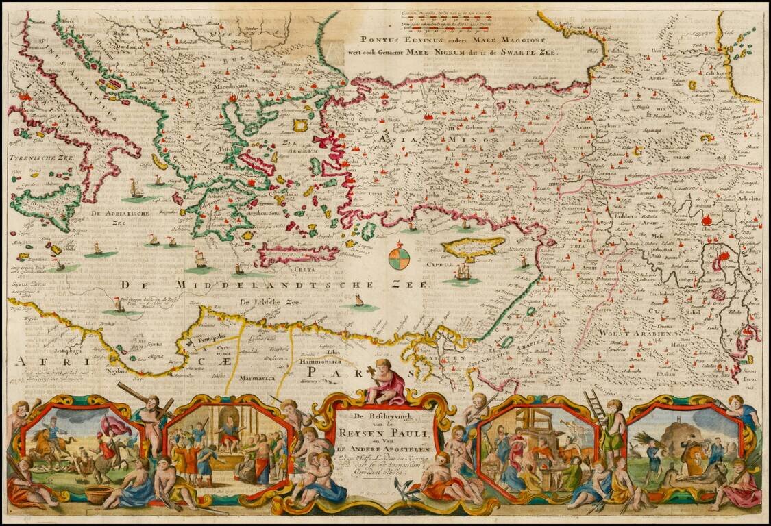
Nice example of Stoopendahl's map of the Eastern Mediterranean, showing the Travels of the Apostels. The map illustrates the travels of Paul in the Mediterranean, and includes 8 biblical scenes from Paul's travels.
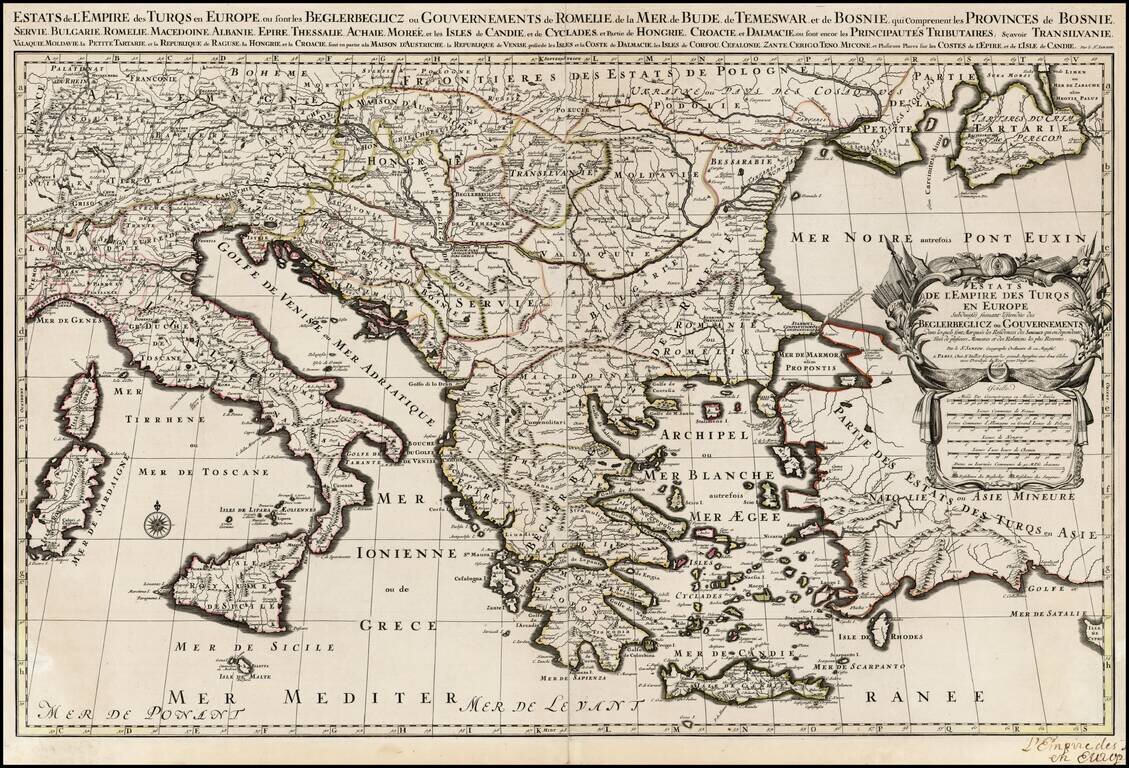
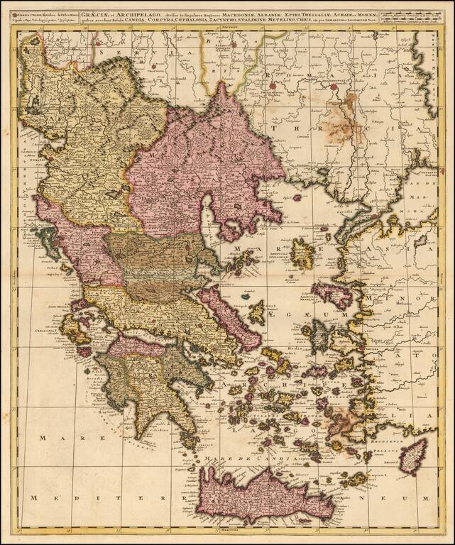
Scarce large format map of the Turkish Empire in Europe and the Eastern Mediterranean, published by Jaillot, based upon the earlier maps of Nicolas Sanson .
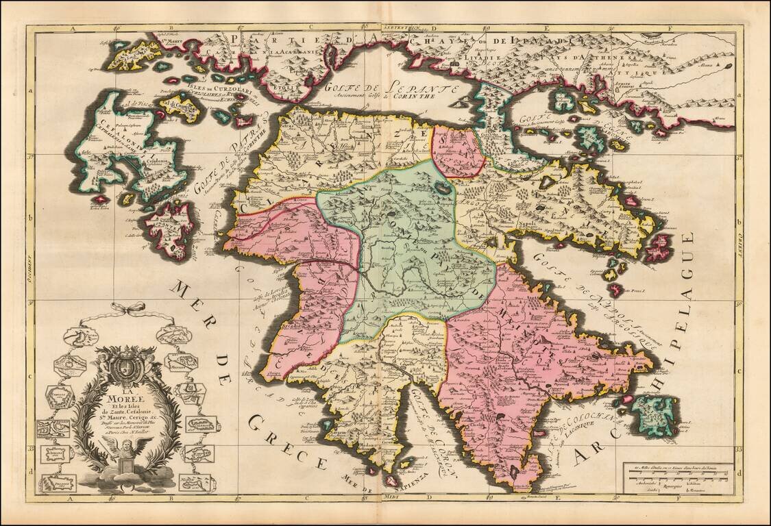
Striking large and highly detailed map of Morea and surrounding islands by Jaillot. Includes smaller plans of 12 other islands.
![[Rhodes and Stanchio, Greece] Rhodus / Stanchio](/map/small/41669.jpg)
Striking view of Rhodes and Stanchio, from De Bruyn's Reizen van Cornelis de Bruyn . . . . The Dutch painter and traveler, Cornelius de Bruyn, traveled to Constantinople and the empire between 1677 and 1684. All the spires, minarets, mosques and...
![[Rhodes] Rhodus](/map/small/41614.jpg)
Striking view of the island of Rhodes, from De Bruyn's Reizen van Cornelis de Bruyn . . . . Finely engraved view of the Greek island of Rhodes, depicting the Old Town with fortifications beside a row of windmills. Numerous ships and boats sail the...
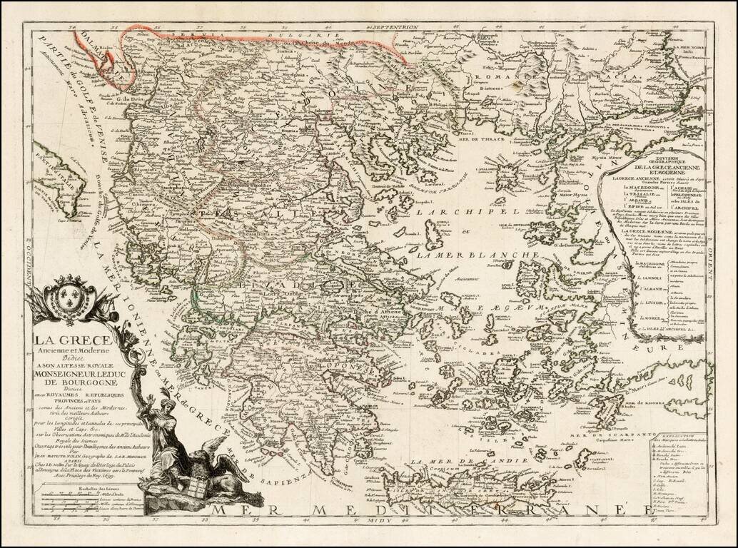
Fine example of Nolin's map of Greece, first published in 1699. The map is divided into kingdoms, republics and provinces and includes a coat of arms and elaborate title cartouche.
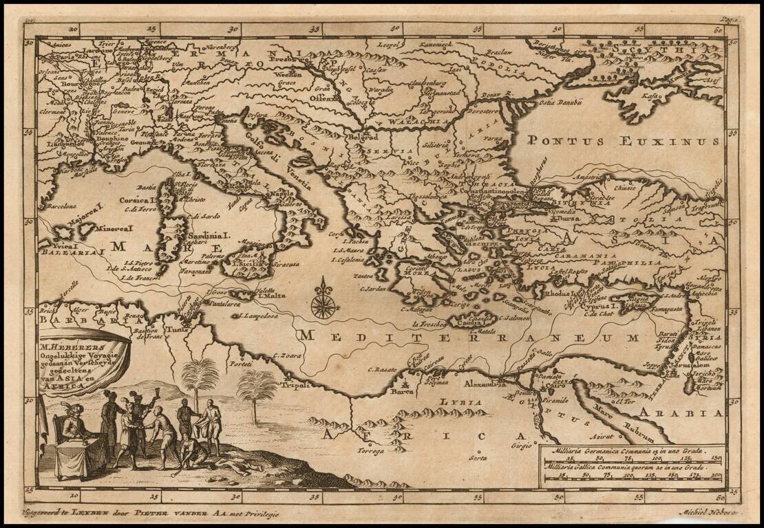
Decorative map of the Mediterranean and contiguous lands. The map was used to illustrate the Dutch translation of the travel narrative of German explorer, Michiel Heberer. Heberer (1560-1623/33?) has been called der pfälzishe Robinson, or Robinson...
Detailed map of Greece and neighboring islands, engraved in Amsterdam by Valk.
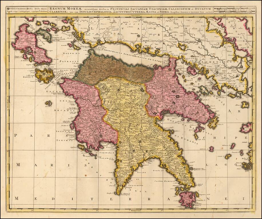
Detailed map of Morea and neighboring islands, engraved in Amsterdam by Valk.
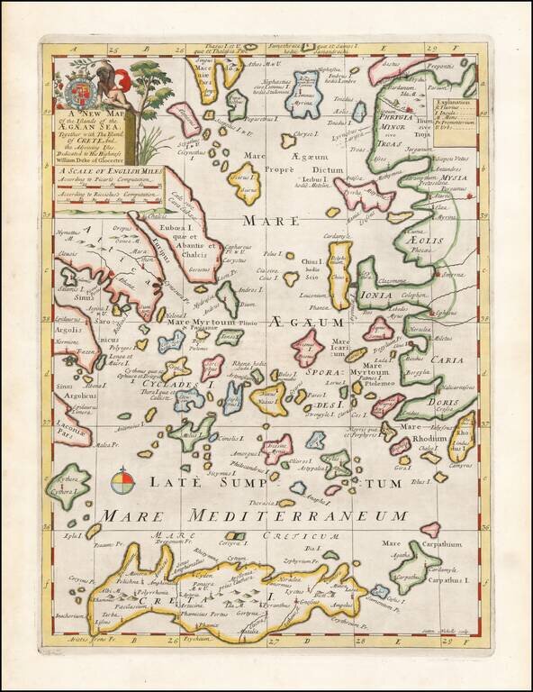
Decorative map of the Aegean Islands. This decorative map was part of a set of 22 maps dedicated to William, Duke of Glouchester, who was then an 11 year old student at Oxford.
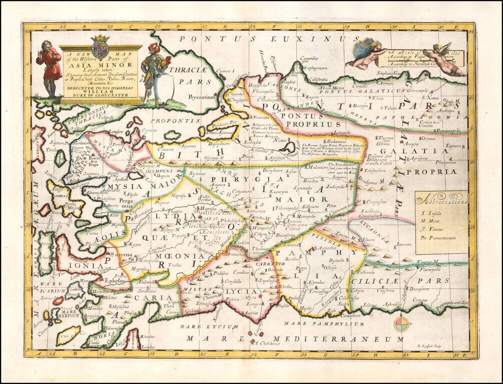
Striking map of Asia Minor and and neighboring Islands. This decorative map was part of a set of 22 maps dedicated to William, Duke of Glouchester, who was then an 11 year old student at Oxford.