

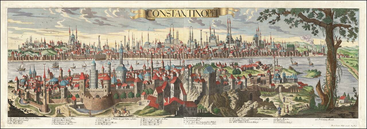
Rare view of Constantinople, extending from St. Demitre to Chateau De Sept Tours and Scutari to Fanarikiosk. The present example is credited to Le Blond and is very rare.

Fine map of the Ottoman Empire, published in Nuremberg by Christopher Weigel. Includes a decorative allegorical cartouche.

Antique Map of the Environs of Istanbul with a View of "the city of Stambul or Constantinople" from the East Side of the Bosphorus Decorative antique map and early view of Istanbul and environs. The map includes a large inset bird's-eye view of the...
Rare, Highly Detailed View of Sixteenth-Century Istanbul This exceptional view of Constantinople (Istanbul) was published by Jeremiah Wolff, the most successful map publisher in Augsburg during his time. It is sumptuously detailed and includes the...

Striking map of the region centered on Saudi Arabia, Cyprus and the Mediterranean Sea. Includes a large decorative cartouche and annotations throughout the map. Excellent detail and nice color.
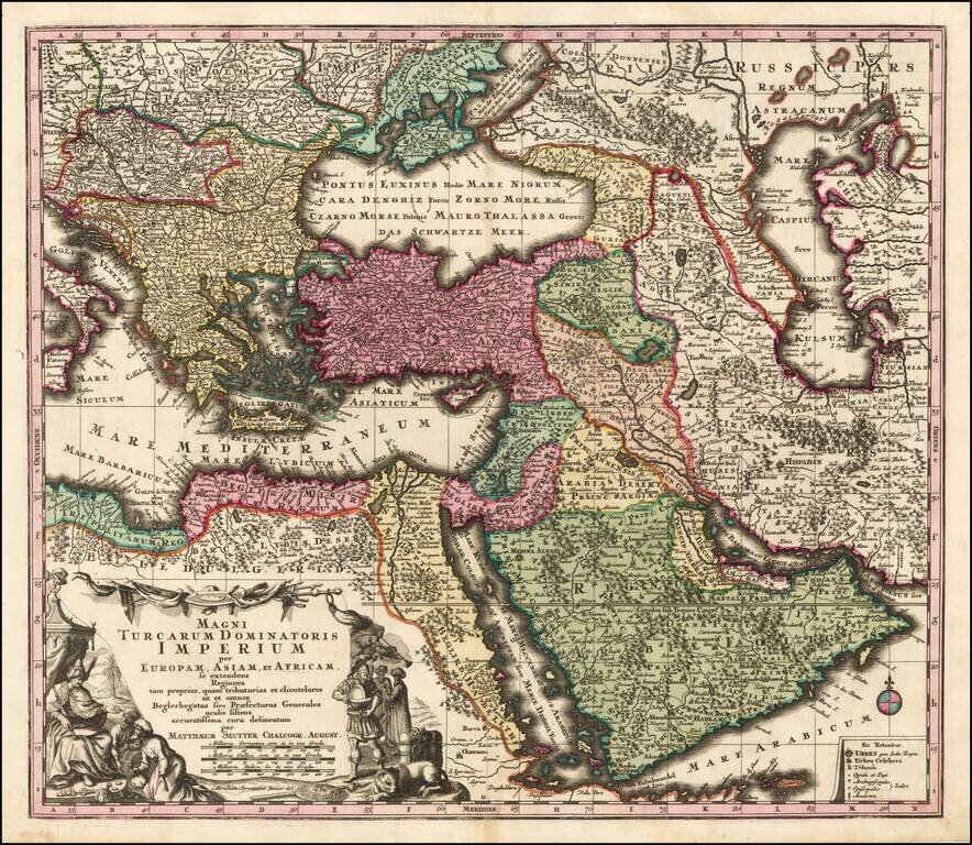
Striking hand-colored engraved regional map, centered on Turkey and Asia Minor, and showing the Eastern Mediterranean, Balkans, Greece, Persia, Saudi Arabia, the Black Sea and the Caspian Sea, published by Seutter. Includes decorative cartouche and...
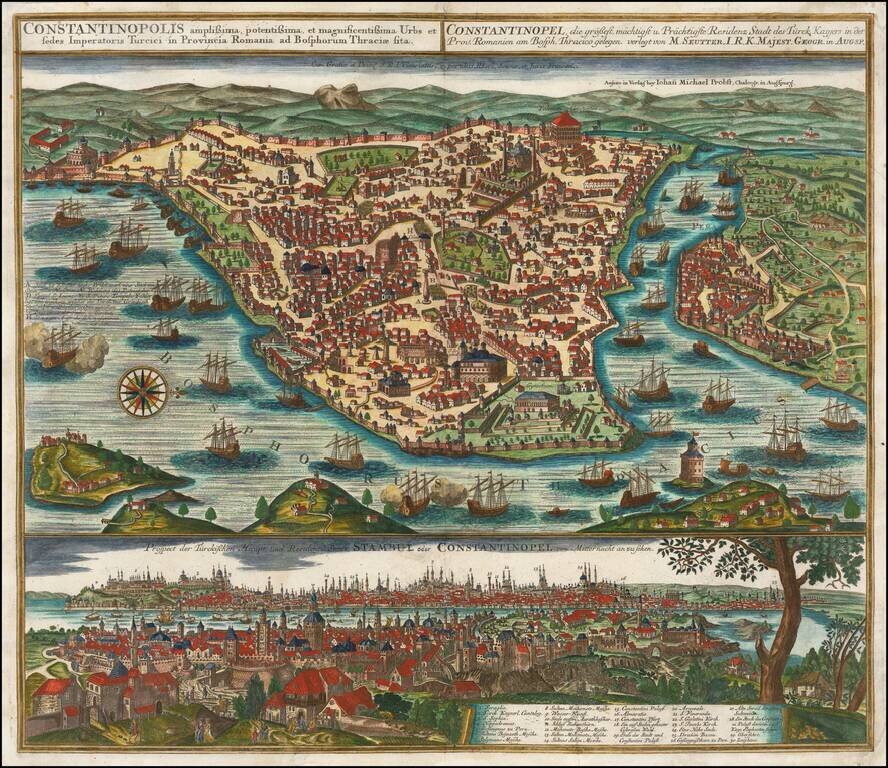
Striking plan of Istanbul, with the Bosphorus in the foreground.. The plan includes a large detailed view of the City at the bottom, with a key locating 30 landmarks. Fine old color example of Seutter's city plan and local views. Seutter engraved...
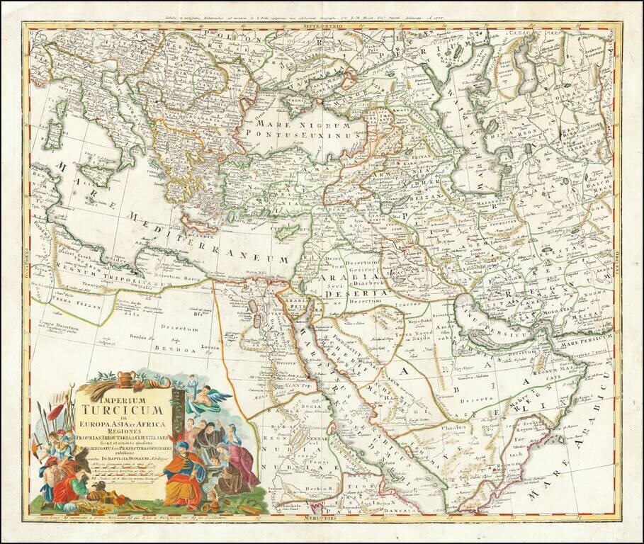
Gorgeous map of the Ottoman Empire, extending from the Persian Gulf and Red Sea to the Mediterranean and Caspian Seas, centered on Cyprus. Excellent detail and an attractive cartouche.
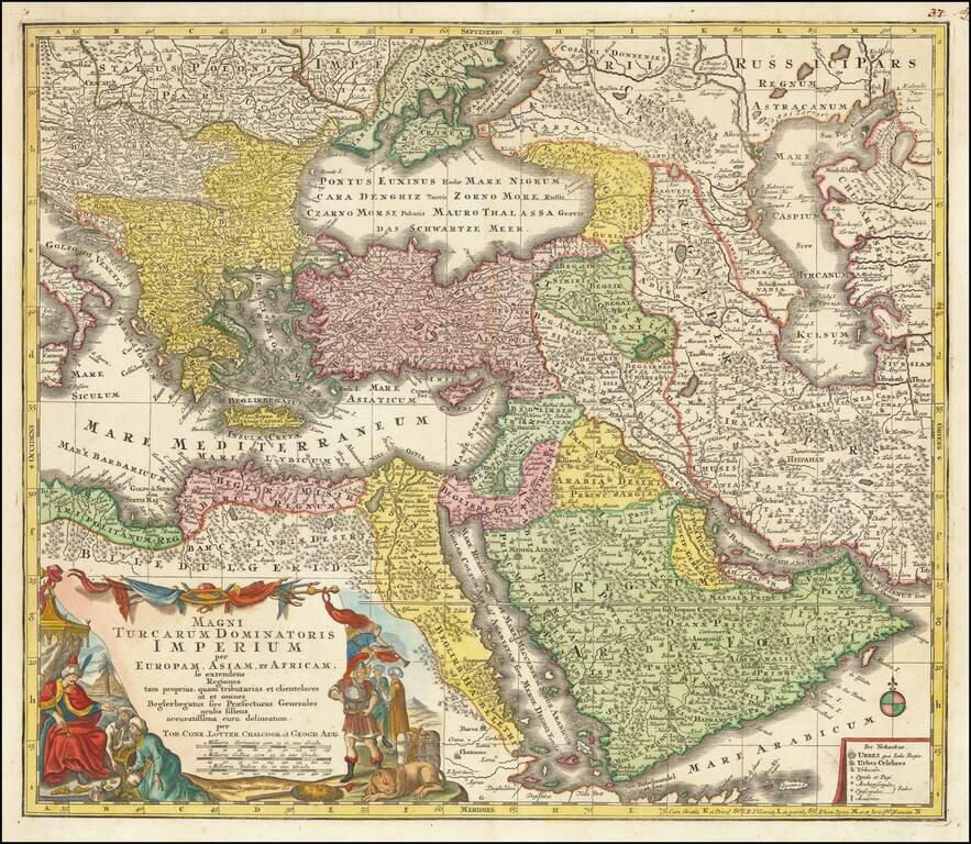
Striking regional map of the Turkish / Ottoman Empire, centered on Turkey and Asia Minor, and showing the Eastern Mediterranean, Balkans, Greece, Persia, Saudi Arabia, the Black Sea and the Caspian Sea. Includes a decorative cartouche in the lower...
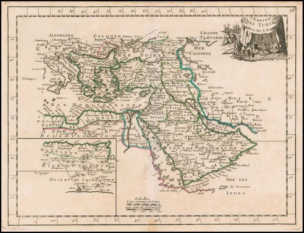
Scarce map of the Turkish Empire, from Le Rouge's Atlas Nouvel Portatif . . . , first issued in Paris in 1748. Includes a fine decorative cartouche.
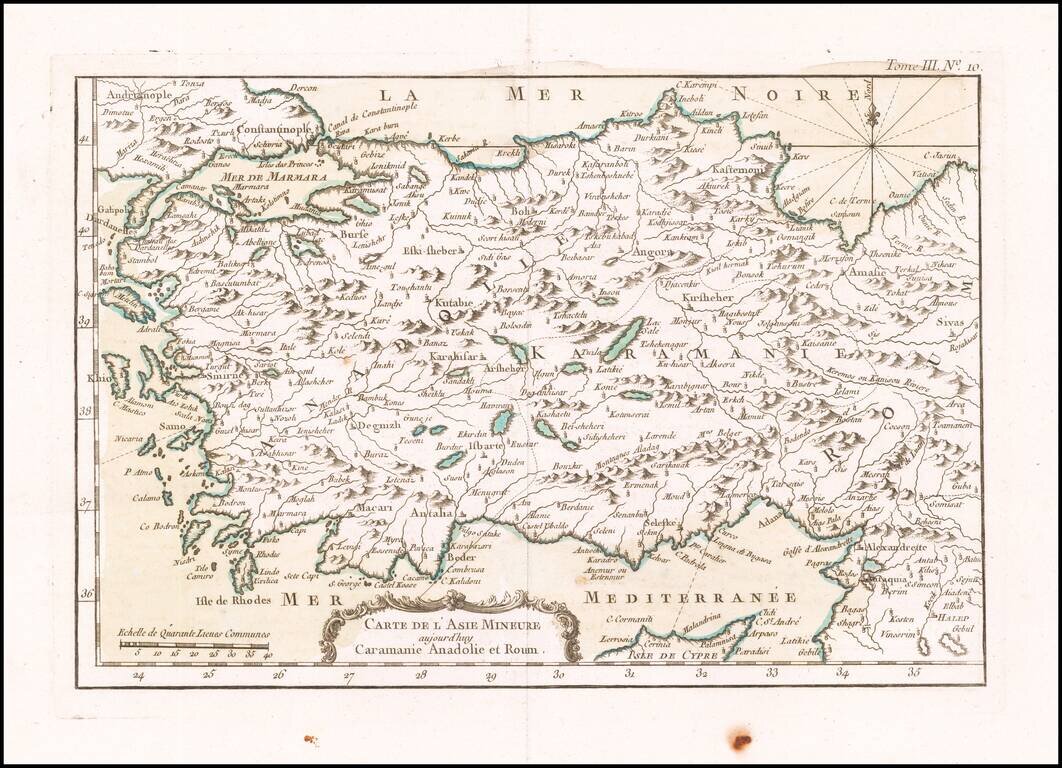
Finely engraved map of Asia Minor and the north part of Cyprus, from Jacques Nicolas Bellin's Le Petit Atlas Maritime Recueti de Cartes et Plans des Quatre Parlies du Monde en Cinq Volumes, first published in Paris in 1764.
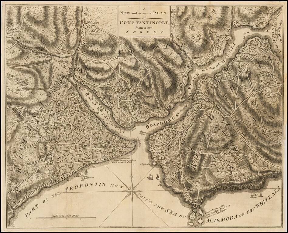
Detailed plan of Constantinople, published in the Universal Magazine. Includes fine topographical detail, compass rose, roads, fortifications, etc.
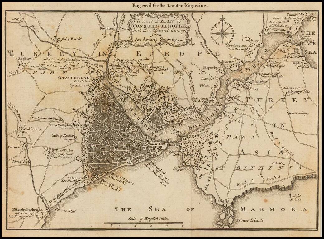
Detailed map of the area around Istanbul, published in the London Magazine. The map shows the area of Istanbul, and the Bosphorus Straits, with a number of roads and smaller towns, much of which is now a part of the sprawling Istanbul Metropolis.
![Turcia Asiatica exhibens Natoliam Modernam….Georgiae, Armeniae, Mesopotamiae, Syriae aet Arabiae…1771 [shows Cyprus]](/map/small/40124.jpg)
Scarce regional map of the Asiatic regions of the Turkish Empire, first published in Nuremberg in 1771. The map is centered on the Black Sea and extends from Cyprus and Greece in the west to the Caspian in the East.
Detailed map of Cyprus, Asia Minor and contiguous Islands and the Black Sea region, from Paola Santini's large atlas, published in Venice.

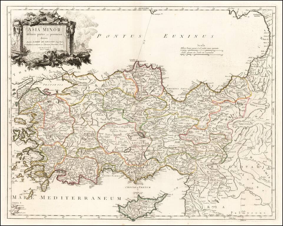
Rare highly detailed map of Asia Minor, Cyprus and environs, engraved by Lindeman, for a Dutch edtion of Pococke's Description of the East and Some other Countries, first published in London in 1745. Richard Pococke was born in Southampton and...