
![A New Map of Turkey In Asia, Divided into its Provinces . . . 1801 [Cyprus]](/map/small/48874.jpg)
Detailed map of Turkey, Asia Minor, Persia, Syria, Iraq, Armenia, etc. Very large Cyprus shown. Colored by provinces. Excellent detail. One of the best large format English atlas maps of the period.
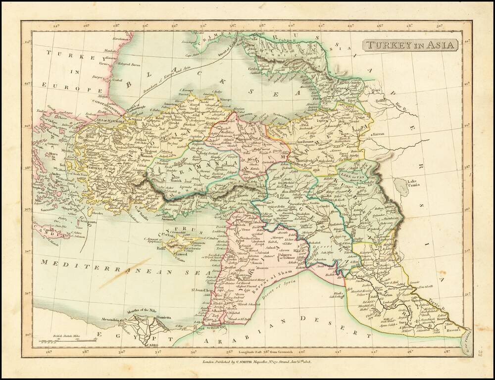
Detailed map of Asia Minor, Syria and Iraq. Excellent detail. Shows towns, rivers, mountains, islands, etc. From Smith's General Atlas. Nice topographical detail.
![Turkey In Asia [shows Cyprus]](/map/small/42881.jpg)
Detailed map of Turkey, Asia Minor, Persia, Syria, Iraq, Armenia, etc. Very large Cyprus shown. Colored by provinces. Excellent detail. One of the best large format English atlas maps of the period. Pinkerton's maps reflect the fine copperplate...
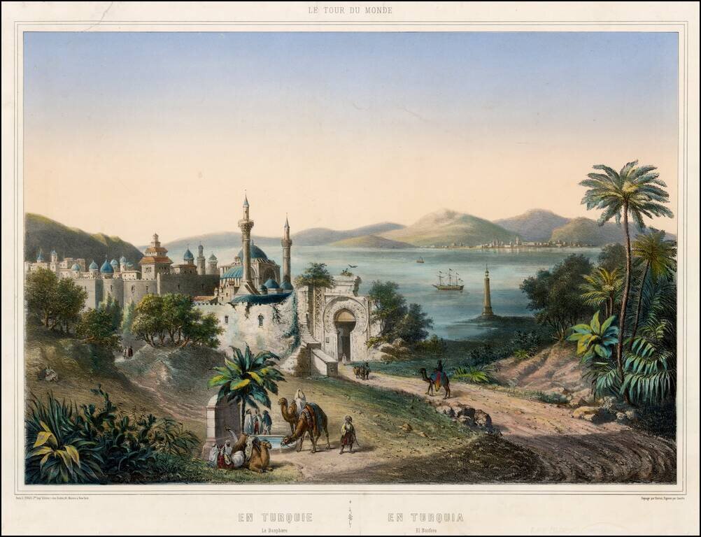
Striking view of Istanbul, with the Bosphorus in the background, published by Turgis in Paris.
![Азіятская Турція, Персія, Аравія, и Часть Туркестана. [Asian Turkey, Persia, Arabia, and Part of Turkestan.]](/map/small/66732.jpg)
Detailed and very rare Russian-language the Middle East, published in Saint Petersburg in 1836. The map differentiates between Arabia, the Ottoman Empire (and internal regions such as Karamania), Persia, Afghanistan, Baluchistan, etc. Rarity The map...
![Turkey in Asia [Shows Cyprus]](/map/small/67948.jpg)
Detailed map of Asia Minor, Cyprus, Syria, Armenia, Al-Jesira, Irak, Kurdistan and Azerbijan. Shows towns, islands, rivers, mountains, gulfs, bays, etc. Includes Cyprus and a large insets of the Environs of Constantinople. Nice ethnic detail, with...
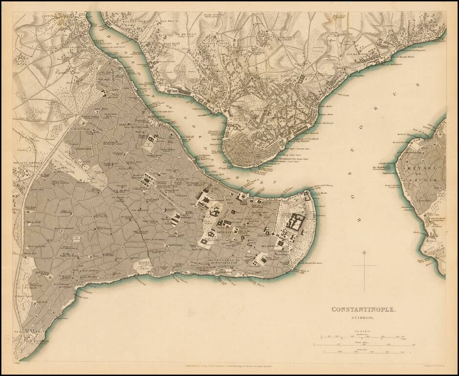
Highly detailed plan of Constantinople (Istanbul) and neighboring areas. Shows buildings, streets, ports of entry, Mosques, gates and a host of other details. One of the best plans of the city to appear in a 19th Century Commercial Atlas.
![Asia Minor [shows Cyprus]](/map/small/44708.jpg)
Striking full color example of Tallis' map of the region bounded by the Black Sea, Mediterranean, Aleppo and Diyar-Bekr, including a nice large Cyprus Vignettes of Olympus, Rhodes, a sailing vessel and Turkish costumes. Engraved for R. Montgomery...
![Turkey in Asia [with Cyprus]](/map/small/54309.jpg)
Decorative full color example of Tallis's map of Turkey in Asia. Includes large vignettes of castles in Europe and Asia, local costumes, Jerusalem and an Ostrich. Engraved for R. Montgomery Martin's Illustrated Atlas. Tallis was one of the last great...
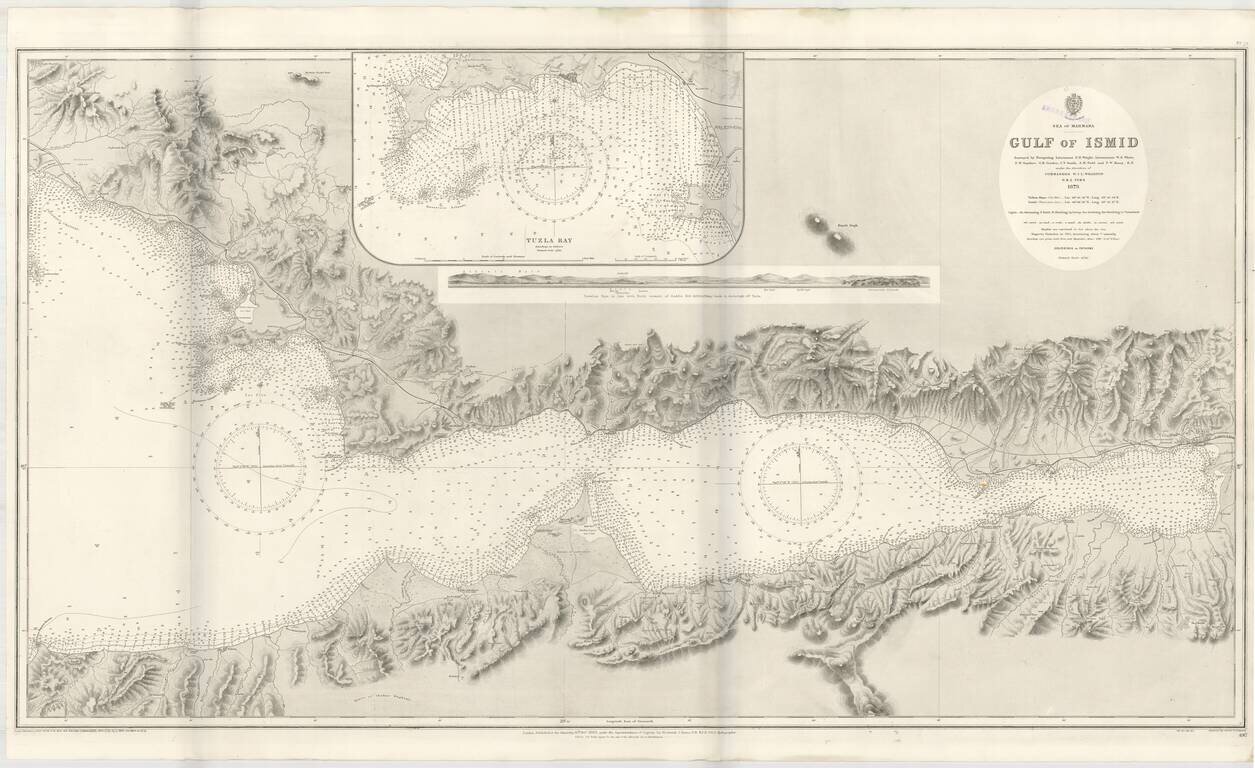
Detailed sea chart of the Gulf of Ismit, the easternmost part of the Sea of Marmara. This elaborate and highly detailed chart extends from Ismit in the east to Sedef Island (Prince Islands), Kartal and the southeastern suburbs of Istanbul in the North,...
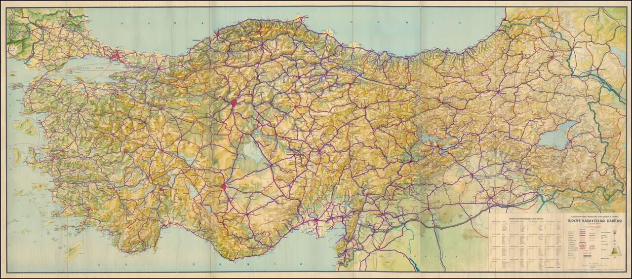
Large Format Road Map of Turkey Celebrating the Anniversary of the General Directorate of Highways Detailed general road map of Turkey focused on major highways, cities, topography, and administrative boundaries. The map’s title is centered over...
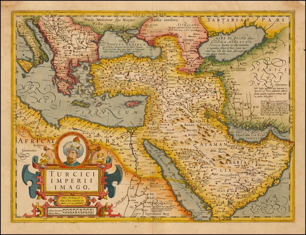
Fine Map of the Ottoman Empire from the Mercator-Hondius Atlas Striking example of this map of the Ottoman Empire, showing their territories in the Balkans, Anatolia, the Levant, the Arabian Peninsula, and North Africa. It was published by Henricus...
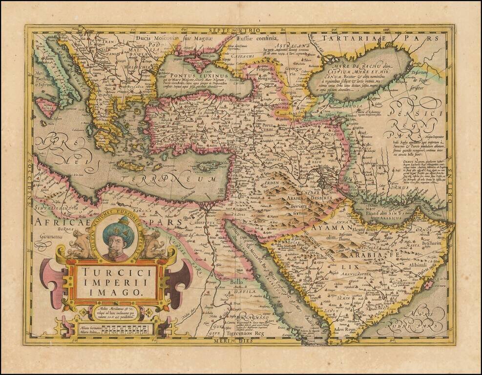
Fine Map of the Ottoman Empire from the Mercator-Hondius Atlas Striking example of this map of the Ottoman Empire, showing their territories in the Balkans, Anatolia, the Levant, the Arabian Peninsula, and North Africa. It was published by Henricus...
![[Bunting's Map of the Mediterranean Region]](/map/small/55211.jpg)
Map of the Mediterranean region, from Heinrich Bunting's Itinerarium Saccrae Scripturae first published in 1581. T he map shows the Eastern Mediterreanean, including Sicily, Malta, Cyprus, Rome, the Holy Land, Alexandria, the southern Black Sea,...
![Tabula Aphricae II [shows Sicily and Sardinia]](/map/small/47363.jpg)
16th Century Italian cartography of Sicily, Sardinia, and North Africa based on Ptolemy. Striking example of Magini's map of North Africa, based upon Ptolemy. Shows part of the Mediterranean, including Sicily and Sardinia. Three sea monsters and an...