
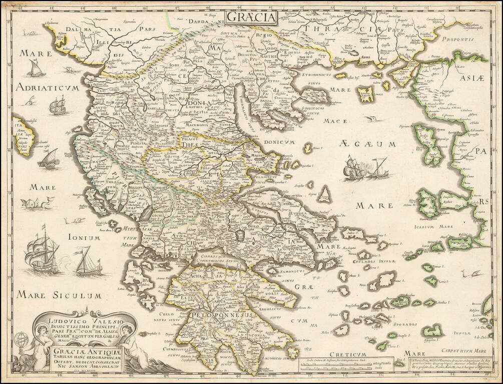
Tavernier and Sanson double-page engraved map of ancient Greece.
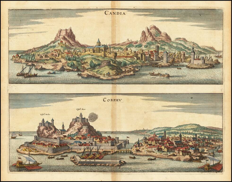
Striking pair of bird's-eye views of Candia and Corphu, from Merian's Neuwe Archontologica Cosmica ..., published in 1638. Shows two fortified harbor towns, castles, topographical details and ships in the harbors.
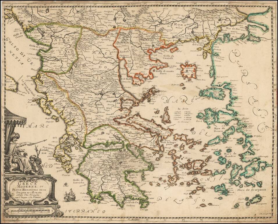
Langlois's Rare (Unrecorded?) Map of Greece and Turkey. Decorative map of Greece and Turkey, one of the earliest maps of the region published in France. Includes a large decorative cartouche and wide clean margins
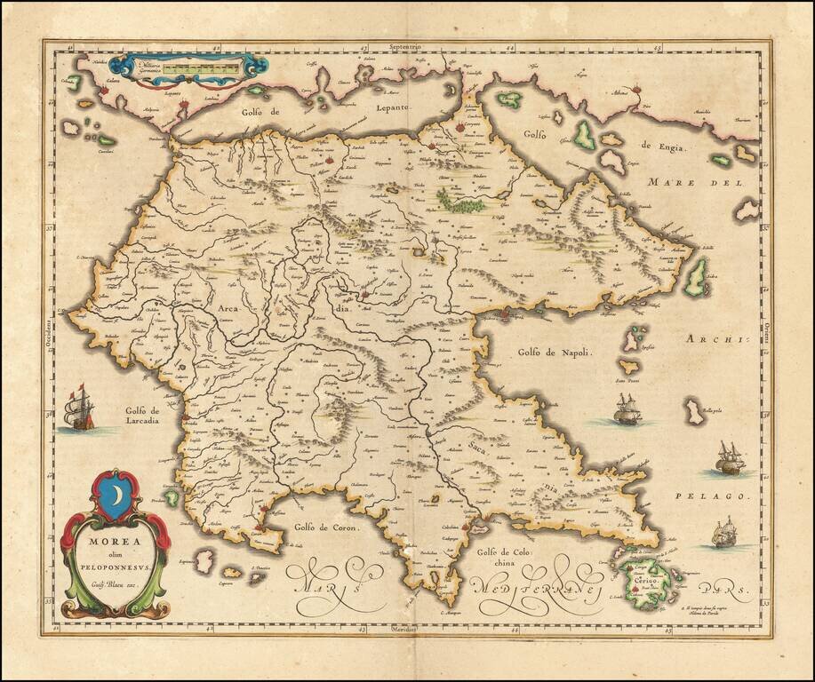
Nice old color example of Blaeu's map of Morea. Includes a coat of arms, sailing ships, decorative cartouche and scale of miles.
![Candia cum Insulis alijs proxime ei adiacentibus [with] Corfu [with] Cefalonia [with] Zante](/map/small/67978.jpg)
Decorative maps of Crete, Corfu, Cefalonia and Zante. Includes nice detail in each of the Islands. Upper neatline trimmed, else a nice example. Normally a $250.00 map.
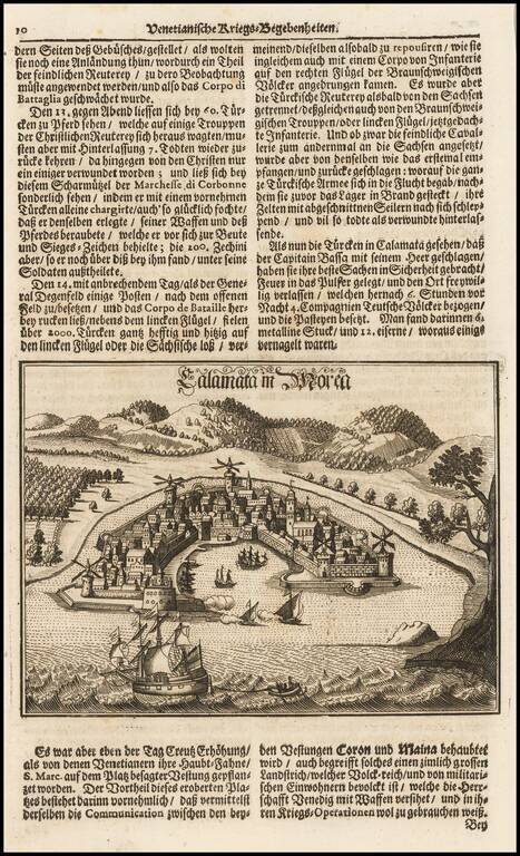
Fine view of the town and harbor of Kalmata, shown during the Venetian Wars.
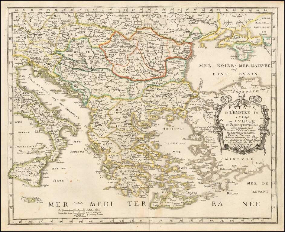
Nicolas Sanson's rare 1655 double-page engraved map of Greece and the Balkans, then the European territory of the Ottoman Empire. The map was subsequently copied by Jaillot and Covens & Mortier, in both one- and two-sheet versions.
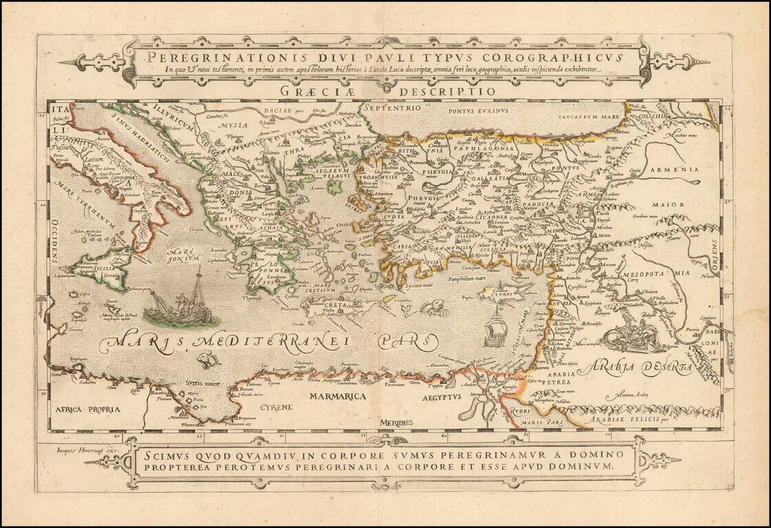
Extremely rare separately published map of the Holy Land, Cyprus, Asia Minor and the Eastern Mediterranean and contiguous regions, published in Paris by Jacob (Jacques) Honervogt. The map illustrates the travels of the Apostole Paul, based upon the...
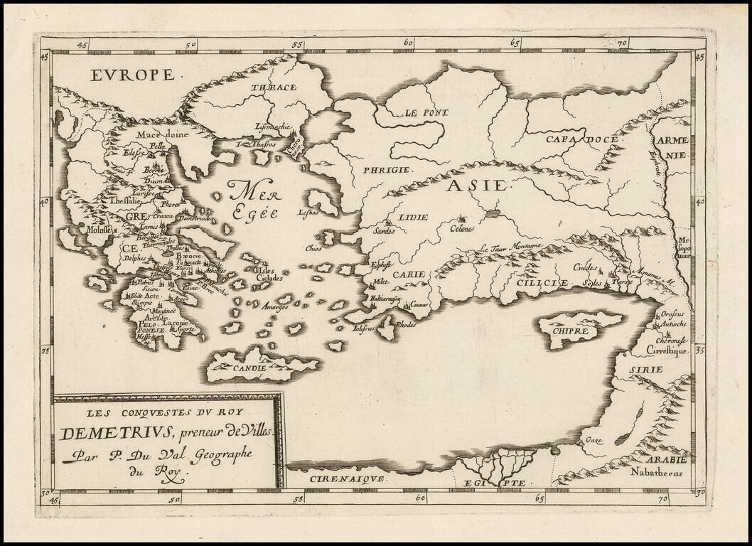
Antique map of the conquests of Demetrius I "Taker of Cities", published by Pierre Du Val in Paris, circa 1660.
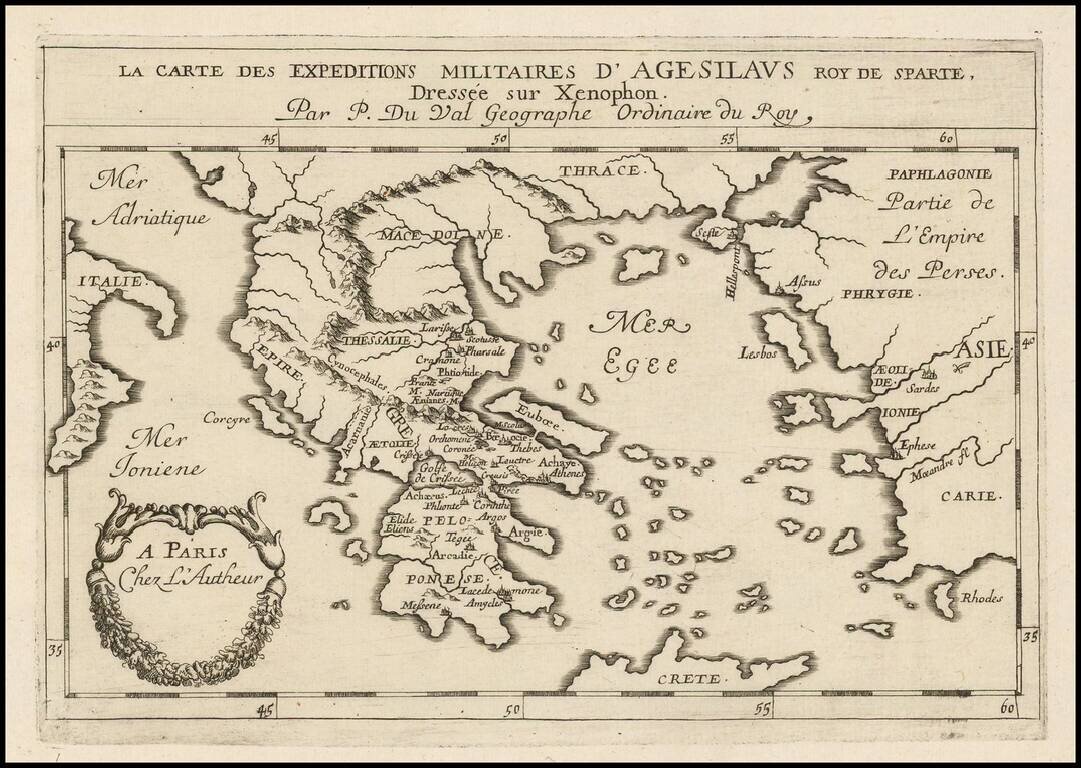
Antique engraved map of the military expeditions of Agesilaus II, as described by his friend the historian Xenophon. Agesilaus II was king of the Greek city-state of Sparta.
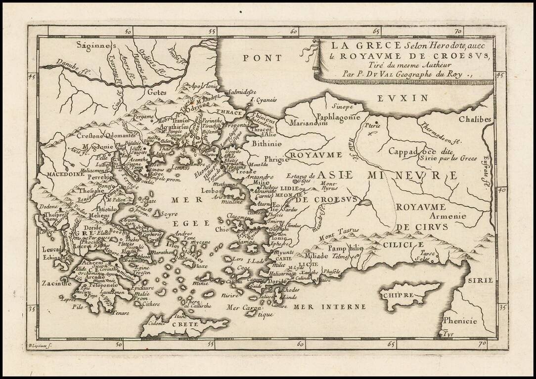
Antique engraved map of Greece and the Kingdom of Croesus (Lydia), after a description by Herodotus. The map was published in Paris by Pierre Du Val, probably around 1660.
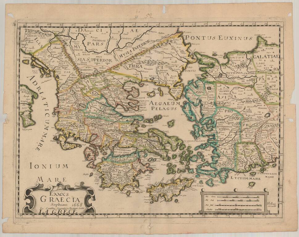
Rare separately issued map of Greece, Asia Minor and Turkey, published in Paris by Jollain. Jollain's map is based upon the Nikolaus Sophianos' map of Greece, first engraved around 1540, which was published by Johannes Oporinus in Basel in 1545, as an...
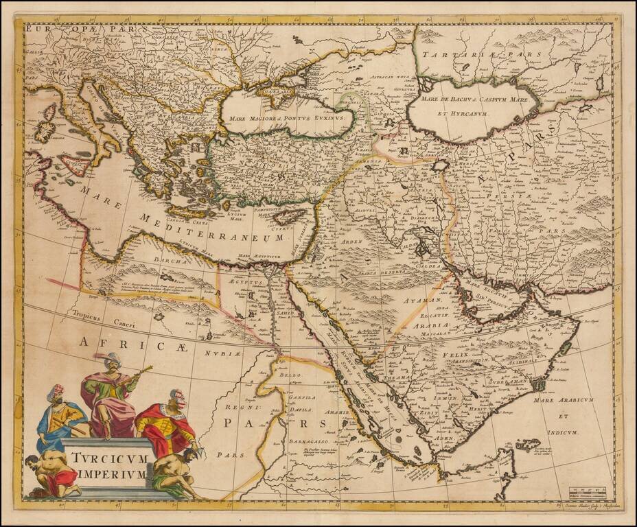
Striking map of the Turkish Empire bounded by the Eastern Mediterranean, Greece, and Italy in the West and Saudi Arabia, the Persian Gulf and Caspian Sea in the east and centered on Turkey and Cyprus. This fine map depicts the Ottoman Empire on the...
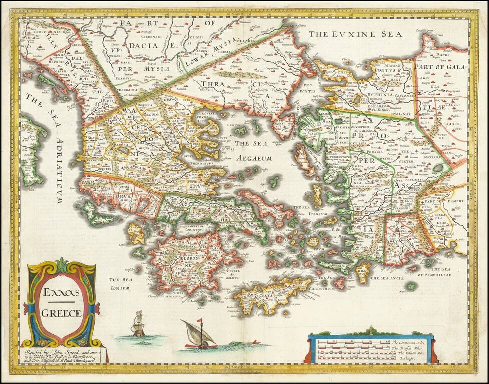
Nice example of John Speed's map of Greece. Extends north to include part of the Black Sea. A highly detailed early depiction of Greece, with fascinating English text description on the verso. The first folio sized map of Greece published in England.

Decorative map of the islands of Lero, Calamo, and Lango. Also shown are Scogli, Lepida, Capra, Caprone, Zechigni and Iali. A number of place names appear on the larger islands. A number of sailing vessels shown in the foreground, etc. From Mallet's...
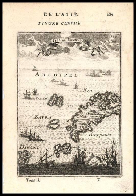
Decorative map of the Greek Islands of Scarpanto and smaller neighboring islands, from Mallet's Description de L'Univers, first published in Paris in 1683.