Map size in jpg-format: 961092B
Click to open in high resolution (open in new tab).
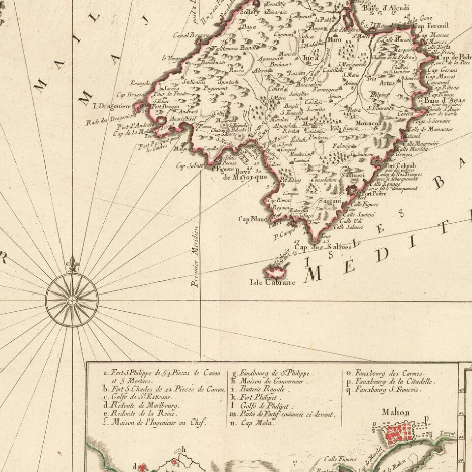
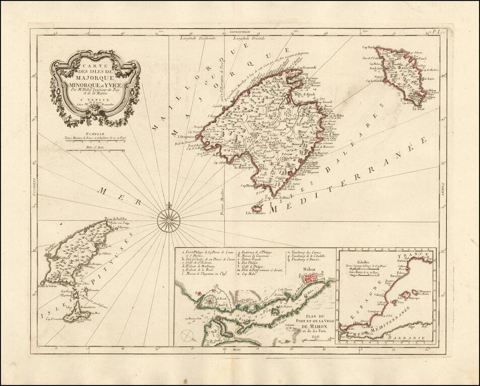
Nice example of the Paolo Santini edition of Nicolas Bellin's map of the Balearic Islands.
Includes a map of Mahon Harbour and the position of the islands against the coast of Spain.
A fine highly detailed map of Majorca, Menorca and Ibiza.
Paolo Santini (1729-1793) was an Venetian engraver known especially for his religious prints and fine cartographic engravings. He published in Venice and may have a been a member of the clergy. In his maps, he largely adopted and adapted the work of his French counterparts, especially the brothers de Vaugondy.
If you are a student, write to us in telegram: @antiquemaps and indicate what material you need and for what work you need a map in high detail. We are ready to provide material on special terms. For students only!
![(Pro-Spanish Republic Political Broadside) [Lift The Embargo Against The Spanish Republic] President Roosevelt says . . .](/map/small/50218.jpg)

