Map size in jpg-format: 1.39058MiB
Click to open in high resolution (open in new tab).
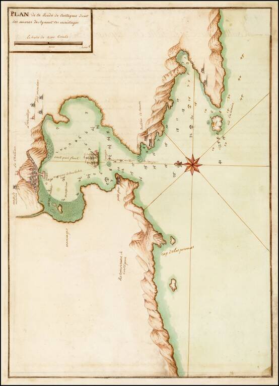
Fine early manuscript map of the Harbor at Cartagena, prepared by an skilled French mapmaker.
Although anonymous, the level of detail and beauty force the belief of it having been made by a skillful artist; French sailors made the map, possibly after the taking of Menorca from the British in 1756.
Manuscript maps of the coast of Spain are not common, most especially of this size, quality and beauty. Embellished with a ship along the coastline, a view of the town in the mountains, the windmills and such, also a compass rose and a scale cartouche at the lower right margin.
If you are a student, write to us in telegram: @antiquemaps and indicate what material you need and for what work you need a map in high detail. We are ready to provide material on special terms. For students only!
![(Pro-Spanish Republic Political Broadside) [Lift The Embargo Against The Spanish Republic] President Roosevelt says . . .](/map/small/50218.jpg)

