
![Parte Septentrional do Reyno de Portugal... 1654 [with] Partie Meridional do Reyno de Portugal.... 1654](/map/small/50470.jpg)
Nicolas Sanson's 1654 double-page engraved maps of northern and southern Portugal, with a large sailing vessel in the upper left corner.
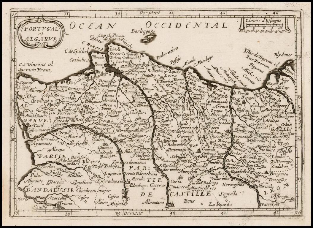
Rare map of the Portugal, which appeared in Picart's Tresor des carte Geographiques, published in Paris. Picart's map is based upon Jansson's map, published in his Atlas Minor in 1628. The first French version of the map was published by Jean Boisseau...

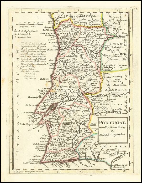
Rare map of Portugal, published by Sir Jonas Moore in London. The map appeared in Moore's A New Geography. Many of the plates in the work were engraved by Herman Moll, who had moved to London in 1678 and had not yet begun publishing under his own...
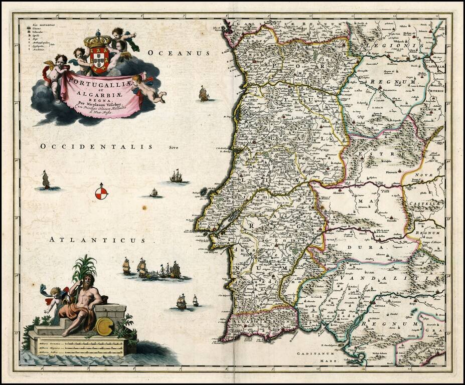
Full original color example of Visscher's map of Portugal, heightened in gold. Two gorgeous cartouches, coat of arms and gold leaf highlights. No text on verso. From a rare Abraham Wolfgang composite atlas.
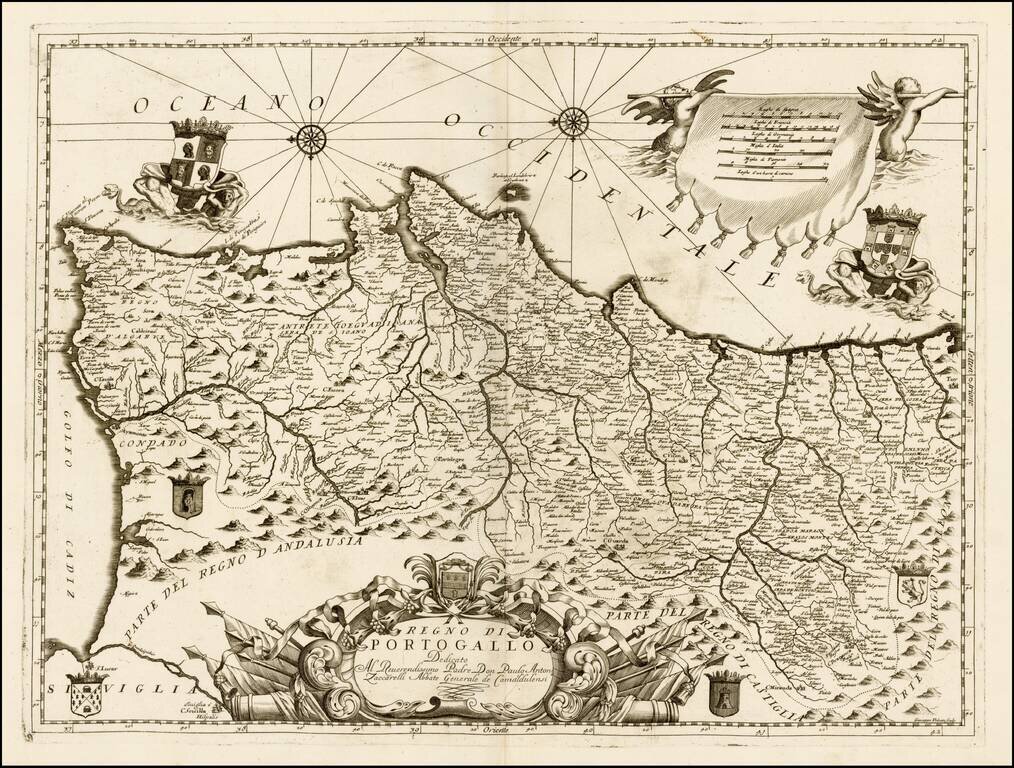
Nice example of this scarce map of Portugal, published by Coronelli in his C orso Geogrpaphico. The map includes a number of coats of arms and decorative embellishments. Decorative title cartouche appears in bottom center embellished with military...
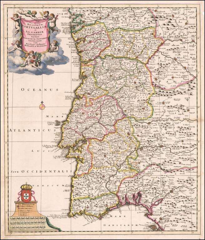
A Rare Theodore Danckerts Map Striking old color example of this rare map of Portugal by Danckerts. Extends from Galecia in the North to Cadiz in the South, centered on Lisbon. Shows the various regions of Portugal and contiguous parts of Spain, as...
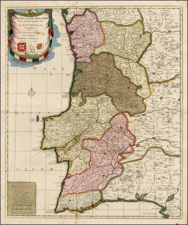
Striking old color example of Schenk's rare map of Portugal, with the coats of arms of Portugal, Algarbia and a Spanish sailing vessell in the cartouche. The map is in fine old color and printed on double thick paper, from a composite atlas of the period.
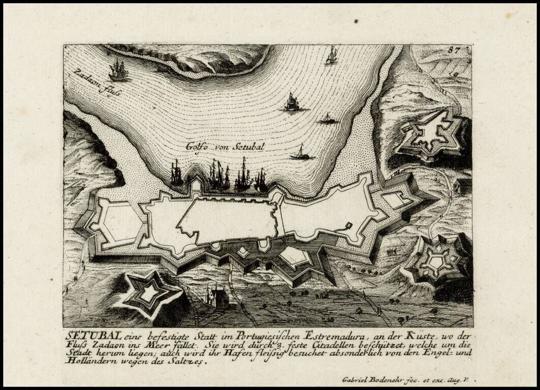
Detailed view and plan of the fortifications of the City of Setubal, published by Gabriel Bodenehr.
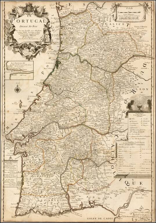
Decorative map of Portugal by Le Père Placide de Sainte-Hélène, the brother-in-law of the famous French mapmaker Pierre Duval. The map provides a large detailed treatment of Portugal, with an inset of the area around Porto on the Douro River.
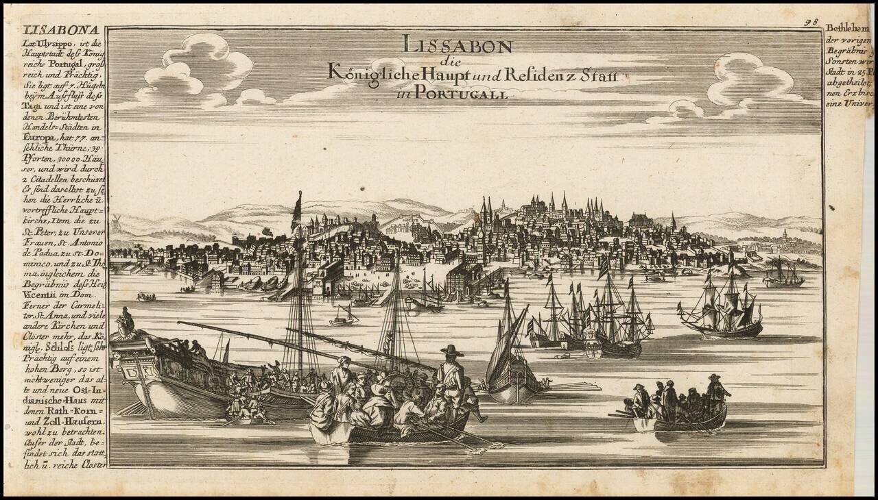
Fine view of Lisbon, published by Gabriele Bodenhr in his Atlas Curieux.
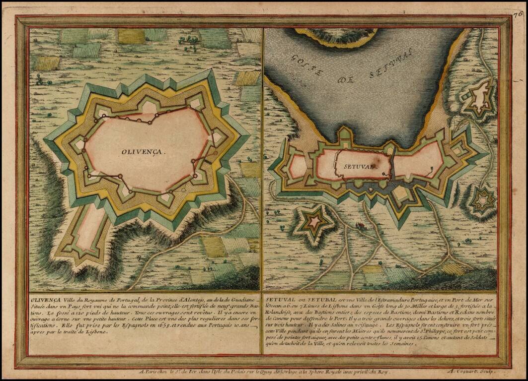
Two plans showing the fortifications of the towns of Olvenca and Setubal in Portugal.
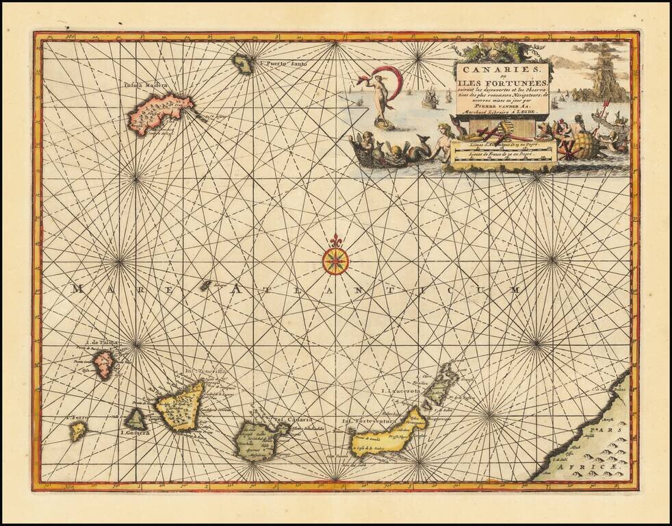
Decorative map of the Canary Islands, published in Leiden by Pierre Van der Aa. Includes an elaborate title cartouche and vignette.
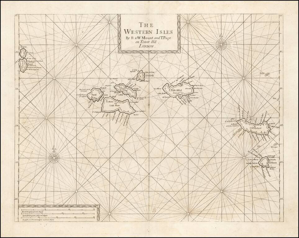
An Early Engish Sea Chart of the Azores Fine early chart of the Azores, which appeared in the English Pilot First Part, Southern Navigation.
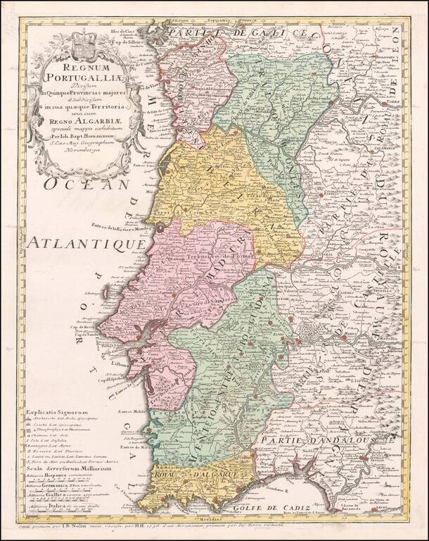
Detailed map of Portugal and the Algarve, first published by Johann Baptist Homann in 1736. The map is colored by provinces, showing towns, rivers, mountains, harbors, roads, etc. Very large title cartouche with figures and a coat of arms.
![Les Isles Canaries . . . [With inset map of the Islands of Madeira and Porto-Santo]](/map/small/70853.jpg)
Detailed map of the Canary Islands, from De Vaugondy's Atlas Portatif, Universal et Militaire. Large inset of Madera and Porto Santo. Lots of place names shown.