
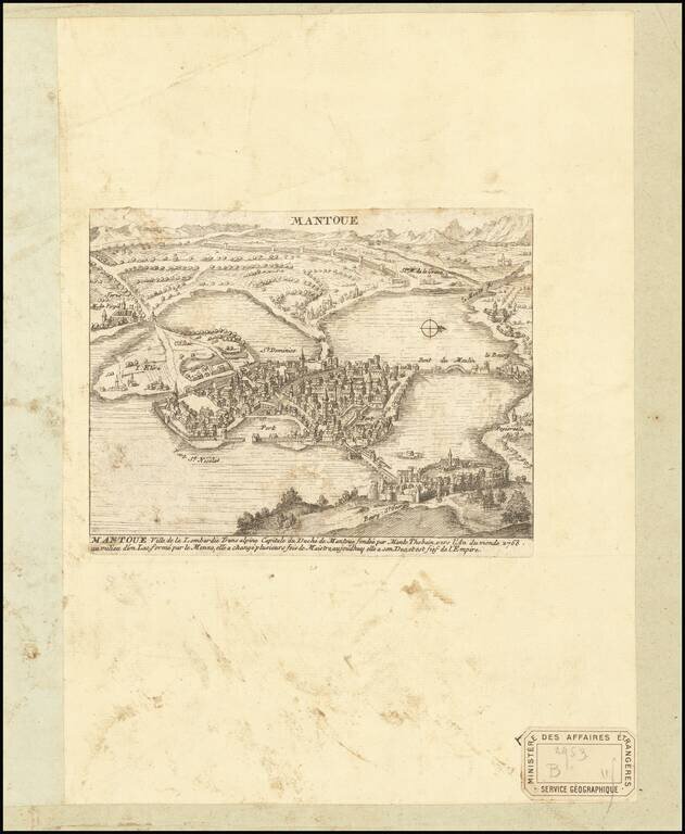
Engraved birdseye view of Mantua, a northern Italian city surrounded by lakes. The view pictures an early Mantua before the southern lakes were drained. Several streets and neighborhoods are named throughout this view, as well as the various bridges...
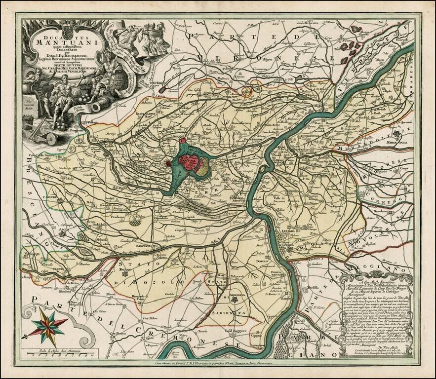
Fine full color example of this scarce decorative map, with Mantua at the center. Includes a decorative allegorical cartouche showing the history of the region, coat of arms and compass rose.

Beautiful large format engraved view of Genoa, Italy, showing the city and its harbor from the ocean. The view was published in Augsburg by the heirs of Jeremias Wolff in 1731. The Coat of Arms of Genoa can be seen in the upper-right corner. There is...
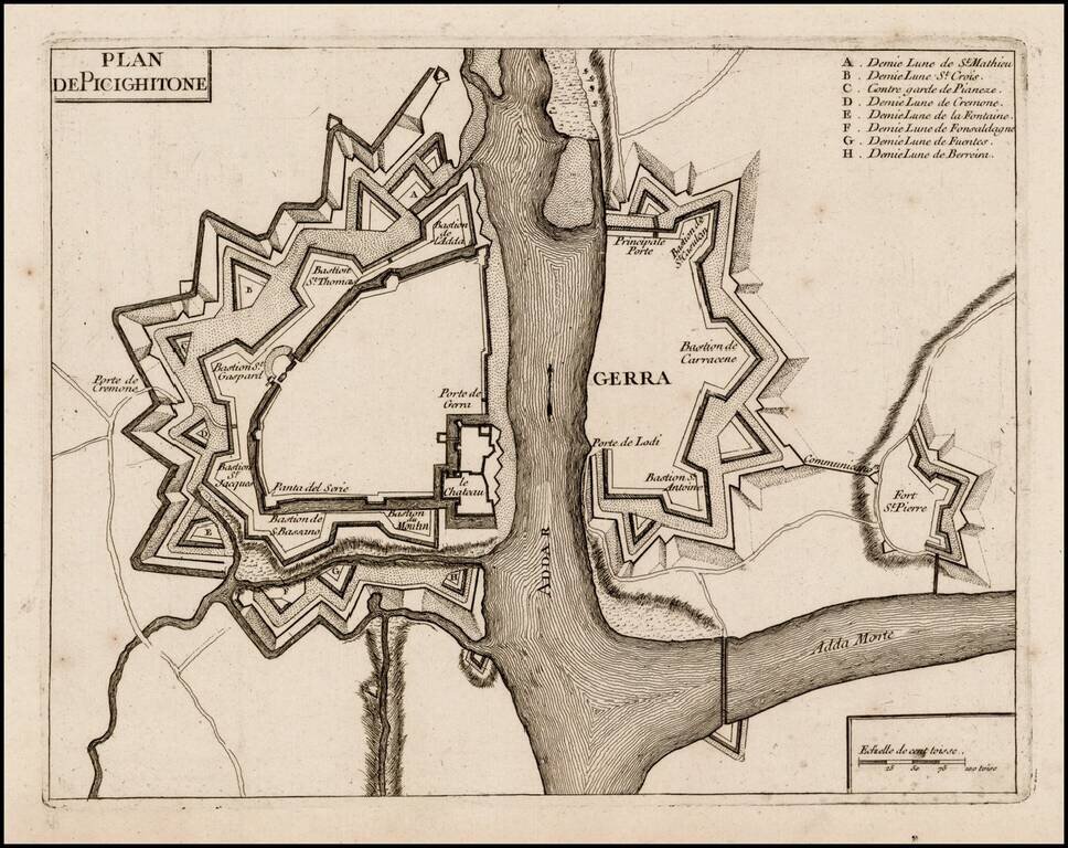
Rare plan of Pizzighettone and Gera, showing the fortifications of these two towns on the Abba River. The plan of the fortifications was likely printed at or about the time of the Siege of Pizzighettone, the first major military engagement of the...
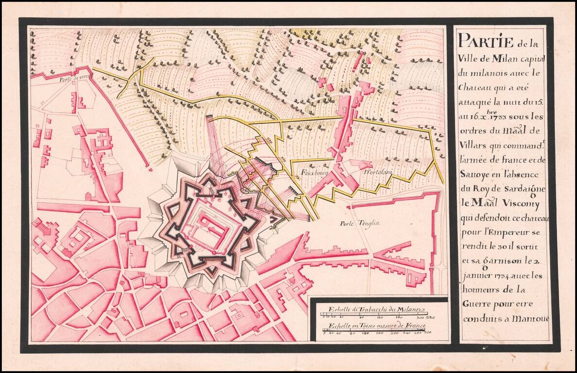
Siege and Surrender of Milan October 1733 to January 1734 Detailed map of the area around Milan, showing the entrenchments of the French soldiers around the Chateau of Milan in October 1733. The map shows Milan at the time is was occupied by Charles...
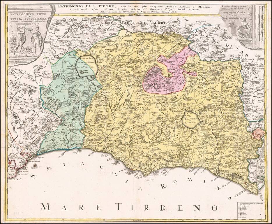
Decorative regional map of Tuscany and the northern part of Lazio, centered on Lago Bolseno and including a massive decorative cartouche. The map is based upon Giovanni Giacomo Rossi's 4-sheet map of the region, published in 1696.
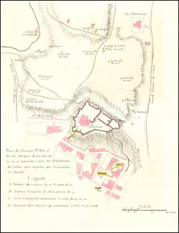
Manuscript Plan of The Defense of Asti in November 1745 -- War of Austrian Succession Finely executed area around Asti in the Piedmont region of Italy, drawn during the War of Spanish Succession. Asti was invaded a number of times by the French in...
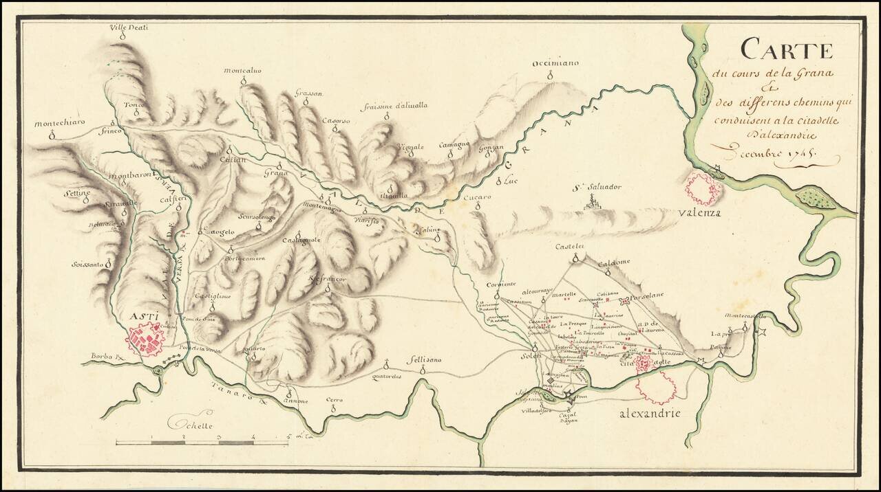
The Italian Campaign -- War of Austrian Succession Fine manuscript map of the area between Allesandria, Asti, Valenza and the Val de Grana, illustrating the theater of war during the War of Austrian Succession. The map illustrates the theater of war...
![[Savona Province and Environs]](/map/small/65400.jpg)
Detailed manuscript map of the Savona Province of Italy, drawn during the War of Spanish Succession. The map was drawn during the period when the region and all of the Republic of Genoa was overrun by Charles Emmanuel III. Italian Campaigns - War of...
Detailed map showing Northern Italy.
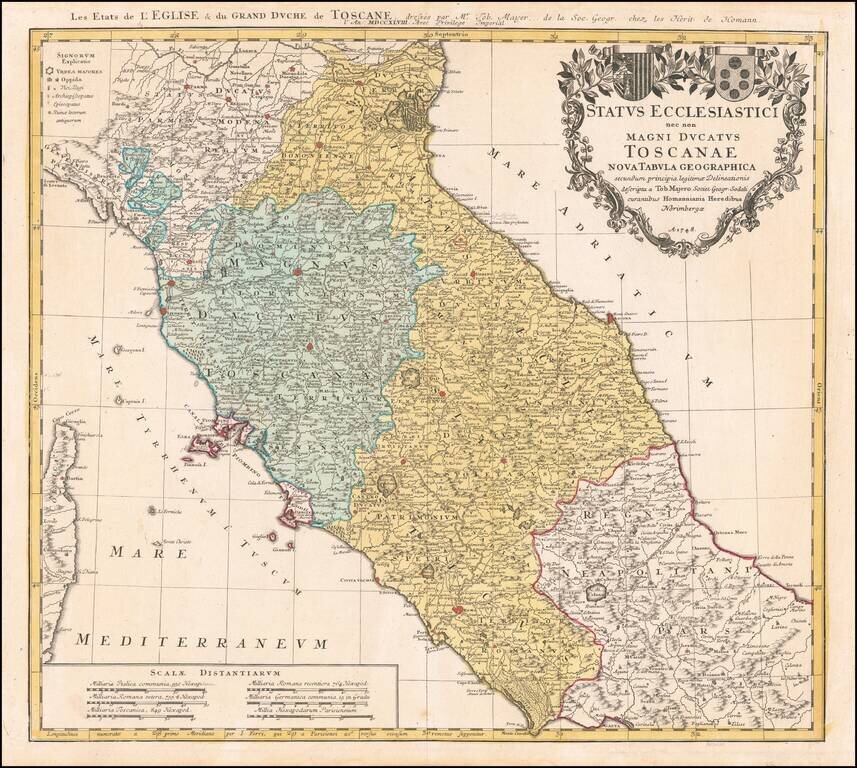
Nice example of Homann's second map of Central Italy, from Ferrara, Parma and Cremona to Territorium Romanum, centered on Florence and Sienna and showing Rome. Includes 2 coats of arms and other details.
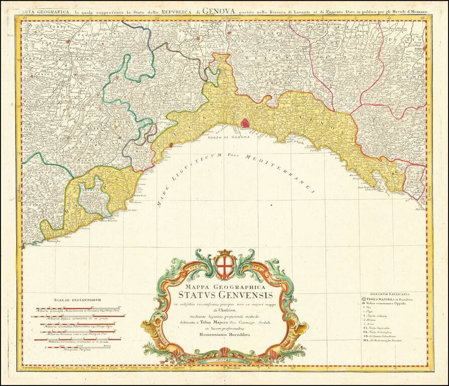
Decorative regional map of Italy, centered on Genoa. Extends from Monaco (named) to Mostrone. Shows roads, rivers, towns, lakes and mountains. Decorative cartouche with coat of arms.
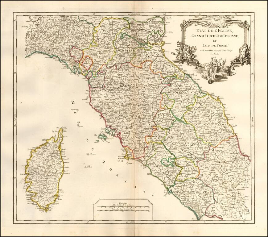
Interesting regional map of Central Italy, Tuscany and Corsica, from an early edition of DeVaugondy's Atlas Universel. Includes towns, mountains, rivers, lakes and a host of other details. De Vaugondy's Atlas Universel was one of the most...
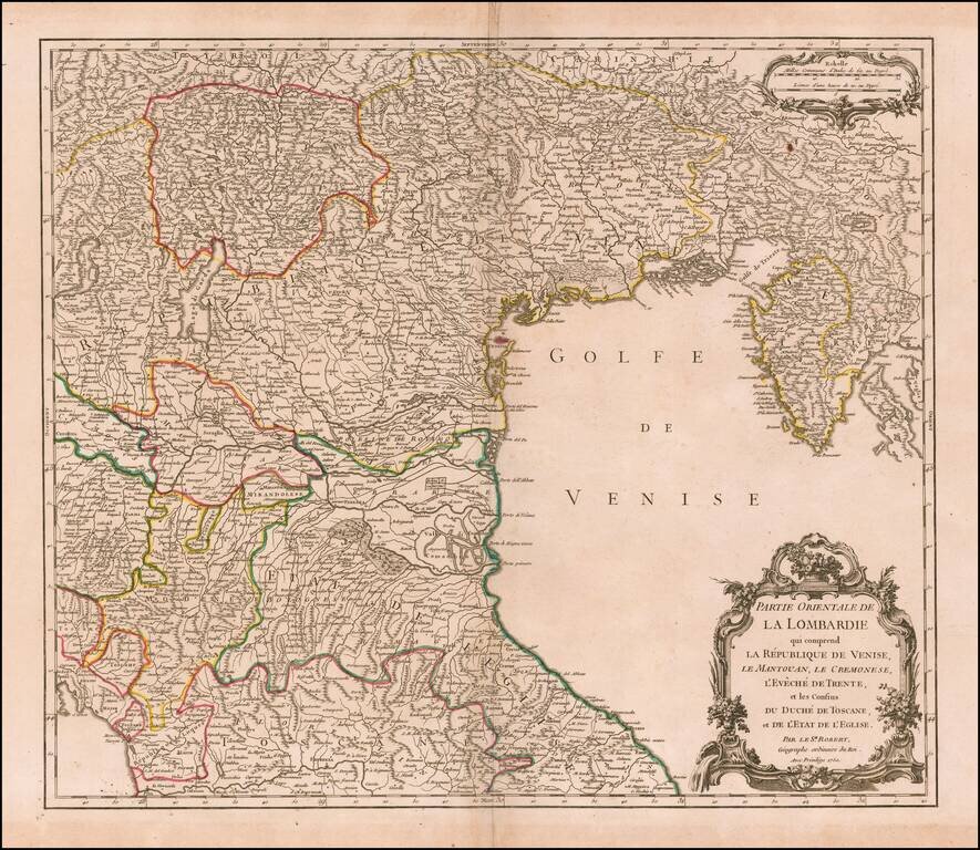
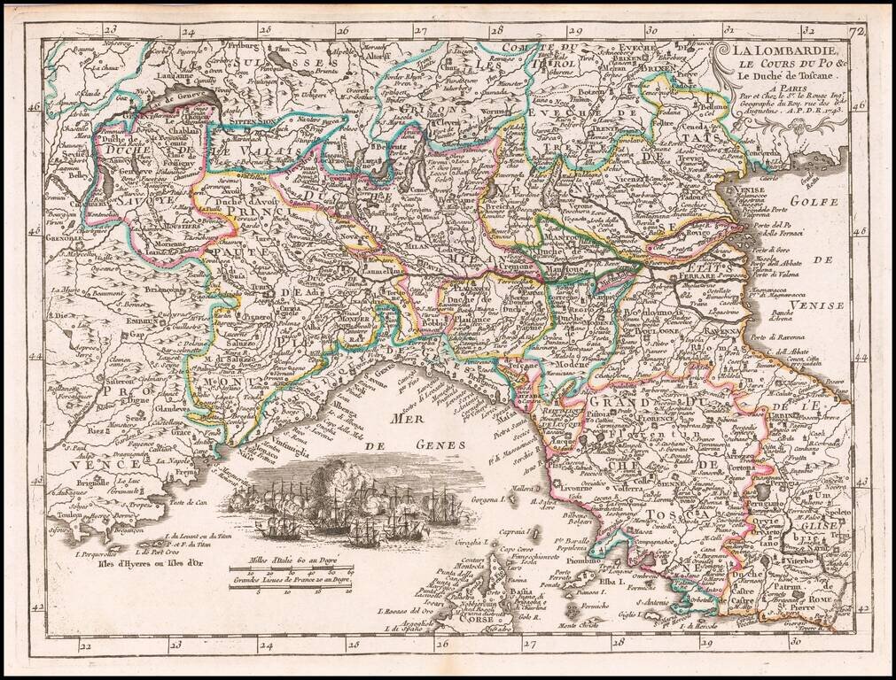
Highly detailed map of the Eastern part of the Lombardy region, from DeVaugondy's Atlas Universel. Includes towns, mountains, rivers, lakes and a host of other details. Decorative Cartouche. De Vaugondy's atlas was one of the most successful and...
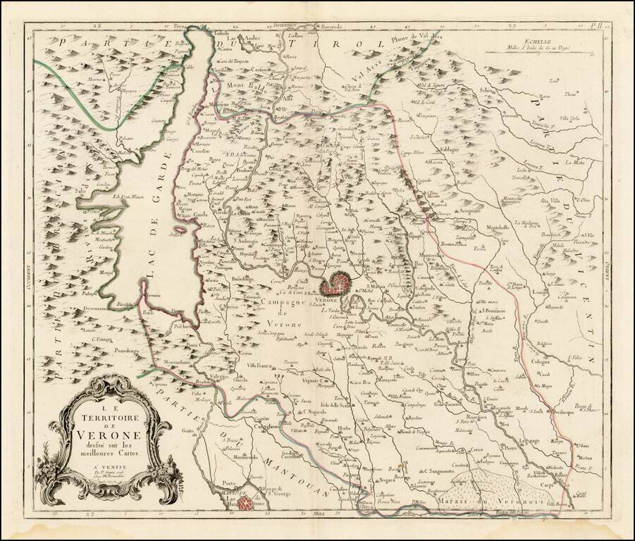
Scarce regional map of the Territory of Verona and environs, published in Venice by Francois Santini. Unlike many of the maps in Santini's atlas, this regional map of Italy is not drawn from De Vaugondy and is based upon Italian sources. One of the...
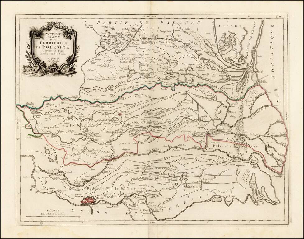
Scarce regional map of the Territory of Polesine and environs, published in Venice by Francois Santini. The map shows the lower Po River region ending to the south of Venice. Unlike many of the maps in Santini's atlas, this regional map of Italy is...