
![[Pozzoli] Explicatio aliquot locorum quae Puteolis spectantur](/map/small/58733.jpg)
Lafreri map Of The Bay of Pozzoli Rare separately published chart of the environs of Pozzoli, immediately to the west of Naples, published in Rome in 1586. The map is oriented with west towards the top of the map and includes Roman ruins, mountains,...
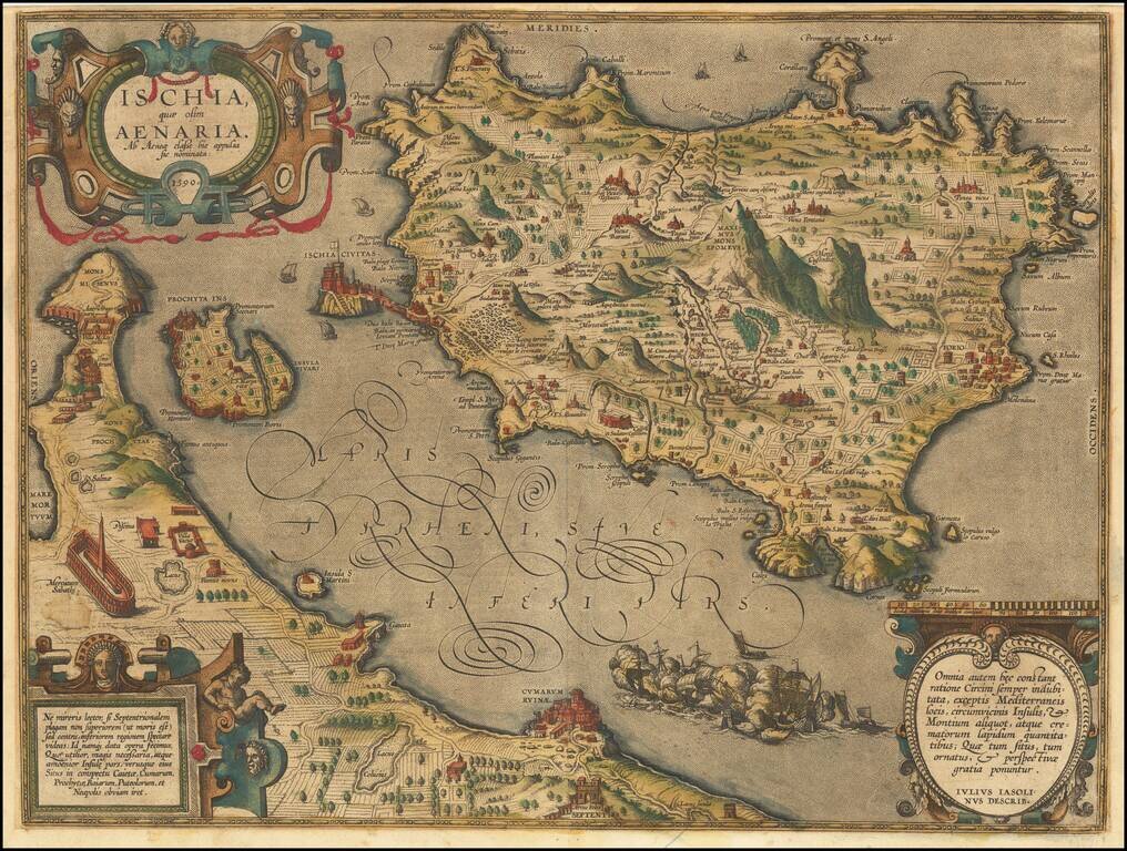
Striking old color example of Ortelius' map of Ischia, from Ortelius' Theatrum Orbis Terrarum. The map is based on a map engraved by Mario Cartario, in a book about Ischia, written by Guilio Iasolino in 1568.
![[Pozzuoli / Bay of Naples]](/map/small/67742.jpg)
Striking map of the area around Pozzuoli and the northwestern part of the Bay of Naples. Includes a key identifying 42 place names.
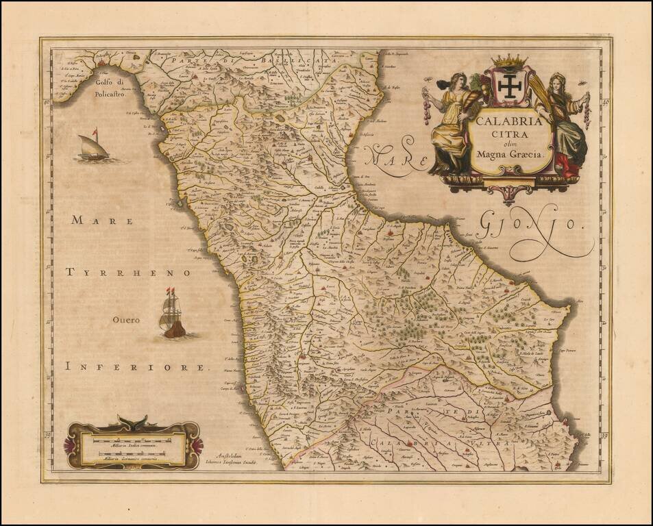
Nice old color example of Jansson's map of the north part Calabria. Includes sailing ships and decorative cartouche. Larger towns include Cosenza and Rossano.
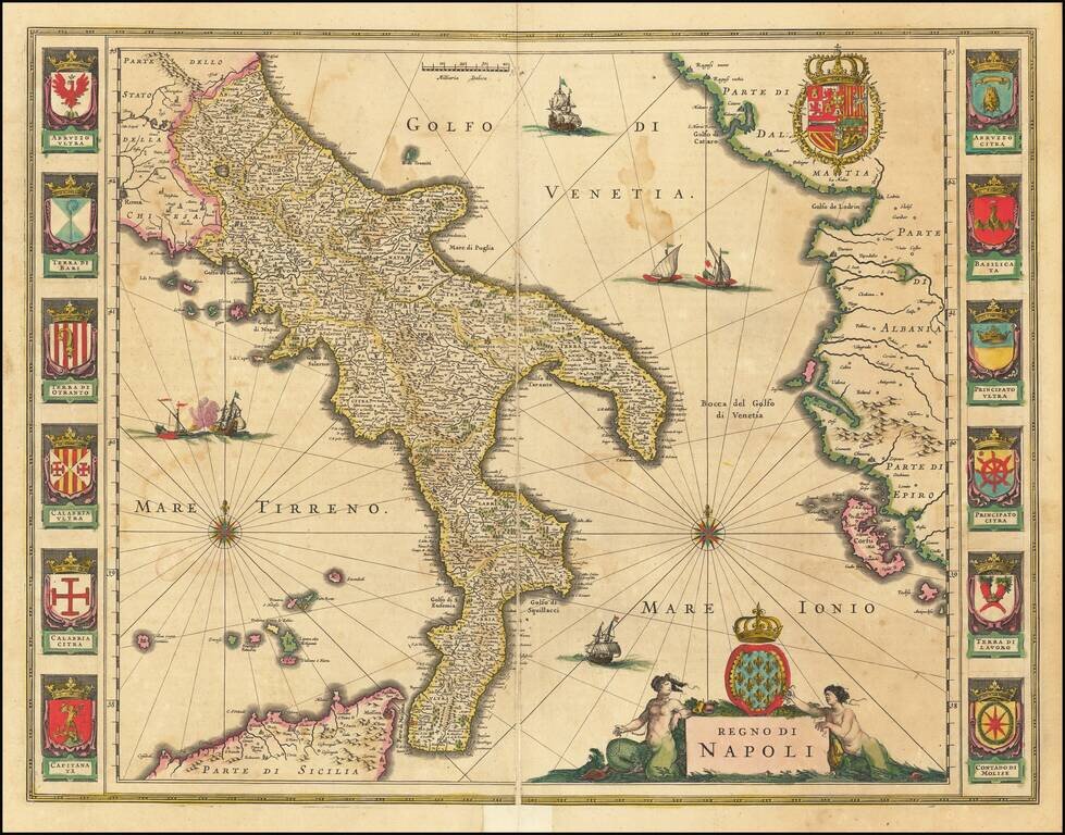
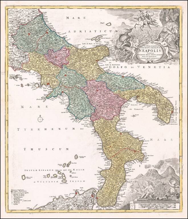
Finely engraved map of the Kingdom of Naples. Includes 12 coats of arms of the local regions on left and right, along with the coat of arms of the Kingdom of Naples above the cartouche and the coat of arms of Spain at the top right.
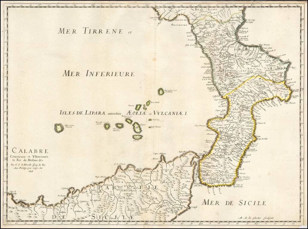
Nicolas Sanson's 1648 double-page engraved map of Calabria, the Strait of Messina, and northern Sicily.
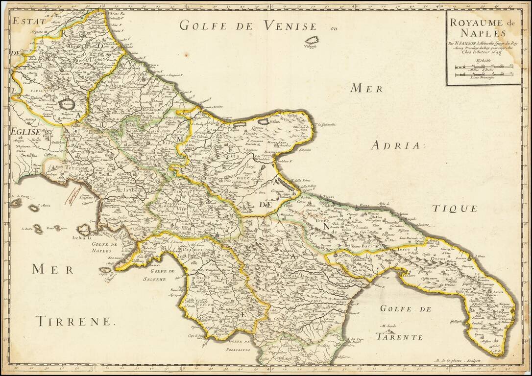
Nicolas Sanson's 1648 double-page engraved map of the Kingdom of Naples.
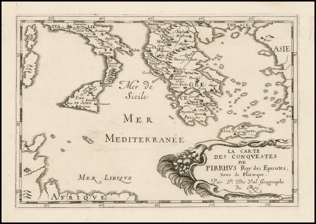
Antique engraved map of the conquests of Pyrrhus of Epirus, covering Greece, Southern Italy, and Sicily. The map was published in Paris in 1660 by Pierre Du Val.
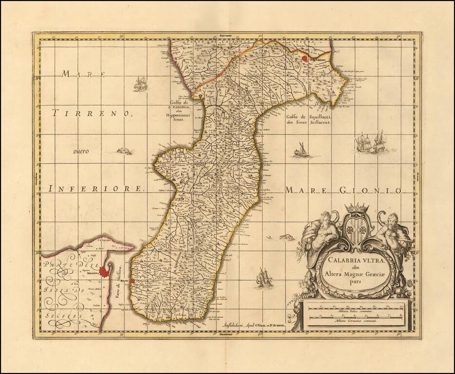
Nice example of Valk & Schenk's map of Calabria and the northern tip of Sicily. Includes sailing ships, a sea monster and decorative cartouche. Larger cities include Reggio Calabria, Bova, Fiumara, Gerace, Oppida, Nicotera, Isola (di Capo...
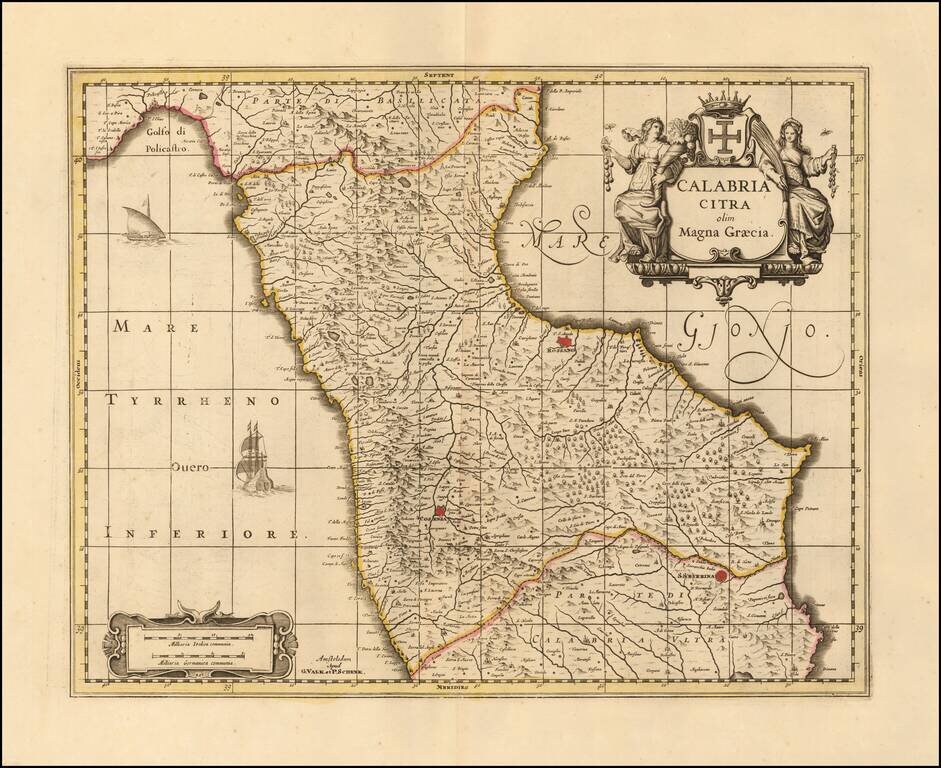
Nice old color example of Valk & Schenk's map of the north part Calabria. Includes sailing ships and decorative cartouche. Larger towns include Cosenza and Rossano.
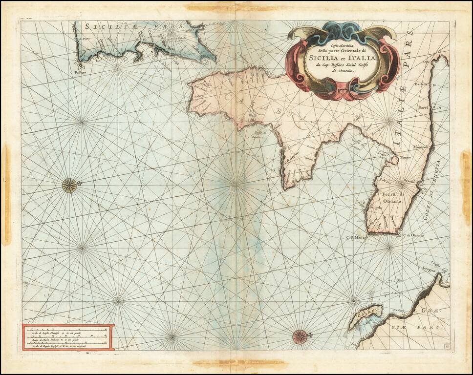
Fine chart of the Mediterranean coastline Southern Italy and southern part of Sicily, which appeared in Volume 1 of Coronelli's Corso Geographico, published in Venice. The sea chart would appear to be the chart originally issued in 1663 by Francesco...
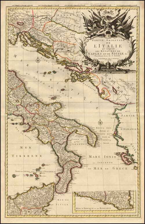
A fine example of Pieter Mortier's map of Eastern Italy which includes the Kingdoms of Naples and Sicily. The map details the surrounding areas of Italy such as the Dalmatian Islands in the Adriatic, the Aeolian Islands north of Sicily in the...
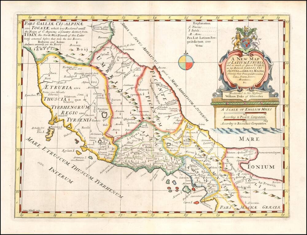
Decorative regional map of the Central and Southen Regions of Italy, as known in ancient times. This decorative map was part of a set of 22 maps dedicated to William, Duke of Glouchester, who was then an 11 year old student at Oxford.
Striking example of Homann's map of the Kingdom of Naples. Includes a spectacular decorative cartouche with sea monsters, cherubs and flying horses, and a second cartouche with Mt. Vesuvius erupting.
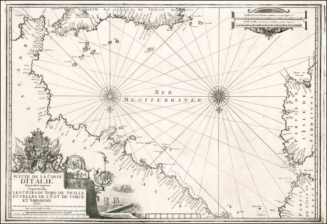
Striking chart of the Southern Italian Mediterranean coastline, from Mt. Argentate and Plages Romenes to the south tip of Calabria, north coast of Sicily, east coat of Sardinia and southeast coast of Corsica. Nice example of this scarce chart, one of...
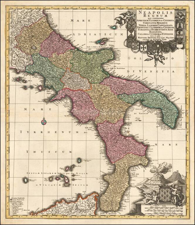
A Fine Dark Impression of Seutter's Map of the Kingdom of Naples Finely engraved map of the Kingdom of Naples, published by Mattheus Seutter in Augsburg. The region is depicted extending from Aprutium to Calabria and including part of Sicily....