
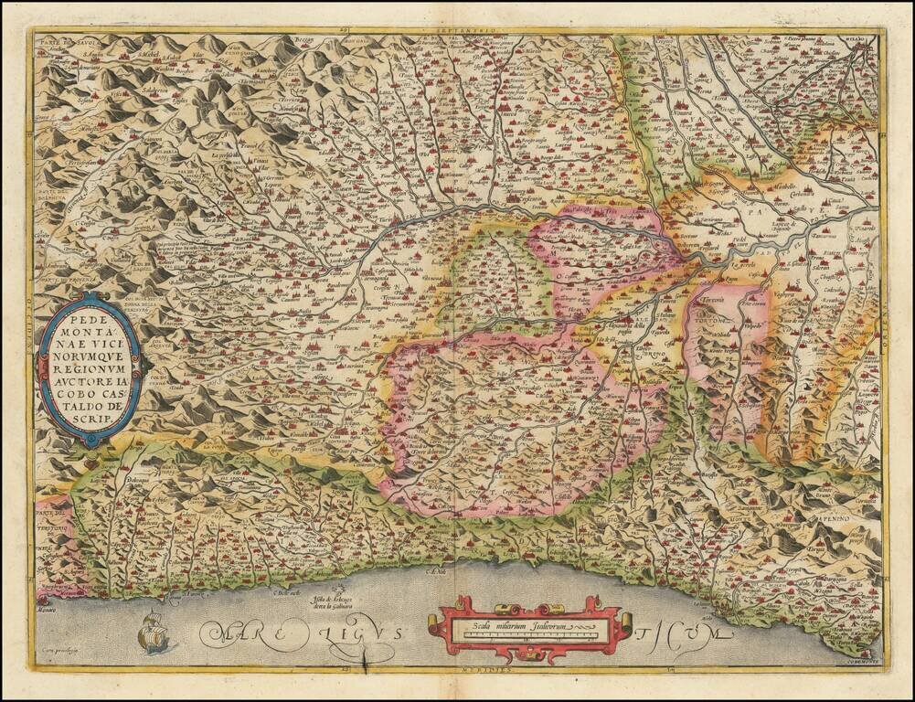
Finely colored example of this detailed map of the Piedmont region, from Santa Margarita, Genoa and Monaco to Milan, centered on Turin, from Ortelius' Theatrum Orbis Terrarum, the first modern atlas of the world. Two cartouches and ship at sea.
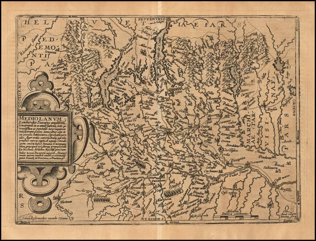
Nice example of Johann Bussemachaer's 1593 double-page engraved map of much of Lombardy, the region around Milan, in northern Italy. The map features Lago Maggiore and Lago di Como.
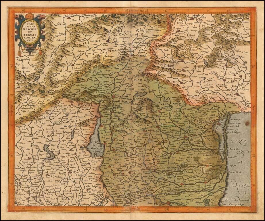
Finely engraved map of Northwestern Italy, published by Gerard Mecator in his Atlas Sive Cosmographia. The map shows the region around the Lago di Garda region in the west to the Lagoon of Venice in the East and North to Tirolia.
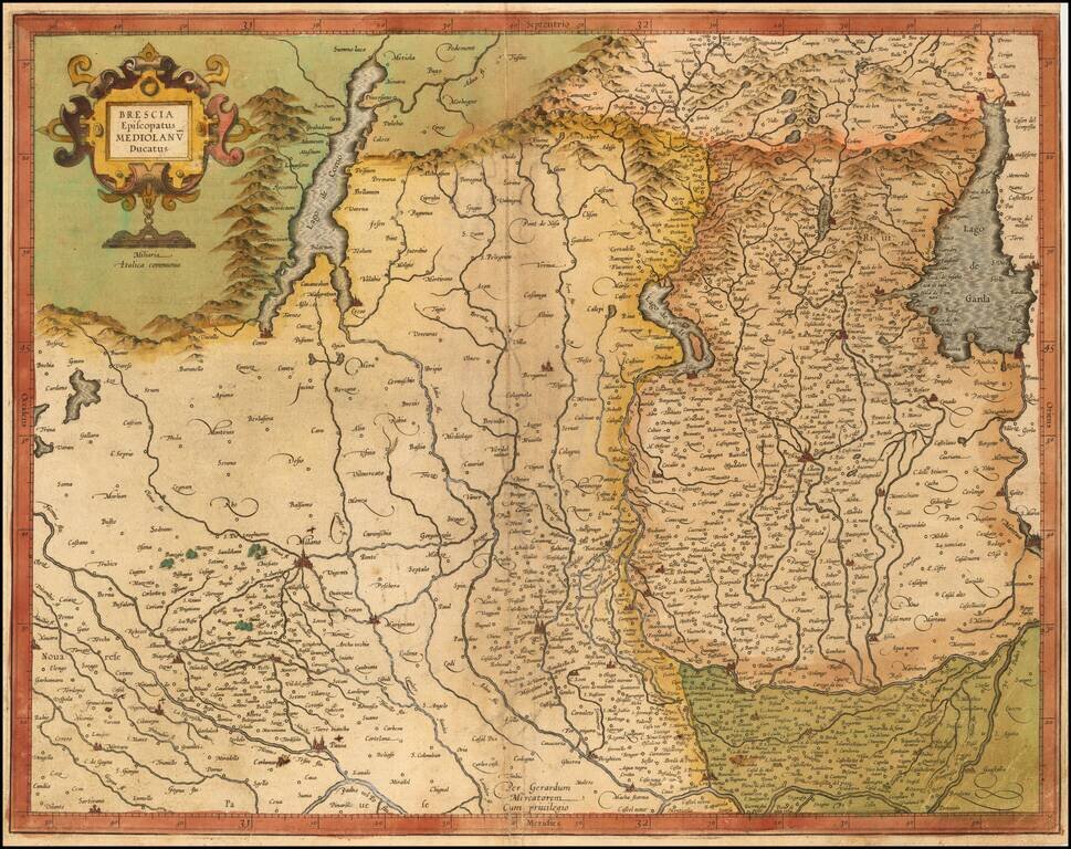
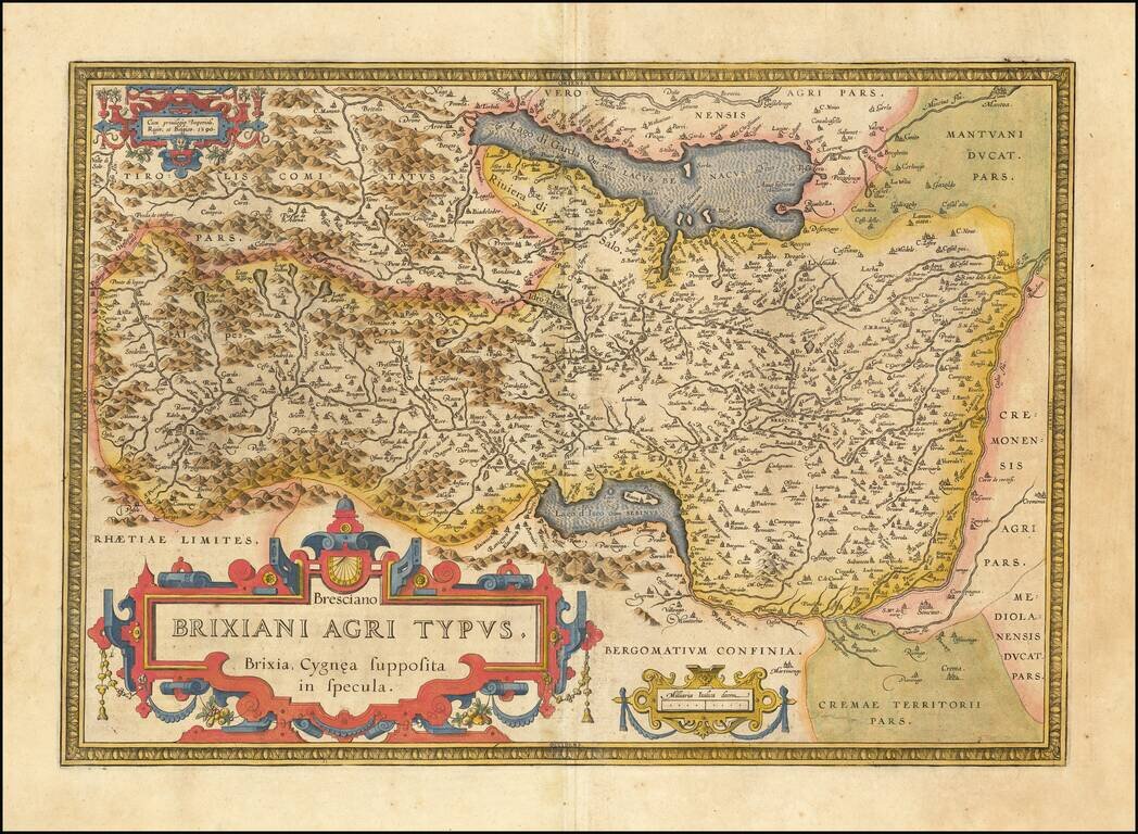
Striking map of Brescia, centered on Bergamo and including Milan, Cremona, Brescia, Lago De Garda, Lago Di Como, etc. Covers the region between Lago di Como and Lago Di Garda and extending south to the Po River region. Includes decorative title...
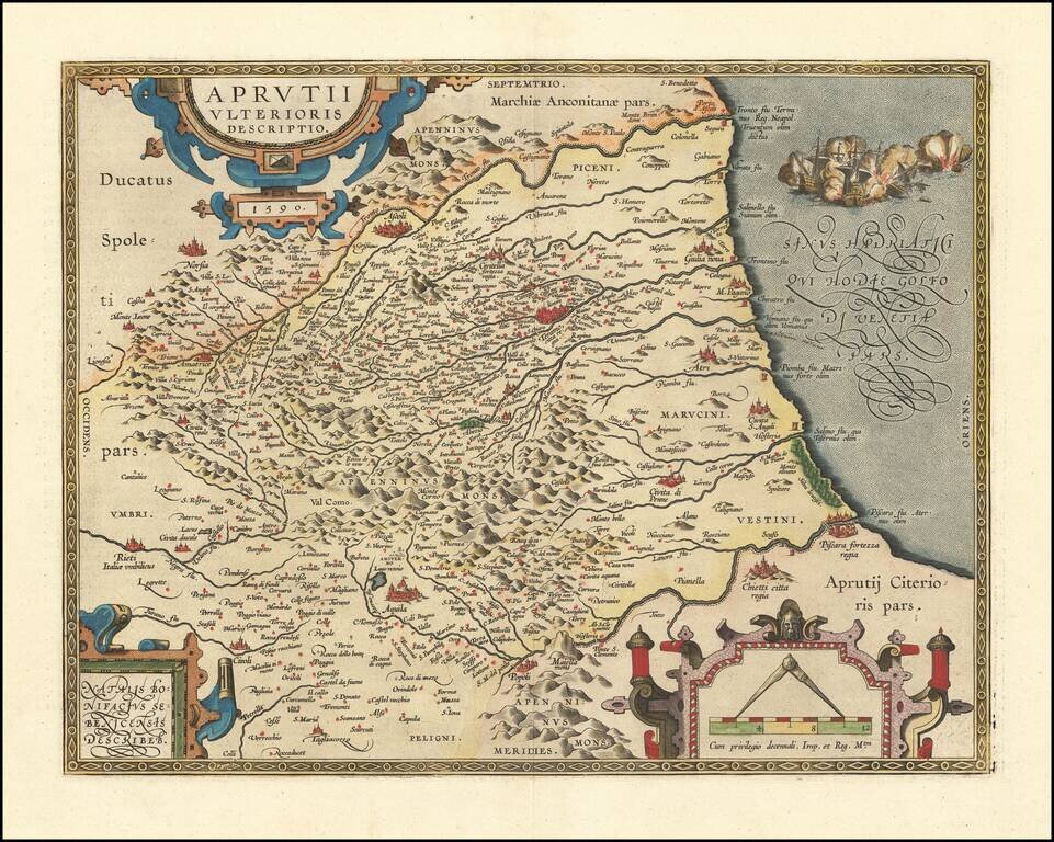
A nice example of Ortelius' map of Abruzzo, published in his Theatrum Orbis Terrarum, the first modern atlas of the World. The map was first issued in 1590 and includes Ascoli, Civitella, Teramo, Aquila and Pescara.
Detailed map of the region between Venice and the Lake Regions, including Lago Maggiore, Lago Como and Lago De Garda. Also shows Bologna, Milan, Bergamo, etc. From the 1597 edition of Magini's Geog rafia, based upon the work of Claudius Ptolemy.
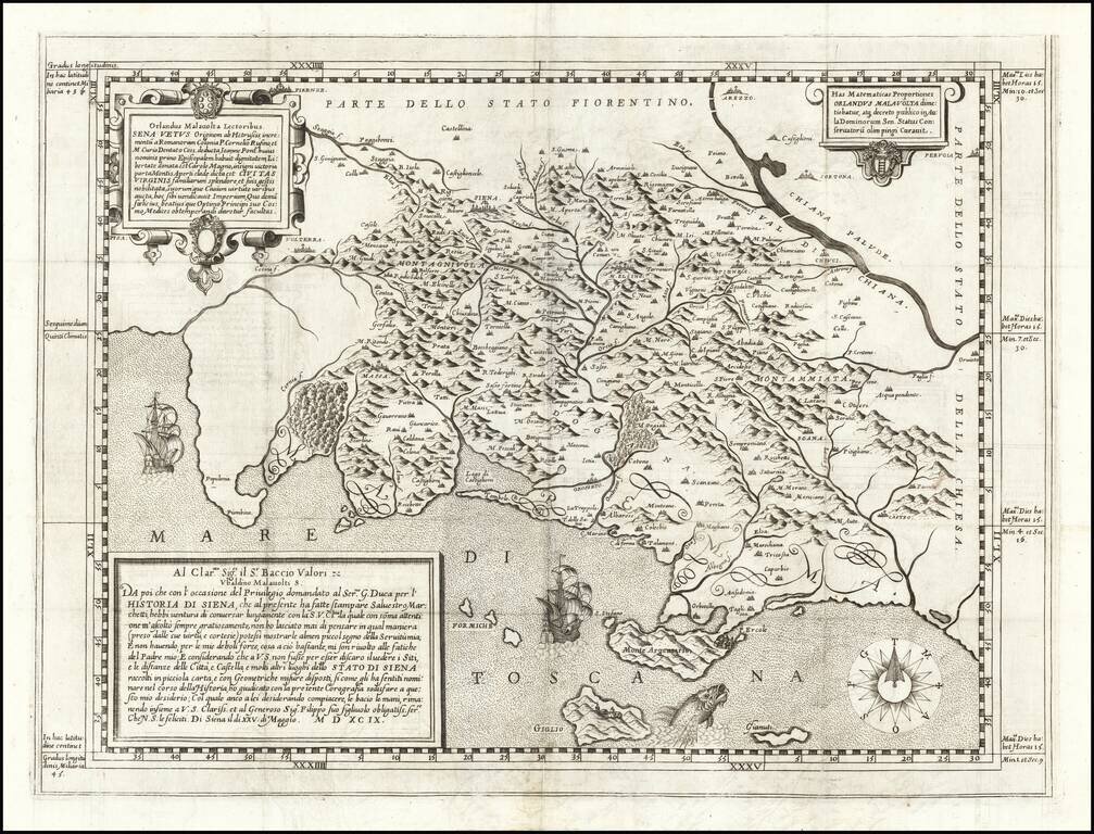
A Map of Siena By Its Most Important 16th Century Historian Scarce map of the "Territorio Senese" after the mural painting by Orlando Malavolti himself in 1573. The painting is believed to have been located in the Palazzo Comunale di Siena, but has...
Detailed regional map of northern Italy from Ortelius' Theatrum Orbis Terrarum, the first modern atlas of the world. The map is oriented with east at the top and shows Lago Di Garda, Brescia, Lago d'Iseo, Lago de Idro, etc. Strong dark impression...
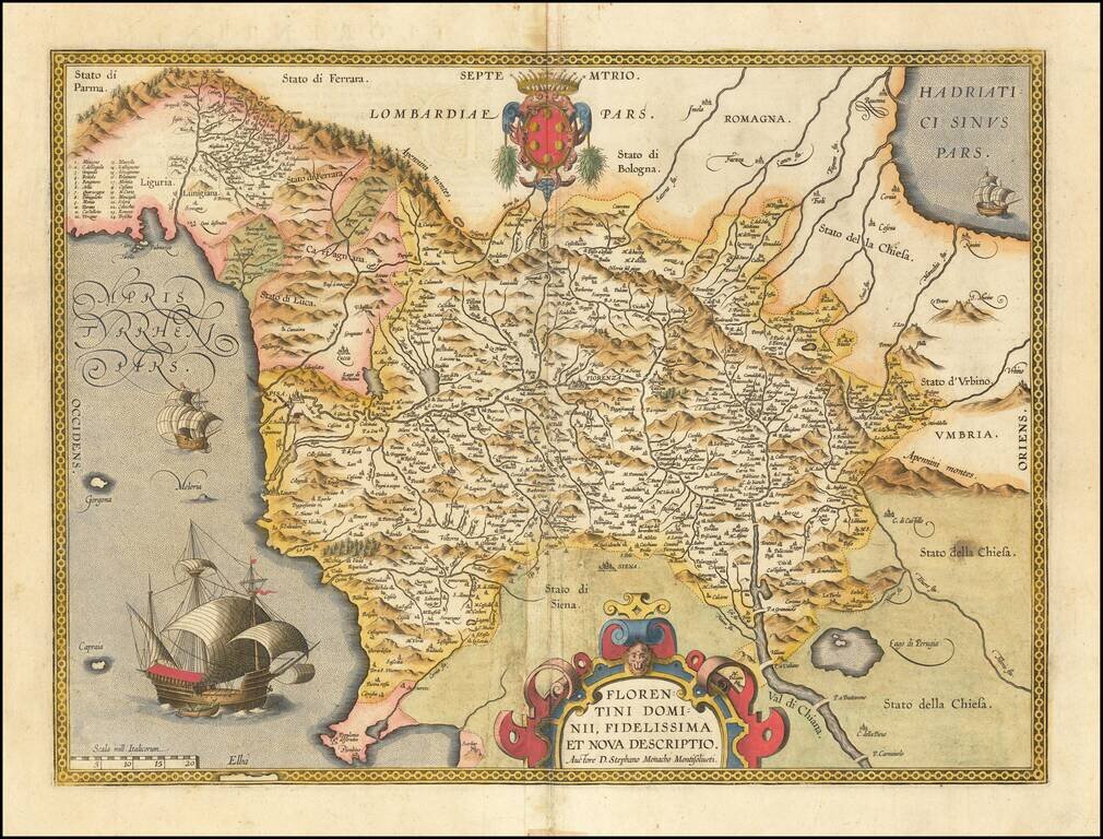
Finely colored example of this scarce map of the Province of Florence in Tuscany, issued in the Vrients editions of Ortelius' Theatrum Orbis Terrarum. The map is centered on the city of Florence and extends to Liguria, the Apennine Mountains, the...
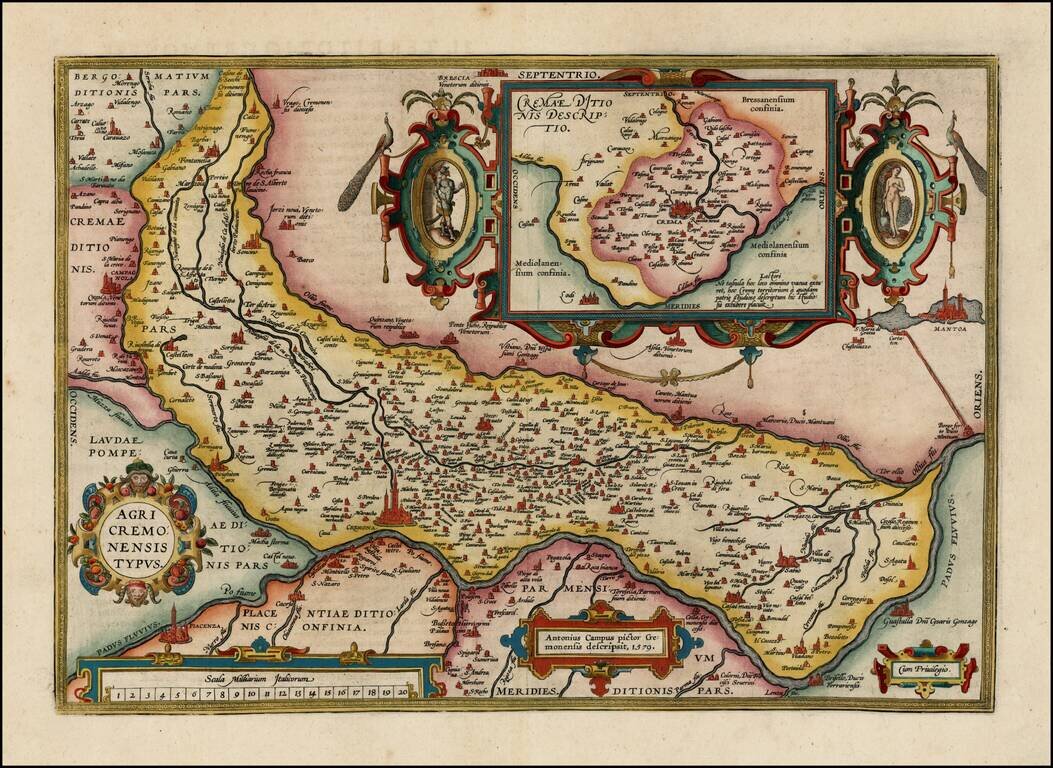
Nice full color example of Ortelius' map of the region centered on Cremona and the Padus River, with a large inset, from Oretlius's Theatrum Orbis Terrarum, the first modern atlas of the world. Extends to Mantua and Piacenza. Several ornate...
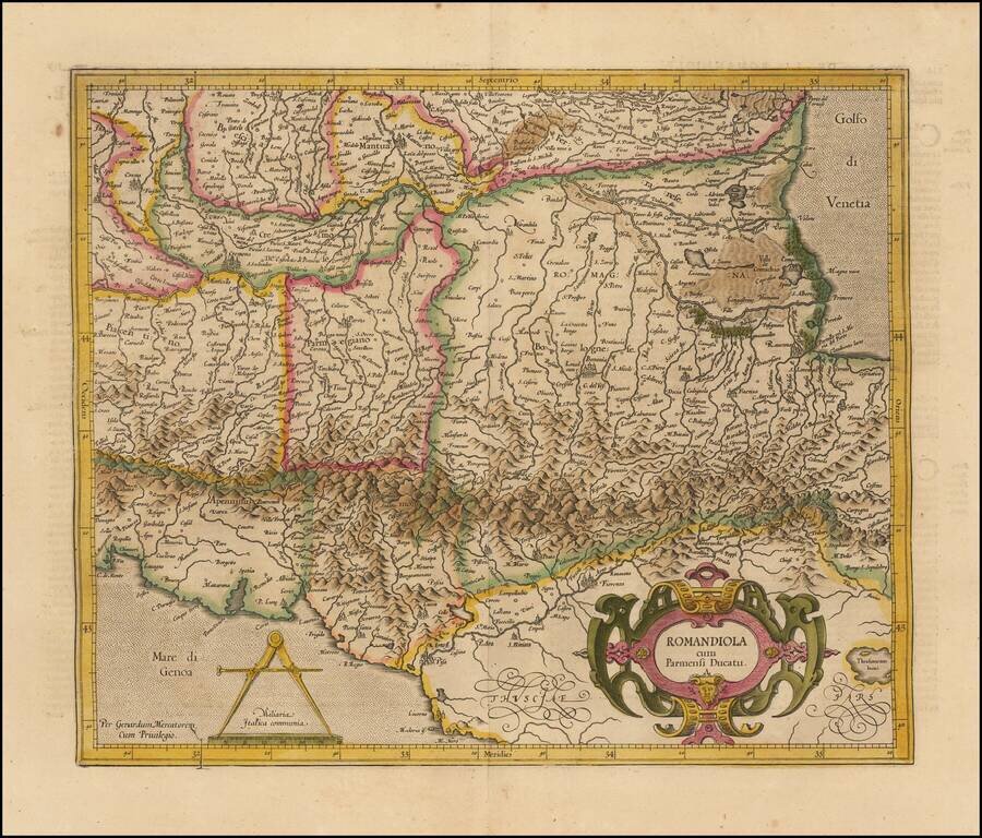
Striking regional map of Italy, published by Gerhard Mercator. Some of the major towns located include Parma, Bologna, Ravenna, Florence, Cremona, Mantova, Brescia, Piacenza, Pisa and Ferrara.
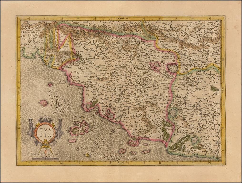
Striking map of Tuscany and surrounding regions, from an early edition of the Mercator-Hondius Atlas Sive Cosmographia. Drawn from contemporary Italian sources, this map is one of the most up to date modern maps of Tuscany printed in the early 17th...
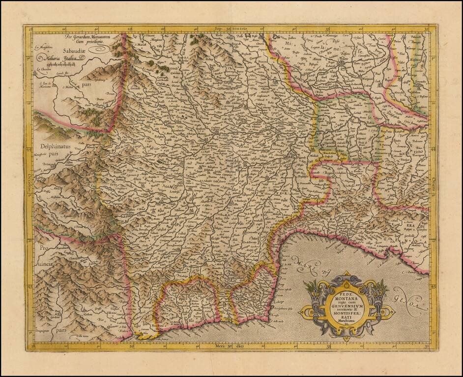
Striking regional map of Italy, centered on the Pedemont region of Italy and Genoa, published by Gerard Mercator and later by Hondius in the Atlas Sive Cosmographia. The map extends to the Milan region in the northeast, Cinque Terre in the southeast,...
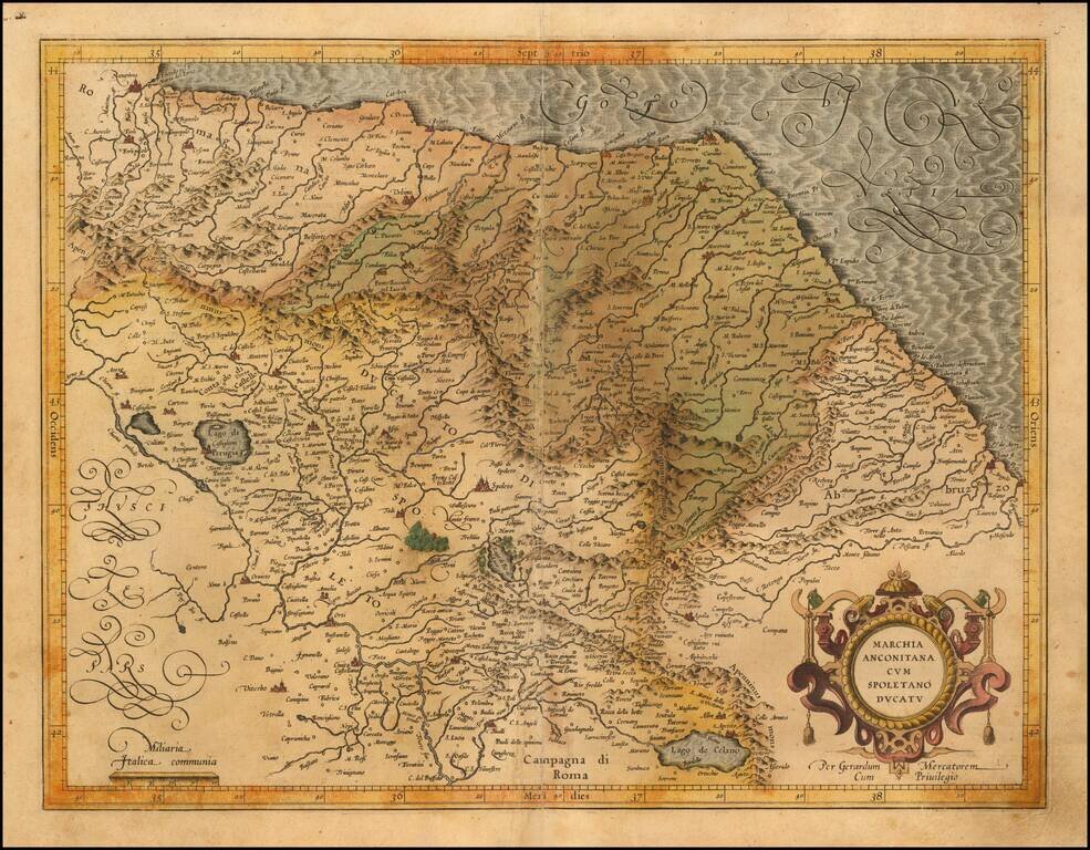
Finely engraved regional map Italy, published by Gerard Mecator in his Atlas Sive Cosmographia. The map extends from Ancona, Ravenna and San Angelo on the Adriatic Coast to Spoleto, Perugia, Tivoli and Lago di Celano
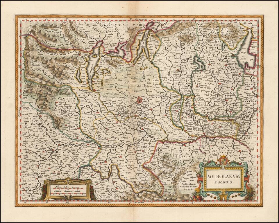
Fine hand-colored example of Blaeu's decorative regional map of Italy, centered on Milan. Decorative cartouches and fine topographical and geographical detail.
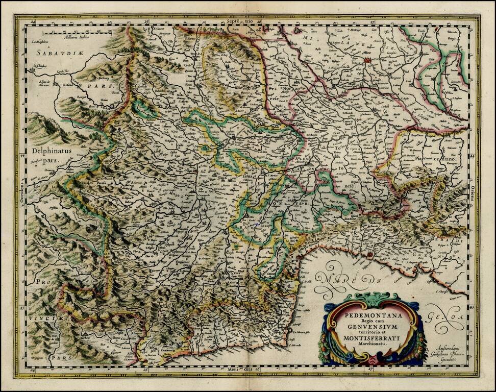
Cinque Terre to Monaco and Milan Fine old color example of Blaeu's map of the Piedmont region of northern Italy, including Genoa, Milano, Crema, etc. The map extends from Monaco on the Riviera Coastline to Cinque Terre. Fine dark impression, with...