Map size in jpg-format: 552251B
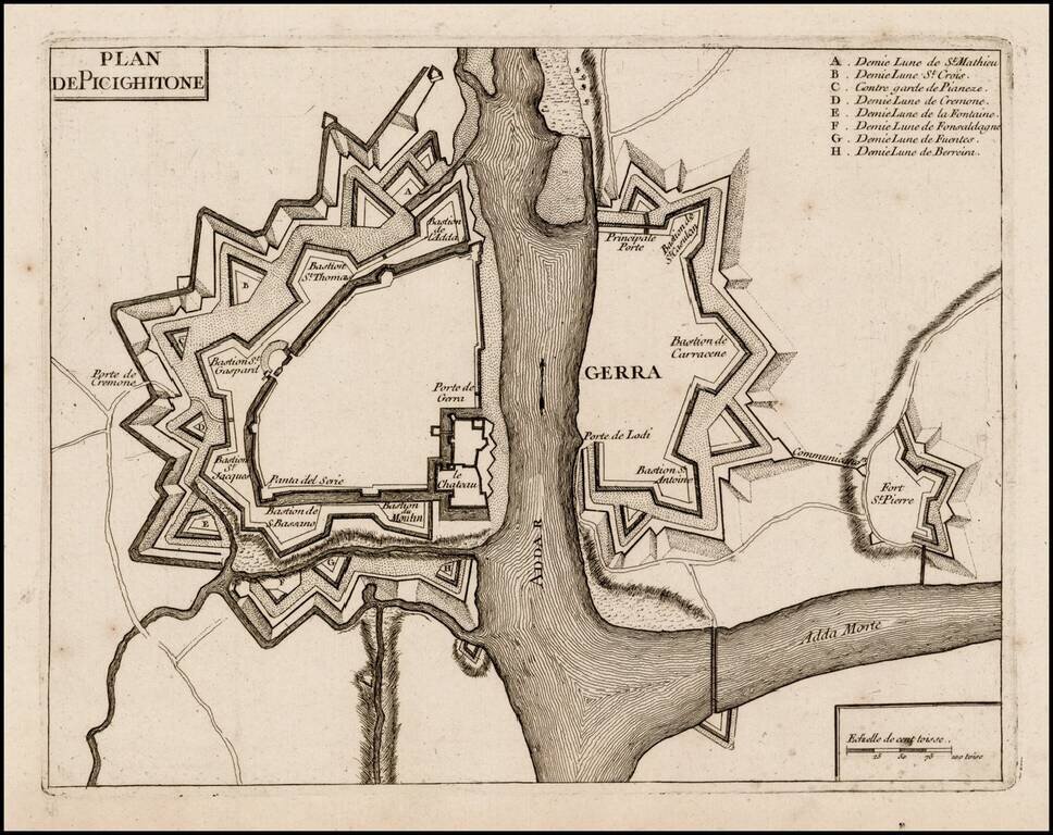
Rare plan of Pizzighettone and Gera, showing the fortifications of these two towns on the Abba River.
The plan of the fortifications was likely printed at or about the time of the Siege of Pizzighettone, the first major military engagement of the northern Italian campaigns of the War of the Polish Succession. Troops from France and the Kingdom of Sardinia began blockading the Habsburg Milanese fortress at Pizzighettone on November 11, 1733, commencing siege operations on November 15. On November 30, the commander of the Austrian garrison negotiated a capitulation in which he promised to withdraw toward Mantua on December 9 if no relief arrived. As no reinforcements appeared by that time, the fortress' garrison withdrew with full honors on December 9, 1733.
The maker of the map is not shown on the map. We have found attributions to De Fer, based upon an entry for copy of the map at the University of Bern, however the catalog entry for the Bern copy is 1690-1710. Jean de Beaurain made a larger plan of Picighitone showing the siege in 1734.
If you are a student, write to us in telegram: @antiquemaps and indicate what material you need and for what work you need a map in high detail. We are ready to provide material on special terms. For students only!


