logo

1776. Le Territoire de Verone dressee sur les meillures Cartes . . . 1776

  • Le Territoire de Verone dressee sur les meillures Cartes . . . 1776

Le Territoire de Verone dressee sur les meillures Cartes . . . 1776 information:

Year of creation: 
Resolution size (pixels): 
 4786x4081 px
Disk Size: 
 3627480B
Number of pages: 
 1
Place: 
 Venice
Author: 

Print information. Print size (Width x height in inches):
Printing at 72 dpi 
  66.47 х 56.68
Printing at 150 dpi 
 31.91 х 27.21
Printing at 300 dpi 
 15.95 х 13.6

An example of detailing the file of this map of in a printable high-resolution:

Click to open in high resolution (open in new tab).
Attention! this is just the central piece (central area 960x960 px) of the map file!
This is an example, so that you can see and study the level of detail of a given map. The entire Map will be fully available after payment!

Le Territoire de Verone dressee sur les meillures Cartes . . . 1776

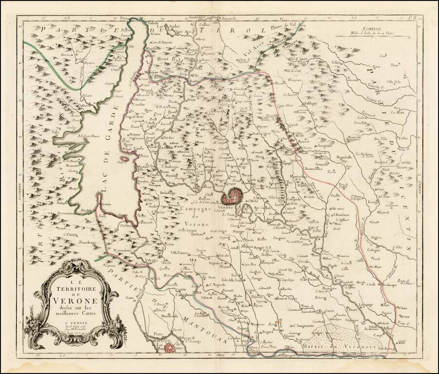
Scarce regional map of the Territory of Verona and environs, published in Venice by Francois Santini.

Unlike many of the maps in Santini's atlas, this regional map of Italy is not drawn from De Vaugondy and is based upon Italian sources.

One of the most detailed maps of the region published in the mid-18th Century.

Paolo Santini (1729-1793) was an Venetian engraver known especially for his religious prints and fine cartographic engravings. He published in Venice and may have a been a member of the clergy. In his maps, he largely adopted and adapted the work of his French counterparts, especially the brothers de Vaugondy.


Special conditions for students!

If you are a student, write to us in telegram: @antiquemaps and indicate what material you need and for what work you need a map in high detail. We are ready to provide material on special terms. For students only!

Item information:

Year of creation:
Size:
4786x4081 px
Disk:
3627480B
Number of pages:
1
Place:
Venice
Author:
Paolo Santini.
$14.99

Related item