
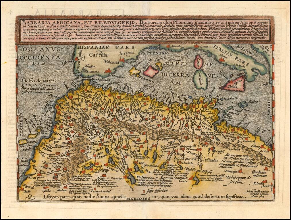
Scarce early map of North Africa and the Mediterranean, engraved by Johann Bussemacher and published by Quad in Cologne.
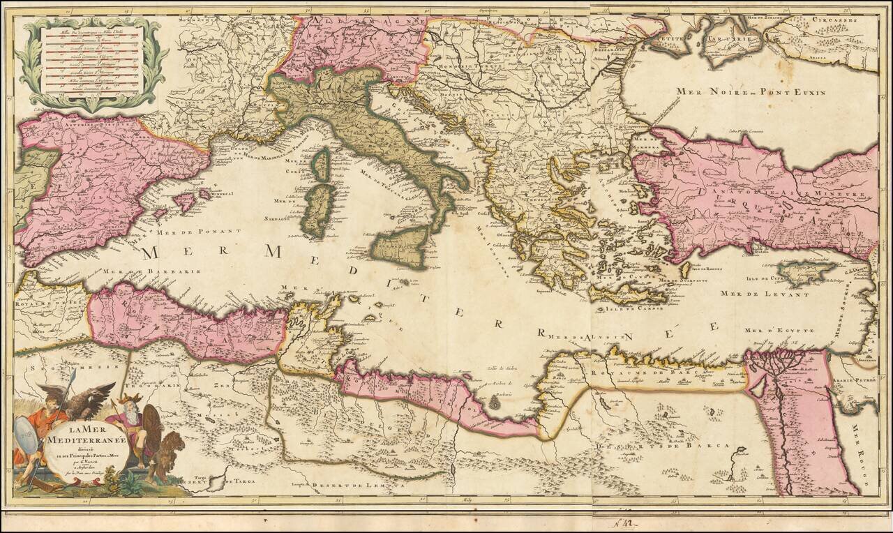
Scarce map of the Mediterranean, published by Gerard Valk circa 1700. The map extends from the Straits of Gibraltar to Cypress and Haifa. Includes an allegorical title cartouche. A fine old color example of a map that appears to be quite rare on the...
![A New Map Shewing all the several Counties, Cities, Towns, and other Places mentioned in the New Testament . . . [shows Cyprus]](/map/small/57664mp2.jpg)
Interesting map of the Eastern Mediterreanean, with smaller inset maps of the Holy Land and the whole of the Mediterreanean. Includes a title cartouche and coat of arms.
![A New & Accurate Map of the Western parts of Barbary Containing Fez, Morocco, Algiers . . . [and] A New & Accurate Map of the Eastern parts of Barbary . . .[Shows Cyprus]](/map/small/67838.jpg)
Two engraved maps on one sheet showing the Mediterranean, with a focus on North Africa. The upper map extends from the Atlantic to "Tripoly," while the lower map extends from Tunisia to the Holy Land. In addition to the many states of North Africa,...
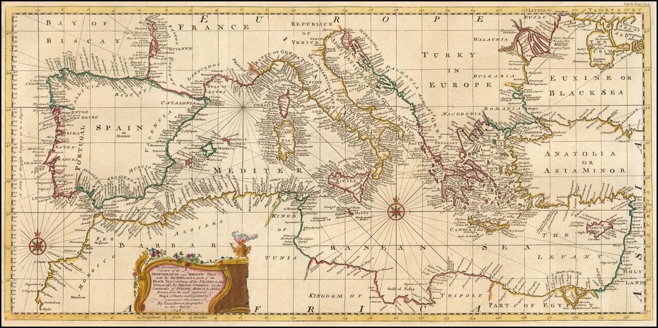
Fine example of Bowen's map of the Mediterranean and contiguous regions, from Harris' Navigantorum. The map is done in the Portolano style, focusing on coastal features. Hundreds of placenames and fine detail throughout. Decorative cartouche and 2...
![Carte De La Syrie [Shows Cyprus and the Holy Land!]](/map/small/47512.jpg)
Finely engraved map of the eastern Mediterranean, from Jacques Nicolas Bellin's Le Petit Atlas Maritime Recueti de Cartes et Plans des Quatre Parlies du Monde en Cinq Volumes, first published in Paris in 1764. The map covers the seaboard north from...

Very attractive engraved double-page sea chart of the Mediterranean Sea, with publisher's hand color in outline. Jean Lattre was one of the premier French mapmakers of the last quarter of the 18th century. This map features his characteristic vignette...
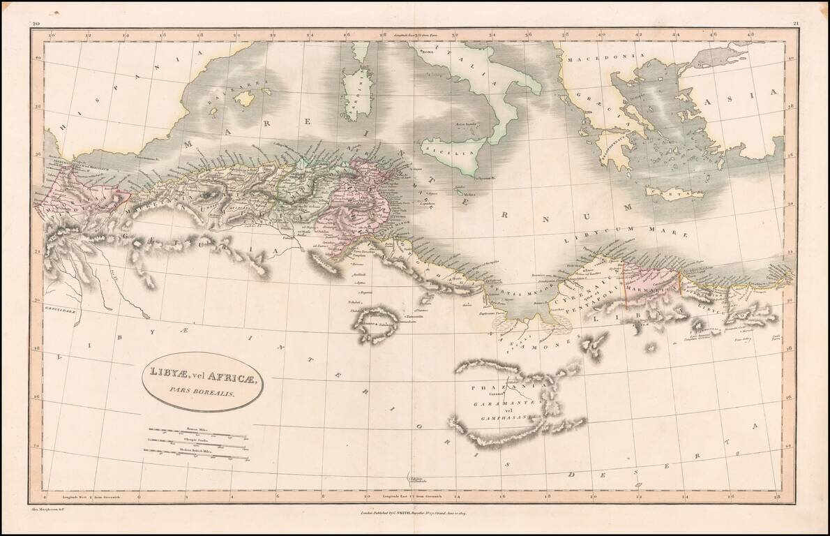
Detailed map of the north coast of Africa and the Mediterranean, published in London by Charles Smith.
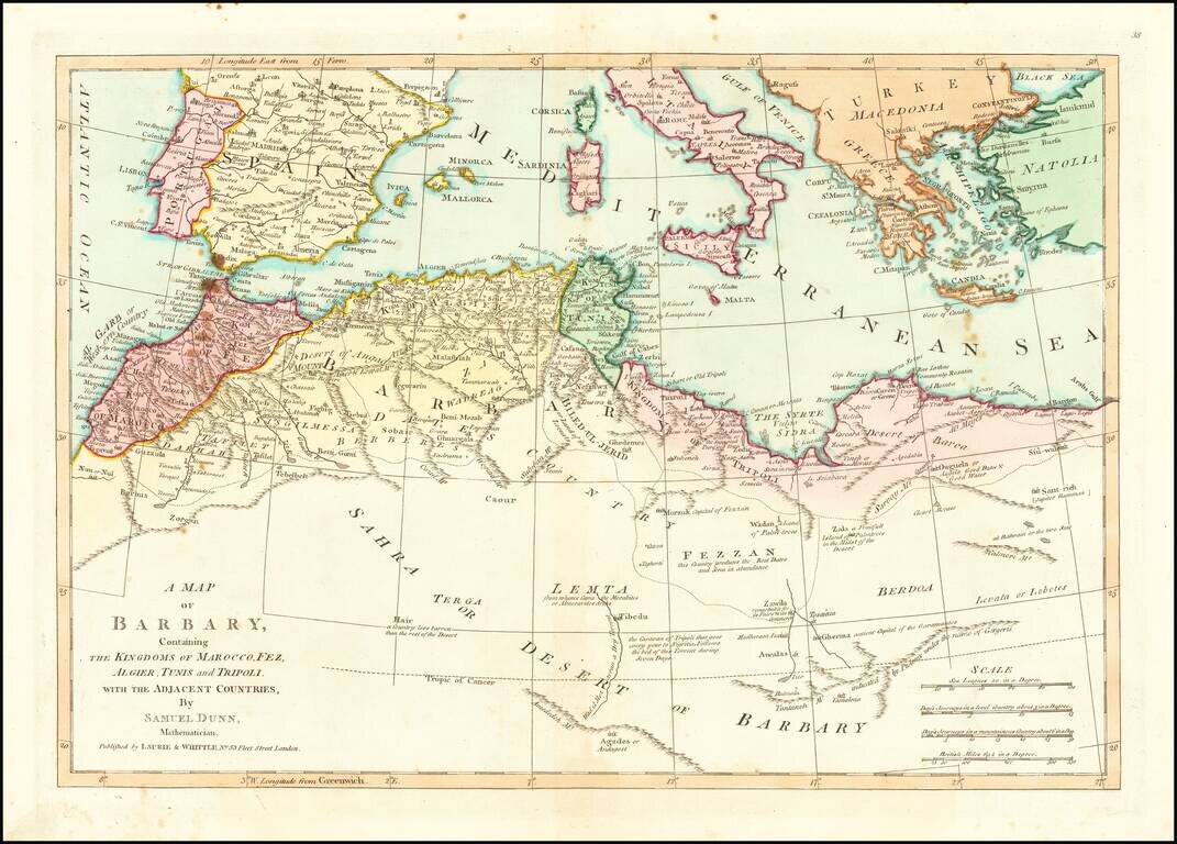
Detailed map of North Africa and the Mediterranean Sea. Nice detail and a number of annotations. The map was first printed for Robert Sayer at 53 Fleet Street, London.
![Chart of the Mediterranean Sea [Cyprus]](/map/small/45182.jpg)
Nice example of the Mediterranean chart from Thomson's New General Atlas. The chart focuses on coastlines and coastal cities in the manner of early Discovery Era portolan charts. The main chart of the Mediterranean basin is surrounded by seven inset...
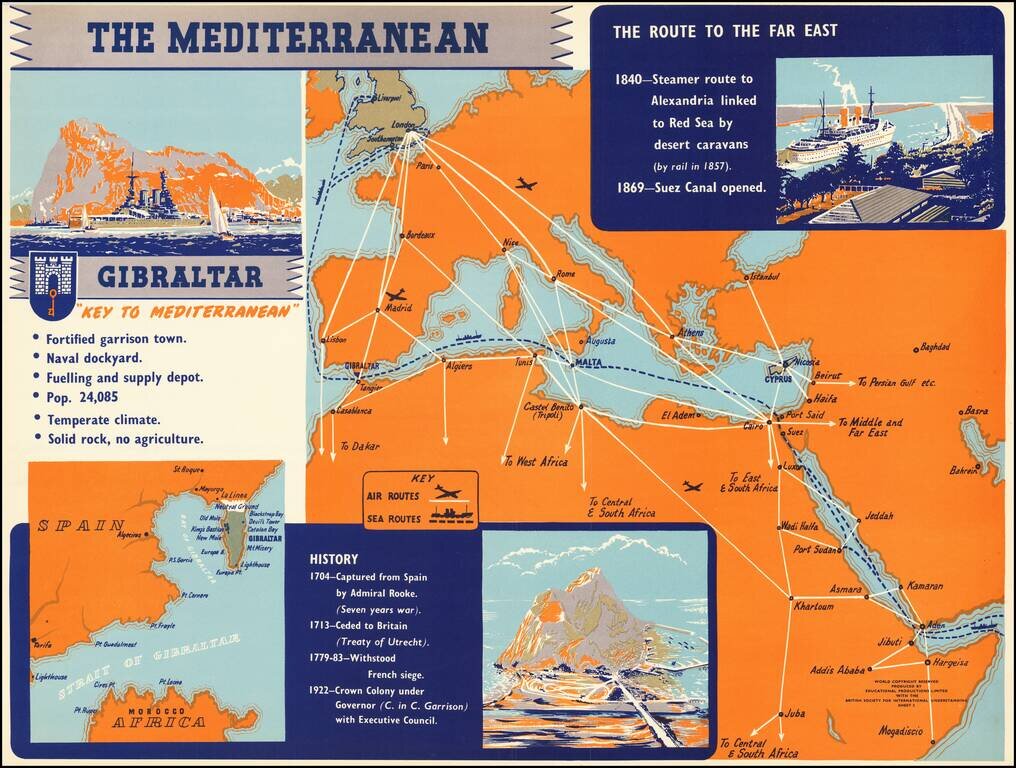
Rare separately published broadside illustrating the strategic importance of the Mediterranean in general and Gibraltar, published by Educational Products Limited with the British Society for International Understanding.
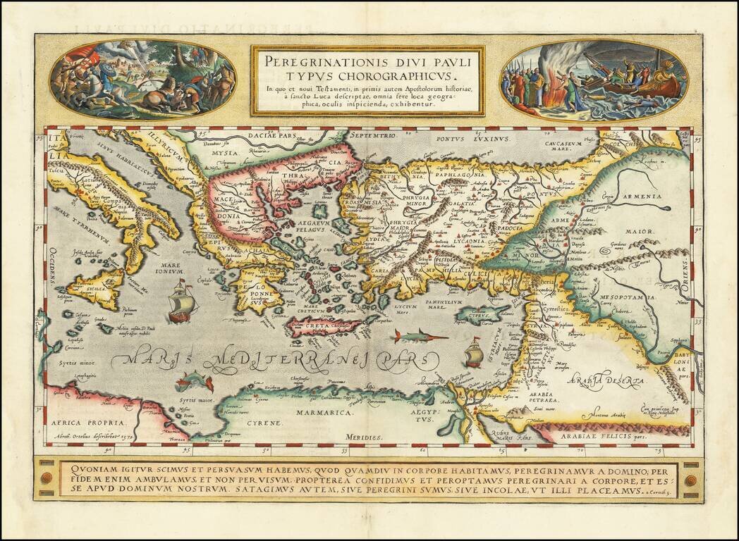
A gorgeous example of Ortelius' map of the travels of St. Paul the Apostle through the Mediterranean, extending west to Italy and east to the Euphrates, including parts of the Red Sea and the Black Sea. Several sailing ships and sea monsters in the...