logo

1952. The Mediterranean / Gibraltar "Key To the Mediterranean"

  • The Mediterranean / Gibraltar

The Mediterranean / Gibraltar "Key To the Mediterranean" information:

Year of creation: 
Resolution size (pixels): 
 14206x10742 px
Disk Size: 
 40.7215MiB
Number of pages: 
 1
Place: 
 n.p.

Print information. Print size (Width x height in inches):
Printing at 72 dpi 
  197.31 х 149.19
Printing at 150 dpi 
 94.71 х 71.61
Printing at 300 dpi 
 47.35 х 35.81

An example of detailing the file of this map of in a printable high-resolution:

Click to open in high resolution (open in new tab).
Attention! this is just the central piece (central area 960x960 px) of the map file!
This is an example, so that you can see and study the level of detail of a given map. The entire Map will be fully available after payment!

The Mediterranean / Gibraltar

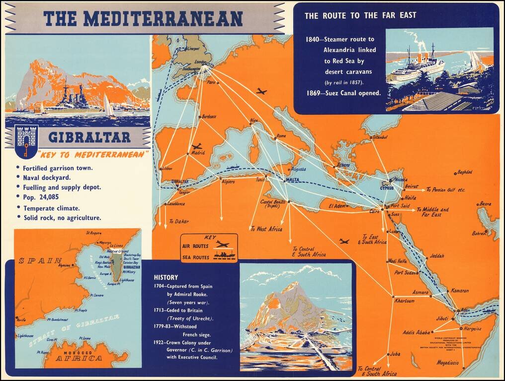
Rare separately published broadside illustrating the strategic importance of the Mediterranean in general and Gibraltar, published by Educational Products Limited with the British Society for International Understanding.


Special conditions for students!

If you are a student, write to us in telegram: @antiquemaps and indicate what material you need and for what work you need a map in high detail. We are ready to provide material on special terms. For students only!

Item information:

Year of creation:
Size:
14206x10742 px
Disk:
40.7215MiB
Number of pages:
1
Place:
n.p.
Author:
British Society For International Understanding.
$14.99

Related item