
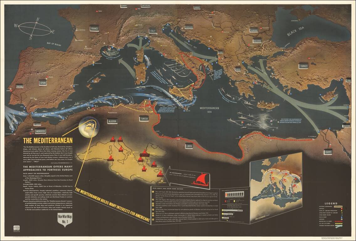
Excellent "NavWar" pictorial map of the Mediterranean Theater during the Second World War. The map highlights the progress of British and American forces in liberating North Africa and parts of southern Italy and the strategic advantages that these...
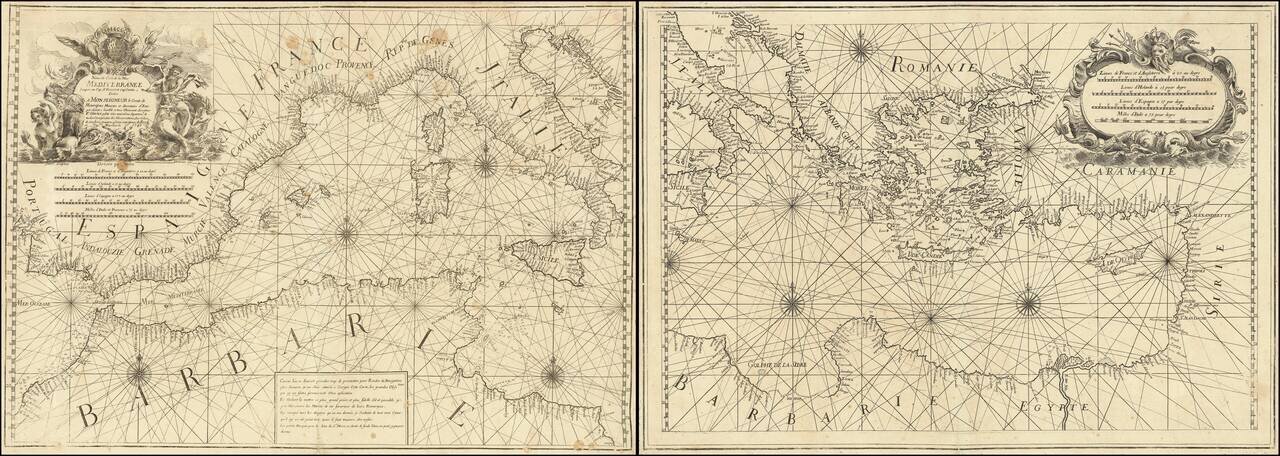
Rare 2 sheet chart of the Mediterranean, published by Francois Olivier in Toulon in 1746. One of the most advanced sea charts of the period, which was produced as a working chart and for which there are very few surviving examples. To the upper right...
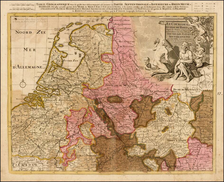
Detailed map the the Low Countries and Germany focusing on the course of the Rhine River.
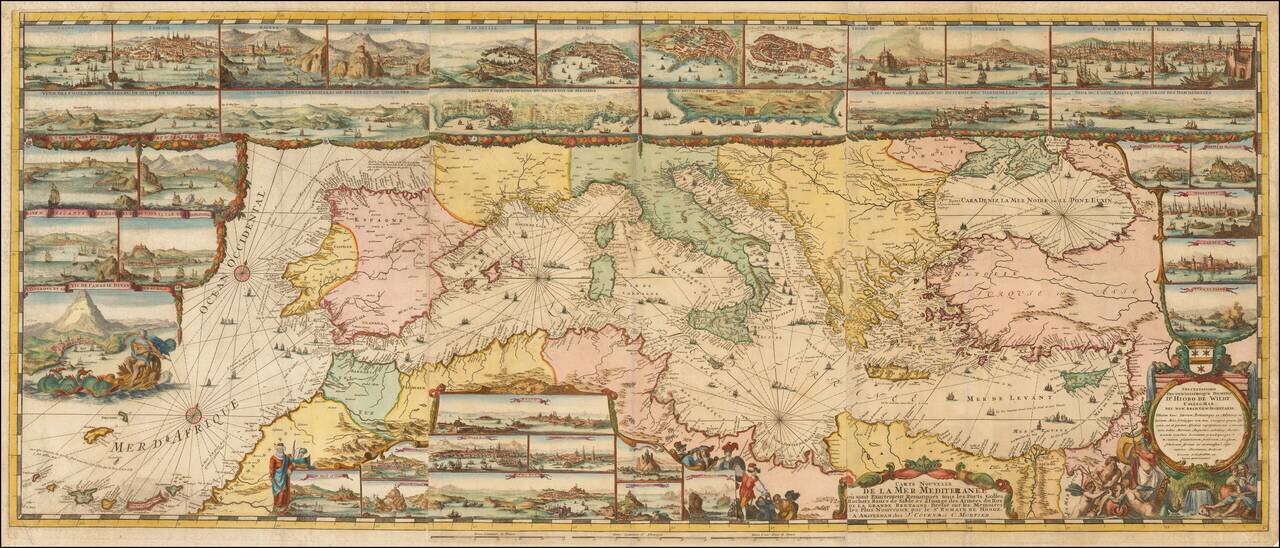
The Most Lavishly Illustrated Map of the Mediterranean of the 17th Century Covens & Mortier edition of Romeyn De Hooghe map of the Mediterranean, embellished with 38 inset maps and views of the major ports and harbors of the Mediterranean. Fine...
![Turcici Imperii Imago [shows Cyprus]](/map/small/68676.jpg)
Fine Map of the Ottoman Empire from the Mercator-Hondius Atlas Striking example of this map of the Ottoman Empire, showing their territories in the Balkans, Anatolia, the Levant, the Arabian Peninsula, and North Africa. It was published by Henricus...
![Constantinoplen en Egypten door Nicolaus Schmidt in enn zes Jarige Reystogt uyt Duytsland [shows Cyprus]](/map/small/57615.jpg)
Decorative map of the region bounded by Italy, Corsica, Sardinia and Sicily in the west and extending to Cyprus, Asia Minor and the Holy Land in the east. Centered on Greece and the Balkans. The map was engraved to illustrate a Dutch translation of...
![Insularum Aliquot Maris Mediterranei Descriptio [Sicily, Malta, Sardinia, Corfu, Elba and Zerbia]](/map/small/45115.jpg)
Fine example of Ortelius' maps of the islands of Sicily, Malta, Sardinia, Corfu, Elba and Zerbia, from the Ortelius' Theatrum Orbis Terrarum, the first modern Atlas of the World. Includes a number of sailing ships, including a sinking vessel off...
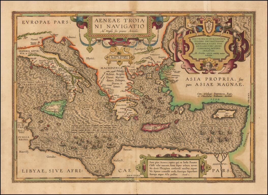
On the Trail of Aeneas, the Trojan—Historical Map of the Mediterranean Sea Chronicling the Story of the Aeneid A finely-detailed map of the eastern Mediterranean Sea, published in Ortelius’ Parergon, his historical atlas of the ancient world. The...
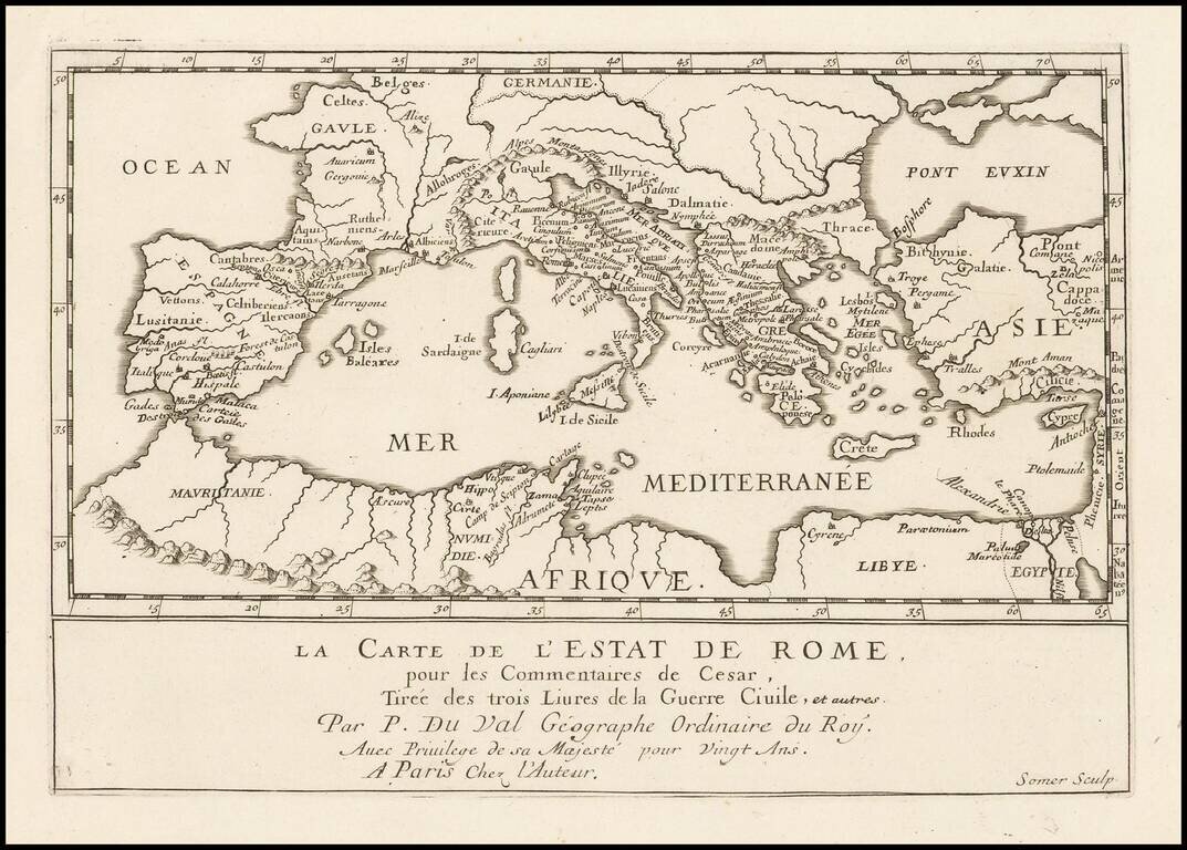
Antique engraved map of the Roman Empire, published by Pierre Duval in Paris in the 1660s. The map shows the important early Roman cities around the Mediterranean. According to the title, the map shows the State of Rome, from the Commentaries of...
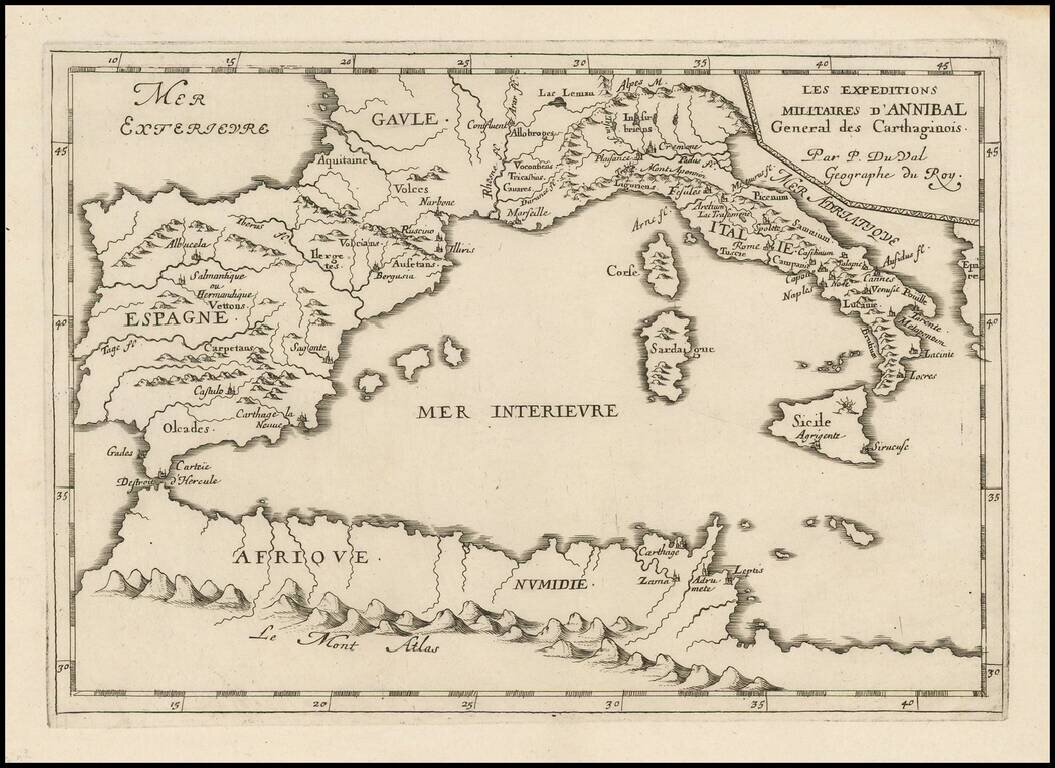
Antique engraved map of the military expedition of Hannibal, the Carthaginian general, published in Paris circa 1660 by Pierre Du Val. The map covers all of the western Mediterranean, with the most detail in Italy and Spain and a few locations in...
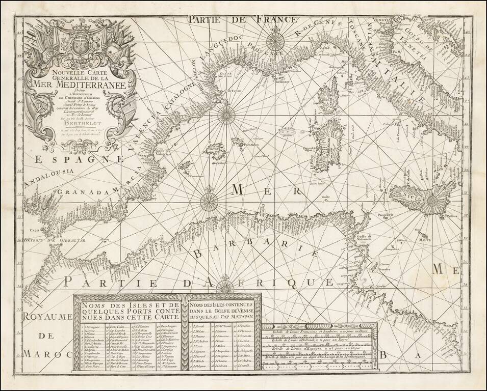
A rare separately issued map of the Western Mediterranean, published in Marseille by François Berthelot. This important early chart of the Western Mediterranean is one of a series of 4 charts published by Berthelot covering the Mediterranean and...
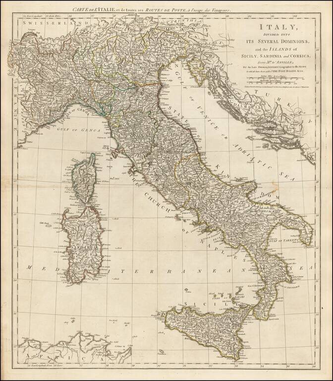
Detailed late 18th Century Postal map of Italy, Sicily, Corsica and Sardinia, with contiguous regions. Title also given in French.
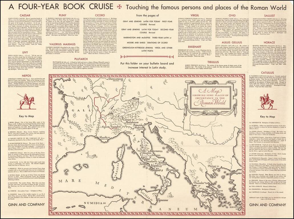
Fascinating "map of the Roman World", illustrating a Ginn & Company promotional advertising brochure promoting its Latin and other educational text books.
![[Western Mediterranean] Carta Particolare del Mare Mediterranio che Comincia con lo Stretto di Gibilterra e Finisce con il Porto di Cartagena in Ispagna e del Capo Falcone in Barberia](/map/small/53991.jpg)
Robert Dudley's Sea Chart of the Western Mediterranean Detailed map of the western Mediterranean and Straits of Gibraltar, from Dudley's Dell'Arcano del Mare. Shows the Spanish coast from Trafalgar to Capo de Paulas (Murcia) and from Tangier,...
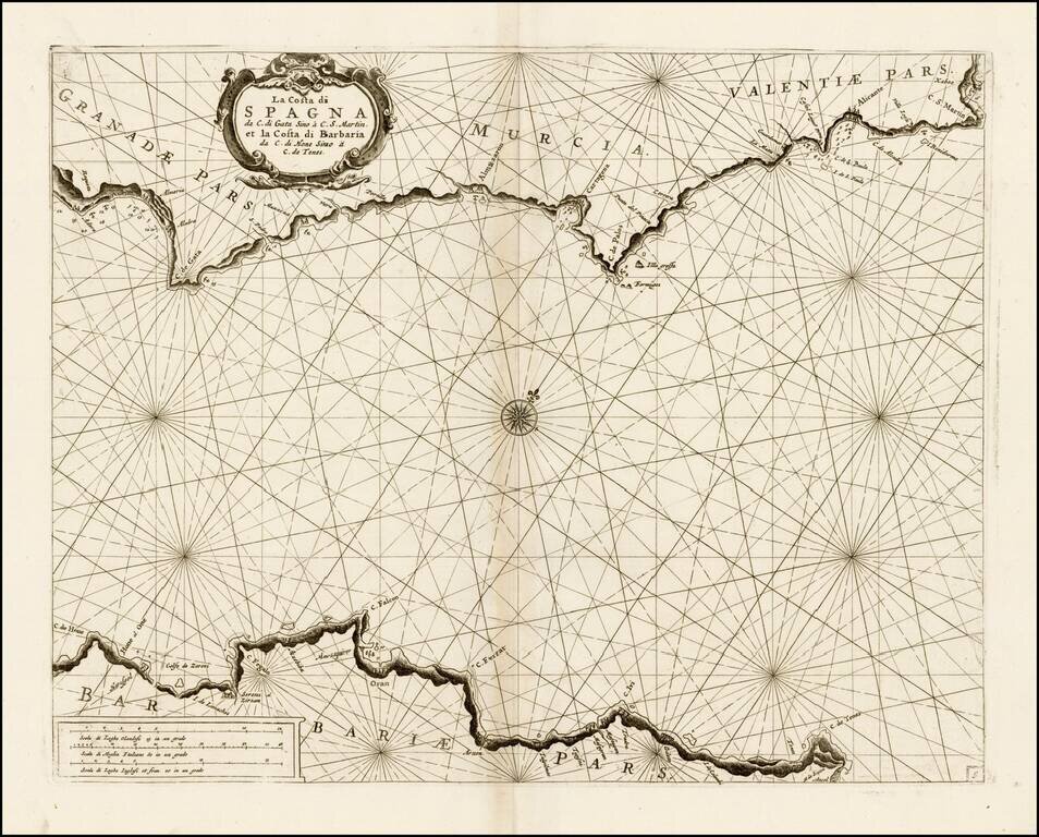
Fine chart of the Mediterranean coastline of part of Spain and North Africa, which appeared in Volume 1 of Coronelli's Corso Geographico, published in Venice. The chart covers the coast of Granada, Murcia, and Valencia, along with the contiguous...
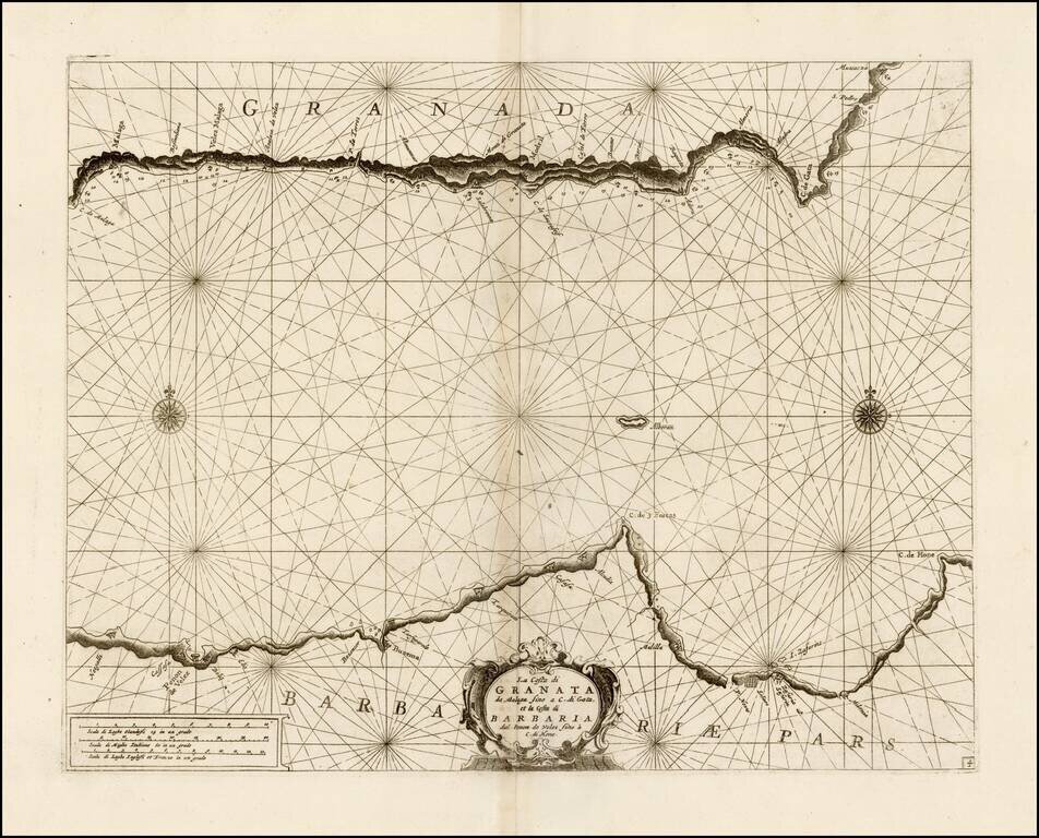
Fine chart of the Mediterranean coastline of part of Granada and North Africa, which appeared in Volume 1 of Coronelli's Corso Geographico, published in Venice. The chart covers the coast of Granada, from Malaga to Carboneras and the contiguous...