
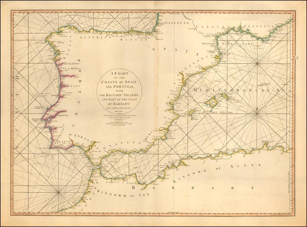
Detailed sea chart of the Balearic Islands, Spain, and Portugal. The chart extends to Provence and much of the Barbary coast to Bona. Good detail along coastal areas including the Straits of Gibraltar.
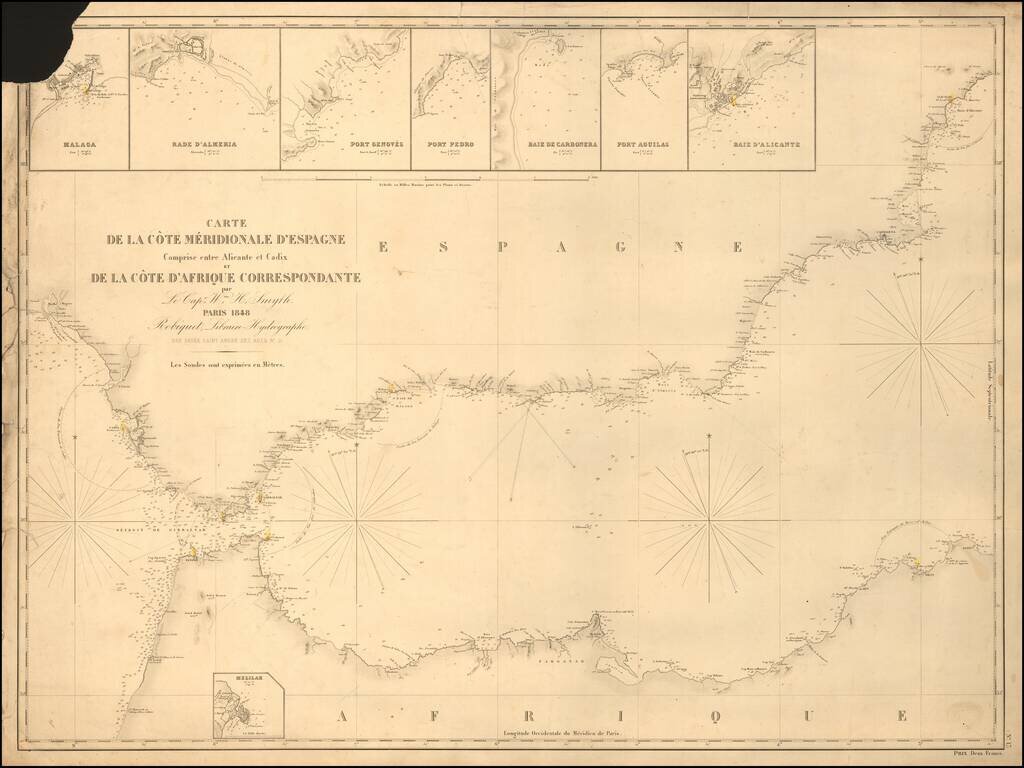
Rare separately published sea chart of the Strait of Gibraltar coast of Southern Spain and the corresponding coast of North Africa, published by Robique. Small inset maps of: Malaga Rade D'Almeria Port Genoves Port Pedro Baie de Carbonera Port...
![[Eastern Mediterranean]](/map/small/59510sb.jpg)
The Only Surviving Example Rare Lafreri school map of the Eastern Mediterranean and vicinity. The map is the Southeastern Sheet of an Unrecorded Map of Europe, published in Venice. The present example is the third state of three.
![[Eastern Mediterranean]](/map/small/61501sb.jpg)
Only known example of the rare map of of the Eastern Mediterranean. As note by Bifolco, this unique map is one of four sheets from a 16th century wall map of Europe, which an incomplete example survives the Civic Library of Bergamo in Italy (3 of 4...
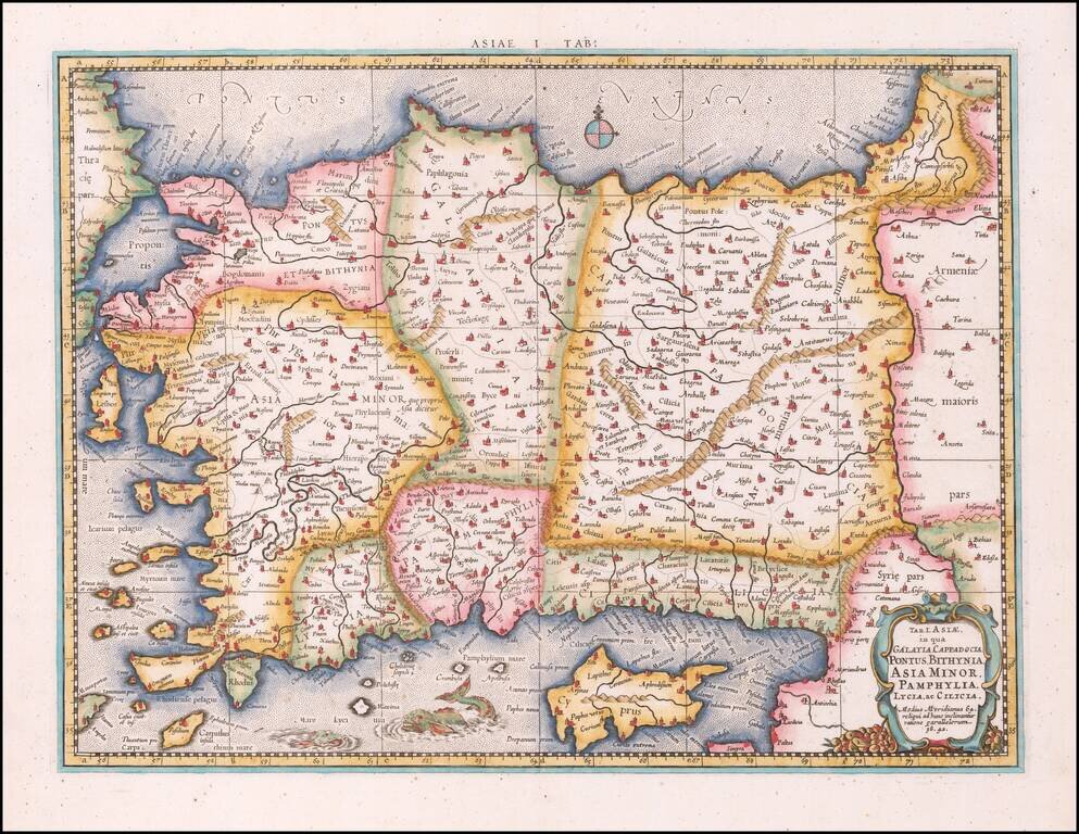
Nice example of Mercator's map of Asia, Minor and Cyprus, from Mercator's edition of Ptolemy's Geographia, first published in 1578 and republished in Amsterdam beginning in 1695. Includes a Sea Monster, cartouche and a detailed treatment of the...
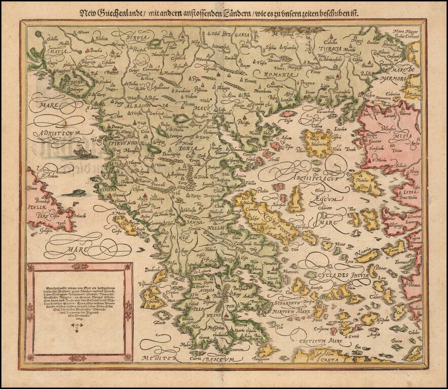
Nice full color example of Munster's second map of modern Greece, from Munster's Cosmographia, one of the most influential georgaphical works of the 16th Century. Munster's Geographia (first published in 1540), and his later Cosmographia, were...
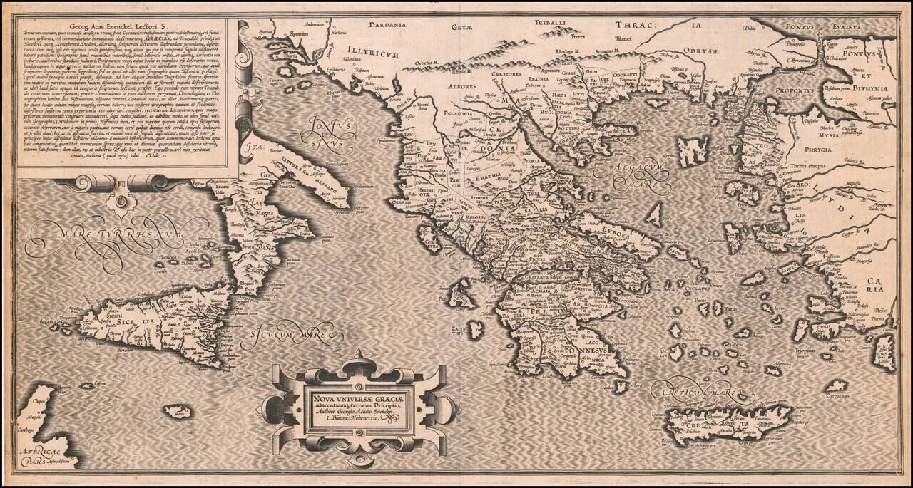
Extremely rare 16th Century map of the "New Greek Universe," by George Achatz von Eneneckel. The map extends from Sicliy and Puglia to the western coast of Asia minor, the regions controlled by the Ancient Greeks. This is the first time we have ever...
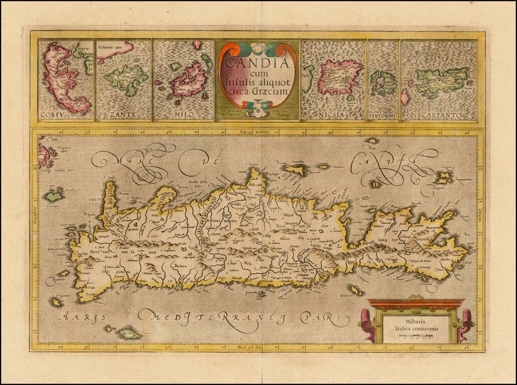
Nice old color example of the true first edition of Mercator's map of Crete and neighboring Greek Islands, from the first edition of Mercator's Atlas Sive Cosmographia. . . . Includes two large cartouches. Nice detail in the map of Crete and the large...
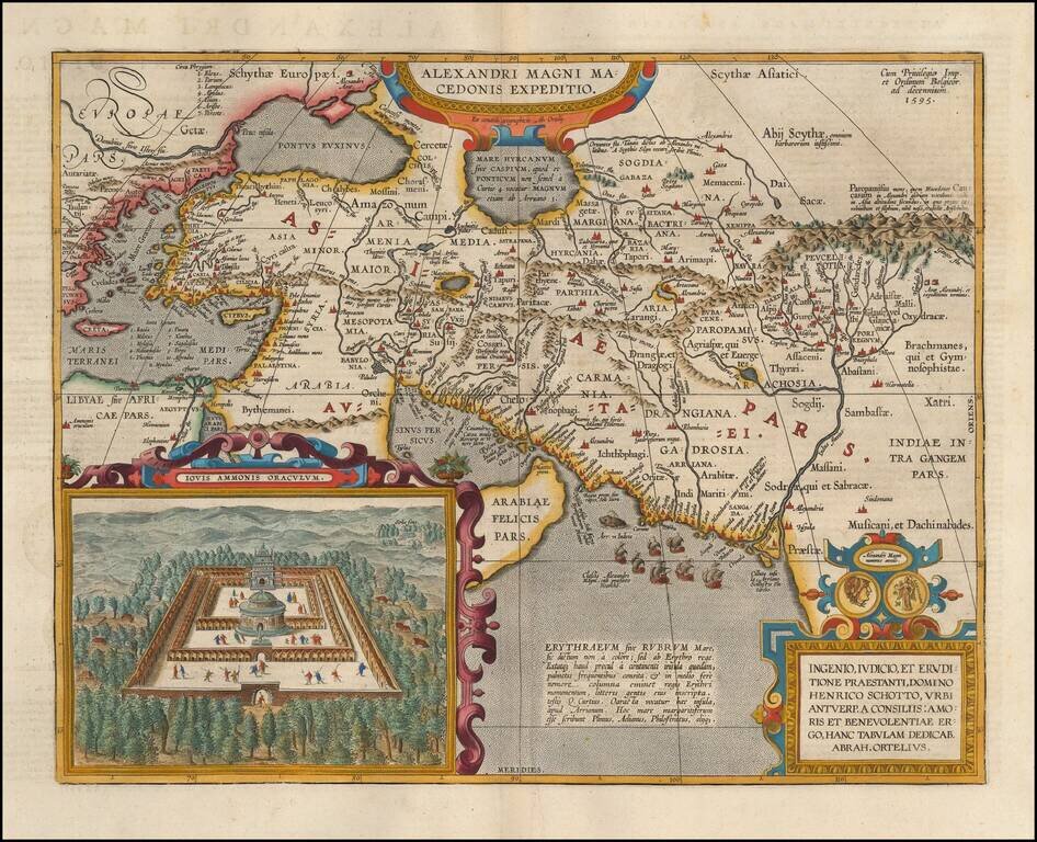
Detailed map of Alexander the Great's expedition to Macedonia. Includes an inset: Iovis Ammonis Oraculum, the oracle in Lybia which Alexander visited before he went to India. Several decorative cartouches, sailing ships, sea monsters, etc.
Striking map of the Eastern Mediterranean, from Italy and Sicily to Cyprus and the Holy Land, centered on Greece and the Aegean Sea. Includes English text on both sides. From the 1625-26 edition of Purchas His Pilgrims, one of the seminal early 17th...
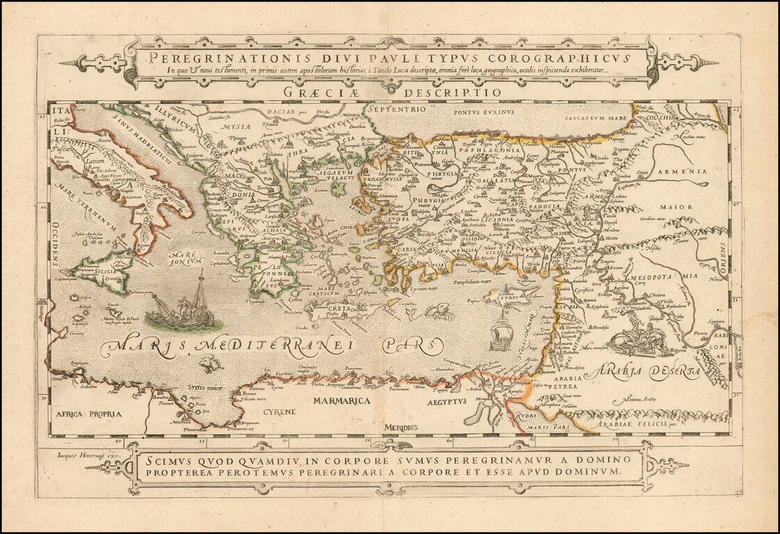
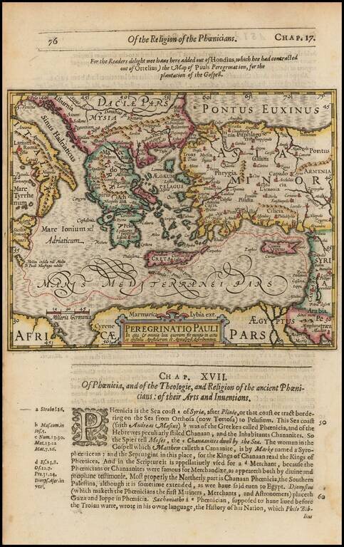
Extremely rare separately published map of the Holy Land, Cyprus, Asia Minor and the Eastern Mediterranean and contiguous regions, published in Paris by Jacob (Jacques) Honervogt. The map illustrates the travels of the Apostole Paul, based upon the...
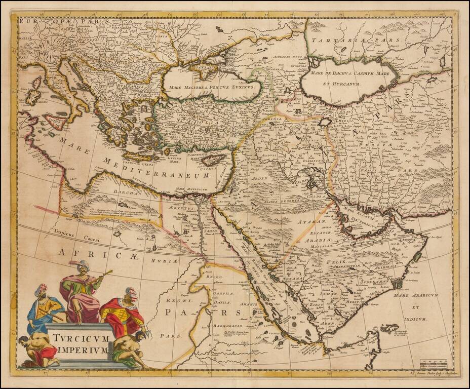
Striking map of the Turkish Empire bounded by the Eastern Mediterranean, Greece, and Italy in the West and Saudi Arabia, the Persian Gulf and Caspian Sea in the east and centered on Turkey and Cyprus. This fine map depicts the Ottoman Empire on the...
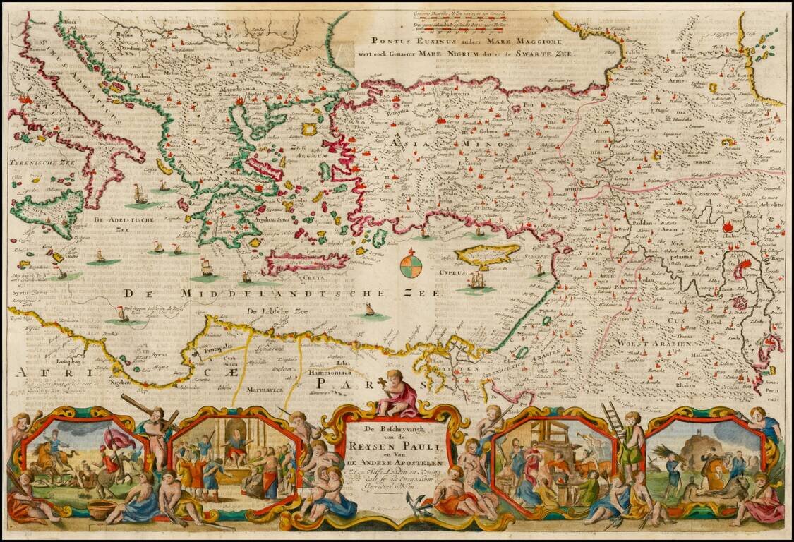
Nice example of Stoopendahl's map of the Eastern Mediterranean, showing the Travels of the Apostels. The map illustrates the travels of Paul in the Mediterranean, and includes 8 biblical scenes from Paul's travels.
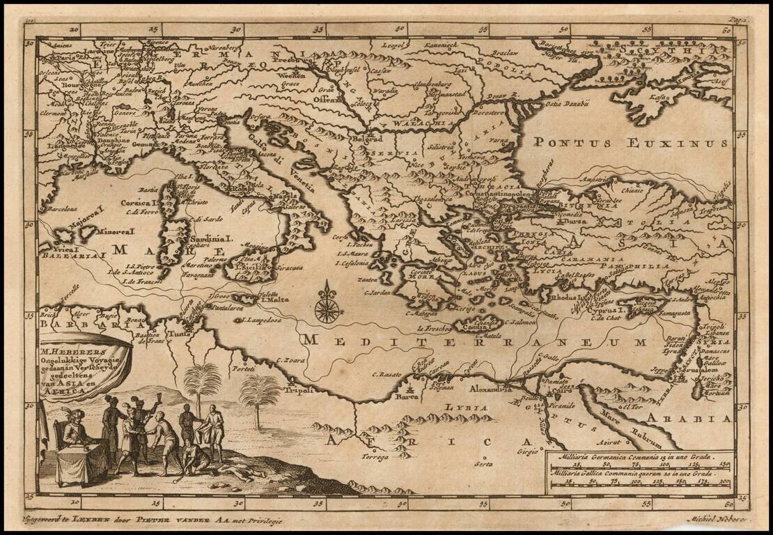
Decorative map of the Mediterranean and contiguous lands. The map was used to illustrate the Dutch translation of the travel narrative of German explorer, Michiel Heberer. Heberer (1560-1623/33?) has been called der pfälzishe Robinson, or Robinson...
![L. Rouwolfs Reys-Togten, door de Levant, of Oosterse Landschappen der Middellandse Zee [shows Cyprus]](/map/small/55336.jpg)
Interesting map of the Mediterranean region, showing Leendert Rouwolf's route from France to Tripoli. Includes decorative cartouche.
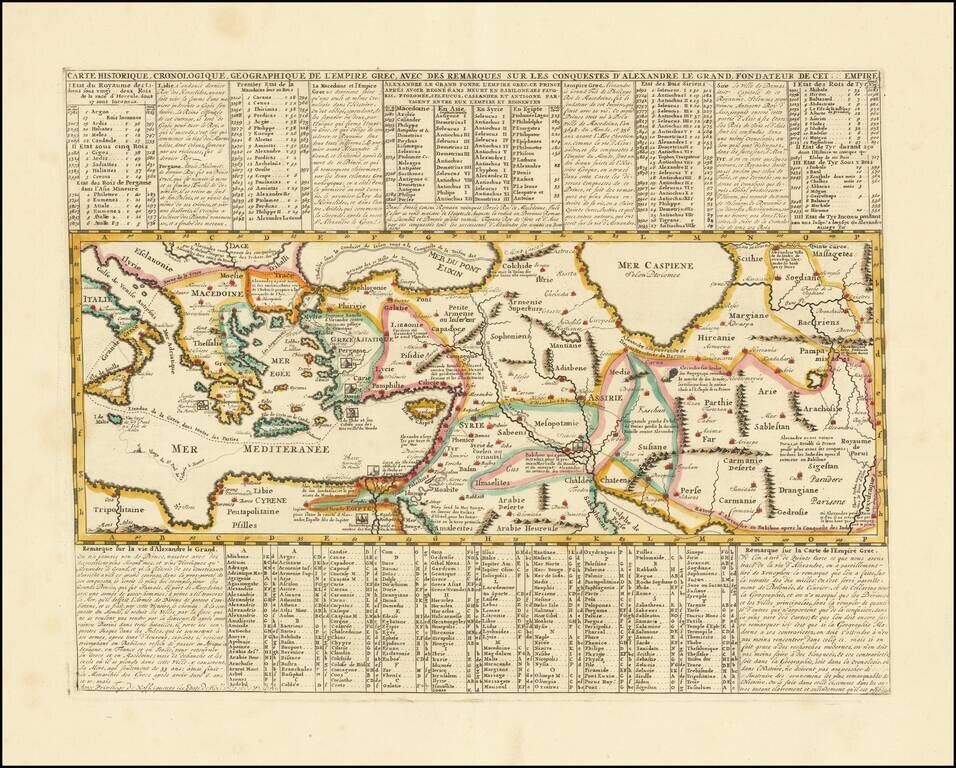
Mapping the Conquests of Alexander the Great. Interesting historical map of the Mediterranean, Black and Caspian Sea regions under Greek Rule. The map has excellent toponymic detail throughout, including extensive notes, trade routes, etc. The...