logo

1809. Libyae, vel Africae, Pars Borealis

  • Libyae, vel Africae, Pars Borealis

Libyae, vel Africae, Pars Borealis information:

Year of creation: 
Resolution size (pixels): 
 14086x9094 px
Disk Size: 
 28.59MiB
Number of pages: 
 1
Place: 
 London
Author: 

Print information. Print size (Width x height in inches):
Printing at 72 dpi 
  195.64 х 126.31
Printing at 150 dpi 
 93.91 х 60.63
Printing at 300 dpi 
 46.95 х 30.31

An example of detailing the file of this map of in a printable high-resolution:

Click to open in high resolution (open in new tab).
Attention! this is just the central piece (central area 960x960 px) of the map file!
This is an example, so that you can see and study the level of detail of a given map. The entire Map will be fully available after payment!

Libyae, vel Africae, Pars Borealis

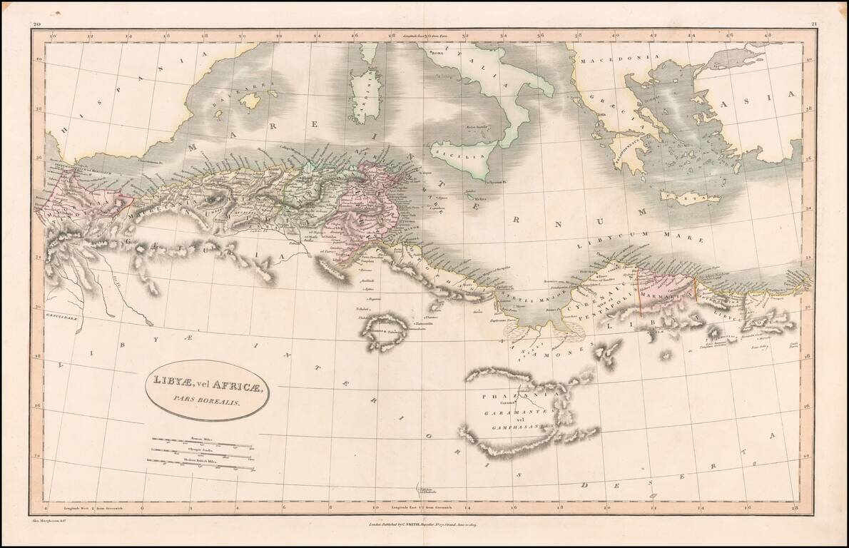
Detailed map of the north coast of Africa and the Mediterranean, published in London by Charles Smith.


Special conditions for students!

If you are a student, write to us in telegram: @antiquemaps and indicate what material you need and for what work you need a map in high detail. We are ready to provide material on special terms. For students only!

Item information:

Year of creation:
Size:
14086x9094 px
Disk:
28.59MiB
Number of pages:
1
Place:
London
Author:
Charles Smith.
$14.99

Related item