
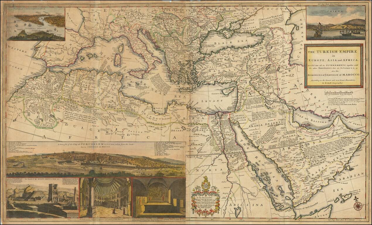
Dynamic Map of the Ottoman Empire with Rich Imagery of Jerusalem Striking large-format map of the Ottoman Empire by Herman Moll, one of England's leading map makers at the beginning of the eighteenth century. The map shows the sprawling Ottoman...
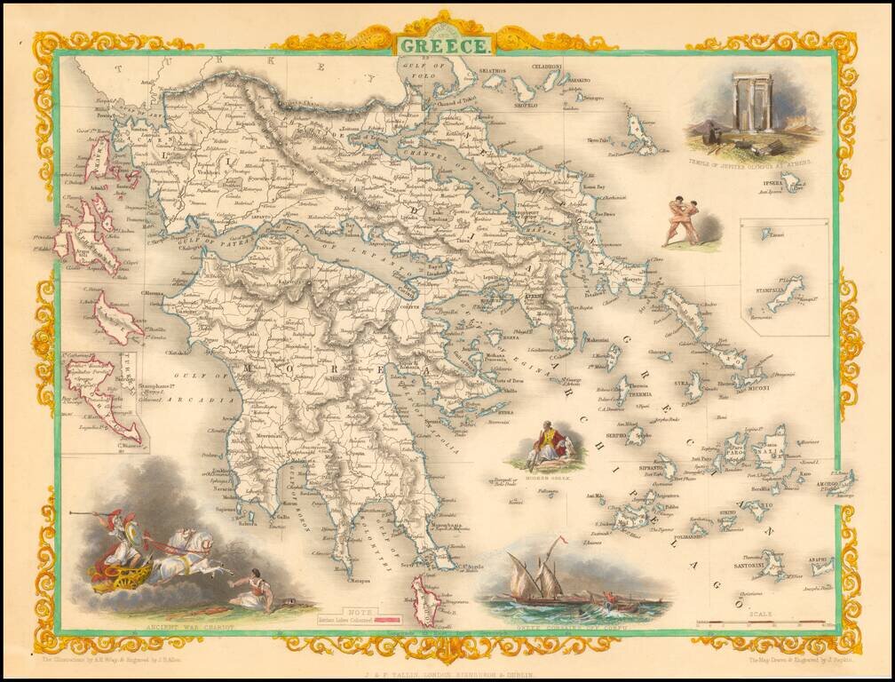
Decorative color example of this marvelous map. Decorative vignettes of an ancient war chariot, Temple of Jupiter on Mt. Olympus, Greek Corsairs off Corfu, a modern Greek and wrestlers. Engraved for R. Montgomery Martin's Illustrated Atlas. Tallis was...
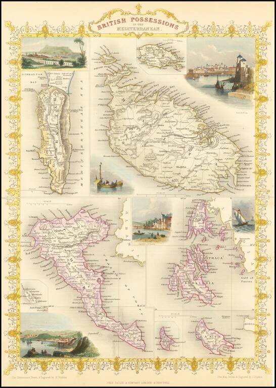
Gorgeous full color example of Tallis' map, with vignettes showing Valetta, Ithaca, Gibraltar and Corfu. Islands that are shown are Gibraltar, Malta, Corfu, Zante, Cerigo, Morea, Cephalonia, Ithaca and Gozo. Engraved for R. Montgomery Martin's...
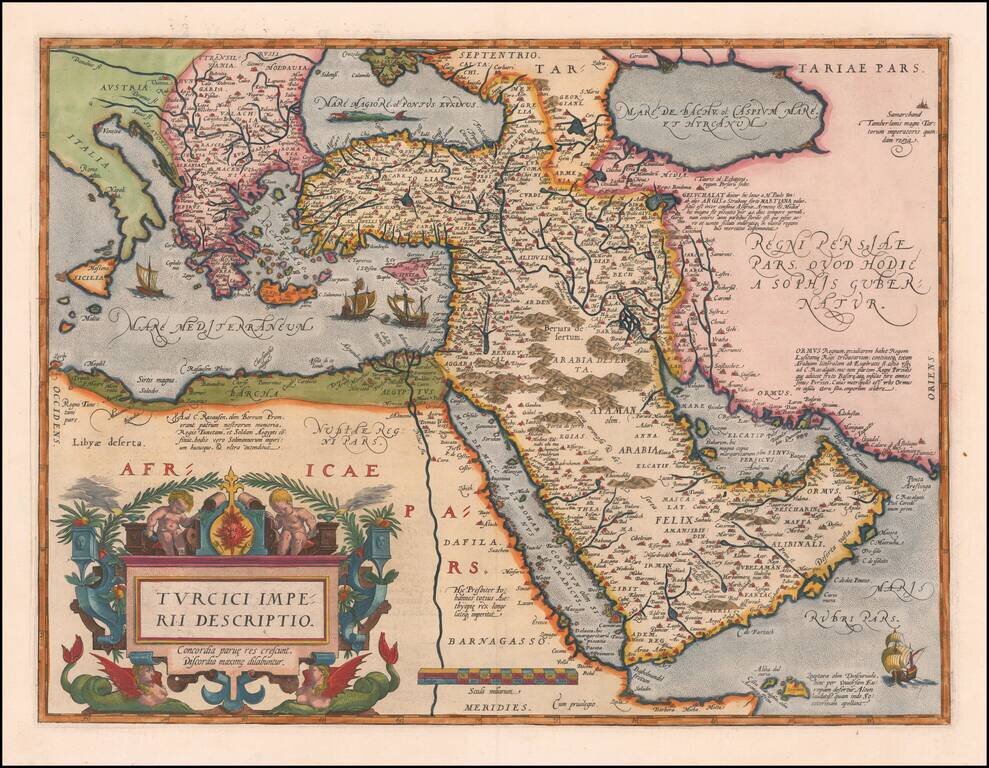
Second Edition of the Ortelius Map of the Turkish Empire Nice example of Ortelius' Turkish Empire, embracing the Middle East, Turkey and the Eastern Mediterranean from Sicily to Cyprus. The map is based upon Giacomo Gastaldi's wall map of Asia of...
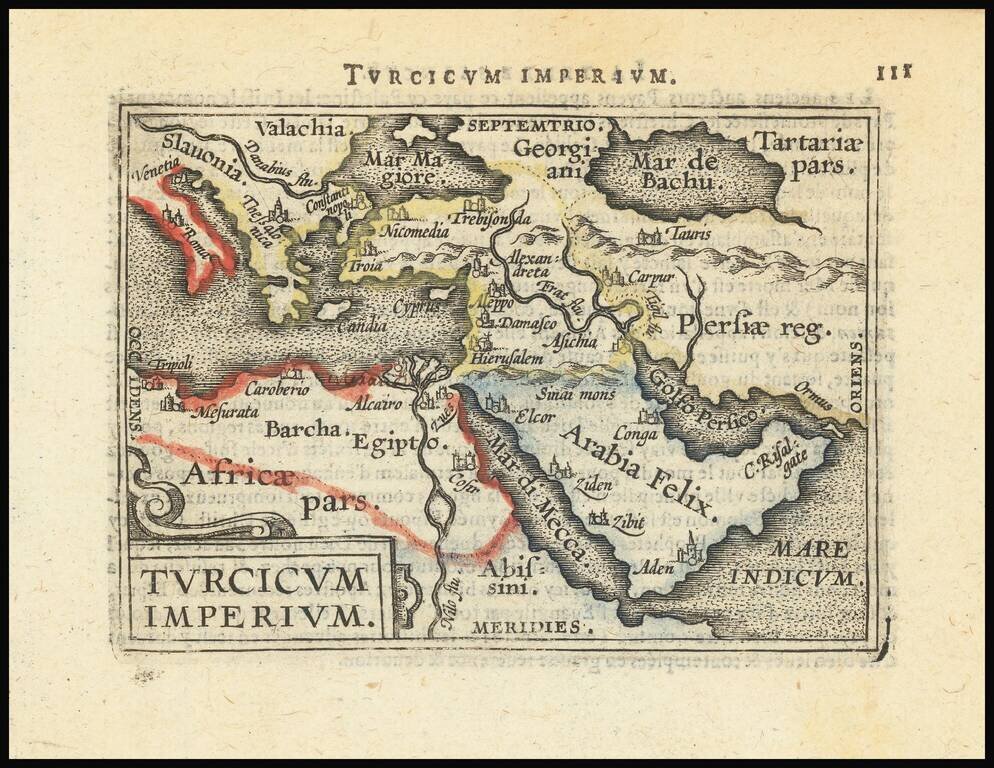
Decorative miniature map of the Turkish Empire. The map appeared in an early edition of Ortelius' Epitome, first published in 1579.
Striking map of the region bounded by the Mediterranean, Greece and Itay in the west and Saudi Arabia, the Persian Gulf and Caspian Sea in the east and centered on Turkey and Cyprus. Includes English text on both sides. From the 1625-26 edition of...
![Natolia, quae olim Asia Minor [shows Cyprus]](/map/small/71119.jpg)
Fine original hand-color example of Blaeu's decorative map of Asia Minor, showing Turkey, Cyprus and the Islands in the Aegean. This attractive map shows all of Turkey, Cyprus, and the Aegean Islands to a relatively high degree of accuracy. At the...
![Natolia, quae olim Asia Minor [shows Cyprus]](/map/small/40634.jpg)
Jan Jansson's decorative engraved map of Asia Minor, showing Turkey, Cyprus, and the Islands in the Aegean. This attractive map shows all of Turkey, Cyprus and the Aegean Islands to a relatively high degree of accuracy. At the time the entire region...
![Turcicum Imperium . . . [shows Cyprus]](/map/small/69623.jpg)
Decorative example of Blaeu's map of the Turkish Empire, based upon Blaeu's map of a similar title. Extends from Sicily and Italy in the west, to the Black and Caspian Seas in the north, and the Gulf of Aden, Red Sea and Saudi Arabia peninsula in the...
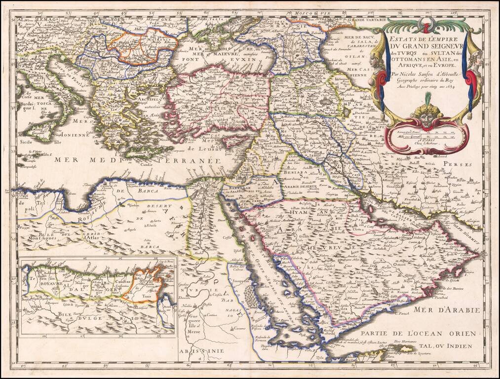
The Ottoman Empire by Nicolas Sanson. Sanson's map shows the powerful Ottoman Empire of the mid-seventeenth century, extending from Italy to the Straits of Hormuz. There is excellent detail from Italy to the Caspian Sea and the Arabian Peninsula. The...
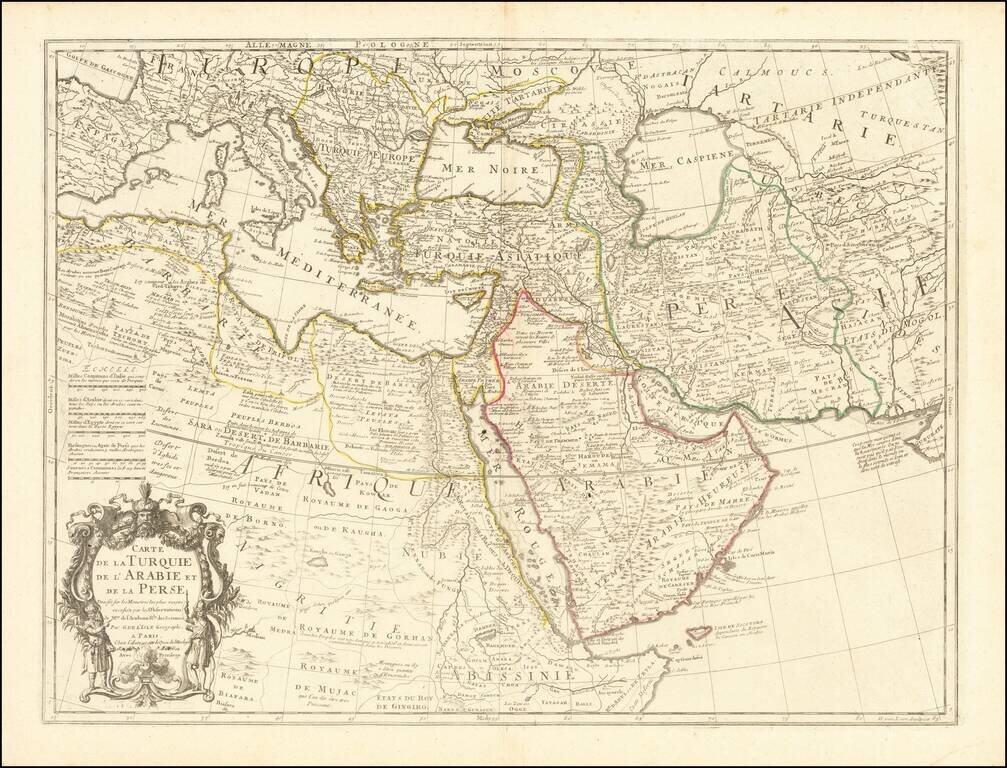
Fine example of an state of De L'Isle's map of the Turkish Empire and Arabian Peninsula, with De L'Isle's "Quai de l'Horlogie al Aigle d'Or" address, which was used only briefly after his move from Rue de Cannettes. Includes the Turkish Empire,...
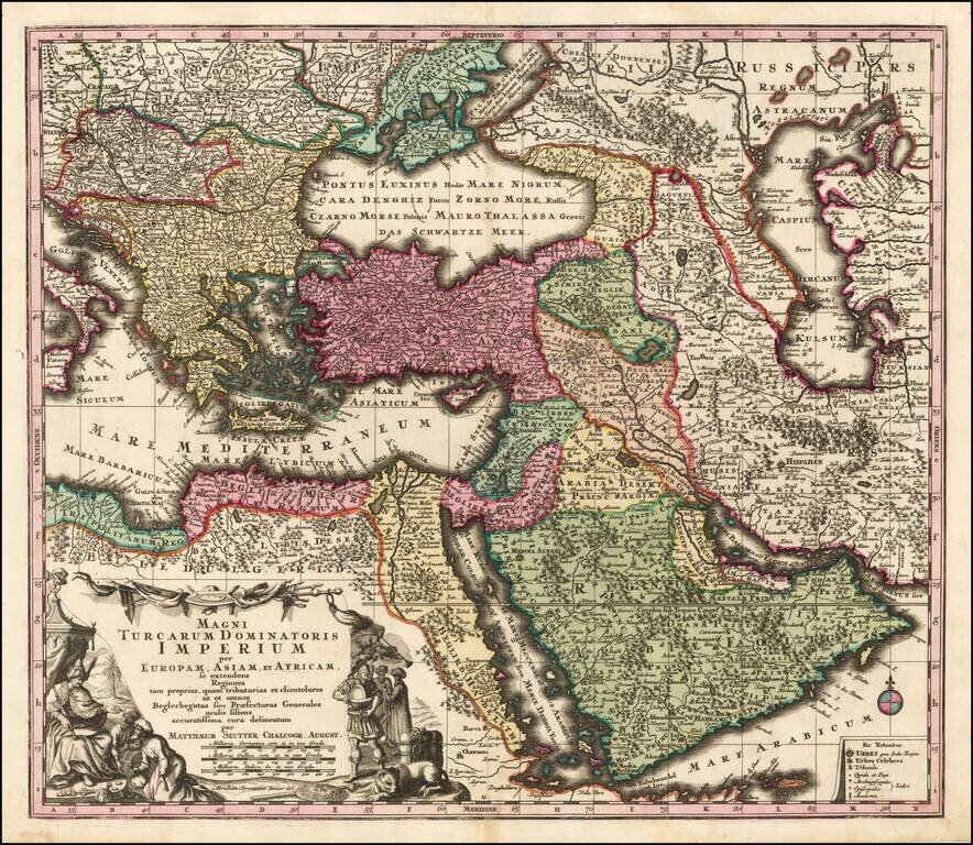
Striking hand-colored engraved regional map, centered on Turkey and Asia Minor, and showing the Eastern Mediterranean, Balkans, Greece, Persia, Saudi Arabia, the Black Sea and the Caspian Sea, published by Seutter. Includes decorative cartouche and...
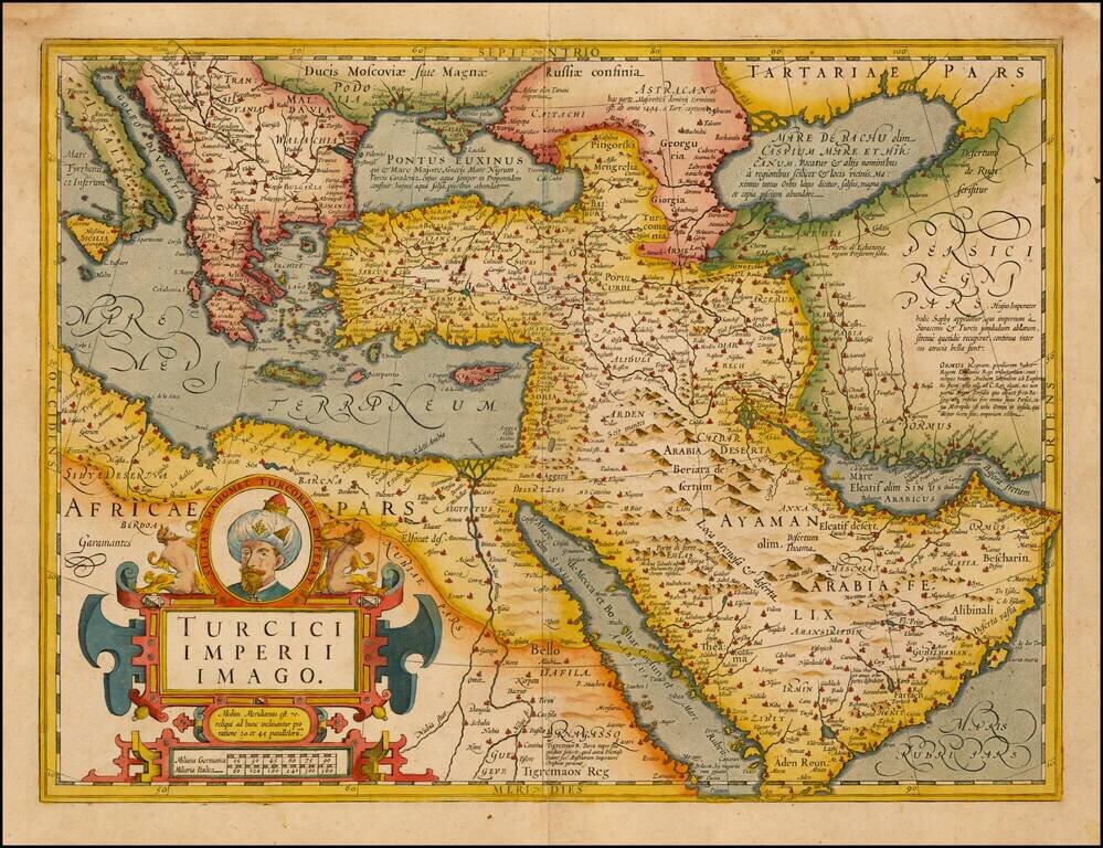
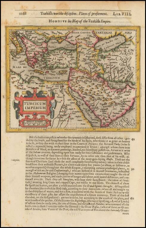
Fine Map of the Ottoman Empire from the Mercator-Hondius Atlas Striking example of this map of the Ottoman Empire, showing their territories in the Balkans, Anatolia, the Levant, the Arabian Peninsula, and North Africa. It was published by Henricus...
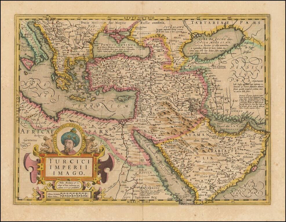
Fine Map of the Ottoman Empire from the Mercator-Hondius Atlas Striking example of this map of the Ottoman Empire, showing their territories in the Balkans, Anatolia, the Levant, the Arabian Peninsula, and North Africa. It was published by Henricus...
![[Bunting's Map of the Mediterranean Region]](/map/small/55211.jpg)
Map of the Mediterranean region, from Heinrich Bunting's Itinerarium Saccrae Scripturae first published in 1581. T he map shows the Eastern Mediterreanean, including Sicily, Malta, Cyprus, Rome, the Holy Land, Alexandria, the southern Black Sea,...
![Tabula Aphricae II [shows Sicily and Sardinia]](/map/small/47363.jpg)
16th Century Italian cartography of Sicily, Sardinia, and North Africa based on Ptolemy. Striking example of Magini's map of North Africa, based upon Ptolemy. Shows part of the Mediterranean, including Sicily and Sardinia. Three sea monsters and an...