Map size in jpg-format: 18.8658MiB
Click to open in high resolution (open in new tab).
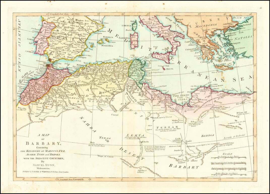
Detailed map of North Africa and the Mediterranean Sea. Nice detail and a number of annotations. The map was first printed for Robert Sayer at 53 Fleet Street, London.
Laurie & Whittle refers to the partnership of Robert Laurie (1755?-1836) and James Whittle (1757-1818), engravers and map publishers. Both men were employed by Robert Sayer (ca. 1724-1794), one of the most prominent British publishers and map sellers of the eighteenth century. Sayer died in 1794 and his business was taken over by his assistants. The two worked together as Laurie & Whittle until 1812, when Laurie retired. They were especially known for publishing sea charts and maritime atlases. From 1812-1818, when he died, Whittle worked with Laurie’s son, Richard Holmes Laurie, as Whittle & Laurie. After 1818, the firm was known as R. H. Laurie, even though Richard died in 1858. Later, the firm was managed by Laurie’s draughtsman, Alexander George Findlay, and, later, Daniel and William Kettle.
If you are a student, write to us in telegram: @antiquemaps and indicate what material you need and for what work you need a map in high detail. We are ready to provide material on special terms. For students only!
![[Europe, Mediterranean, Asia Minor and the Persian Empire]](/map/small/43558.jpg)
![[Facsimile - 15th Century Portolan Sea Chart] Portolan des Iehuda ben Zara](/map/small/64285.jpg)