logo

1935. A Map Showing Some Places of Importance in the Roman World | A Four Year Book Cruise

  • A Map Showing Some Places of Importance in the Roman World  |  A Four Year Book Cruise
  • A Map Showing Some Places of Importance in the Roman World  |  A Four Year Book Cruise

A Map Showing Some Places of Importance in the Roman World | A Four Year Book Cruise information:

Year of creation: 
Resolution size (pixels): 
 14620x10888 px
Disk Size: 
 37.4039MiB
Number of pages: 
 2
Place: 
 n.p.
Author: 

Print information. Print size (Width x height in inches):
Printing at 72 dpi 
  203.06 х 151.22
Printing at 150 dpi 
 97.47 х 72.59
Printing at 300 dpi 
 48.73 х 36.29

An example of detailing the file of this map of in a printable high-resolution:

Click to open in high resolution (open in new tab).
Attention! this is just the central piece (central area 960x960 px) of the map file!
This is an example, so that you can see and study the level of detail of a given map. The entire Map will be fully available after payment!

A Map Showing Some Places of Importance in the Roman World  |  A Four Year Book Cruise

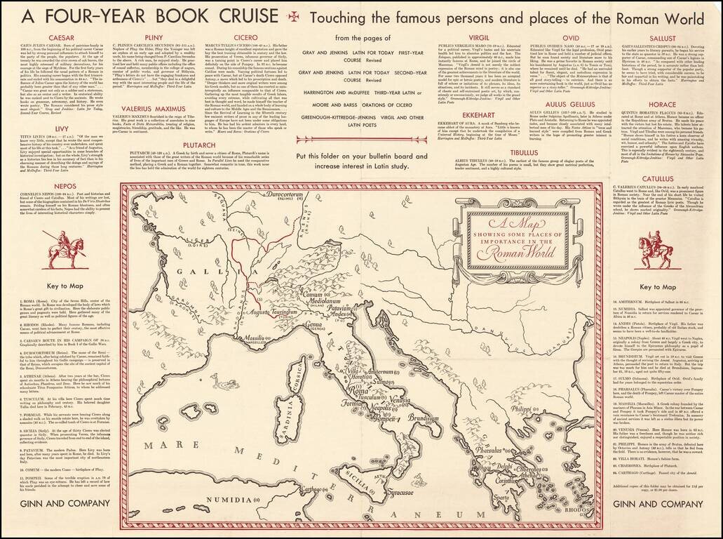
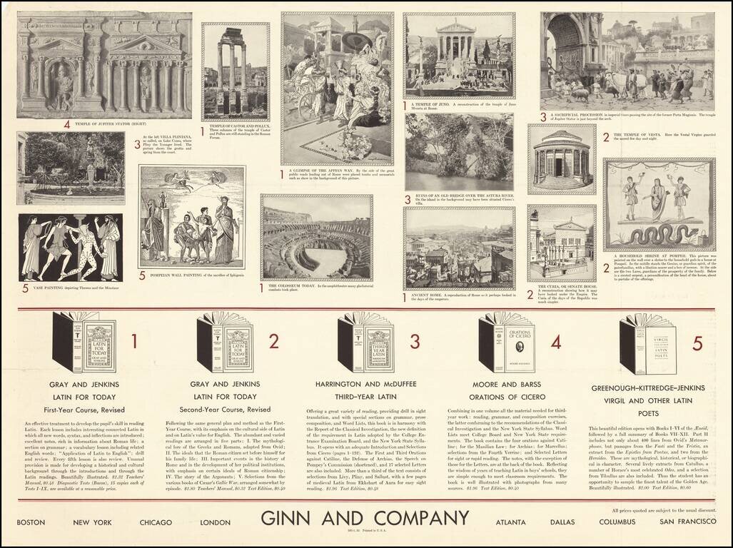
Fascinating "map of the Roman World", illustrating a Ginn & Company promotional advertising brochure promoting its Latin and other educational text books.


Special conditions for students!

If you are a student, write to us in telegram: @antiquemaps and indicate what material you need and for what work you need a map in high detail. We are ready to provide material on special terms. For students only!

Item information:

Year of creation:
Size:
14620x10888 px
Disk:
37.4039MiB
Number of pages:
2
Place:
n.p.
Author:
Ginn and Company.
$14.99

Related item