Map size in jpg-format: 361.313MiB
Click to open in high resolution (open in new tab).
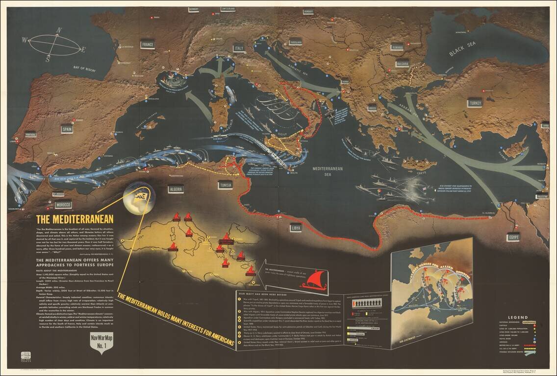
Excellent "NavWar" pictorial map of the Mediterranean Theater during the Second World War.
The map highlights the progress of British and American forces in liberating North Africa and parts of southern Italy and the strategic advantages that these advances gave to the Allies.
The red dashed lines show the advances of the British 8th & 1st Armies; the yellow dashed lines show the progress of the U.S. 5th & 7th Armies.
A note at the bottom remarks "The Mediterranean Holds Many Interests For Americans", citing the numerous times the U.S. military had been active in the region since 1801.
Two inset maps are at the bottom of the image. One shows the Mediterranean as the cradle of ancient sea power, the other shows the extended bombing range due to the establishment of airfields in Corsica, southern Italy, and Greece.
The so-called "NavWarMap" series was published by the Educational Service Section, Bureau of Naval Personnel, Navy Department, Washington, D.C. The Nav War Maps are some of the pictorial maps to have come out of World War II.
The NavWar series included the following maps:
If you are a student, write to us in telegram: @antiquemaps and indicate what material you need and for what work you need a map in high detail. We are ready to provide material on special terms. For students only!

![[Eastern Hemisphere Globe Gores] (Nova et integra universi Orbis descriptio)](/map/small/54480.jpg)
![[Signed Political Satire Artwork] Vietnam ... Vietnam ... Vietnam ...](/map/small/68726.jpg)