Map size in jpg-format: 4.87411MiB
Click to open in high resolution (open in new tab).
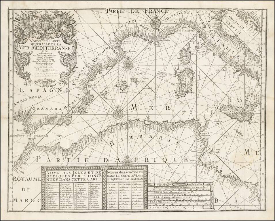
A rare separately issued map of the Western Mediterranean, published in Marseille by François Berthelot.
This important early chart of the Western Mediterranean is one of a series of 4 charts published by Berthelot covering the Mediterranean and contiguous seas, first published in 1693. Berthelot's charts were the standard French navigational reference for French mariners during the first part of the 18th Century. It is generally believed that Henri Michelot's chart of the Mediterranean is based upon Berthelot's charts.
Berthelot was a Marseillaise pilot and hydrographer who had extensive first-hand experience of navigating Mediterranean waters. His suite of charts was preceded by a book on pilotage, Abregé de Navigation (1691).
Five editions of the chart were issued from 1693 to 1759, and all editions are rare. While the present chart is not dated, evidence suggests that it was printed around 1730. The present example bears the imprint of Joseph Roux Fils, suggesting a date of after 1725. Moreover, the chart is dedicated to "Le Chevalier d'Orleans", the popular name of Jean Philippe d'Orleans (1702-1748), a soldier and the nephew and son-in-law of Louis XIV.
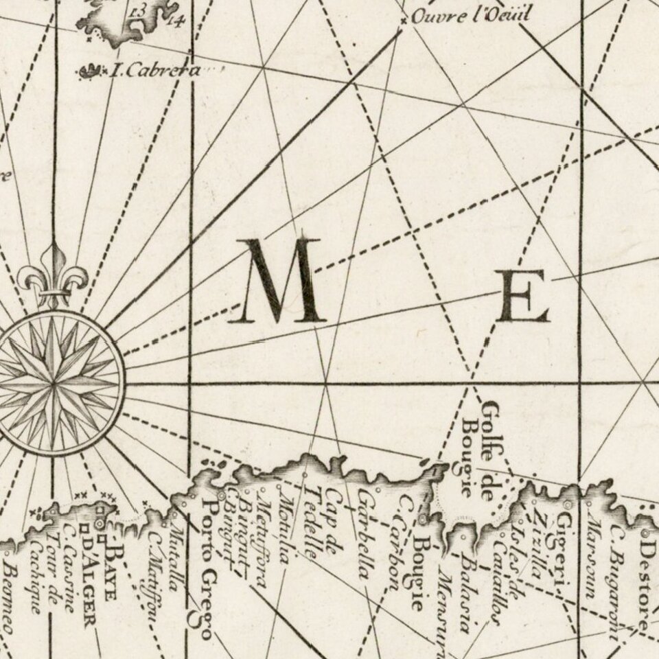
The chart is executed in the style of a Portolan chart, with the place names in the inland regions, so as not to interfere with the depiction of coastal features and navigational hazards.
We are not aware of another example of this edition of the chart appearing at auction or in dealers' catalogs during the last 25 years.
If you are a student, write to us in telegram: @antiquemaps and indicate what material you need and for what work you need a map in high detail. We are ready to provide material on special terms. For students only!


