
Detailed map of America, showing North America immediately prior to the discoveries of Lewis & Clark, and South America on the eve of its century of Revolution. The map is dated 1816 and includes an unknown region west of the Rocky Mountains,...
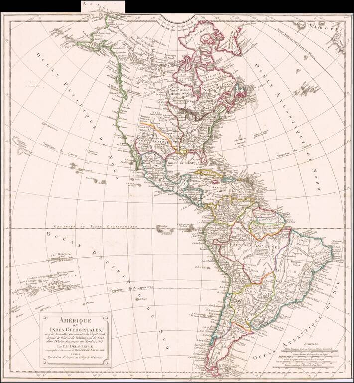
Rare late state of De Vaugondy's map of America, updated to include the details of all three of Cook's voyages. The Northwest Coast of America has again been heavily revised to include the discoveries up to 1800, with the earliest hint of the course...

Rare early lithographic portait of the 16th Century explorer, Sir Francis Drake, celebrating his discovery of the Potato, which he brought from America to Europe in 1544. Smaller copies of the 1817 lithographica edition are noted in the Hampton L....
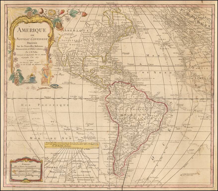
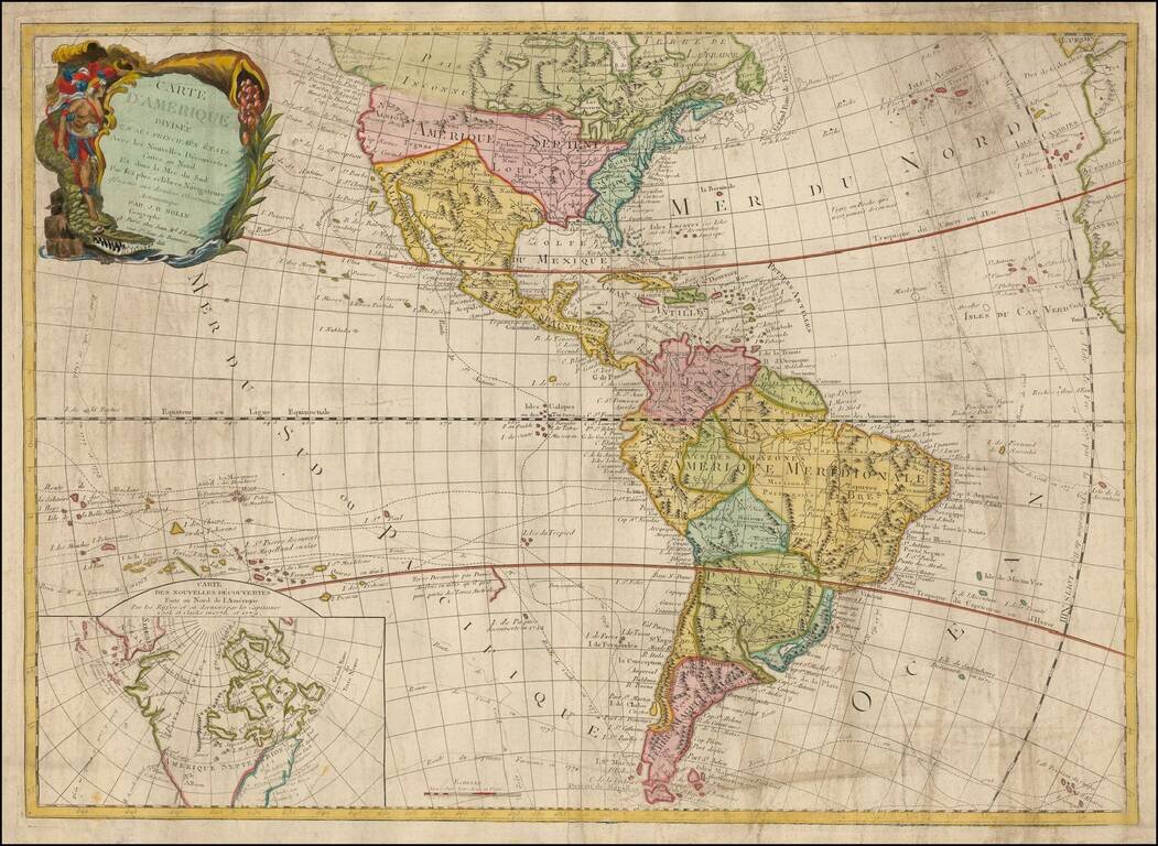
Rare late edition of Johanne Baptiste Nolin's map of America, first issued nearly 100 years earlier. The present example is noteworthy for its use of extremely old/dated cartographic detail. The map was updated in the latter part of the 18th Century...
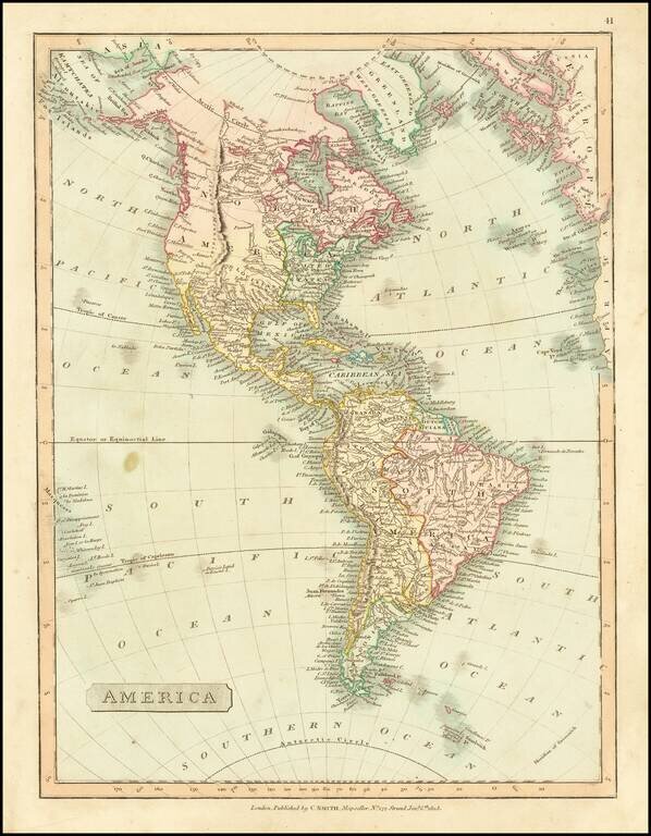
Fine-Lewis & Clark era map of America, reflecting the geo-political boundaries immediately after the Louisiana Purchase. Mississippi Territory is shown prior to the creation of Alabama. Massive Indiana Territory pre-dates the creation of Michigan...
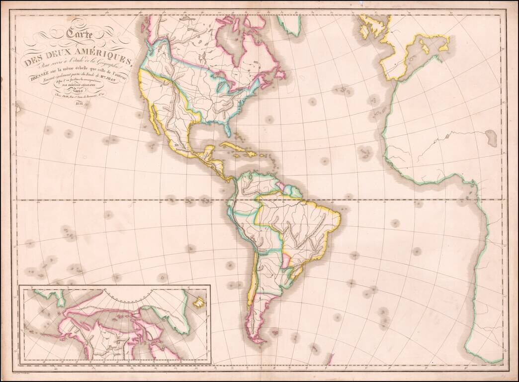
A fascinating early 19th Century reissue by the French firm of Chez Jean of the 1787 Clouet, revised to include the first voyage of Captain Cook. Gone is the Bay of the West, although the Northwest Coast still hints at some sort of inland sea. The...
First state of Henry Schenk Tanner's map of America from is American Atlas. The map shows Russian America (green) in great detail, with very little known or shown in California and the West. The Lewis River reflects details supplied by Lewis &...
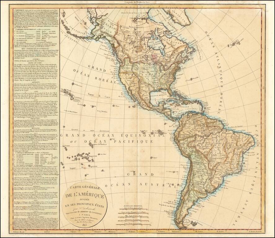
Scarce map of America, published by Felix Delamarche in Paris in 1823. The map presents an interesting look at North and South America at a time of great change and intrigue on both continents. This is during the height of South America's...
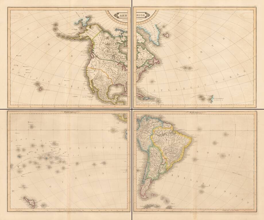
Fine example of Lizars 4 sheet map of America. The map shows the progress towards finding the Northwest Passage, Russian America (Alaska), a massive area in Western Canada called "Indian Countires), and a separately named Texas. Among the more...

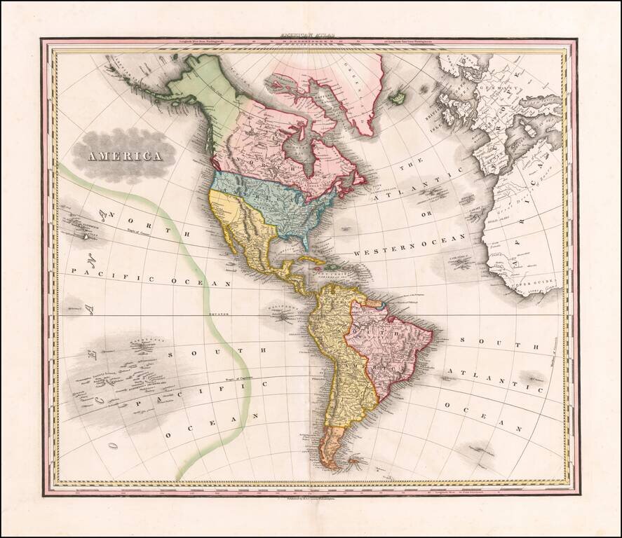
Striking large map of North America and South America in attractive full wash colors, from the French edition of Carey & Lea's Atlas of America, one of the most important American Atlases of the early 19th Century.
![[New General Map of North and South America Showing the Routes of Kruzenshtern and Lisyansky] НОВАЯ ГЕНЕРАЛЬНАЯ КАРТА СѢВЕРНОЙ И ЮЖНОЙ АМЕРИКИ СЪ ПОКАЗАНІЕМЪ ПУТЕЙ КРУЗЕНШТЕРНА И ЛИСЯНСКАГО](/map/small/58490.jpg)
A Superb Russian Map of the Americas, Made to Highlight the Explorations of Kruzenshtern and Lisyansky in the Pacific. In Alaska, the map notes Lisyansky's landfall on Kodiak Island and at New Archangel (Новоархангелѣскъ, i.e.,...
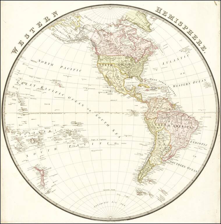
Nice map of the Western Hemisphere, published in London by Wyld. South America appears at the height of its Revolutionary period, where Spain and Brazil were losing their colonies. The Newly independent Mexico is shown, with Adams-Onis Treaty...
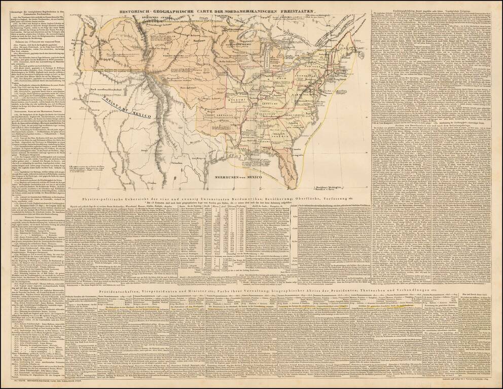
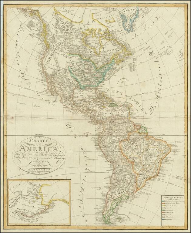
Scarce engraved map of the United States, with coverage of the recent discoveries in the west, and extensive descriptive text in German. There are some printed annotations scattered around the map in German as well. The map shows numerous Indian...
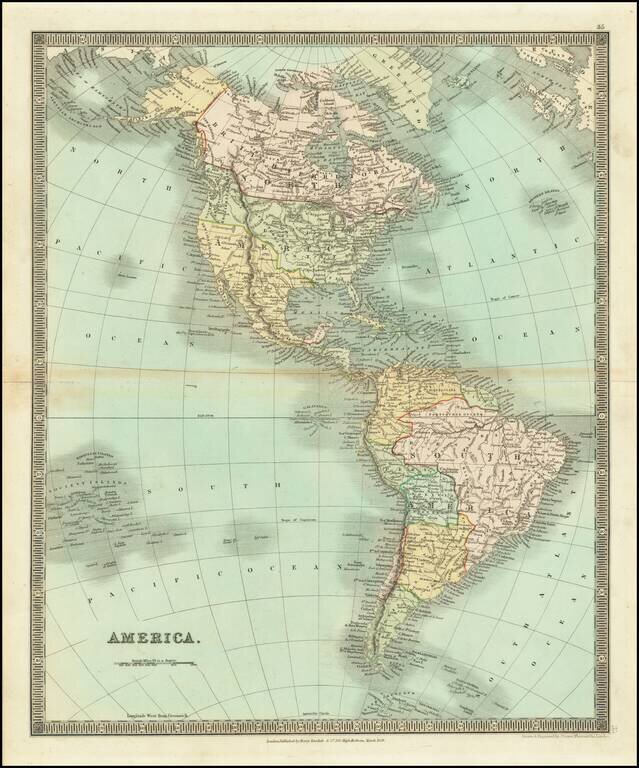
Detailed engraved map of the Americas issued by Henry Teesdale in London in 1834. On the west coast of North America, we have Old and New California, New Cornwall, New Hanover, New Albion, New Georgia, and Russian America (Alaska). The Canadian...
A Fascinating Cartographic Teaching Tool with a Curious Northwest Passage Large format map of America, intended as a teaching tool. While the map is large, the geographical features are devoid of names and it was likely the purpose of the author to...

A detailed map of America, by John Arrowsmith. The map shows the lands from "Russian America" to an unclaimed Patagonia, at a time when many parts of the continent were truly wild. Major cities, rivers, islands, lakes, and much more are all shown....