
![[Wall Map] West-Indische Paskaert waer in de graden der breedde over weder zyden vande middelyn wassende so vergrooten dat die geproportioneert syn tegen hunne nevenstaende graden de lengde.](/map/small/60169.jpg)
A Remarkable Dutch Sea Chart Used For Navigation Between Africa and America Rare Johannes Van Keulen issue of Pieter Goos's sea chart of the Atlantic Ocean, America and Africa, first published circa 1680. This chart was created for use at sea by...

Decorative old color example of Joannes De Ram's extremely rare map of America. Includes California as an Island, no sign of the Great Lakes, non-existent coastline north of the Island of California and misprojected South America. The map predates La...
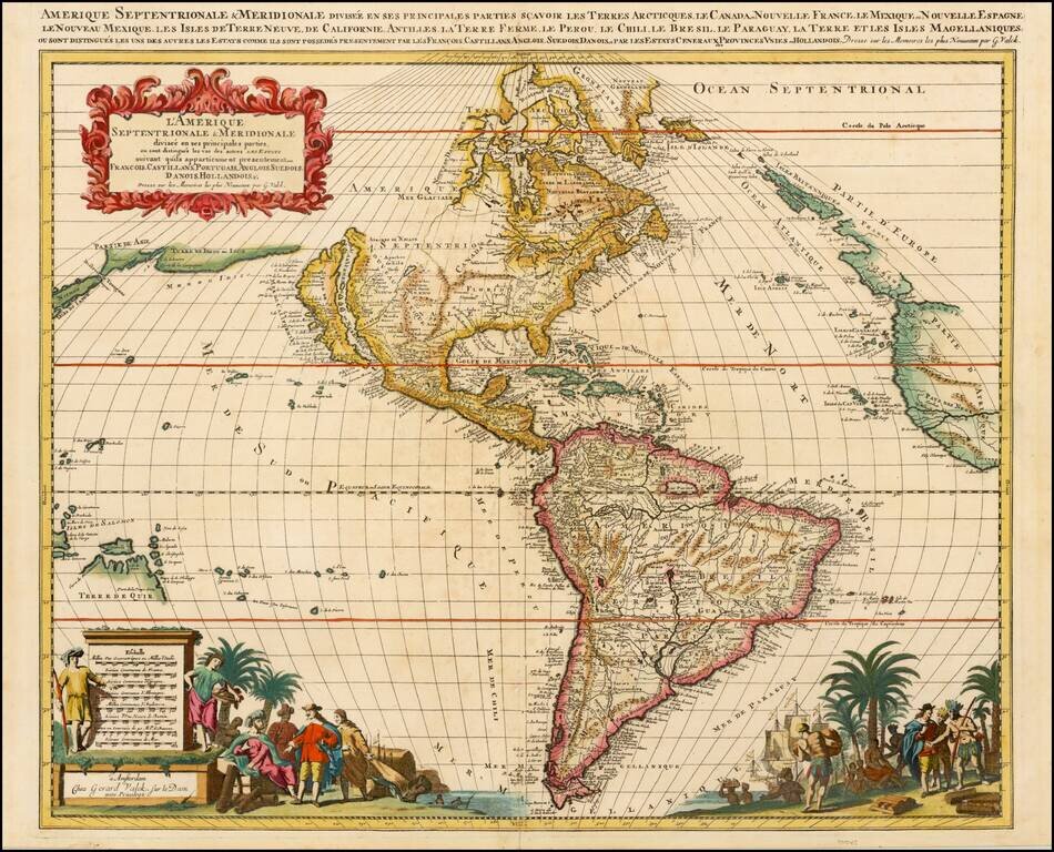
De Wit’s Map of the Americas—The First Dutch Map to Show Five Great Lakes Fine example of De Wit’s map of the Americas, first published ca. 1675. It was the first Dutch map to include all five Great Lakes, an improvement on De Wit’s first map...

Scarce map of America, showing California as an island, from the Thesaurus Geographicus, a scarce late 17th century English publication. While the publisher is not credited, this is almost certainly one of Herman Moll's earliest engraving efforts....

Fine example of Pierre Mortier's map of the Pacific, which appeared in later editions of the famous Neptune Francois This fine map of the Pacific was drawn from previously unpublished manuscript maps collected by the Portuguese crown and secreted away...
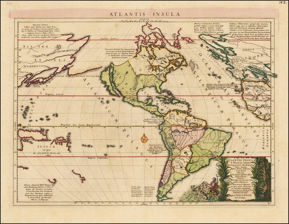
Fascinating map of America, published by Mortier and based upon a map by Nicolas Sanson, purporting to show the Western Hemisphere about 200,000 years ago before the earliest human civilizations. The map reflects the populating of the lost continent...

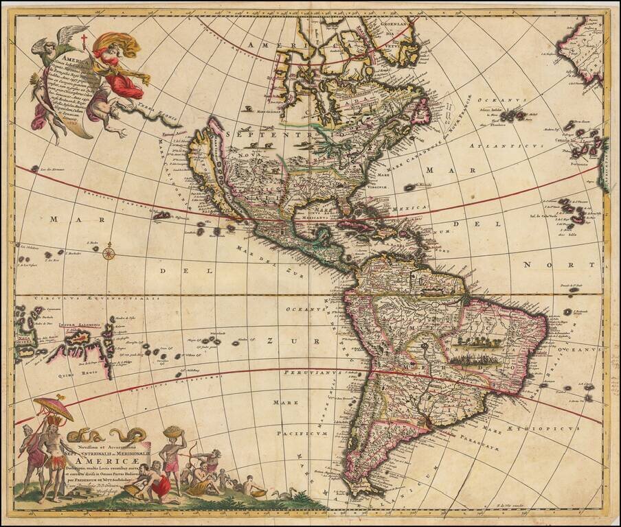
Antique Map of America -- California as an Island -- First Credible Naming and Depiction of the Missouri River Nice old color example of Allard's rare map of America, with a small inset of New Zealand, California as an island, and an unusual land...
Scarce map of America, published in Amsterdam by Gerard Valk. Valk's map of California shows many of the most fascinating myths of the 17th Century. California is shown as an island on the so-called "second Sanson Model." A massive land bridge extends...

Rare map of the Western Hemisphere in mirror image format, from a very rare work by Pierre Moullart Sanson, the grandson of Nicolas Sanson the Elder. The map is part of a series of maps intended to depict the various ways of depicting the Globe. The...
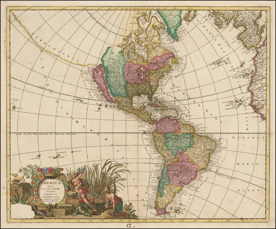
Decorative example of this striking map of America, showing California as an Island based upon the Second Sanson Model, published by the Valk family. Terrae Esonis and Fretum Anian shown in the Northwest. Intriguing detail in the interior. Mississippi...
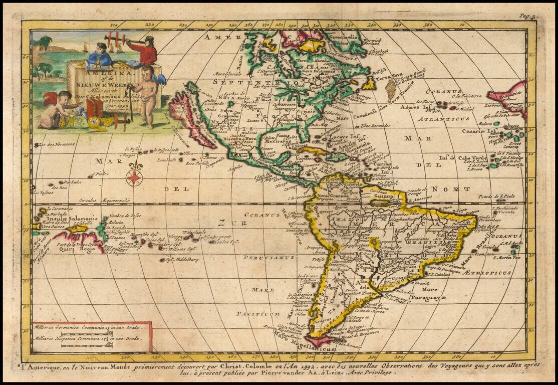
Decorative map of America, illustrating the voyage of Christopher Columbus to then New World in 1492. Includes and incomplete Great Lakes, unknown Northwest Coast of America, highly inaccurate mapping of the Mississippi River, the 7 Cities of Cibola...
Scarce Zurner Map of America -- California shown as an Island. Fine old color example of this scarce map of America, showing California as an island, published by Zurner and engraved by Pieter Schenk. Zurner's map is a fascinating compilation of up...
Scarce map of America with a fascinating treatment of the Northwest Coast of America. The map shows a very unusual "est fort Inconu" and "Terre de Jesso," a curious marriage between the treatment of the region from the mid-17th century and more...
![[California as an Island - First State!] Totius Americae Septentrionalis et Meridionalis Novissima Representatio . . .](/map/small/69781.jpg)
Nice example of the first edition of Johann Baptiste Homann's map of America, showing California as an Island on the second Sanson model and pre-dating Homann's privilege. The Straits of Anian are shown forming a Northwest Passage between California...
Nice example of John Senex's decorative map of America. Senex's map is curious for several reasons. First, unlike most maps of the period, Senex adds a conjectural Northwest Coastline, which includes a number of islands and several lakes, including...
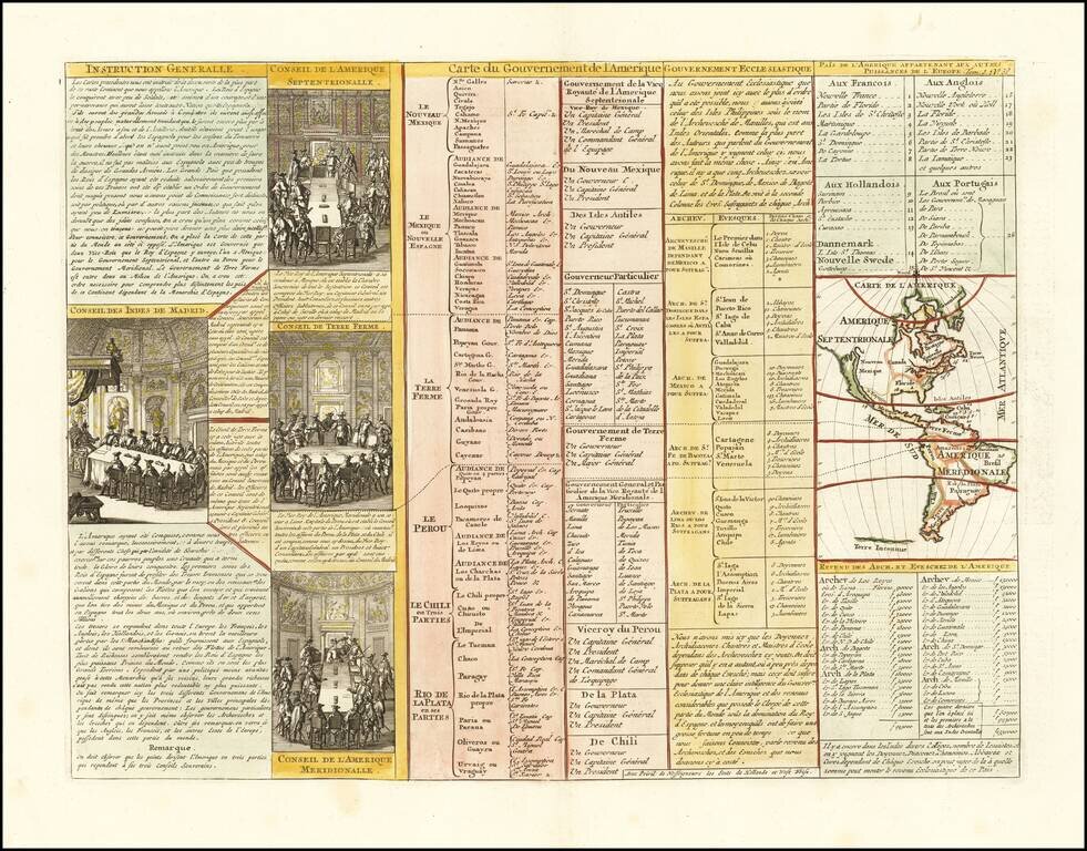
Interesting map of North America, showing California as an island, from Chatelain's monumental 7 volume Atlas Historique. Includes 4 printed views of the counsels of the West Indies, North America, South America and Terre Ferme.