
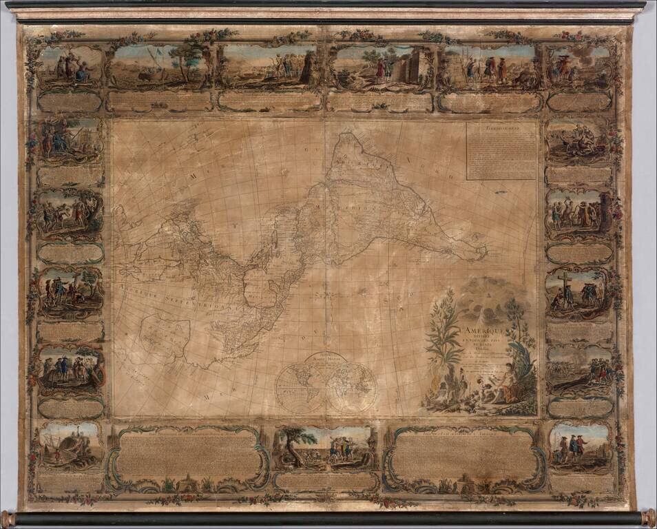
Important 18th Century wall map of America, one of the earliest obtainable printed maps to show the Sea or Bay of the West and the earliest wall map of America to show this configuration. The map is oriented with east at the top, one of only a few...
Fascinating map of America, featuring an unusual northwest coast of America, which includes Martin d'Aguilar's strait which provides for a Northwest Passage via the Great Lakes, via what would likely be the so-called River of the West. The rest of the...
![[The First Maps in a la poupée Printed Color] Cartes en Couleur des Lieux Sujets aux tremblements de Terre Dans toutes les parties du Monde Selon le Sisteme de l’impulsion Solaire](/map/small/52293op.jpg)
The First a la poupée Color Printed Maps in A Rare Pamphlet On The Relationship Between The Sun and Earthquakes Extremely rare separately published pamphlet by Jean Fabien Gautier D'Agoty, containing a complete set of his maps from his Observations...
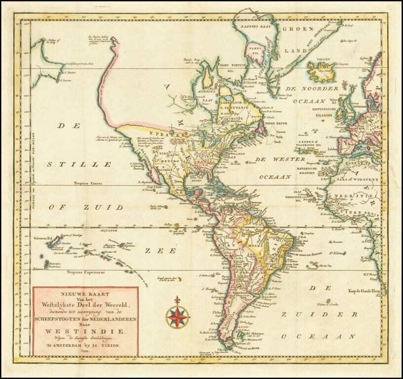
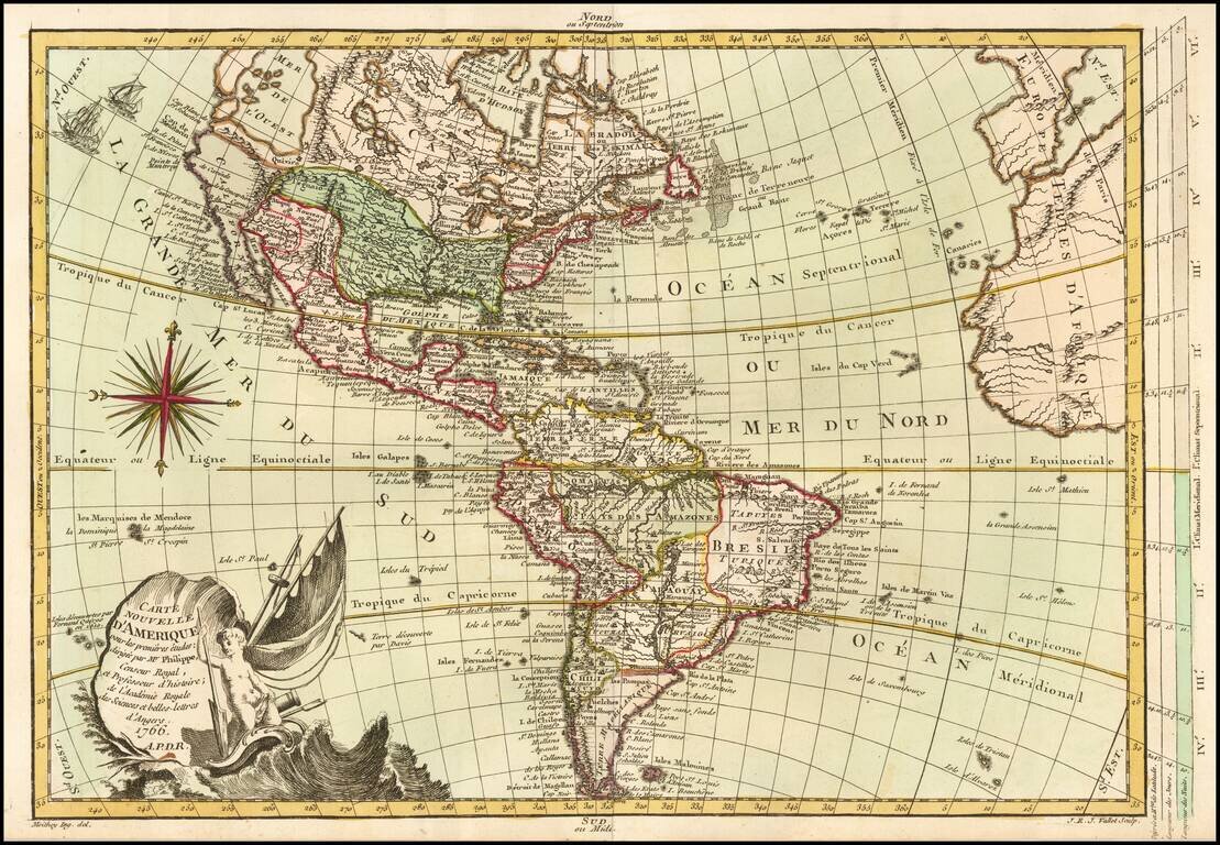
Decorative map of America, published in Paris by Daumont, based upon work of Johann Baptist Nolin. A fine early example of the map, which includes a large inset map showing the "New Discoveries" in the Northwest part of America, most notably the...
![America [Manuscript Map Showing the Sea of the West!]](/map/small/41297dm.jpg)
Decorative manuscript map of America, illustrating the mythical Sea of the West, apparently prepared in Italy. The map includes a marvelously precise hand and wonderful detail, with fine wash colors.
![[Western Hemisphere]](/map/small/70708rd.jpg)
Finely-Drawn Eighteenth-Century Manuscript Map of the Western Hemisphere Carefully-constructed, single-hemisphere manuscript map of the Americas, signed by Michael Rampf. Oceans, continents, and cartographic elements such as the equator, tropics, and...
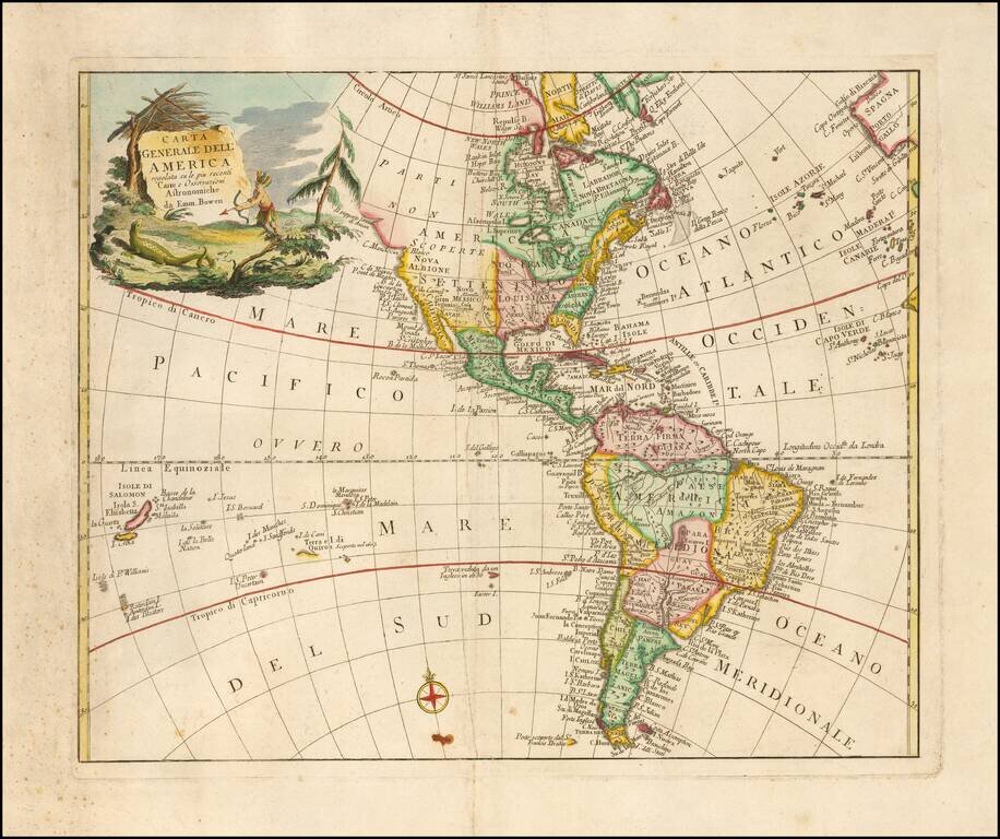
Rare Italian map of America, drawn from the work of Emanuel Bowen. Includes a large decorative cartouche. This is the first time we have ever seen this map.
Interesting map of America, published in Paris by Brion de la Tour. Featuring an unknown Northwest Coast, River of the West, Straits of Juan De Fuca and other early details. Includes 16 ships and decorative cartouche. Ornate decorative border.
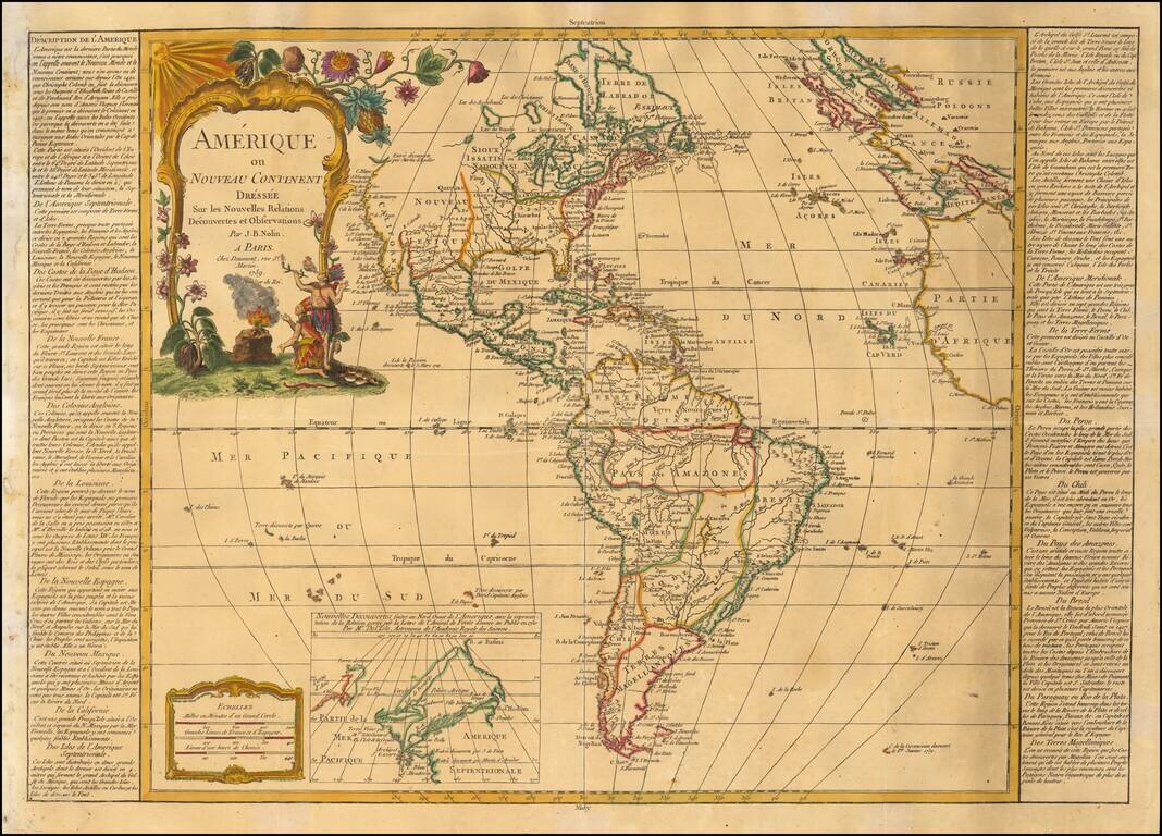
Fine old color example of the first state of this scarce map of America, published in Paris. Includes a massive Bay of the West, curious depiction of Florida and an unusual wide projection of North America. California is still baed upon de L'Isle's...
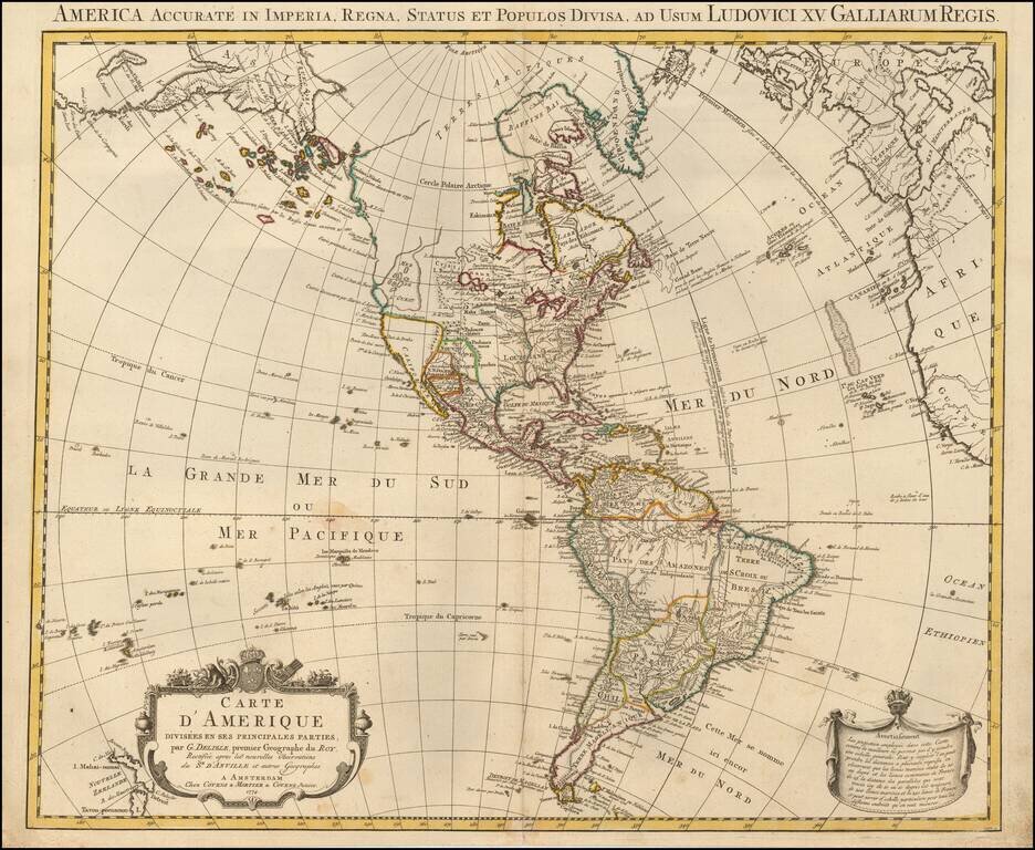
Rare Late State of De L’Isle's Map of America, Showing the Sea of the West and Recent Russian Discoveries A Covens & Mortier state of De L’Isle’s map of the Americas, with revisions to 1774. The map borrows from many contemporary sources,...

Scarce map of the Western Hemisphere, with California as an Island. Issued in his: Orbis Sensualium Picti Pars Prima ... Norimbergae : In Bibliopolio Joh. Andr. Endt. Anno Salutis, MDCCLXXXI (1777). Orbis Sensualium Pictus, a school geography, was...
![L'Amerique divisee en ses principaux Etats . . . [Sea of the West]](/map/small/51998.jpg)
Striking map of America, published by Santini, in Venice. The map shows a massive Sea of the West with the entries thereto discovered by Juan De Fuca in 1591 and by Martin D'Aguilar in 1603. The map reflects the sighting of land near what would...
The Great River of the West and Lahontan's Longue River Scarce second state of De Vaugondy's map of America, pre-dating information from any of the Cook Voyages. The Northwest Coast of America is shown wildly distorted to the west, with a number of...

Fine example of Buache's map of America, recently updates and improved to remove the sea of the west, based upon the discoveries of Cook and Russian explorers. This map gives extraordinary treatment to the region, although there is curiously no...

Unrecorded map of the Western Hemisphere Printed on Linen Finely executed map of the Western Hemisphere, printed on linen. The map depicts the Western Hemisphere on a stereographic projection, centered on a point in the Pacific. The notable...
![[Atlantis?] Ristretto Delle Carte presentate all' Academia delle Scienze di Parigi negli anni 1737 e 1752 dal Sig di Buache](/map/small/58667.jpg)
The First Americans Came To America via the Lost Continent of Atlantis?—Rare Italian Map from Work on the Origins of Americans Utilizing The Theories of Philippe Buache Very rare, Italian example of Buache’s theoretical geographic ideas on...