
![Western Hemisphere [and] Eastern Hemisphere](/map/small/46484.jpg)
Nice full color example of these highly decorative maps of the Western Hemisphere and Eastern Hemisphere, each with 12 decorative vignettes. Perhaps the most decorative mid 19th Century Atlas map of its type. Engraved for R. Montgomery Martin's...
![[Greek Map of the Americas.] ΧΑΡΤΗΣ ΤΗΣ ΑΜΕΡΙΚΗΣ ΕΚ ΤΟΥ ΑΤΛΑΝΤΟΣ ΤΟΥ ΗΡ. ΛΑΖΑΡΙΔΟΥ ΕΝ ΑΘΗΝΑΙΣ 1861. [Map of the Americas... Lazaridou in Athens 1861]](/map/small/55792.jpg)
Fredonia in Texas! Fascinating Greek Map of the Americas, Published in Athens During the American Civil War. Lithographed folding map of the Americas entirely in Greek. Published in Athens by Lazaridou in 1861, during the American Civil War. The...
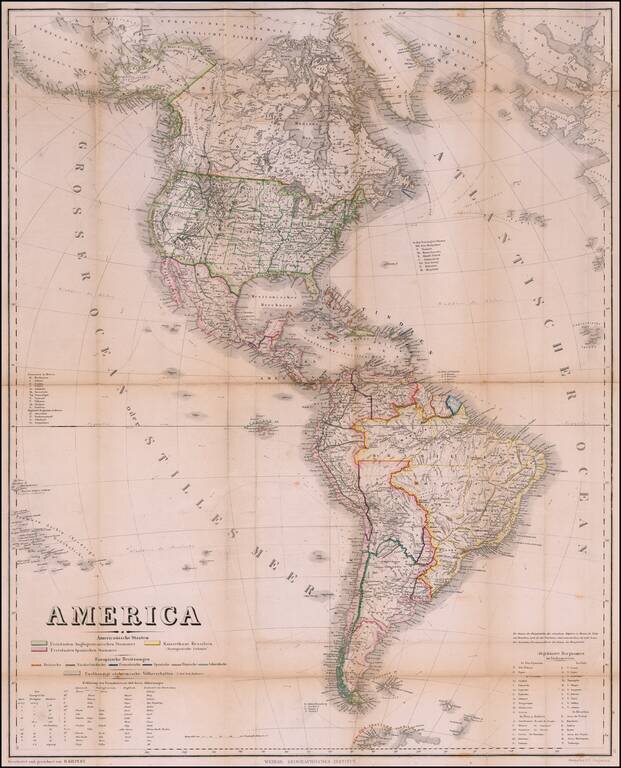
Rare Pocket Map of America, Celebrating World Conferences in Antwerp & Moscow Rare separately published map of America, published by the Weimar Geographische Institut, in conjunction with the International Geographical Conference in Antwerp of...
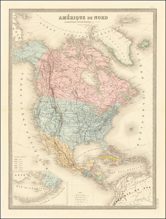
Excellent detailed map of North America, published in Paris. Alaska is now part of the United States and a massive British Columbia is outlined in red. The shape of Wyoming is very curious, with Yellowstone outlined as its own state.
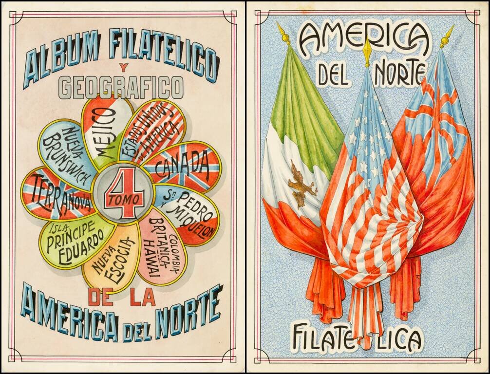
Award winning pair of manuscript cards, prepared by Antonio Raggio for the 11th Congreso de la Union Postal Universal (World Postal Congress) Exposition Filatelica Internacional, held in Buenos Aires, Argentina, in 1939. The award was given to Raggio...
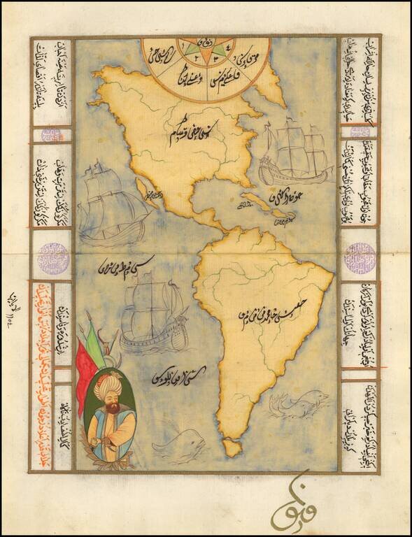
Decorative manuscript map of America, showing California as an island, with decorative embellishments. Maps of this type are typically hand drawn for tourists in Istanbul, using old paper which frequently includes earlier manuscript writing in...
![[Early Photographic Facsimile] Kunstmann II (Four-Finger Map)](/map/small/66513.jpg)
Early Facsimile of the Kuntsmann II Portolan from the Collection of Edward Luther Stevenson. Fascinating early facsimile of the Kunstmann II map, one of the earliest maps of any kind to show the new world. The map is sometimes attributed to Amerigo...
![[Early Photographic Facsimile of the Egerton Portolan of circa 1510]](/map/small/65127.jpg)
"It appears to be not only the oldest known portolan atlas on whose charts any part of the New World is laid down, but the oldest known atlas in which the coast regions of a very large part of the entire world are represented with a fair approach to...
![[Early Facsimile] Esta Carta General en Plano Hizo Sancho Gutierrez Cosmographo de Su. S.C.C. Magt Del Īperador Y Rei Nuestro Señor [dō Carlos] Quinto Deste Nōbre. En la Qual Esta Todo Lo Hasta Oy Descubrierto. Imitando Alto Tomeo en Parte Y Alos Modernos](/map/small/66534.jpg)
Early photographic facsimile of the Western Hemisphere of the famed 1551 Sancho Gutierrez planisphere. Sancho Gutiérrez is the author, in 1551, of a world map addressed to Carlos Quinto and based on the Padrón Real. It includes many details of the...
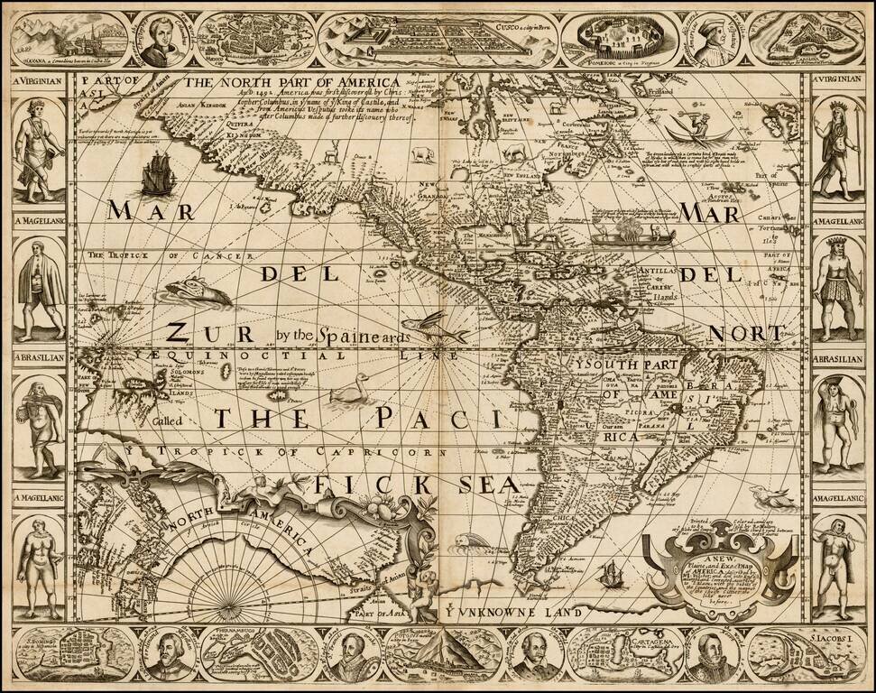
Eye-catching Seventeenth-Century Carte-à-Figure Map of the Americas—An English Rarity Rare, separately-issued English map of the Americas, published in London by Robert Walton. This remarkable map is Walton's version the carte-à-figures style...
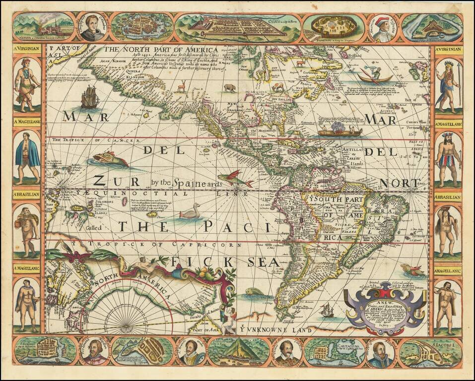
Eye-catching Seventeenth-Century Carte-à-Figure Map of the Americas—An English Rarity Rare, separately-issued English map of the Americas, published in London by Robert Walton. This remarkable map is Walton's version the carte-à-figures style...

An English Rarity Rare, separately-issued English map of the Americas, published in London by Robert Walton. The present example lacks the decorative borders, which may have been trimmed away before the map was bound in the 17th Century. Walton's...