Map size in jpg-format: 3.01472MiB
Click to open in high resolution (open in new tab).
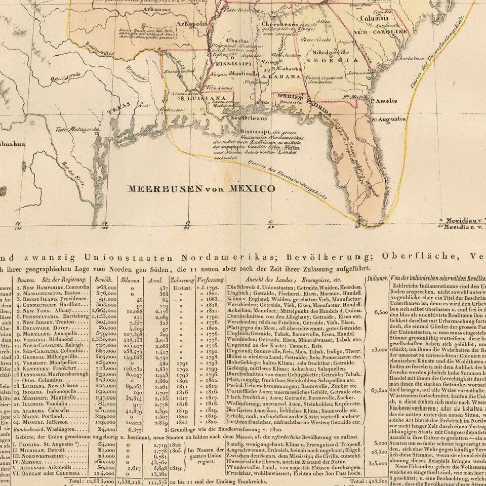
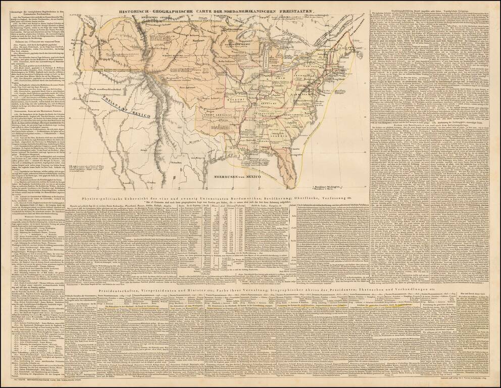
Scarce engraved map of the United States, with coverage of the recent discoveries in the west, and extensive descriptive text in German. There are some printed annotations scattered around the map in German as well.
The map shows numerous Indian tribes in the west, as well as the Northwest and Arkansas Territories. Treaty boundaries and disputed territories are shown, particularly noteworthy in the Northwest.
The map was published in the 1831 German edition of the atlas of Emmanuel-Augustin-Dieudonné-Joseph, comte de Las Cases (21 June 1766 - 15 May 1842), under the pseudonym Le Sage. It was titled: Historische-genealogisch-geographischer atlas von Le Sage.
If you are a student, write to us in telegram: @antiquemaps and indicate what material you need and for what work you need a map in high detail. We are ready to provide material on special terms. For students only!

![[Signed Political Satire Artwork] Vietnam ... Vietnam ... Vietnam ...](/map/small/68726.jpg)
