Map size in jpg-format: 33.1462MiB
Click to open in high resolution (open in new tab).
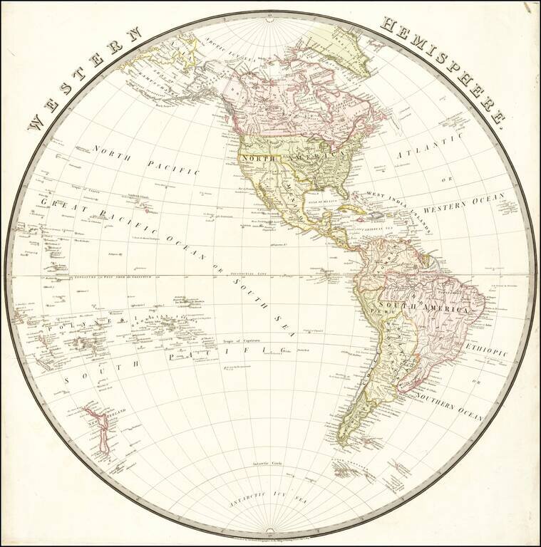
Nice map of the Western Hemisphere, published in London by Wyld.
South America appears at the height of its Revolutionary period, where Spain and Brazil were losing their colonies.
The Newly independent Mexico is shown, with Adams-Onis Treaty boundaries. No sign of Moses Austin's first Texas colony.
In the northwest, a decidedly British boundary is shown between British Canada and Oregon Territory. Many Hudson Bay Company houses and factories are shown.
In the Arctic regions, the recent expedition of Ross and Parry is shown.
If you are a student, write to us in telegram: @antiquemaps and indicate what material you need and for what work you need a map in high detail. We are ready to provide material on special terms. For students only!