
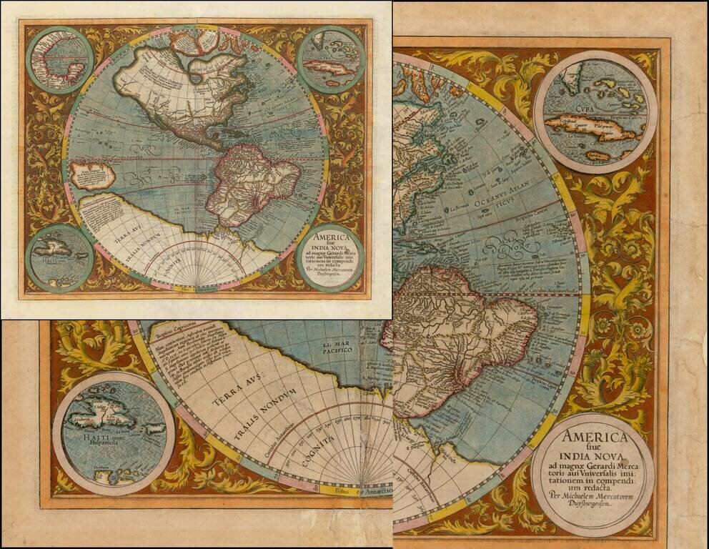
Striking Example of Michael Mercator's Map of the Western Hemisphere, the Only Map he Ever Engraved This is a fine example of Mercator's map of the Western Hemisphere, based upon Rumold Mercator's world map of 1587. Fascinatingly, this is the only...

Scarce Variant of Blaeu's Map of the Americas This is a decorative example of Blaeu's map of America, one of the most sought after maps of the continent from the Golden Age of Dutch Cartography. The map blends contemporary geographical knowledge with...
![[The Second Map of California as an Island!] Zwoelffter Theil der Newen Welt...](/map/small/68875.jpg)
The Beginning of the Myth -- The Second Map To Show the Island of California Beautiful engraved title page for the 1623 German-language edition of Herrera, published as the twelfth part of Theodore de Bry's Grand Voyages. This title page follows the...
![America noviter delineata Auct. Judoco Hondio . . . [Exceptionally Rare Four-Border Variant]](/map/small/70347mp2.jpg)
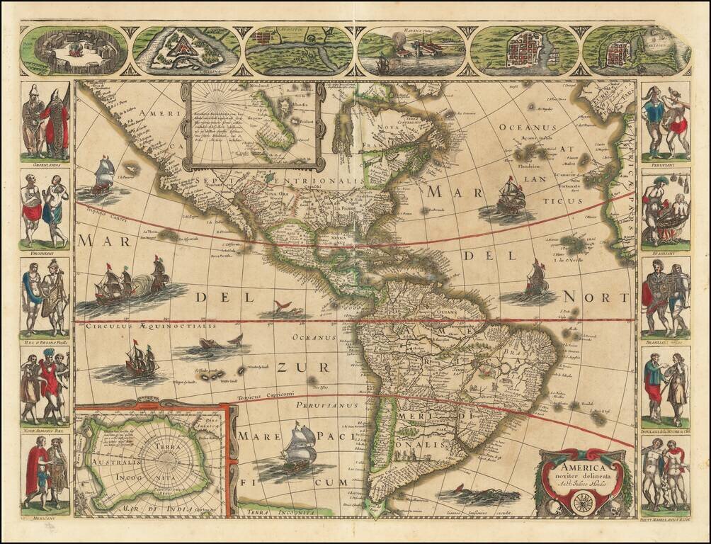
Extremely rare four-border 3rd state of Jansson's rare map of America, issued in 1623. The six views at the bottom are of South and Central American cities: Olinda, Cusco, Potosi, Ila Mocha, "R. Ianeiro", Mexico. As noted by Philip Burden in the...
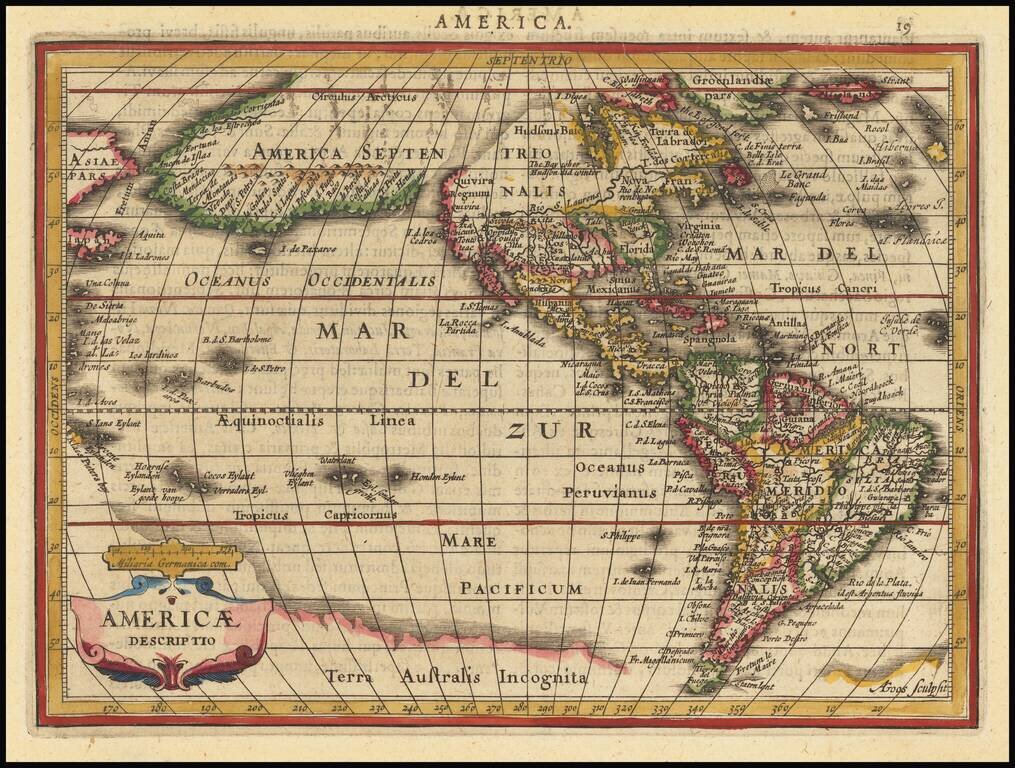
Detailed map of America, which appeared in Jansson's Atlas Minor. The most interesting element of the map is the massive land bridge, running from North America to Asia, with only two small breaks. This configuration was derived from the globe of...
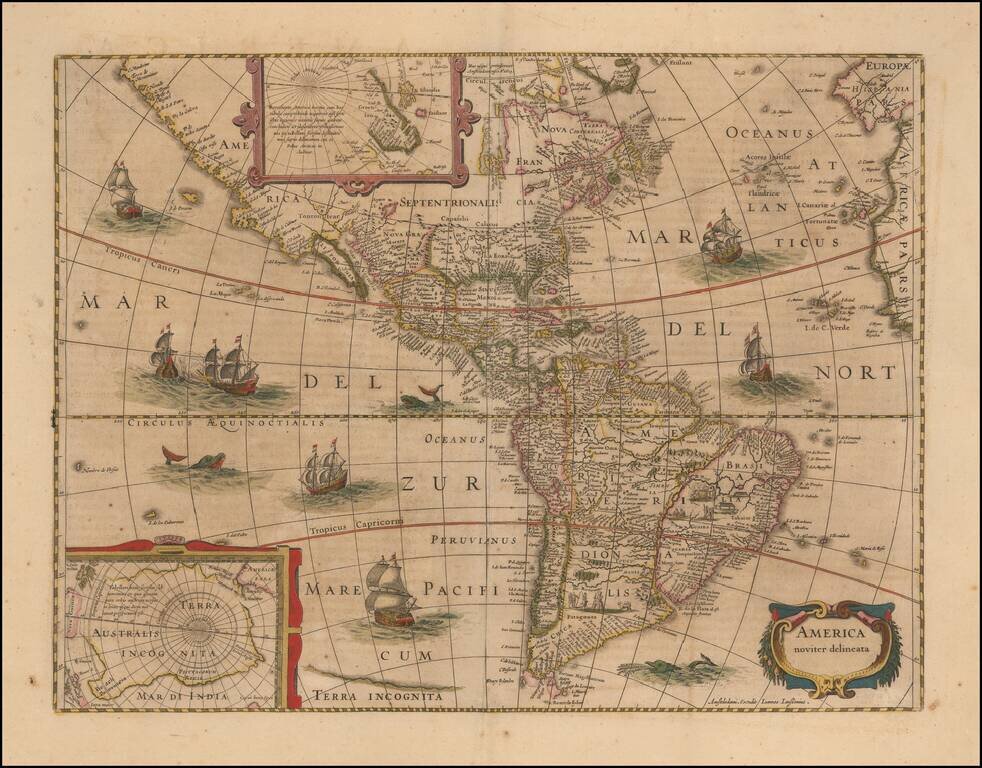
This is the 1632 state of Jansson's rare map of America, first issued in 1623. The map shows the Americas from Tierra del Fuego to Cape Mendocino and the Hudson Strait. Two inset maps depict the poles, with a large Australis Terra Incognita depicted....
Nice example of Merian's fine early map of America. The map is derived from Jodocus Hondius' map of 1618. Includes a marvelous peninsular California with the NW Coast of America stretch almost due westward toward Asia, with over 30 place names....
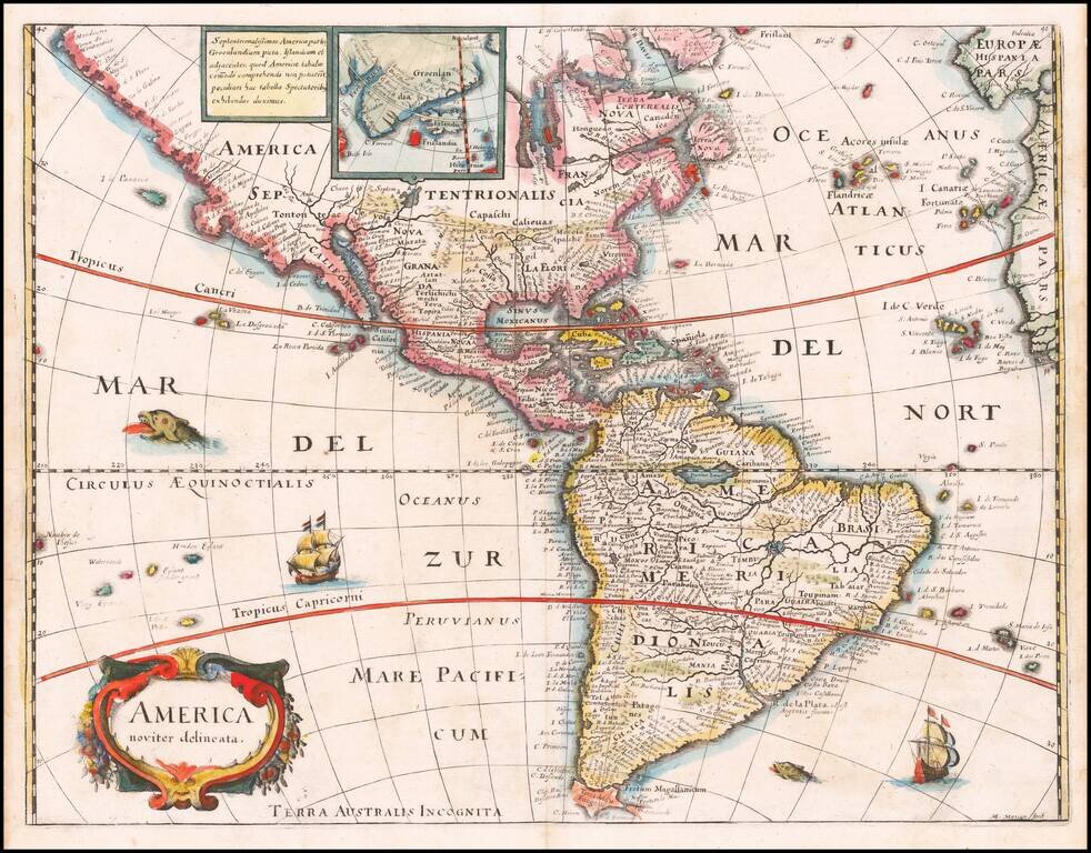
Rare separately published map of America, based upon Jodocus Hondius' map of 1618. The map is a reduced edition of the Bertius/ Tavnernier Map of 1627, without embellishments. A definite northwest coast of America is shown, unlike the Hondius...
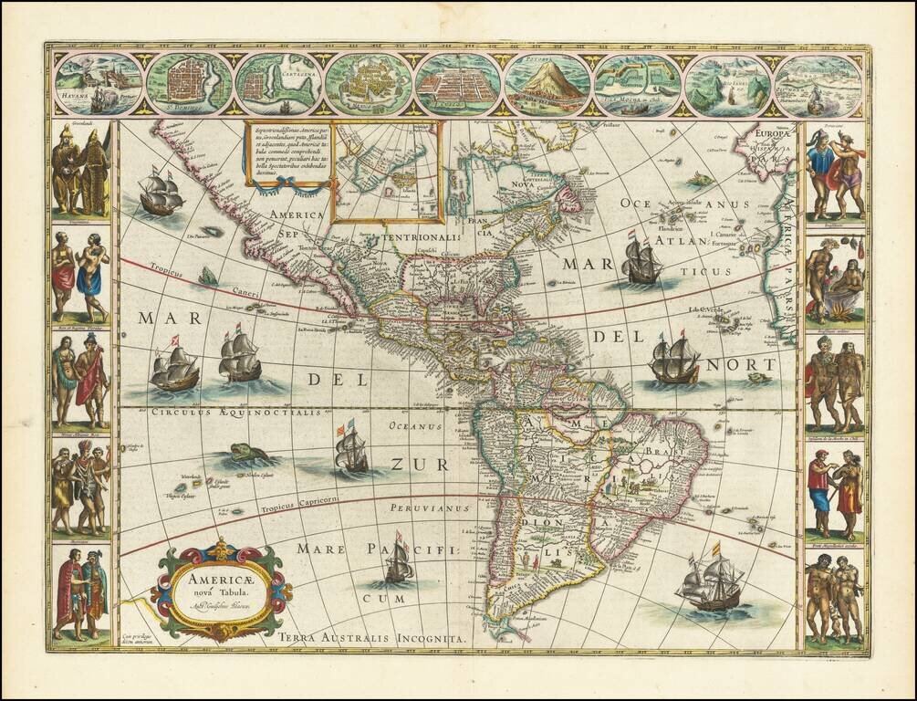
Antique Map of America From The Golden Age of Dutch Cartography Willem Blaeu's famous antique map of the Americas. Blaeu's map of America is one of the most sought after maps of America from the Golden Age of Dutch Cartography, blending contemporary...
Nice old color example of the Hondius-Jansson Map of North America, first published in 1618. The map includes a marvelous peninsular California with the Northwest Coast of America stretching almost due westward toward Asia, with over 30 place names....
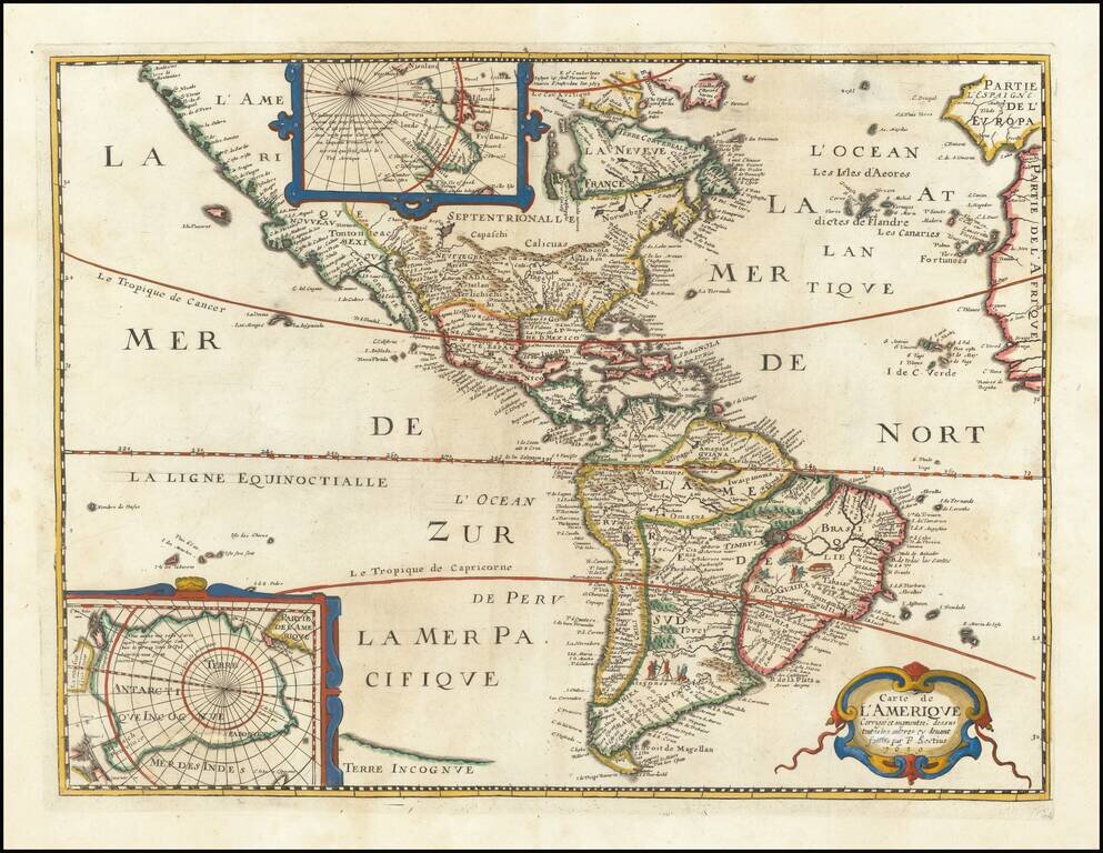
Rare Separately Published Nicolas Berey Map of America Fine example of Nicolas Berey's rare map of America, first published in Paris in 1658. The map is largely based upon the earlier maps of Bertius and Tavernier, published in the 1620s, which...

Beautifully hand-colored example of Visscher's famous map of the Western Hemisphere, showing California as an Island and a small slice of New Zealand at the lower-left corner, next to the title cartouche. Visscher's map became the proto-type map for...
![[Blaeu Atlas of America] America, Quae Est Geographiae Blavianae Pars Quinta Liber Unus Volumen Undecimum](/map/small/66852.jpg)
A Beautiful, Clean Example in the Publisher's Gilt-Vellum Binding. Johannes Blaeu's atlas of the Americas is an attractive and important atlas that deftly blended contemporary geographical knowledge with rich decorative imagery. Blaeu's maps set the...
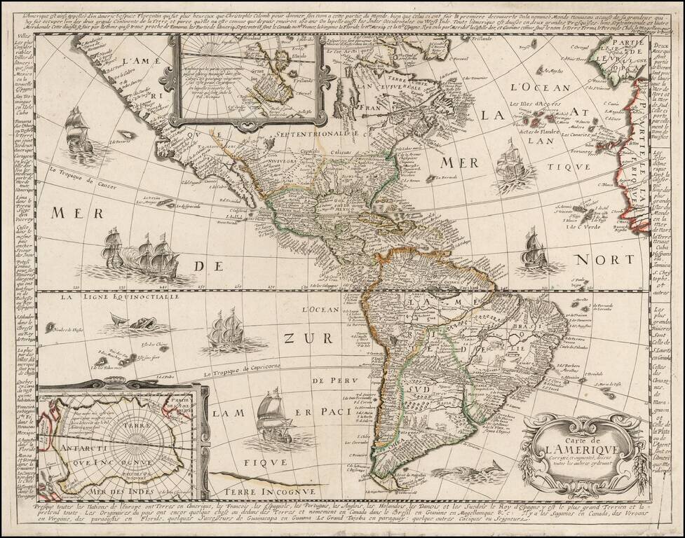
![L'Amerique Autrement Le Nouveau Monde et Indes Occidentales . . . 1664 [1st complete state]](/map/small/68897.jpg)
Early state of Du Val's scarce map of America. Du Val's map of America was first issued in 1655, in the second edition of his Cartes Geographiques. Between 1655 and 1687, the map went through at least 12 recorded examples. Both the 1st and 2nd states...
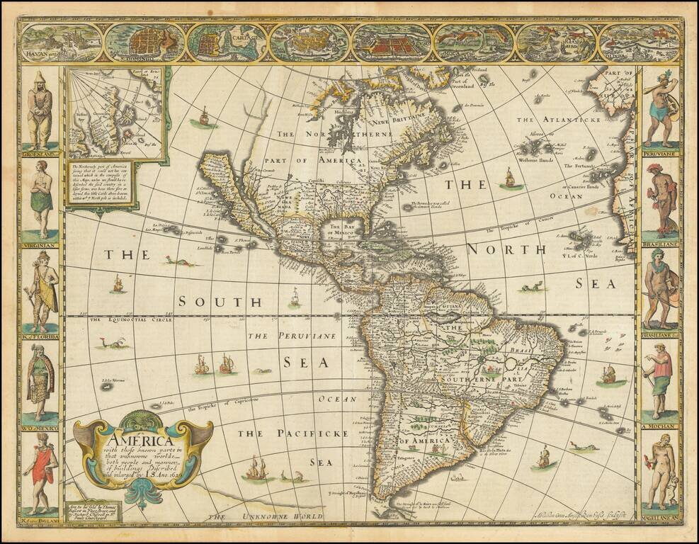
Decorative example of the 1676 edition of Speed's landmark map of America, the first atlas map to depict California as an Island and to accurately depict the East Coast of North America, from Speed's Prospect of the Most Famous Parts of the World. The...
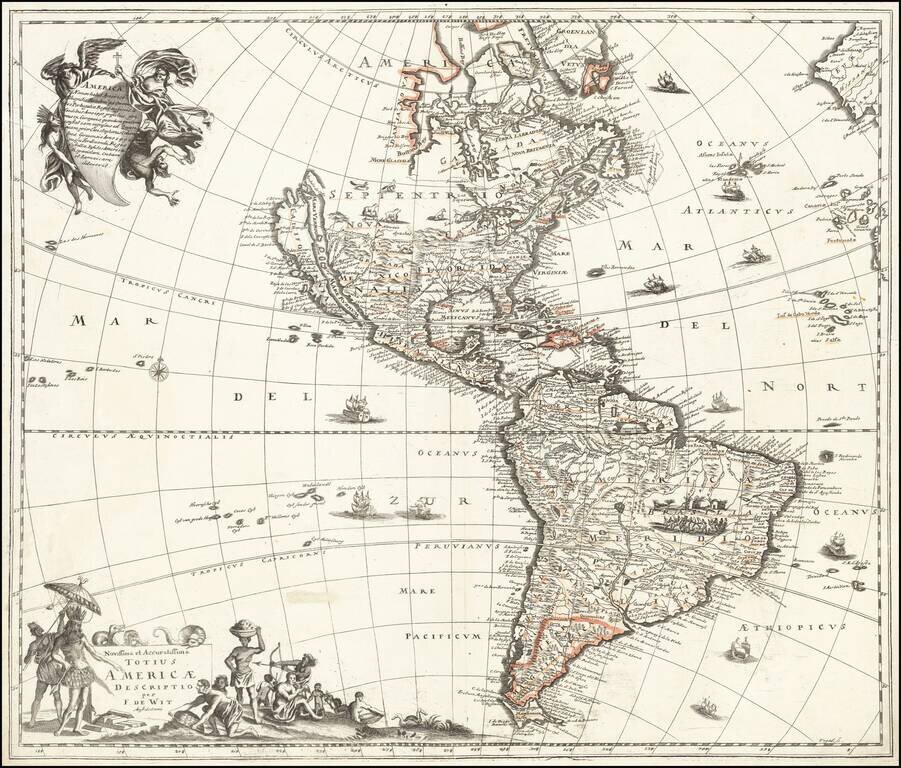
A Newly Discovered Map of America Showing California As An Island Apparently the only known example of this interesting map of America, which credits "Vogel, sc." as its engraver. While the map title identifies Frederick De Wit as the maker, this is...