Map size in jpg-format: 15.7934MiB
Click to open in high resolution (open in new tab).
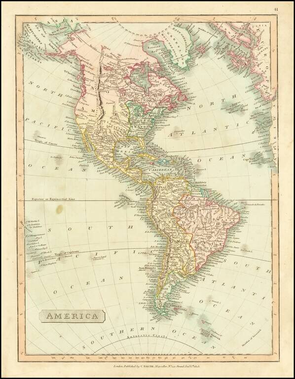
Detailed map of America, showing North America immediately prior to the discoveries of Lewis & Clark, and South America on the eve of its century of Revolution.
The map is dated 1816 and includes an unknown region west of the Rocky Mountains, pre-Humboldt configuration for the Rockies, limited knowledge of Louisiana Territory and NW Coast based upon Cook and Vancouver.
From Smith's General Atlas.
If you are a student, write to us in telegram: @antiquemaps and indicate what material you need and for what work you need a map in high detail. We are ready to provide material on special terms. For students only!


