logo

1834. America.

  • America.

Map size in jpg-format: 27.6737MiB

Download "America.", in high resolution.

America. information:

Year of creation: 
Resolution size (pixels): 
 8831x10614 px
Disk Size: 
 27.6737MiB
Number of pages: 
 1
Place: 
 London
Author: 

Print information. Print size (Width x height in inches):
Printing at 72 dpi 
  122.65 х 147.42
Printing at 150 dpi 
 58.87 х 70.76
Printing at 300 dpi 
 29.44 х 35.38

An example of detailing the file of this map of in a printable high-resolution:

Click to open in high resolution (open in new tab).
Attention! this is just the central piece (central area 960x960 px) of the map file!
This is an example, so that you can see and study the level of detail of a given map. The entire Map will be fully available after payment!

America.

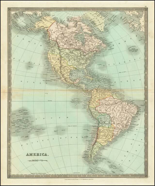
Detailed engraved map of the Americas issued by Henry Teesdale in London in 1834.

On the west coast of North America, we have Old and New California, New Cornwall, New Hanover, New Albion, New Georgia, and Russian America (Alaska).

The Canadian Arctic is still poorly delineated, and there is barely a hint of the Antarctic in the south.


Special conditions for students!

If you are a student, write to us in telegram: @antiquemaps and indicate what material you need and for what work you need a map in high detail. We are ready to provide material on special terms. For students only!

Item information:

Year of creation:
Size:
8831x10614 px
Disk:
27.6737MiB
Number of pages:
1
Place:
London
Author:
Henry Teesdale.
$14.99

Related item