

The First National Atlas of the United States. The Exceptionally Rare 1783 Edition of Jeffery’s American Atlas. Thomas Jefferys' American Atlas was one of the four great atlases of the Colonies available during the Revolution - along with Faden's...
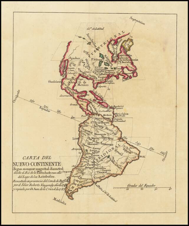
Rare Spanish edition of De Vaugondy's map of America. The map was apparently created to illustrate a Spanish edition of Georges-Louis Leclerc, Comte de Buffon's natural history. The map credits Juan de la Cruz Cano y Olmedilla, whose 9 sheet map of...
Fascinating Alaska Configuration 1783 edition of Janvier's map of America, issued in the same year that the United States was formally granted its independence from England. The mythical Sea of the West is no longer shown, replaced by a curious...
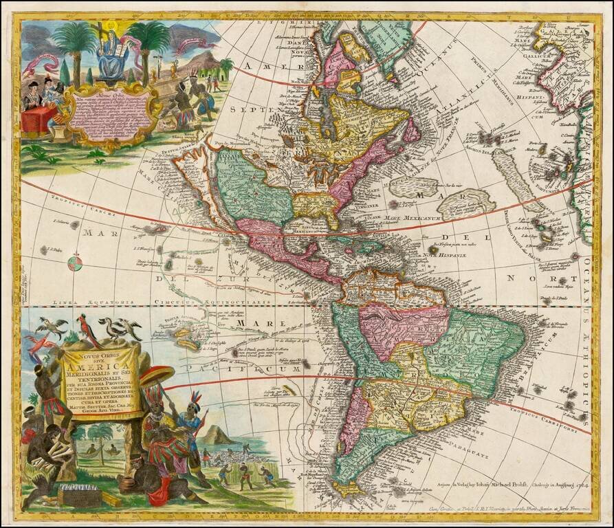
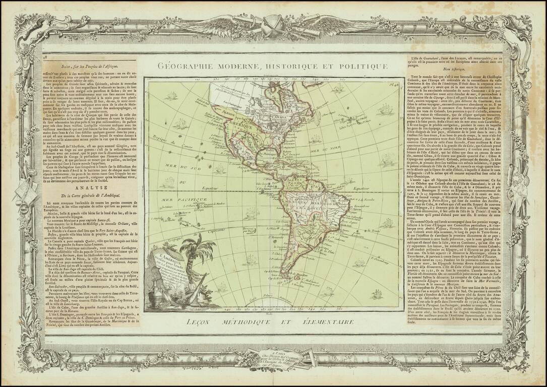
Striking, Richly Engraved Map of the Americas—One of the Last to Feature California as an Island Fine, detailed map of the Americas, with California as an island and two richly illustrated cartouches. This is one of the last maps to be printed with...
Rare map of America, showing California as an Island. California is shown as an Island, with the extended westward land mass to Asia and the Mississippi River extending to the Straits of Anian. Odd Great Lakes Projection and other interesting...
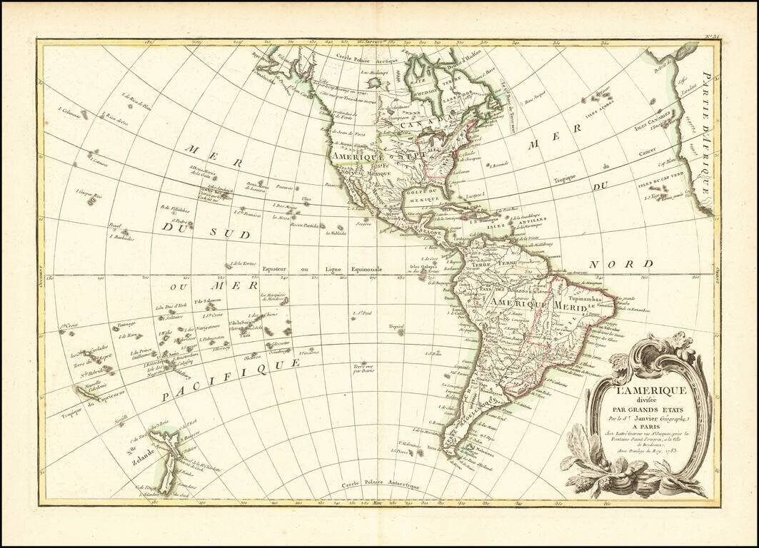
Interesting map of America, published in Paris by Brion de la Tour. The map includes a largely unknown Northwest Coast, River of the West, Straits of Juan De Fuca and other early details. Includes 16 ships and decorative cartouche. Ornate decorative...
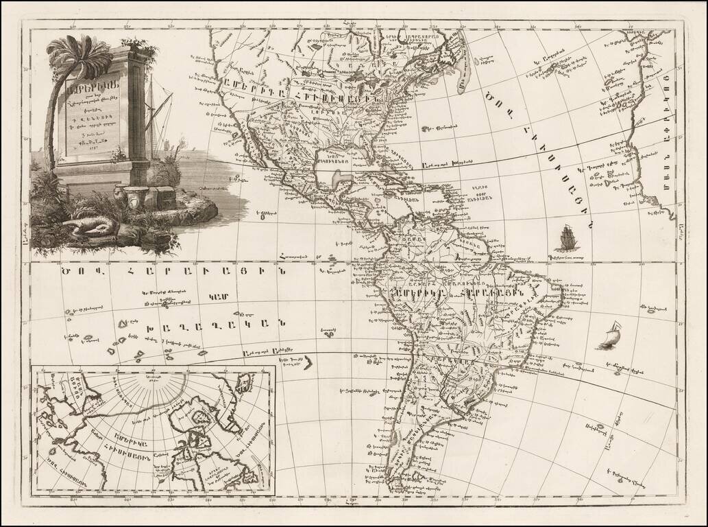
Fine example of the first map of America printed in Armenian. The translation of the title into English is "Amerika, engraved according to recent geographical observations." One of four continental maps compiled by Elia Endasian, printed in Armenian...
![L'Amerique divisee en ses principaux Etats . . . 1790. Augmentee du voyage de Cook en 1782 [Sea of the West]](/map/small/29459.jpg)
Rare 1790 Janvier/Lattre map of America, which contains not only the mythical Sea of the West, but also an equally mythical reference to a 1782 Voyage of Cook. The present map is one of the most fascinating (and lazy) examples of the use of a recycled...
Scarce third state of De Vaugondy's map of America, updated to include the details of all three of Cook's voyages. The Northwest Coast of America is still mapped with part information and part conjecture. The Spanish contacts with the region are...
Interesting map of America, published shortly after the dissemination of the Official Account of Captain James Cook's Third Voyage. The map retains the location of Mendana's Land west of Hawaii, a reference to a pre-Cook Spanish expedition that may...
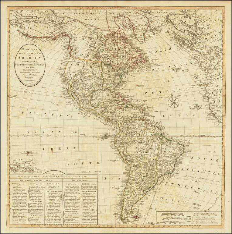
Finely detailed map of America on the eve of the 19th Century and the radical transformation that would see the European powers expelled from both North and South America. The table in the bottom left corner showing the various British, French,...
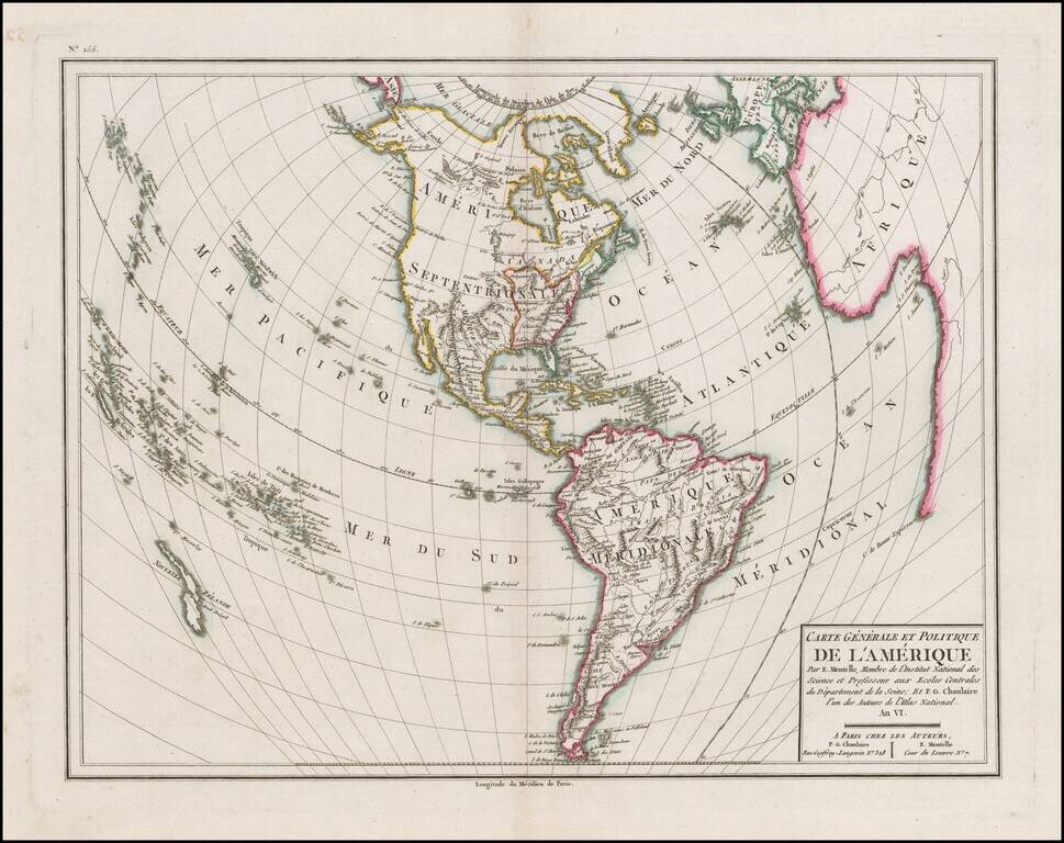
Detailed map of America, with the United States outlined in red, published in the Sixth Year of the First French Republic. The limited knowledge of the interior of North America and the Northwest Coast of America and Alaska are still quite evident....
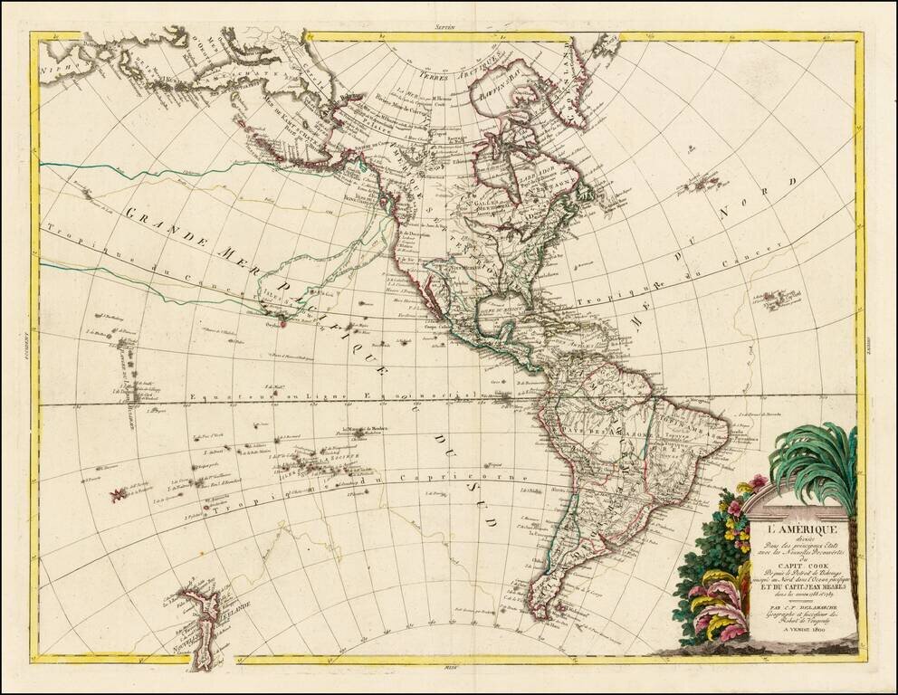
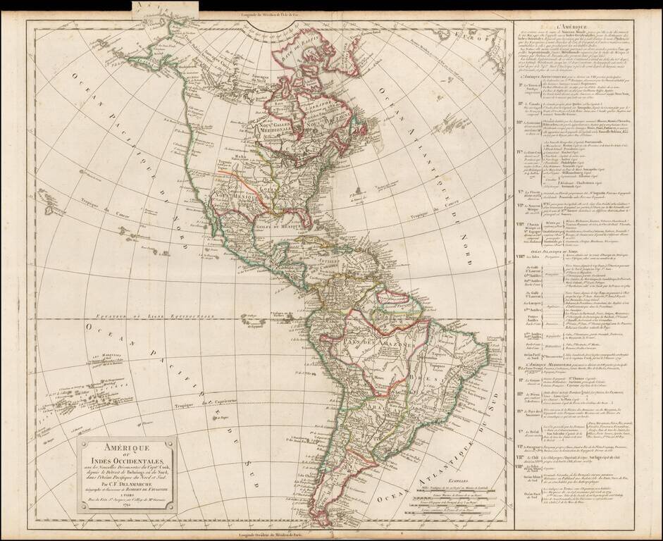
Rare separately issued map of America, published in Venice by C.F. Delamarche. Delamarche is best known as having continued the business of the De Vaugondy family. This map, with its Venice imprint, is very unusual. The map notes that it includes...
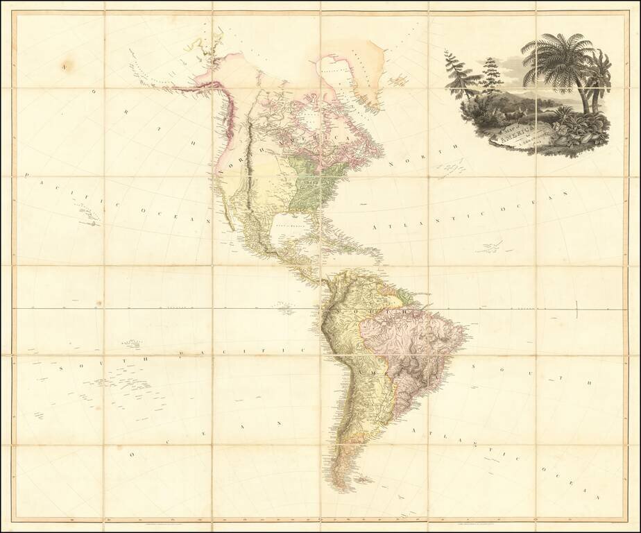
Fine example of Aaron Arrowsmith's wall map of America, in four sheets, first published in 1804. An excellent map of America on the eve of the great era of Amerian exploration by Lewis & Clark, Humbolt, Pike, Long and others. The map reflects the...
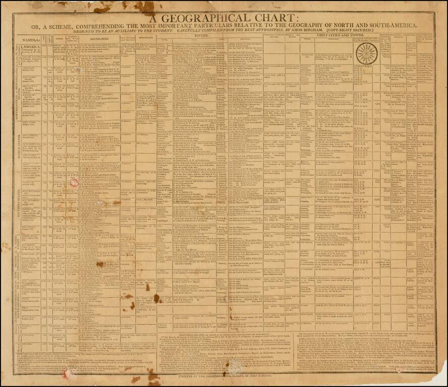
Rare American Geographical Chart & Teaching Aid Extremely rare broadside "Geographical Chart," published in Albany by the Albany Register in 1805. The chart provides a marvelous multi-column presentation of information concerning America, the...
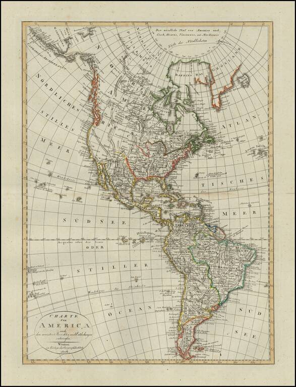
Scarce map of America, published in Weimar in 1806. The western part of North America is still relatively unknown, pre-dating the reports of Lewis & Clark and other western explorers. The map shows a very speculative Northwest Passage with a...