
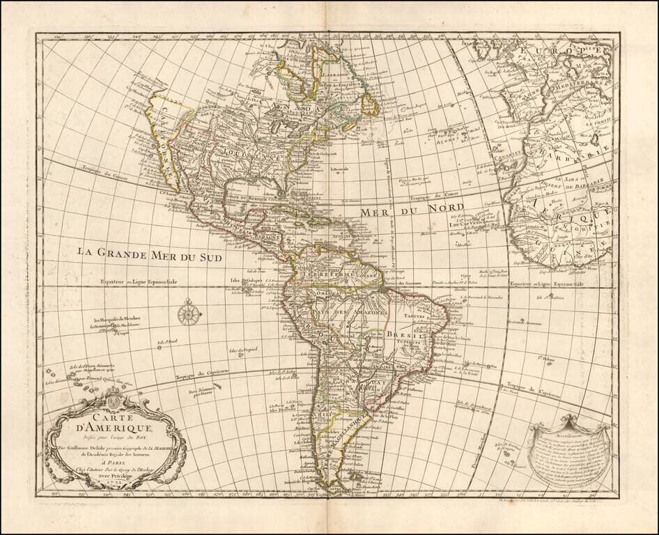
1745 state of this finely engraved map of America, published by Guillaume De L'Isle in Paris. De L'Isle's map of America was compiled from the best available source and includes significant modern cartographic detail for the period. California is...
Scarce map of America, featuring a number of the most famous myths and inaccuracies on contemporary maps of the period. California is shown as an island on the second Sanson model, including over 30 place names. The Mississippi River is shown flowing...

Early Four-Sheet Sea Chart of the Atlantic Ocean Scarce and detailed early eighteenth-century English set of sea charts of the Atlantic Ocean, with a fine, large inset of the area between the Hudson River and the mouth of the Chesapeake Bay. The...
![Americae Aucta Delineatio [California as an Island]](/map/small/67220.jpg)
Decorative map from a scarce A.F. Zurner atlas. Full original color. Shows a unique projection of California as an island, and marvelous Terra Iesso, running from Fretum Anian to Japan. Bits of Australia are shown as Quiri Regio. A nice scarce map.
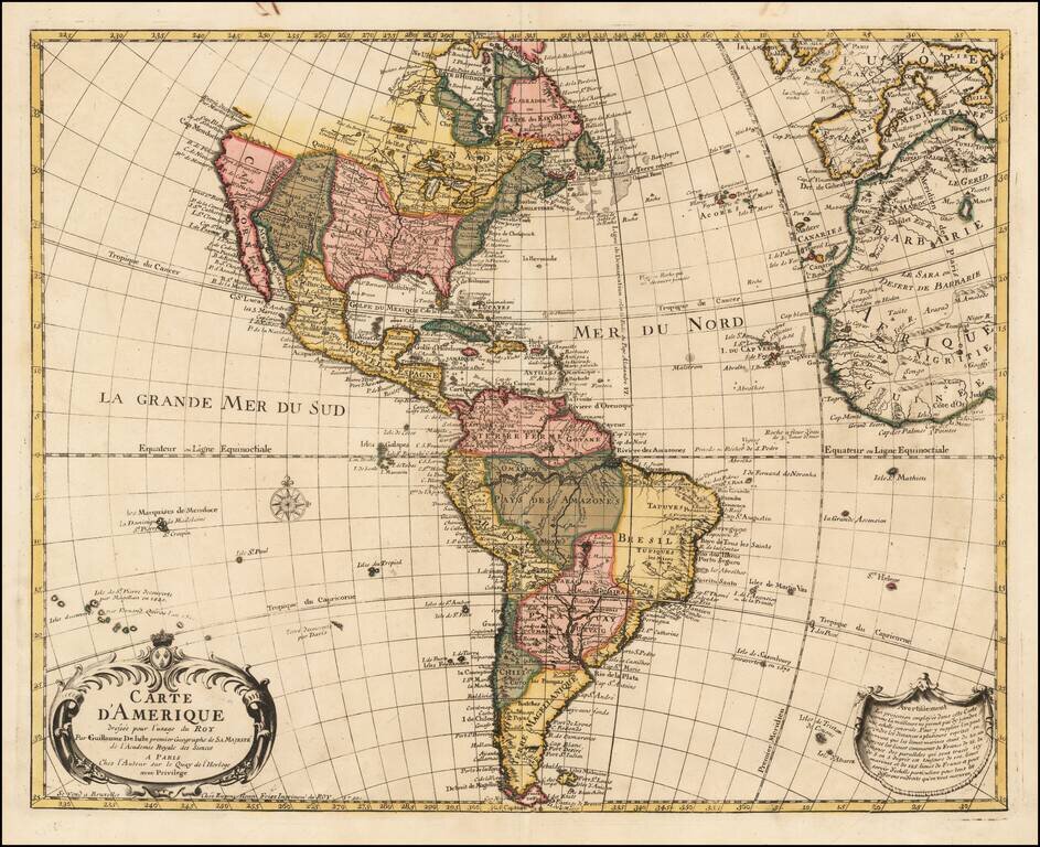
A Rare Map of America By the Royal Belgian Geographer Fine old color example of Eugene Henri Fricx's rare and finely engraved map of America, published by Guillaume De L'Isle in Paris. De L'Isle's map of America was compiled from the best available...
Striking, Richly Engraved Map of the Americas Fine, decorative and detailed map of the Americas, with California as an island and two richly illustrated cartouches. The present map depicts the Americas and parts of France, Spain, Portugal, and...
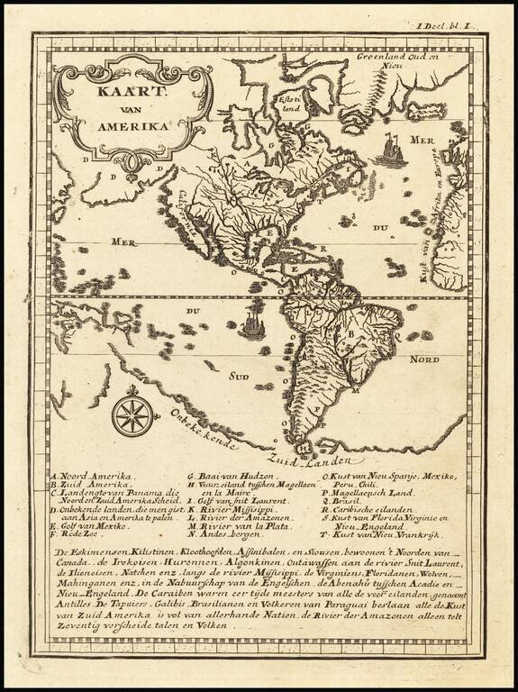
Fascinating map of America, illustrating a number of the great myths of the 17th and early 18th Centuries. The map illustrated the Dutch translation of Father Jean Francois Lafitau's Moeurs des Sauvages Ameriquains, comparées aux moeurs de premiers...
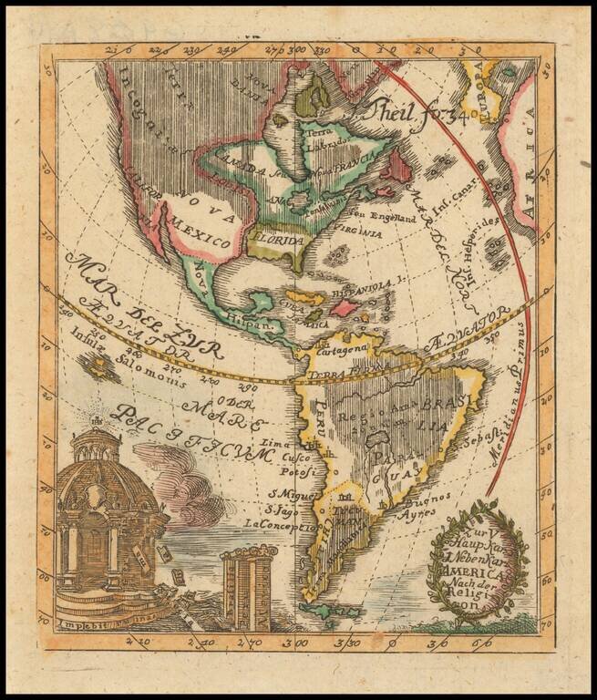
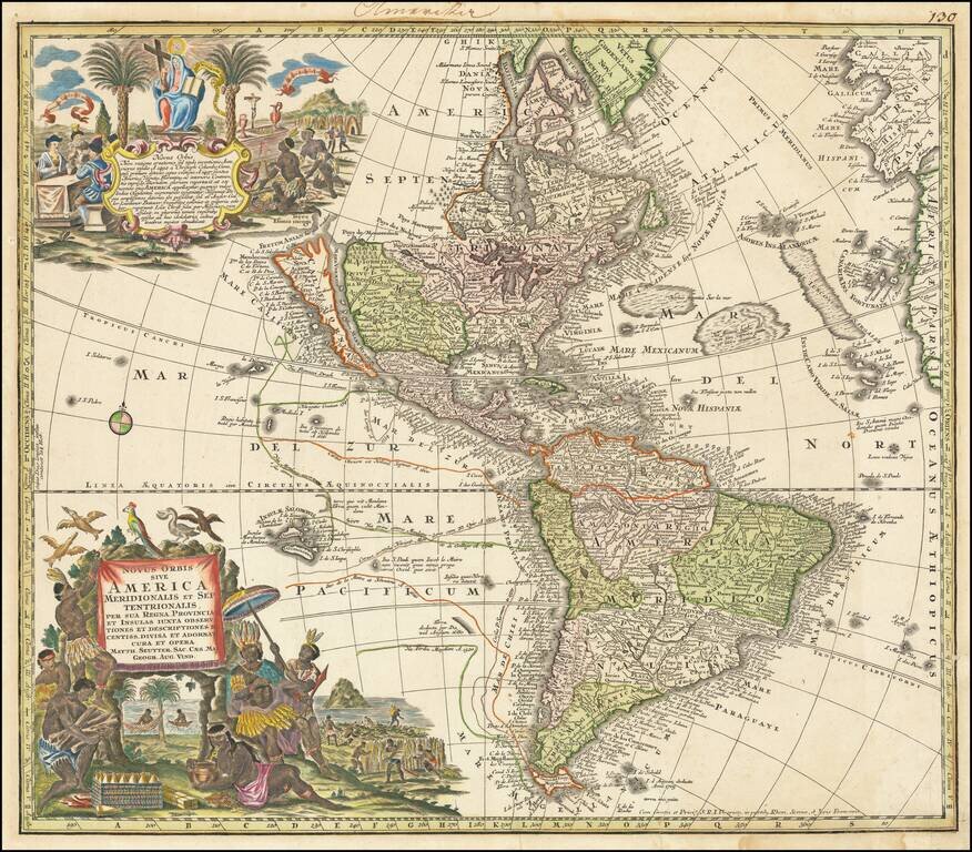
Rare decorative map of America, highlighting the religions of the peoples inhabiting different American Regions.
![Nov. Orbis sive America Septentrionalis . . [California as an Island]](/map/small/66995.jpg)
Decorative map of North America, showing California as an Island, based upon the second Sanson Model. The present example is from the private collection of Glen McLaughlin, author of The Mapping of California as an Island. (Letter available upon...
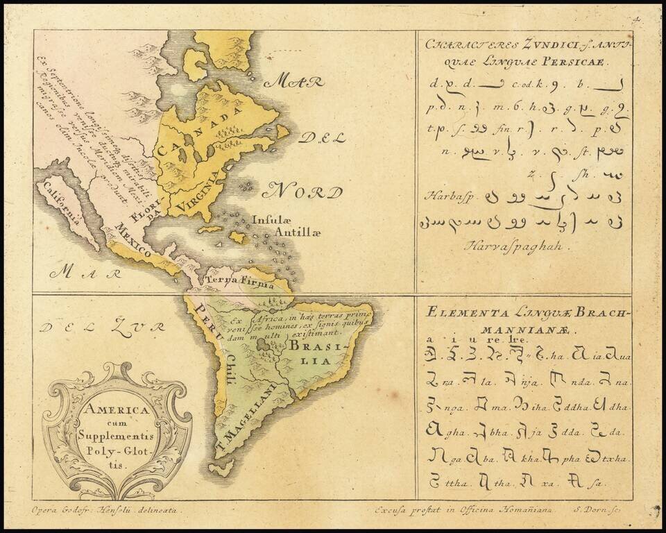
Rare map of America identifying the prevalent languages of the world. Includes two text tables with the Characters of the Persian and Brahmam languages. California is shown as an Island. From Synopsis Universae Philologiae.
Decorative map of North & South America, published in London by Emanuel Bown. Shows the Parts Undiscovered in the Northwestern part of North America, locating the supposed Straits of Anian, Cape Mendocino, New Albion, Drake's Port, Monterrey, and...
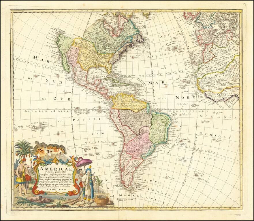
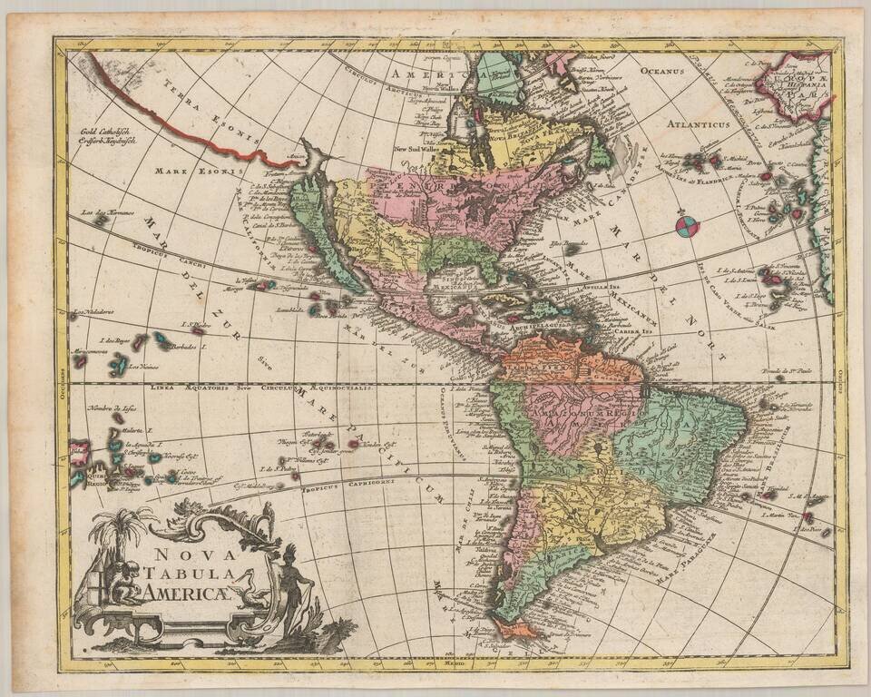
Nice example of the Homanns' second map of America, which reflects the substantial new information obtained since the issuance of the first map of America by the patriarch of the Homann Family, Johann Baptiste Homann. The decorative cartouche includes...
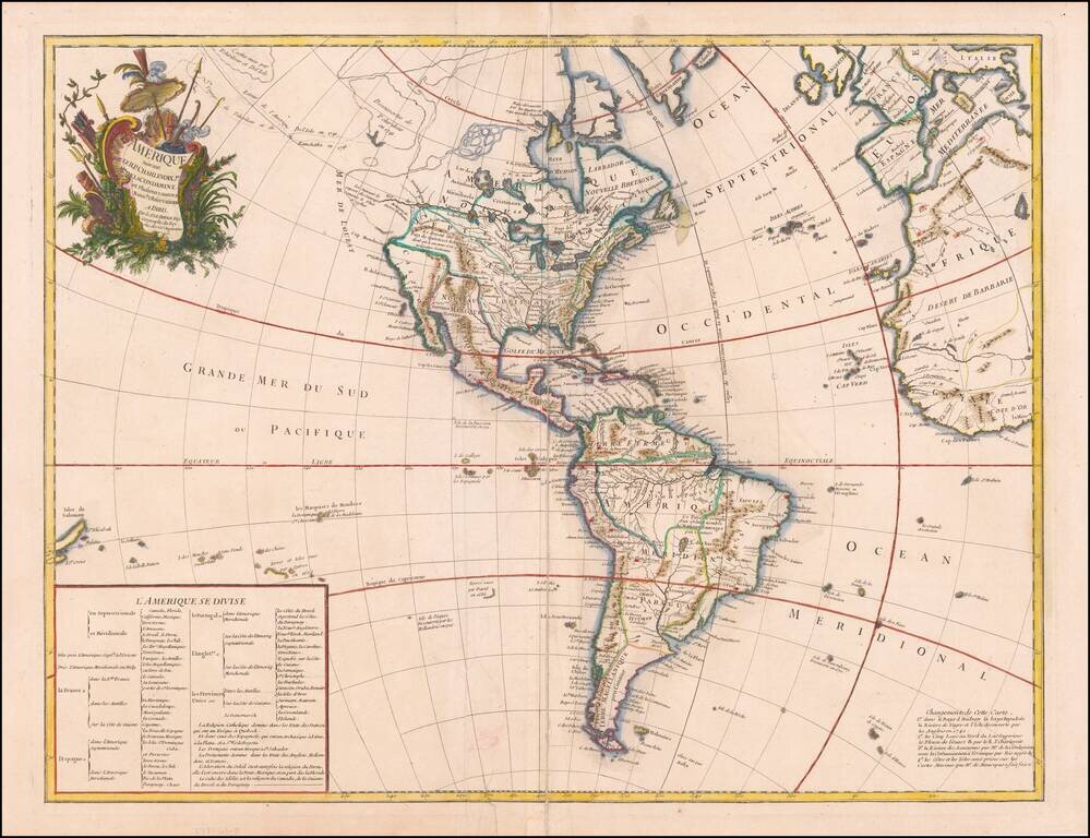
An Early Sea of the West, with Contributions from Charlevoix and Condamine The first map to show Behring's discoveries along in Alaska and the Northwest Coast and a prototype map for the subsequent Buache, De L'Ise, Jefferys debate of the 1750s. The...
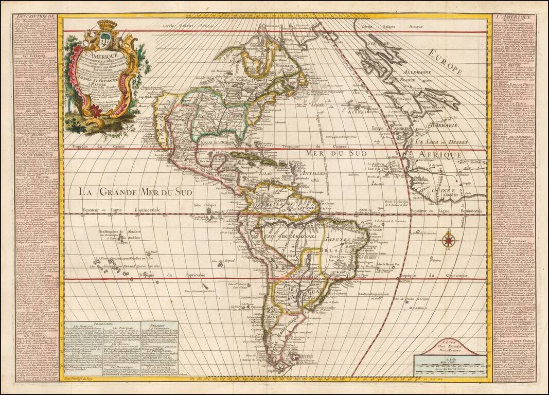
Rare map of America, published in Lyon by Daudet. Finely engraved map of the Americas, with bold topographical details and many place names and Indian tribal designations. In North America, an oversize Louisiana dominates the continent, minimizing...
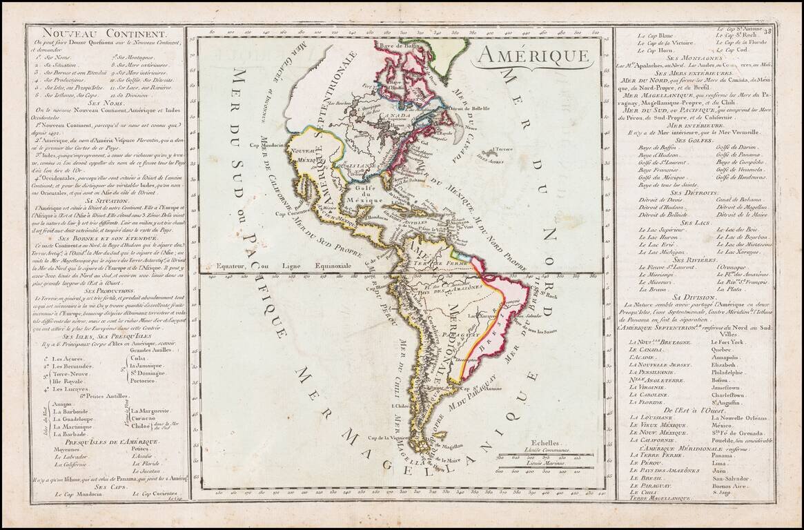
Interesting map of America from the mid-18th Century. The map illustrates the state of America on the eve of the Seven Years (French & Indian) War.
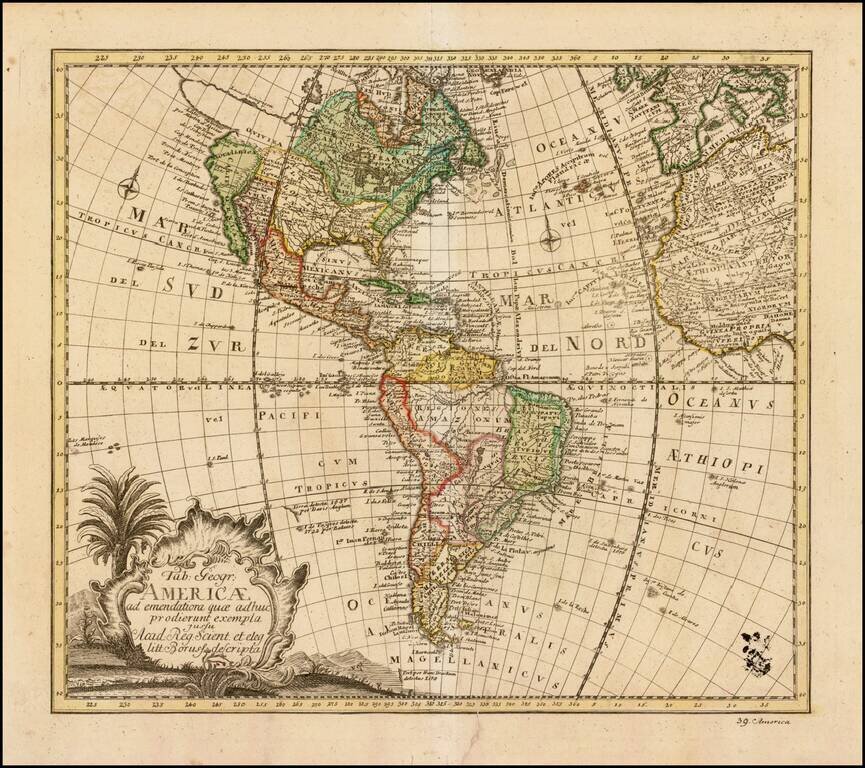
Nice example of Leonhard van Euler's map of America, published in Berlin in 1753. Von Euler's map would appear to follow Guilluame De L'Isle in terms of its cartographic details. In North America an elaborate system of rivers and lakes, including...