
Rare old maps of the United States.
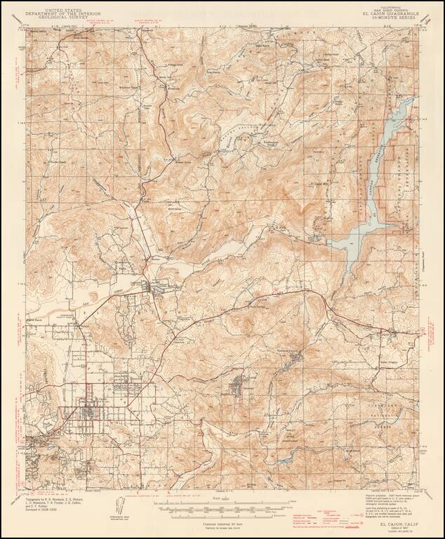
Detailed geological survey map from the WW II Period, extending from El Cajon and Fletcher HIlls in the southwest to Warner Ranch and Vallecitos in the northwest, Gower Truck Trail, Capitan Reservoir and Indian Reservation in the northeast, and Sequan...
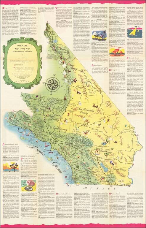
Rare Sightseeing Map of Southern California. The map combines pictorial vignettes with a tourist road map of the region, with text describing tourist opportunities in each of Southern California's counties. On the verso, a sightseeing map of Los...
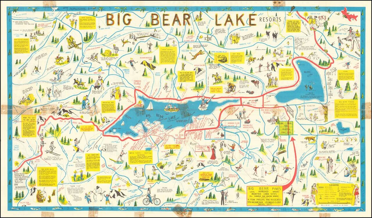
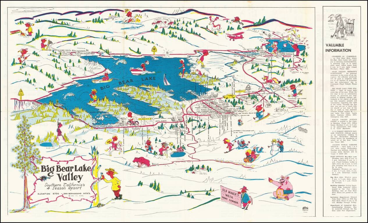
Rare Big Bear Lake Pictorial map, published by the Recreational Publishing Company. The main map shows the area around Big Bear Lake, with emphasis on recreational activities, both winter and summer, including Moonridge Ski Run Snow Valley...
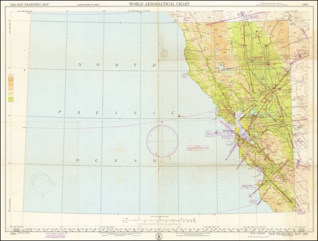
Detailed aeronautical map of the area around San Francisco Bay, and the Northwestern part of California. The chart is a font of information about civil and military aviation in postwar Northern California. It was intended for civil aviators flying by...
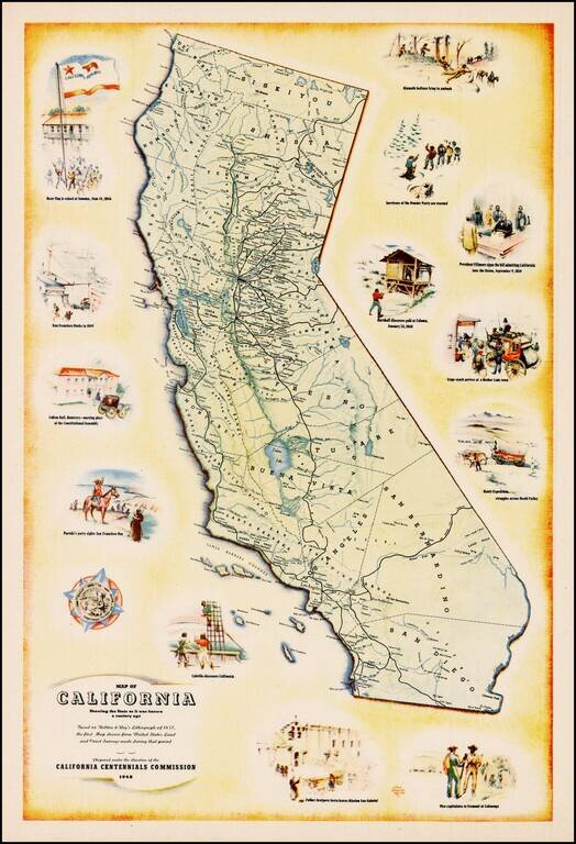
Decorative map of California, prepared under the direction of the California Centennial Commission to celebrate 100 years of California statehood. The map shows California as it was in 1848 and includes illustrations of the Bear Flag Revolt, San...
![[California] Honor Roll Foresters of America May 1, 1947 to May 1, 1948](/map/small/63016.jpg)
Previously unrecorded map of California, promoting the growth of the Foresters of America within California from May 1947 to May 1948. Includes the following information: 27 Courts Initiated 582 Re-instated 5 Net Gain 12 Courts Total - 59...
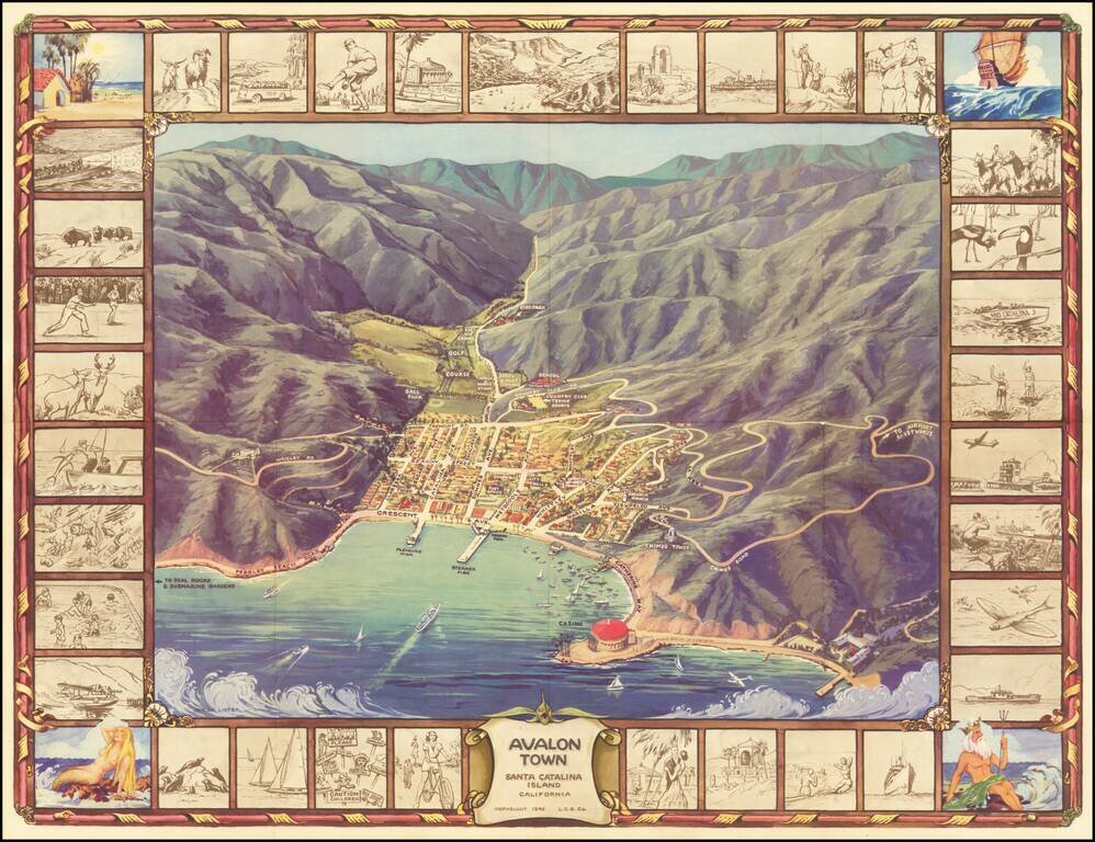
Pictorial Map of Avalon, During the Catalina Golden Age Decorative birdseye view of the town of Avalon on Santa Catalina Island, off the coast of Southern California. Includes a striking birdseye view of the town, Casino, harbor and vicinity, showing...
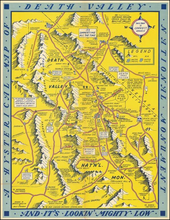
First edition of this humorous map of Death Valley. "Drawn In Broken English by Jolly Lindgren," this comic pictorial map is full of puns and comic vignettes related to Death Valley. The Lindgren Brothers issued a number of other silly whimsical maps...
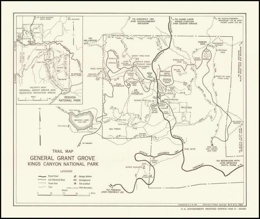
Trails and Big Trees Early trail map of the General Grant Grover in Kings Canyon, published by the United States Government Printing Office. The map shows paved roads, low standard roads, truck trails, trails, ranger stations, campgrounds and fire...
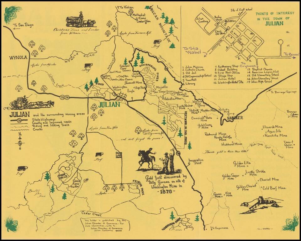
Julian -- Where Winds From The Sea and Desert Meet Rare pictorial map and promotional brochure for Julian, in San Diego County, published by the Julian Chamber of Commerce. The primary map shows the areas around Julian, stretching from Wynola and...
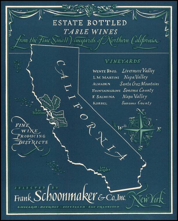
Rare advertising map promoting California wines. Frank Schoonmaker established himself in 1934 with his Complete Wine Book, and later, the classic Frank Schoonmaker's Encyclopedia of Wine. As a wine merchant he started "Frank Schoonmaker Selections"...
Rare Big Bear Lake pictorial tourist map, published by the Artisan Press in Azusa, California. The verso title is A Souvenir Fun and Street Map, with a price of 20 cents. The lake is filled with recreational and boating images, with the Clifford Lynn...
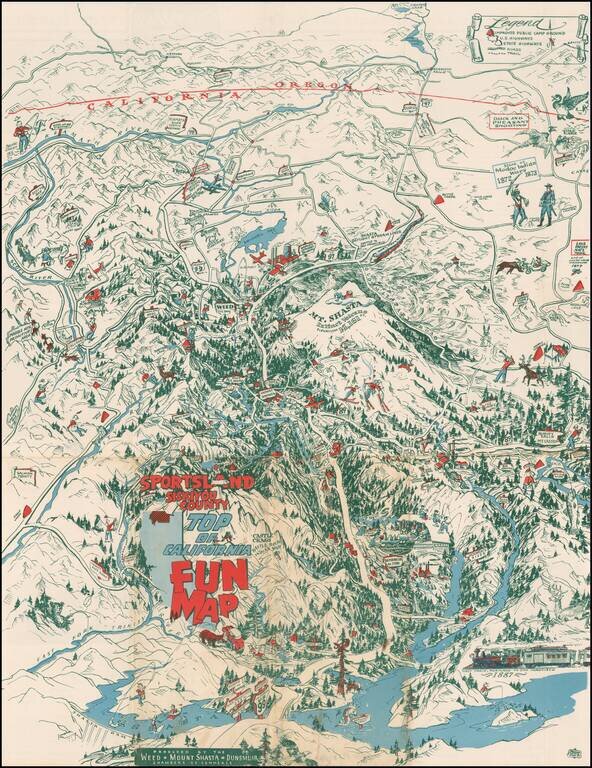
Whimsical pictorial map of Siskiyou County, California, published by the Weed, Shasta and Dunsmuir Chamber of Commerce.
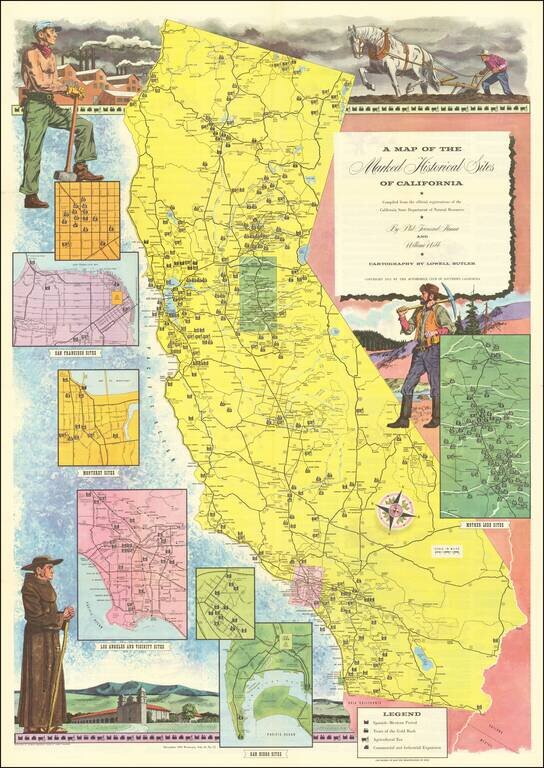
Interesting illustrated map of California, identifying each of the historical landmarks around the state, with inset maps of the area around San Diego, Los Angeles, San Francisco, Monterey and Gold Country. The landmarks are identified by whether they...
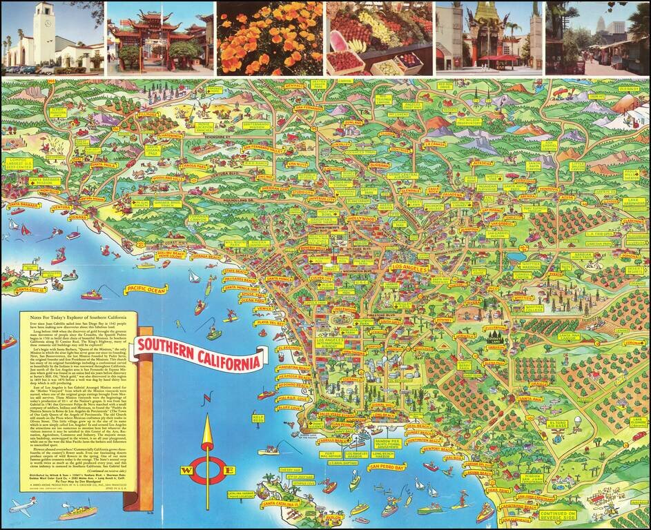
Pictorial Southern California -- A Pic-Tour Map of Southern California Scarce pictorial map of Southern California, published by A Mirro-Krome Production and Drawn by famed pictorial artist Don Bloodgood. Bloodgood's pictorial map of Southern...
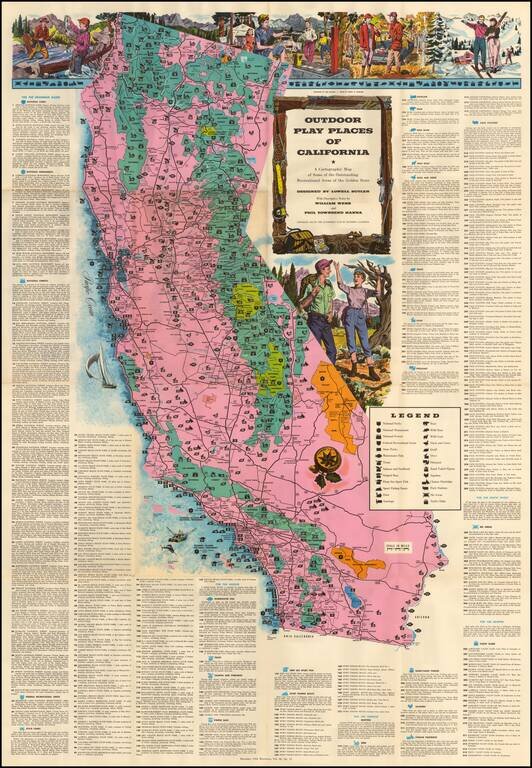
Large decorative map of California, identifying and location over 300 recreational areas around the state and including a series of decorative recreationally themed vignettes of fishing, camping, skiing, hunting and hiking, with additional vignettes...