Map size in jpg-format: 107.326MiB
Click to open in high resolution (open in new tab).
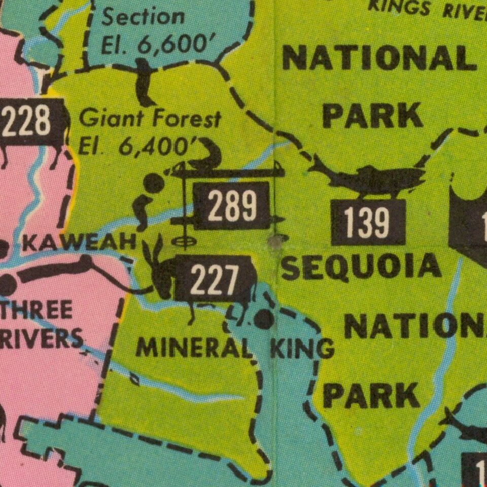
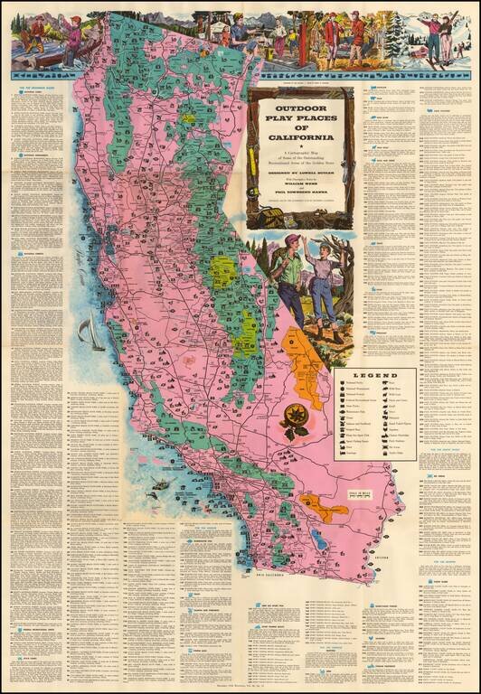
Large decorative map of California, identifying and location over 300 recreational areas around the state and including a series of decorative recreationally themed vignettes of fishing, camping, skiing, hunting and hiking, with additional vignettes within the map.
This fascinating map was identified very early on as a map of great merit. The following is excerpted from Volume 7, Number 1of the UCLA Librarian (October 9, 1953)
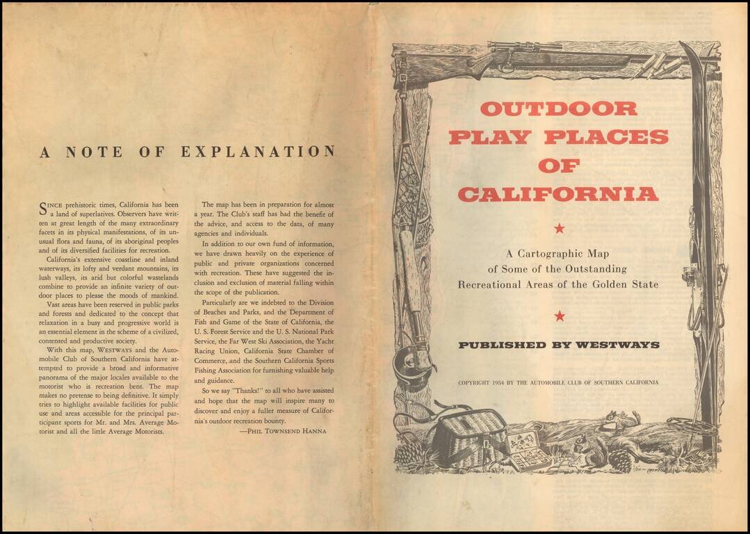
A Map Everyone Should Have Outdoor Play Places of California; a Cartographic Map of the Outstanding Recreational Areas of the Golden State, designed by Lowell Butler, with descriptive notes by William Webb and Phil Townsend Hanna, is a new publication of Westways and the Automobile Club of Southern California. A copy of this excellent map Has just been added to the map collection in the Department of Special Collections, and William Bellin, the curator, thinks everyone ought to have one. With a minimum of confusion, he says, the map shows the national forests and state parks, and how to get to them, and also the haunts of fish and game of various sizes, and how to get to them. Places for skiing, sailing, and just sitting are also pointed out; and added notes tell the visitor what he may do and when. The map sheet itself is large and decorative, with robust color and exuberant pictorial vignettes, and is similar in format to the Map of the Marked Historical Sites of California issued by the same publisher in 1952.The full title of the map is OUTDOOR PLAY PLACES OF CALIFORNIA. A Cartographic Map Of Some Of The Outstanding Recreational Areas Of The Golden State Designed By Lowell Butler With Descriptive Notes By William Webb And Phil Townsend Hanna. Drawings By Ken Sawyer. Color By Harry O. Diamond.
Lowell Butler created pictorial maps for publications of the Automobile Club of Southern California in the mid 1950s, including A Map of the Marked Historical Sites of California (c. 1952), Outdoor Play Places of California (c. 1954) and Spanish California: A Map of the Missions, Presidios, Pueblos and Some of the More Interesting Ranchos (c. 1956).
If you are a student, write to us in telegram: @antiquemaps and indicate what material you need and for what work you need a map in high detail. We are ready to provide material on special terms. For students only!
![[Signed Political Satire Artwork] Vietnam ... Vietnam ... Vietnam ...](/map/small/68726.jpg)

