Map size in jpg-format: 37.3126MiB
Click to open in high resolution (open in new tab).
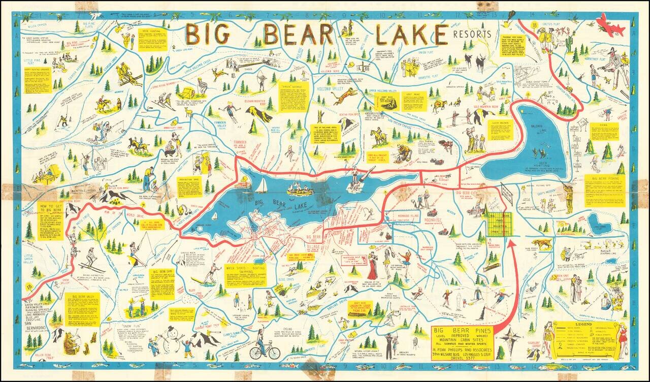
Rare Big Bear Lake Pictorial map, published by the Recreational Publishing Company.
The main map shows the area around Big Bear Lake, with emphasis on recreational activities, both winter and summer, including
The map tracks Highway 18 to and around the Lake, with yellow boxes provide regional facts and information for tourists.
Numerous cartoon-style images of men and women recreating themselves throughout the lake region: camping, bicycling, fishing, skiing, ice skating, etc. plus images of the animal life of the region.
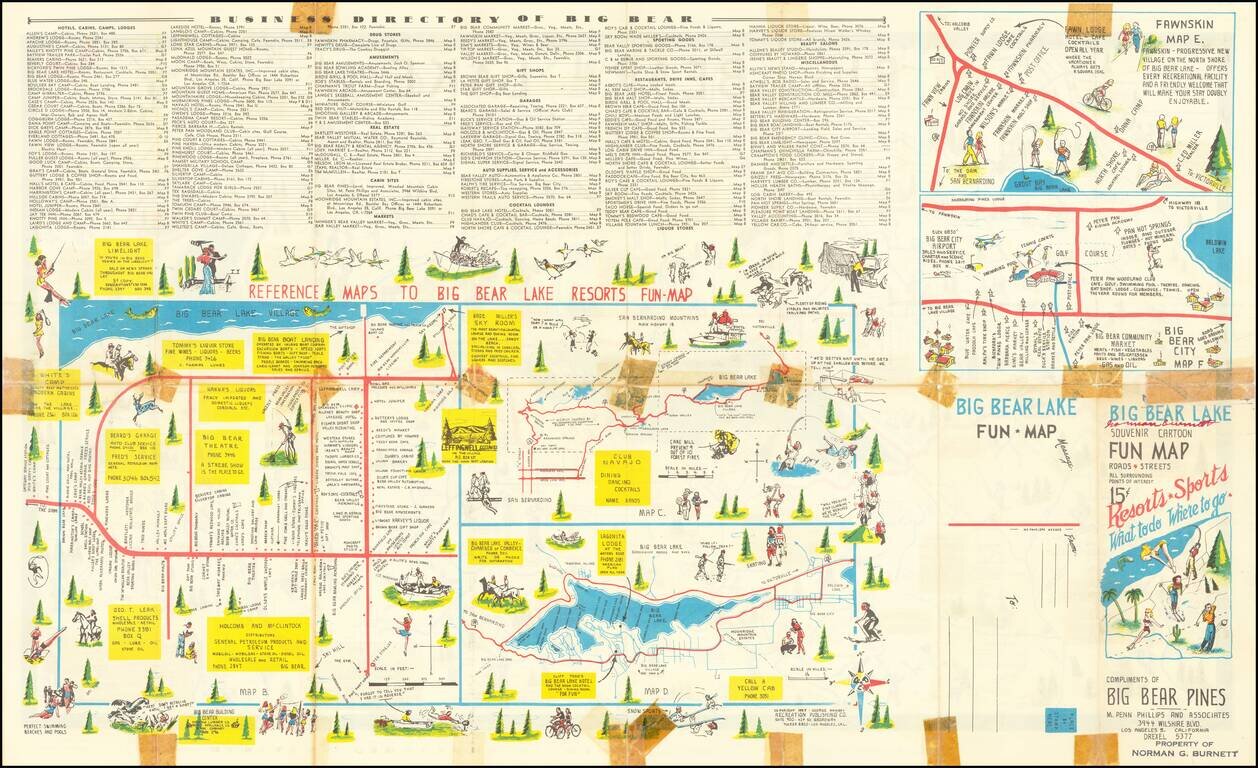
Verso of map features three smaller maps, the largest being a pictorial 'Reference Map to Resorts,' identifying by name cabins, lodges, clubs, cocktail lounges, the Chamber of Commerce, etc. Two smaller maps depict "Fawnskin" a "progressive new village on the North Shore" and a "Big Bear City Map" showing businesses, resorts, hot springs, etc.
Rarity
Not in OCLC or the Rumsey Collection.
If you are a student, write to us in telegram: @antiquemaps and indicate what material you need and for what work you need a map in high detail. We are ready to provide material on special terms. For students only!
![[Signed Political Satire Artwork] Vietnam ... Vietnam ... Vietnam ...](/map/small/68726.jpg)

